Half Dome via the Cables
Waterfalls, Wires, & Waiting in Line
Half Dome, California — it is perhaps the most famous hike in the United States. Every Summer, thousands attempt the 16-mile round-trip from Yosemite Valley's floor to Half Dome's 8836-foot summit.
Along they way they will travel through some of Yosemite's most inspiring terrain, passing not one but two major waterfalls and countless jaw-dropping vistas. But the route's main attraction is its finale: an exposed, makeshift stairway constructed of wires, poles, and wood.
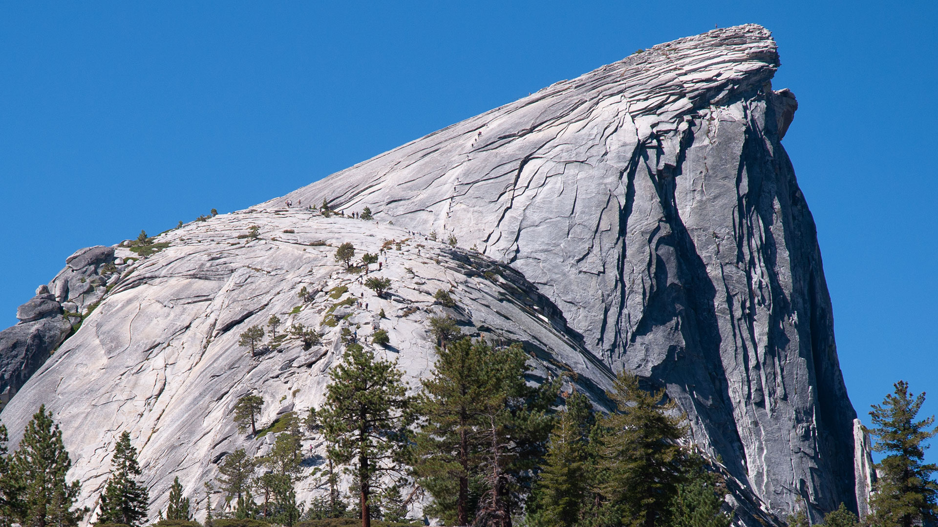
Normally, ascending Half Dome's 46° east face would demand technical rock climbing skills and equipment. But, thanks to the cables installed in 1919, hundreds of hikers climb Half Dome every day.
I vividly remember my reaction upon first seeing the route's cable section: I was astonished and terrified. Astonished that such a flagrant hazard could exist in modern-day, liability-adverse America; terrified I was actually going to go up it.
In its Half Dome hiking guide, Yosemite National Park says, "Since 1919, relatively few people have fallen and died on the cables. However, injuries are not uncommon for those acting irresponsibly."
That's not an entirely reassuring endorsement.
The cables are indeed dangerous. People do indeed die on the route. Fatalities, however, tend to occur mostly in the off season, when the cables are down, and even then in relatively low numbers given the route's astounding popularity.
Park Rangers install the cables every summer, typically by the end of May, and take them down every fall, usually by October.
One wonders if there will come a year when they cables remain down permanently. The most basic argument against the cables' continued existence is that they enable people to go where they otherwise would not. Instead of thousands of people crawling up Half Dome's east face every year, there would be but a handful, as with the other climbing routes on Half Dome. The circus would be closed.
On the other hand, the best argument in favor of the cables is that they enable people to go where they otherwise would not. Given the obvious safety concerns, that reasoning may sound simpleminded, but the vast numbers of people who climb Half Dome (and the effort they give in doing so) suggests there is something essential to be found here.
To be sure, the cables would never be built today—liability and environmental impact (in a National Park, no less) would see to that. But, thanks to those mad geniuses of the early 1900's, we have a storied route upon which 'relatively few' people die, and thousands upon thousands enjoy what is likely to be the single most memorable wilderness experience of their lives.
What could possibly be wrong with that?
Curry Village
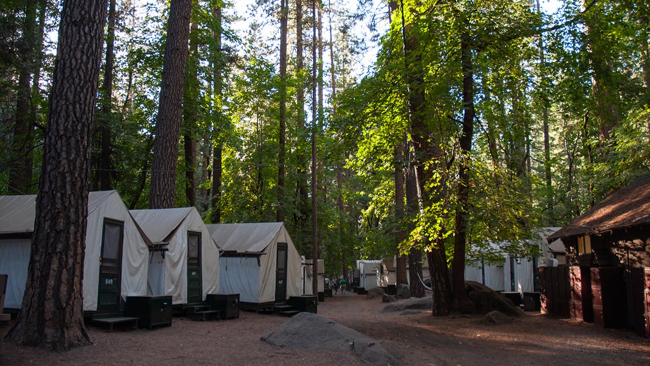
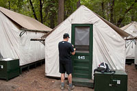
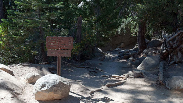
My Half Dome adventure begins in Yosemite Valley's Curry Village, where I've booked a tent cabin to spend the night near the trailhead for an early start tomorrow.
'Camp Curry' was founded in 1899 by David and Jenny Curry, two schoolteachers from Indiana. They dreamed of visiting Yosemite, but found that they could not afford park lodging at $4 per night, so they established Camp Curry, offering affordable room and board.
According to the National Park Service, the camp was originally comprised of a dozen tents with a common dining center, but it quickly grew to hundreds of tents within a few years.
Today, Curry Village's tent cabins remain perhaps the best deal in the park—not impossible to reserve, as are campsites and motel rooms, and not terribly expensive either.
In addition to putting would-be hikers in excellent proximity to Half Dome's trailhead, Curry Village also offers an impressive array of services, including a dining hall, a well-stocked mountaineering shop, a swimming pool, and a grocery.
Of course, you also get to stay in the heart of Yosemite Valley, in the literal shadow of both Half Dome and Glacier Point.
I find a parking spot and then carry gear from car to tent. While I'm loading food into the bear box, one of my new neighbors wanders over to say hello. He is here with his son, enjoying a few peaceful days in the Valley. Though I don't know it now, I'll be seeing (and not seeing) them again soon.
I head to the dining hall for a big buffet dinner. Soon after that my climbing buddy Bill arrives. We're both eager to get on the trail to Half Dome tomorrow.
A quick confession: prior to visiting Yosemite for the first time, I must admit the place always sort of flew under my radar. As a regular visitor to the Eastern Sierra, I always envisioned Yosemite as just another part of the Sierra—beautiful, no doubt, but one beautiful place among many in California's Range of Light, and not one that I was in a particular hurry to visit.
In hindsight this attitude was about as foolish as regarding the Grand Canyon as just another hole in the ground. Yosemite above all is unique—and unique in many respects. It is first of all the absolute center of the human rock climbing universe, for reasons which become clear as soon as you enter the valley. It is also home to not one but several of the world's highest waterfalls.
There are the redwoods, the rivers, the meadows, the granite faces. Both lush and austere, Yosemite Valley is the Sierra's Shangri-La, a pocket of magic which must be seen in person to understand its wonders. And Half Dome is the centerpiece. Climb Half Dome, and you'll experience a hearty portion of Yosemite's feast. Is it any wonder the route is so popular?
The John Muir Trail
Four a.m. My tent-neighbor's alarm clock goes off, waking me. This can mean only one thing: just like Bill and me, father and son next door are hiking half dome today.
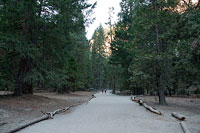
After they've rustled about for a bit in the dark and then departed, I try unsuccessfully to settle back into sleep. Two hours later our alarm beeps, and after a quick breakfast we're on the trail as well, heading east out of Curry Village toward the John Muir Trail.
There are two initial options hikers can choose: the John Muir Trail and the Mist Trail.
It's not a bad idea to go up one and down the other, so that you end up looping around Nevada Falls. Of the two variations the Mist Trail is shorter, steeper, wetter, and most definitely slipperier, making the JMT typically safer and easier—especially if you're hiking in the dark.
For those unwilling or unable to hike all the way to Half Dome, a loop around Nevada and Vernal Falls is itself a fine day hike, well worth the effort. Today, Bill and I will be going up the John Muir and (eventually) down the Mist Trail, ensuring we get to see as many of the sights as possible.
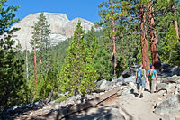
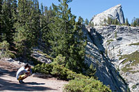
Regardless, we begin the day on the John Muir Trail, joining it at the end of the road out of Curry Village, and here at 7 a.m. the trail is already well-populated with hikers and sightseers.
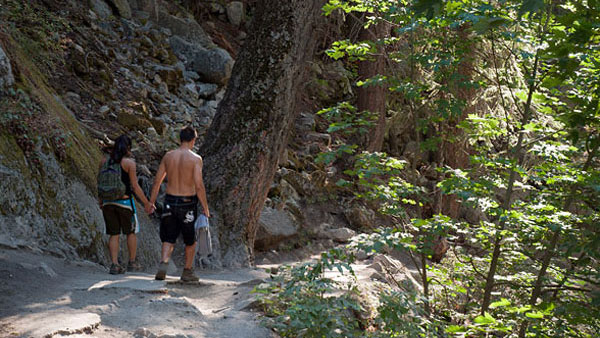
It is worth mentioning the trail begins with a steep climb that seems even steeper in these early morning hours. We're soon above the chilly air at the valley's floor, and with warming temperatures and a continued climb, I peel off my extra shirt.
Between us and Half Dome there are a number of water sources, but only one is safe to drink untreated.
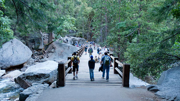
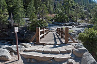
That would be the obvious drinking fountain at the footbridge that crosses the Merced River, about an hour above the trailhead. Just past this bridge is the junction to the Mist Trail. Bill and I pass our tent-camp neighbors at the footbridge. They turn left, along with most of the morning hikers, heading up the Mist Trail. After topping our water bottles, Bill and I turn right, continuing up the now much less crowded John Muir Trail.
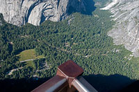
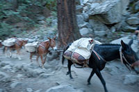
Soon, we're passed by a mule train. With the rise of thru-hiking, mule packers have seen a resurgence in business, as they are often contracted to drop supplies for backpackers attempting long sections of the John Muir Trail. After letting the mules and the dust pass, Bill and I continue our ascent, gradually gaining elevation. We've soon climbed high enough to watch the new day breaking over Glacier Point and Yosemite Valley. It looks like a perfect day to climb Half Dome, with a bright blue sky, no wind, and no trace of clouds.
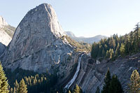
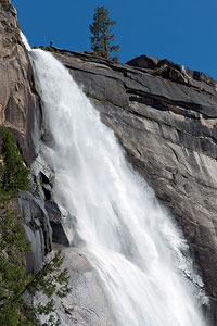
Nevada Falls
Of all the National Parks I've visited, Yosemite offers by far the most abundant and hair-raising opportunities to flirt with certain death. We're about to find one such opportunity now, atop Nevada Falls.
If you like to stand on the edge now and then and feel a little electricity, the viewing area atop Nevada Falls is a wall socket into which you can stick your fingers for not just a little buzz but a heart-stopping jolt. Be careful here!
As well-coddled Americans we expect our various government agencies to have childproofed everything in sight, keeping us safe not only from neighbors and nature but also from ourselves.
That is not the case in Yosemite.
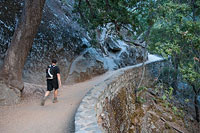
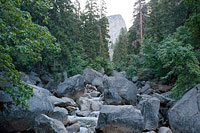
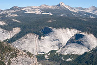
Bill and I make steady progress up a long series of switchbacks, ascending toward and then beneath Yosemite's Panorama Cliff. There is quite a bit of climbing to be done in the early going here—from Curry Village's 4000' elevation, we must gain fully 2000' before we'll top the 594-foot high Nevada Falls.
We pass Clark Point, which offers a bypass connecting to the Mist Trail. Soon after, the John Muir Trail begins angling eastward, and we get our first good look at Liberty Cap and Nevada Falls.
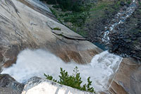
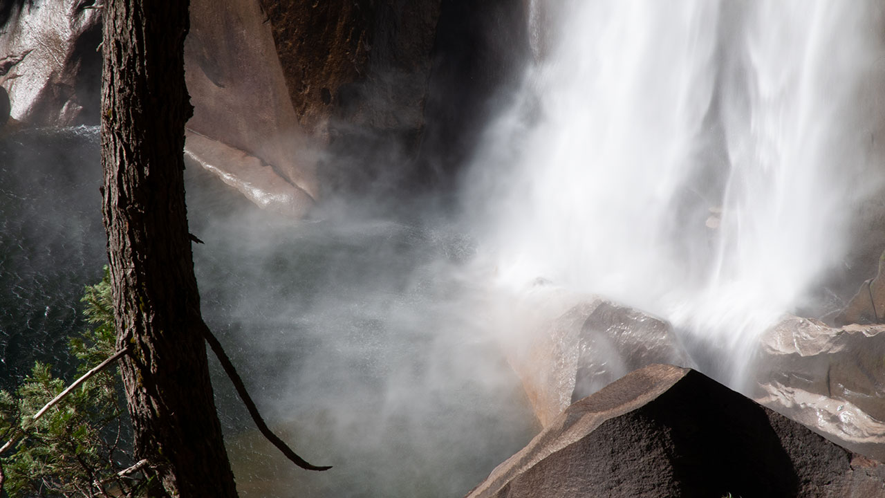
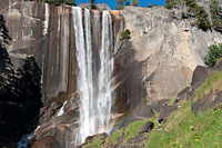
Though Nevada Falls is far from the highest of Yosemite's waterfalls, it still looks big and robust. Here, the Merced River plunges off a broad bench on Liberty Cap's shoulder, flaring impressively across a nearly vertical fan of granite below.
We pass the Panorama Trail intersection, which traverses westward along the top of Panorama Cliff, connecting the John Muir Trail and Glacier Point—a major loop possibility that begs to be hiked at some future date.
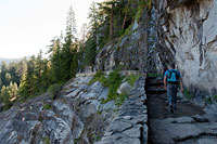
Today, however, we continue on toward our objective, following the John Muir Trail toward Nevada Falls. The trail here has been carved directly out of rock, passing along a great, exposed traverse that offers a fine view of Nevada Falls.
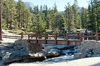
Soon, the trail enters and then exits a verdant forest, and a footbridge across the Merced River pops into view. The river itself meanders peacefully here (and seemingly-harmlessly) until it abruptly plunges into space.
Statistically, this placid scene is one of Yosemite's more treacherous landscapes. People have waded into the river here and found themselves swept over the falls—no doubt to their great surprise.
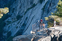
Let's cross the footbridge and hook around the falls, to the 'viewing platform', where we can attempt to contemplate what that fate would be like. A short scramble down some rocks gets us to a flat section of granite adjacent and overlooking Nevada Falls. Here, the National Park Service has kindly put up a rickety guardrail, where we can put our toes on the very edge of the precipice mere feet from the thundering waters of the falls.
I look down and...overload. Brain recoils at the suddenly topsy-turvy horizon. It's as if the world has been tipped on end, and this clash of sensory data is scrambling my processor. 600 feet straight down! Isn't this normally the kind of place where the guardrails are meant to keep us out, rather than encourage us to stand right on the very brink and look down?
And maybe we've just discovered a subtle but vitally important difference about Yosemite. Maybe it's because of the valley's climbing history, or maybe it's just because so much of the place is vertically constructed, but you will be expected to take care of yourself here. Mostly you won't even get a guardrail, just unforgiving rock and unfathomably-large drops. And if you do wander carelessly and go over that edge, divine intervention itself won't save you.
Little Yosemite Valley
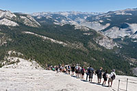
Having connected with the top of the Mist Trail, the John Muir Trail becomes noticeably more crowded, populated once again with the full complement of today's Half Dome hikers.
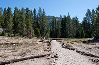
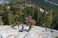
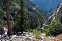
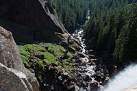
This section of the route crosses the long, sandy floor of Little Yosemite Valley, passing initially alongside the Merced River before eventually making a big semi-circle about Half Dome's impressive south face, which rises high above the horizon to our left.
Even from this considerable distance, sharp-eyed persons may be able to see a tiny line of spec-like hikers working up the route's cable section.
But that's a long way from here.
Plodding across sandy ground always proves to be a grind—especially on the hike back out. Sand erodes muscles and spirits, even though the way is mostly flat here.
About a mile ahead Bill and I pass the turnoff to the backpacker's camp. Now the trail begins to climb a bit, first gently, then more aggressively up a series of switchbacks. This is the section of the hike where you begin to suspect (incorrectly) that you're actually getting somewhere.
In fact, after another mile or so of this we leave the John Muir Trail for the Half Dome Trail, where the climbing and huffing and puffing begin in earnest.
We've got fully 2000 more vertical feet to gain, and now the altitude plus the sand-slogging plus the heat of the day are beginning to take their toll on me, slowing my pace considerably.
Bill seems unaffected. He scampers along ahead, soon traveling out of sight. I continue grinding along.
A curious phenomenon, so many miles up the trail now, is the abundance of people who appear utterly unprepared for a hike of this magnitude. Lack of proper footwear, clothing, even water—you name it, you'll probably find it here. Can some of these people really be hiking this far without any water? The perks of being young, says Bill, when I find him waiting for me ahead.
But still...really? I'm hot and thirsty, trying to conserve what I have in my water bottle. I can't imagine hiking here without water entirely. Half Dome, it must be said, absolutely does have that zooish quality found, say, on the Mount Whitney Trail or Shasta's Avalanche Gulch. It is a place where popularity draws the full range of the human spectrum, young and old, prepared and not.
Of course, conflict arises in that these places are wilderness, each with their own set of challenges seen and unseen. This dynamic generates a stage filled with daily mini-dramas, in which the unprepared (or the unlucky) find their way into troubles great or small (mostly small). Meanwhile, rangers and policy makers furrow their brows, trying in vain to find solutions to eliminate rescue calls without denying people access.
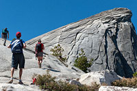
Sub Dome
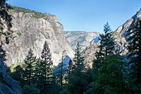
Up, up, up we go, until at last we emerge from Little Yosemite Valley's forested interior and gain the exposed spine of Half Dome's east ridge. The transition is abrupt.
The ground simply gives way to a massive 3600' drop into Tenaya Canyon, below Half Dome's sheer north face. Now Half Dome itself comes into view, so Bill and I decide to stop for lunch, enjoying airplane views beneath our feet as we munch happily on sandwiches, grapes, and potato chips.
It's a good place to take a break.
Half Dome's summit remains over a thousand vertical feet above, and we're both feeling a little worn from the climb thus far.
From here on up, exposure in one or more directions will be a constant companion. The trail will follow Half Dome's east ridge up Sub Dome, which will take us to a precarious landing at the base of Half Dome's east face—the start of the cables.
First, however, there is the climb up Sub Dome to be dealt with.
Bill and I resume hiking. The trail steepens considerably when we reach Sub Dome's granite staircase.
And if you're feeling a little alarmed by the angle here, you're not alone. The steepness combined with the empty air both north and south make it feel as if a fall here would send you off into space—a sentiment which will be true soon enough.
Lines of people work their way up the stairs, pausing regularly either to cope with fatigue or the growing sense of exposure.
I make my way slowly upward, timing my breathing to my steps, stopping now and then to sip from my water bottle. The view, if you can manage to admire it, grows ever-more expansive.
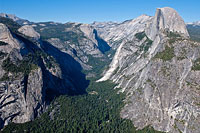
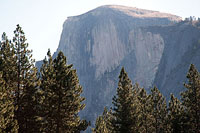
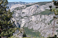
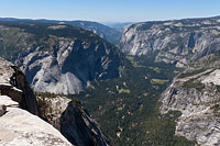
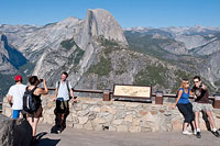
Half Dome is the centerpiece not just of Yosemite Valley but much of Yosemite National Park itself, with commanding 360° views of the region. Already, we can trace much of our ascent route through Little Yosemite Valley to the south. To the east, we see the crest of the High Sierra, and the Cathedral Range. To the north is the mind-bending drop into Tenaya Canyon.
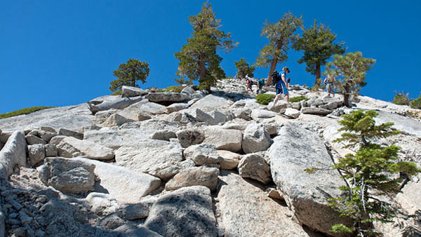
Higher we go. This part of Half Dome Trail doesn't waste much time with switchbacks. Mostly it's just a pure climb up granite blocks arranged into rough steps that always seem to mismatch my stride. Despite my fatigue I'm beginning to get excited. Soon, we will crest Sub Dome's staircase, and all eyes will on Half Dome itself, and the final leg of our ascent.
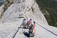
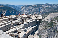
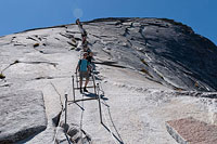
The Cables
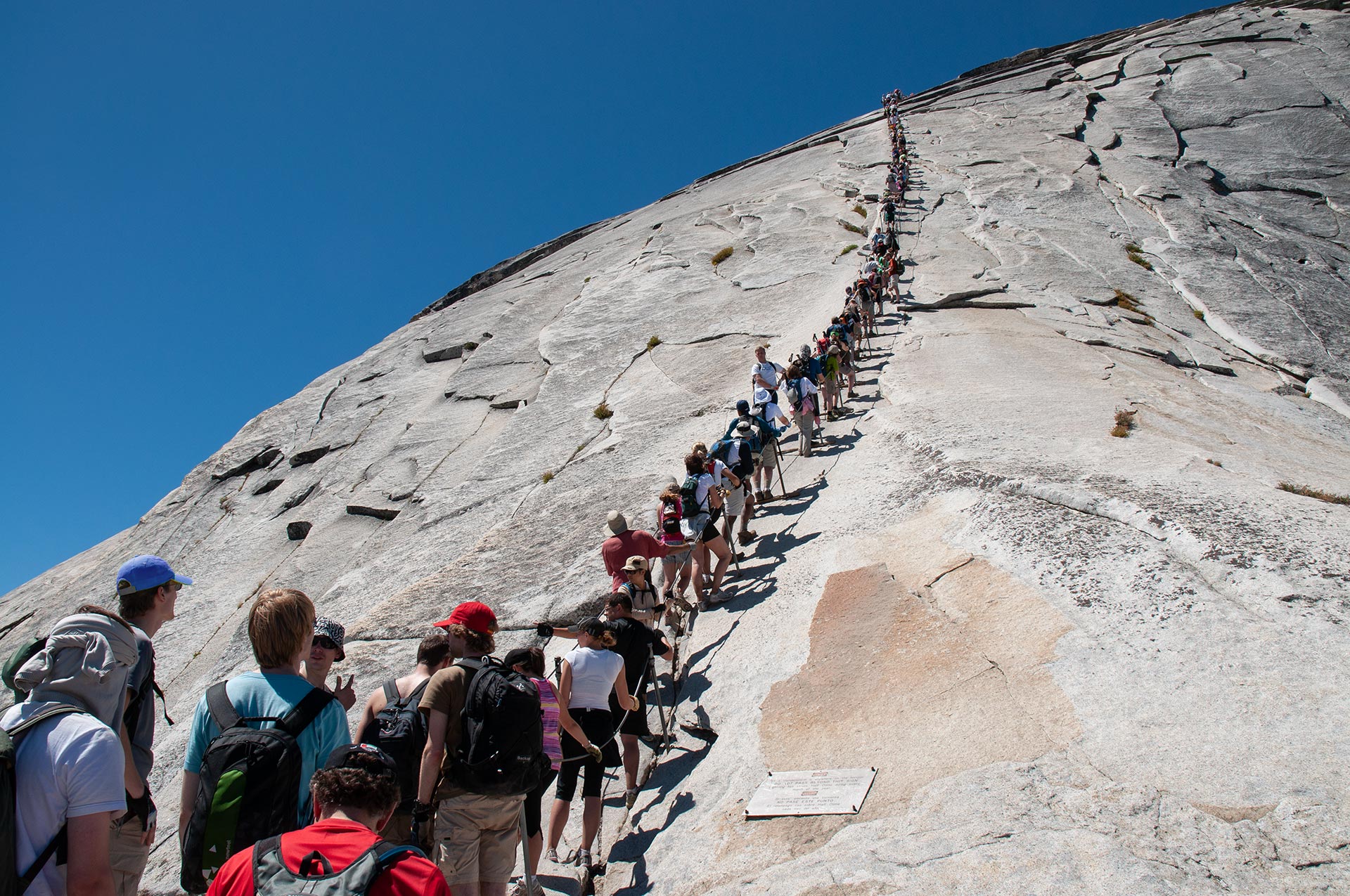
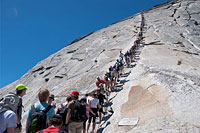
Wilderness traffic jam: hikers clog Half Dome's cables
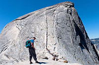
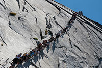
Probably just about everyone has the same reaction when the cables first pop into view, leading wildly upward across Half Dome's smooth granite face: you've got to be kidding.
Maybe it's not really as steep as it looks—maybe it's just some trick of perspective fooling our eyes. No. That really is a 46° slab of granite you're staring at, steep enough that if for some awful reason you happen to let go, you will roll, skid, bounce, and fly all the way to Curry Village.
Or thereabouts.
As if on cue, someone high above tries to pull out their water bottle, loses the handle on it, and we folks down below watch as the bottle goes rocketing downward, ping, ping, ping across the rocks, on its way to places unknown.
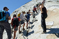
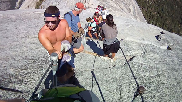
Today, the business of the cables is greatly complicated by crowds. At the bottom of the cables is a long queue of people waiting to get up. They don't seem to be moving. Higher up, the midsection of the cables is clogged with people. None of them seem to be moving, either.
Ordinarily this is the part where'd I say fair enough, turn around, and head back down. But I'm on a mission to photograph the whole route today, top-to-bottom, so unhappily I take my place at the end of the line and begin waiting.
As of 2010, the NPS has instituted a trial weekend quota of 400 permits per day for the Half Dome cables. Predictably, this new policy has shifted the bulk of the traffic away from weekends and toward weekdays—Mondays, to be exact, which is exactly what today happens to be.
Gazing upward, I bet I'm seeing at least 400 people gridlocked on the cables right now.
Bill settles down onto a comfortable rock nearby. He doesn't appear particularly inclined to join this rat race. I settle into my place in line and summon as much patience as I can possibly muster for what unquestionably is going to be a long, long wait. That this fiasco unfolds daily with so few fatalities is a testimony, I think, to how much luckier we humans are than we generally imagine.
What I am looking at right now is a complex and tightly-coupled system just begging to fail. With so many things going wrong simultaneously, it's hard to even know what to begin to fear. Just exactly how much weight can these cables bear, I wonder? Pack enough people on a suspension bridge, yard-thick cables and all, and the weight can collapse it. How about the collision of steadily eroding nerves and tempers? That can't be good.
Somewhere up there, it is rumored, someone has frozen and is blocking the way. Some folks begin climbing up the outside of the cables to get past the jam. This works until they get to the route's steepest part, which sends them scurrying back between the cables for safety, packing even more people into the most crowded section.
I find myself expecting to see some sort of critical mass explosion—a mass panic, perhaps. But, as long minutes pass and pass, a tiny bit of movement appears, and this tiny progress seems to appease the angry crowd—for the moment, at least.
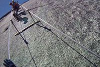
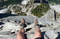
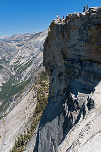
Atop Half Dome†
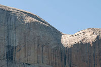
Half Dome began miles beneath the Earth's surface, when a mass of magma cooled and crystallized under tremendous pressure to form a "pluton"—a really big rock, basically.
As geologic shifting gradually raised Half Dome to the surface, the pressure on it diminished, causing fracture sheets to form parallel to its surface. These sheets over time eroded in layers much like the skin of an onion, giving Half Dome its rounded shape.
Glaciers in Yosemite Valley and exfoliation finished the job, eroding the missing portion of Half Dome, forming the iconic peak we see—and climb—today.
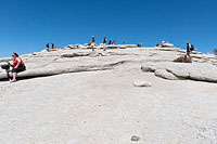
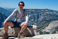
Having successfully run the gauntlet clogging the wires, I at last exit the top of the cables. From here, it is a short stroll over the hump of Half Dome's rounded summit, where I join perhaps a hundred fellow hikers and commence some serious gawking.
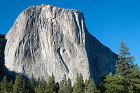
We can argue endlessly as to which of Yosemite's big walls is more spectacular: Half Dome or neighboring El Capitan.
El Capitan forms a higher continuously vertical drop (or nearly so) than Half Dome, though Half Dome is obviously and considerably higher overall.
Perhaps it's best to simply marvel that two of the world's greatest walls of rock happen to exist mere miles apart in this extraordinary valley.
On to the view...
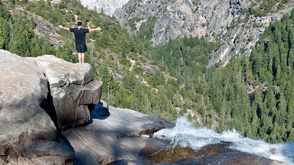
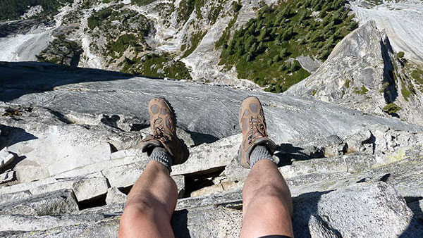
If the drop at the guardrail atop Nevada Falls was electric, the plunge off the north end of Half Dome is otherworldly.
I creep cautiously toward the naked edge and take a peek at the void below.
A wave of vertigo puts a little bobble into my legs.
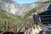
From Half Dome's 8836' summit, it's nearly a vertical mile down to Mirror Lake and the Yosemite Valley floor, elevation 4000'. Horizontally, that drop occurs in roughly the span of half a mile, making it feel as if the whole of the plunge is dead vertical.
To the west, the encampment of Curry Village is clearly visible, looking much like it would if we were flying over via airplane. In all directions there is this charged sense of danger. The safest way down is the way we came up—the cables. Everything else is vertical.
Despite all this technical rock, most people do indeed seem to make it to the top of Half Dome. This, as I've noted, is a direct consequence of the cables' existence: they allow people to go where they otherwise would not. But is is also a testimony to the fact that humans on the whole are a scrappy lot, capable when pressed of far more than they tend to suspect of themselves.
Of course, we all still have to get back down. Time spent on the congestion of the cables has already put me well behind schedule. I wander back to the cables and find yet another queue of people waiting to descend. Wouldn't you know it, once again no one is moving in either direction. Aw, heck. It looks like it's going to take me at least as long to go down as it did to get up.
I find a flat rock by the top of the cables and take a time out, eating the rest of my food and drinking my remaining water. I wait here a bit for Bill, in case he decided to come up. Fifteen minutes pass. Not a single person has successfully come up the cables in all that time. Figuring I may as well get in line now, I pack up my things and saunter over to the cables.
†photo courtesy William Henry — DON'T DO THIS! In order to take this photo safely, the photographer was roped in place (you were roped in, weren't you Bill???)
Descending
Having been maybe a little bit impatient on the way up, I resolve to do better on the way down—and in particular to stay safely between the cables the whole way.
So, my descent begins with another long, long wait. I take my place at the end of the line of people trying, like me, to get back down. Time passes. No one moves. I try to imagine what the holdup is. When after twenty minutes or so a lone person crests the hump and ascends past us, we aggressively interrogate him: what's going on down there?
The answer seems to be just too many people.
Since we've got some time to kill, then, it might be a good time to discuss ways that you can maximize your future cable-crawling enjoyment.
I assume NPS is going to extend the currently-trial permit system to eliminate the Monday loophole. So crowds next year are not likely to be so oppressive.
Still, the best way to beat the crowds is to get up early. Get to the base of the cables by 10 a.m., and you'll likely find the route all but empty. Peaks hours are 11 a.m. to around 3 or 4 p.m., the period when most people reach the cables from Yosemite Valley, mill around at the top for an hour or so, and then head back down.
If there are two mandatory pieces of gear for the route, they are good leather work gloves, and hiking or mountaineering boots with a vibram rubber sole.
The gloves are invaluable for the descent, as they allow you to use friction to step-'n-slide down the cables. The boots are even more important: decades of foot travel across Half Dome's east face have polished the rock to glass-like slipperiness.
In ordinary footwear, including most running shoes, you'll have almost no traction whatsoever on the steepest part of the route—not good. Also, notice that there are wood slats across the cables at each pair of rail posts—use them!
Where it gets steep, stand on the slats, and only move when it's clear on your side to advance to the next slat. Don't attempt to hang from the cable in between slats.
When all is going well, people move single-file up one cable and down the other in a spaced rhythm, stopping at each slat until it's clear to move to the next one. When all is going poorly (ie, today), people clog the cables, getting hung up between slats in large bunches, where they cling, death grip-style, feet slipping and skidding beneath them, their strength and sanity rapidly eroding.
Are we moving yet? Ah, good. I'm ready to get down. It is just shy of 3 p.m. when I reach the bottom of the cables, where I find long-lost Bill ready to ascend. He's decided the crowds on the cables have thinned enough to have a go at it. I wish him well, and we make plans to reunite back in the valley. That done, I set a fast pace down the trail, hoping to make dinner at the Curry Village dining hall.
I'm blazing along when I spy the weary faces of our tent-cabin neighbors, father and son, still diligently working their way upward, now at the base of Sub Dome's granite steps. I say a quick hello as I pass; they don't seem to recognize me. It seems to me they should have turned back by now—especially if they expect to get home before dark—but I'm in a hurry, hungry and thirsty, and I don't stop to say anything.
The Mist Trail
From the base of the cables to Curry Village is a long way down. Assuming an average pace, hikers should allow 5-6 hours for the descent to avoid having to hike back in darkness.
And as I'm speeding downward, my thoughts remain on my neighbors, the time of day, and their terribly slow pace. I'm running the numbers and regretting not taking a moment to ask them if they realize the day is getting late. Do they have headlamps? Jackets? Food? Enough water?
Such trailside advice is typically not appreciated, but still, I'd feel better if I'd said something.
Hopefully they'll abandon the cables and turn back soon.
As for myself, I'm absolutely parched when I finally reach water at the base of Half Dome Trail's switchbacks.
I peel off my shirt, wet my head, and filter some water, which I immediately drink. This looks like a good place to rest, and so I do, sitting down in the shade to cool off a bit.
From here, I've got about a mile of mostly flat travel back across Yosemite Valley to the top of Nevada Falls, where I will descend via the Mist Trail.
Unlike my ascent route, the meandering John Muir Trail, the Mist Trail is steep and short, providing by far the quickest route up or down.
Also unlike the John Muir Trail, the Mist Trail travels right up against both Nevada and Vernal Falls, giving the trail its name (it can be very wet, particularly in Spring).
Back in motion, I cross the sandy section of Little Yosemite Valley. At the junction to the Mist Trail I turn right, heading down. Right from the start, the Mist Trail drops steeply via granite steps in a shaded nook.
Soon, I emerge from beneath the trees into sunlight and in-you-face views of Nevada Falls.
I nearly land on my back as I'm gawking while walking—it's hard to look away from the spectacle of nearby Nevada Falls.
I'm not the only one who's taken by the view of the falls. Roving gangs of photographers lurk about, many with heavy tripods on their shoulders. Probably setting long exposures to blur the rushing water, I reckon. Meanwhile, for me, tired legs, slick granite, and grand scenery make for a tricky combination. I resolve to watch my steps.
The Mist Trail continues its aggressive descent, traveling just north of the mighty falls, down, down, down. Though it may be a little scandalous to suggest it, I'm beginning to think that by leaving the Mist Trail for the end of today's Half Dome adventure, I've saved the best for last. And we've yet to reach Vernal Falls, which lies just ahead...
Vernal Falls
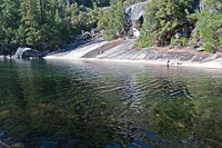
Just across a wooden footbridge, we leave the thundering Nevada Falls behind and soon arrive at the Silver Apron and Emerald Pool, en route to Vernal Falls.
The Silver Apron is a broad granite fan surrounding Emerald Pool. Given our relatively close range to Curry Village, this area tends to be crowded with casual hikers and tourists. In years past, Emerald Pool was a popular sunbathing site—a practice the NPS now discourages.
In fact, signs advise not only of the danger of swimming here, but also that entering the water is a federal offense.
Why all the fuss?
Just below the placid waters of Emerald Pool lies Vernal Falls, and if you haven't guessed by now, swimmers here get swept over the falls with a little too much regularity.
While scenic and misty Vernal Falls isn't quite so high as Nevada Falls, it's still not the kind of place where you'd suddenly want to try to learn to fly.
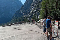
The Mist Trail takes us right to the brink of Vernal Falls, where a guardrail lets us peer over the edge to oblivion with some degree of security. From here, the trail plunges right down Vernal Falls' headwall, in a not-too-modest display of trail engineering that cuts right through solid rock.
As Emerald Pool is far too gorgeous a place to ignore, I stop once again to refresh my water supply and soak my feet. A few hardened criminals (probably Europeans) are swimming in the pool, I see, in brazen defiance of the law.
I'd love to join them, but then again, as I eye the water's current, I decide maybe the feds are on to something after all.
After fifteen minutes or so of rest I'm back on the trail. I pause atop Vernal Falls to peer over the edge, which provides a great view of the trail ahead. The air seems less misty than usual today, which is probably for the best. The trail below the falls is particularly steep, with a prolonged section of steps that are slick enough to cause trouble even when they're dry.
Past the steps, the trail flattens, entering a bright green forest. Just past that, we rendezvous with the John Muir Trail, having completed the loop around the two falls. Curry Village is just another mile or two away, and after a long day on trail and cables, I'm looking forward to a hearty meal. True, it's not easy to leave the beauty of the Mist Trail. But I promise myself I'll come back soon.
Yosemite
Expectation, I've learned, is a funny thing: the more you anticipate being dazzled, the more likely you are to be disappointed. So maybe it's best to think of Yosemite as just another place.
For those who've never been, come with no preconceived notions, no expectations, and let this place make whatever impression it will upon you. Whatever you do, just make sure you end up visiting at least once in your lifetime.
Climbing Half Dome today, I sense I've just barely begun to explore Yosemite National Park. That's a deficiency I resolve right now to remedy.
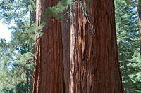
And there is more here than just cutting-edge climbing walls. Enjoy the many short hikes throughout the area. Drive to Tioga Pass, or Glacier Point. Visit one of the giant Redwood Groves.
For a more leisurely day, rent a bicycle and circle around the valley floor on the bike path at your own pace. Or just settle in at one of the picnic areas and fix up a barbecue.
Whatever kind of adventure you're looking for, be it razor's-edge or easy chair, you've got a good chance of finding it.
Humans have enjoyed Yosemite Valley for tens of thousands of years. It's not hard to imagine ancient peoples looking up at those big granite walls and being just as inspired as I am today.
That's one of the unique aspects of Yosemite—for all its wild grandeur, it is also a remarkably habitable place, perfect for a camping trip with the kids.
As I make my way back to Curry Village, I recognize faces I've seen high on Half Dome. From the look of them, they're as excited to have been atop Half Dome as I am.
Bill arrives back down at camp a little over an hour after me. We compare notes, happily reliving the highlights of the day, such as peering over Half Dome's north face, or flirting with Nevada Falls. Half Dome and its crazy cables seem just about perfect in this moment, and when I finally settle my tired body into bed that night, I am exhausted but thoroughly satisfied.
Alas, at four a.m., Bill and I will be woken yet again by our tent neighbor's alarm clock. Tonight, however, there is no one inside the tent to take the call. Father and son, we will later learn, got stuck in the dark high on the trail, spending a scary night above Nevada Falls. Whatever experience they were expecting to have on Half Dome, that likely wasn't it.
Their story is unfortunately not as rare as it ought to be. Most people will get up and down the cables just fine, of course, but some won't, and maybe someday the park service will say enough and have done with the entire business.
It would be a perfectly reasonable decision to pull the cables for good, but I myself hope it never happens. Not everything is meant to be safe, and some horizons are worth expanding.