House of Pain
Climbing Olancha Peak via Sage Flat and the West Face
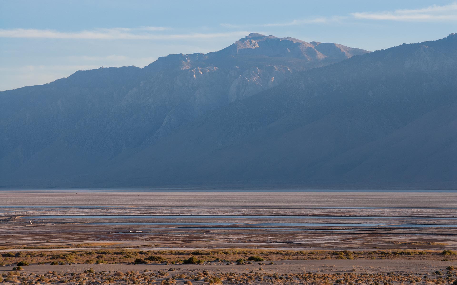
Owens Valley, California — Olancha Peak has long commanded my attention. First of the Southern Sierra's big mountains, Olancha can be thought of as the range's regional ambassador.
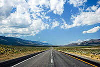
Drive Highway 395 north just past Little Lake, and there it is: a looming outline that fills the horizon. In that first glance, scrappy high desert ranges are instantly forgotten; here it seems as if the whole of the Sierra has suddenly sprung into view, lofty and unbounded.
Draw closer, and Olancha dominates the area, not at all coy about revealing the range's wonders. Olancha is the first of the Southern Sierra's giants to press upon your mind the topography's titanic verticality.
Standing some 12,123 feet above sea level, Olancha Peak is not nearly so high as its next-door neighbors, Whitney, Langley, and Russell, to the north. But then none of these sisters are nearly so close to Highway 395, and the very bottom of Owens Valley.
I stare at Olancha Peak every time I drive past, admiring and puzzling the geometry of the mountain's vast east escarpment.
In this introductory glimpse of the High Sierra, we get a fine sampling of many of the unique traits that make the range so compelling. Massive granite uplift adjacent one of the world's hottest deserts. Complex winding ridgelines connecting sand to sky. Merciless cirques and canyons, unbroken by glaciers, all but impassible.
I have thought often of hiking, climbing, and even skiing Olancha Peak, but some subconscious awareness that it had to be a beast always had me finding other objectives to pursue instead. By any measure it is a long, long way from Owens valley to Olancha Peak's summit: hot, rugged, waterless. But a recent success on San Gorgonio Mountain had me feeling a little cocky. I figured it was time to take on the challenge.
Sage Flat
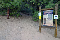
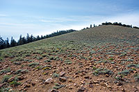
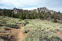
Dawn breaks over Owens Valley. I quit my sleeping bag and wander over a short rise to get a better view. My hiking partner Trevor and I have spent the night at the Sage Flat trailhead, just west of the town of Olancha.
This affords us a nice early start for what we assume will be a long but manageable day getting up Olancha Peak and then back down again. I wish I'd slept better. We started this trip with a classic L.A. traffic jam—an accident shut down the 405 in Sepulveda Pass, costing us an extra hour, putting extra mileage on my stress level.
And it was warm all night—much warmer than I was expecting. We're right around 5800 feet, apparently not quite high enough to escape the heat of Owens Valley.
In addition to restlessness, heat poses a particular worry today: Olancha Peak is waterless. We've got to carry our full ration of water today, and the pre-dawn warmth suggests we'll be sweating right from the start.
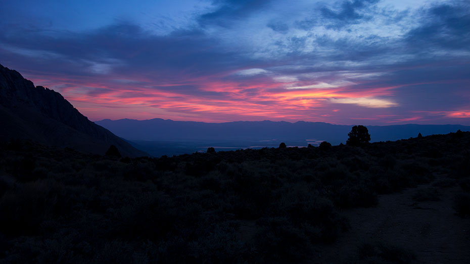
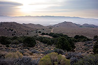
Traffic and heat woes notwithstanding, I'm glad to be here, glad to be enjoying the spectacle of color breaking over the Inyo Mountains to our east.
The quiet of the moment—and my present serenity—stands in jarring contrast to the anxieties of being stuck on the 405 only hours ago, yesterday afternoon. There are times I'm convinced the city is killing me, minute by minute, grinding me up and wasting me away. I feel the pressure of it like a steel band about my chest, ever-tightening.
And now I am here in wilderness, feeling just the barest hint of a warm breeze on my face, watching a bug's silhouette flit against the sunrise, watching clouds glow violet across the horizon. The band about my chest loosens a bit. I take a deep breath. Is this an antidote, I wonder? Can I regain here whatever it is the city has taken from me?
There is no simple answer. Just the gentle rustle of wind across sage brush. Purple hues fade, and the sky begins to lighten. I head back toward camp to see if Trevor is awake. He is, already brewing up some tea. Time for a quick breakfast, and then we'll hit the trail and get this thing started.
Cow Driveway
How much water are we carrying? A lot. Based on a somewhat measured guesstimate of 22 to 24 miles round trip, with no expected refills, we've decided on six liters each.
Okay—five and a half for me. Trevor and I both pre-hydrate at the car, trying to fill our bellies with as much fluid as we can. Then we heft water-heavy packs and start trudging upward in air that is already unwelcomely warm and maybe even a touch muggy. At the Pass—elevation unknown—we'll drop a liter or so to save weight.

But for now, I fiddle with my waist and shoulder straps, trying to find the magic formula to get as much of the load as possible off my back and onto my hips.
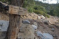
We pass the trailhead sign, then start a stout climb right away, which soon gets us to a cattle gate and a big and oddly-steep holding pen.
Obviously and unexpectedly, ranchers drive cattle through here. In fact, it's soon obvious, via the dung on the trail ahead, that the cows go all the way to the pass.
I've never actually seen a cow do much of anything except graze in a field. The thought of them pushing their way up this inarguably steep trail suggests they're hardier than I credited.
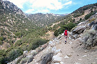
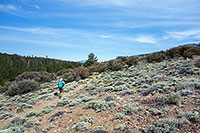
Meanwhile, as with all stock trails, the downside for us humans is both the poop and the dust. All those heavy hooves crush ordinary dirt and rock into fine powder, producing sandy ground that swallows our hiking boots and puffs up around us.
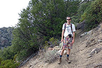
As we hike upward, I'm soon coated in dust and soaked in sweat, already losing those precious bodily fluids. No doubt about it: we'll be playing the salt game, extreme edition, today.
We come to a sign and a fork in the road. Humans to the right, cows to the left. The 'cow driveway' looks to be the direct approach—even steeper than the human trail. Where do the cows get their water, I wonder? Trevor and I go right, up a long series of switchbacks, and all the while I'm imagining those hardy mountain cows, marching upward.
Heat and Sand
Here's something I tend to do: whenever I'm on a big hike, I find myself looking at all the nearby subpeaks, contemplating how eventually I'll be looking way, way down at them.
This probably doesn't exactly qualify as motivational thinking. Those subpeaks—and the pass—tower far overhead right now. But my mind seems endlessly fascinated by this notion of vertical travel—escaping our everyday two-dimensional landscape. Even a thousand feet—a walk across the block—becomes consequential when it involves the z-axis.
And oh, there are consequences today. The heat is positively murdering me. We're currently mucking about somewhere in the 7K elevation range, clock just under 8 a.m., and there's not a whiff of a cool mountain breeze.
No, the temperature's got to be well over 80 degrees. For a while now I've been looking up at those damned subpeaks, thinking we'll soon be looking down at them.
But they stubbornly refuse to give their ground—they're still way the heck higher than we are.
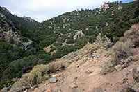
I keep thinking the pass can't be that much higher, but still we trudge up this silty thumping sandy ground, clearly higher than we started, but seemingly no closer to the end. It just didn't look that far on the map.
So now I'm thinking how high can that pass—and how low can we—possibly be?
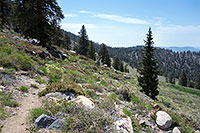
And the cows—my god the cows!—how do they do it? We reach a rocky spine, and I signal to Trevor I need to take another water break. Off comes the pack, heavy thump on the ground, and I plop down next to it, pull off my hat, and fish out a water bottle.
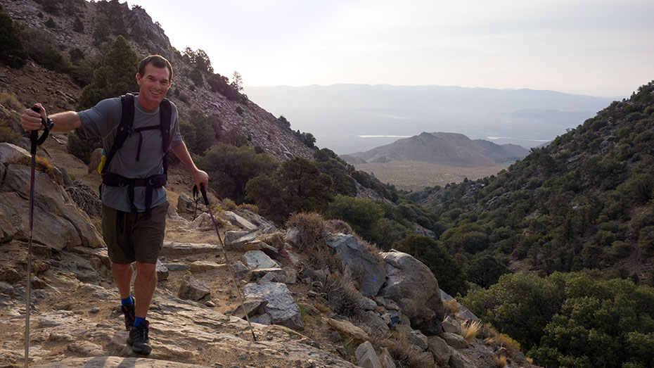
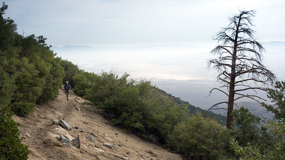
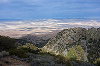
While I'm drinking, I sense I've already got that used-up look about me, hair soaked and swirled in all directions, eyes going wild and desperate. I can see Owens valley far below us, and that indicator of progress gives me at least a little bit of hope. I want to believe we're 3K above the trailhead by now, but my darker thought is we may not even be 2K up.
The air hangs heavy over the valley today, clearly laden with monsoon moisture. We'll likely see a thunderstorm threat later. For now, thin high clouds are mercifully taking the edge off the hot sun, and one or more of this summer's firestorms has also put smoke in the upper atmosphere, adding to the soup and giving everything a sickly orange tint.
Time for more tromping in the sand. Somewhere up here, we're supposed to rejoin the cow driveway, but that junction never seems to come. Instead, following a long traverse, we crest a rocky false pass, with the true pass—I hope—still far in the distance. I wipe my eyes with my sweat-soaked shirt, then fiddle with my pack straps. Time for another water break.
Olancha Pass
Olancha Pass at last. It's certainly been a bit of a grim morning, but we're here, and things are looking up. The westward sky is brighter, clear of smoke, and Sierra colors are finally starting to pop.
Another plus: the hike ahead can't possibly be worse that what we've just gone through. No, it's not exactly cool up here, but it's not hot, and that's a big improvement. As well, from now on Trevor and I expect to be on the gentle grades of the PCT, with Olancha Peak itself little more than a walkup from the neighboring trail.
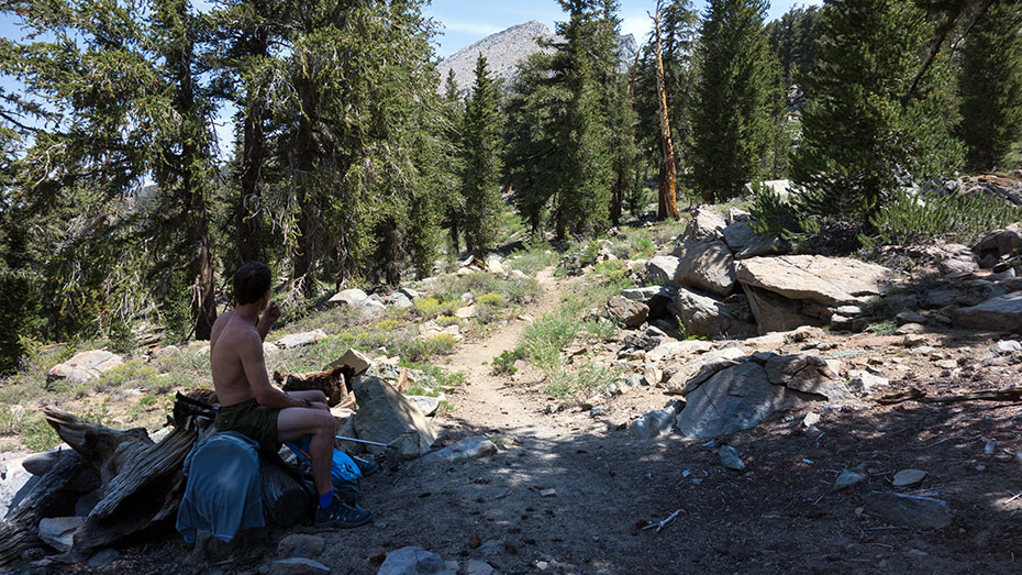
Here at the Pass we peel off soaked T's to cool in the breeze while we take a quick snack break. I mix up a liter of energy powder-enhanced water, hoping to rebalance my almost-certainly out-of-whack electrolytes.
And another liter gets pulled out of my pack, to be stashed in a shady nook here at the Pass for our return trip—no point carrying it any further up the hill.
What's our elevation?
9212'. Figuring we parked the car right around 5700 feet, that's a net gain of among the most grueling three hours and 3500 vertical feet I've ever hiked.
Well, maybe that's an exaggeration. Thoughts of rough days on Shepherd Pass come to mind in comparison. But I knew those days would try to kill me. I sure wasn't expecting such a tough haul just to get here, to the pass.
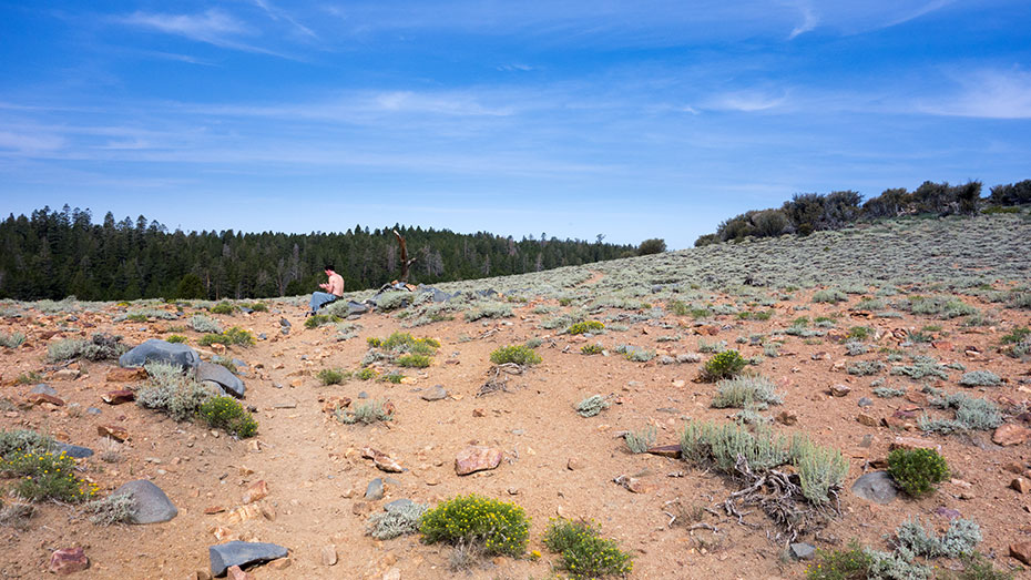
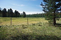
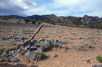
Refreshed or mostly so, we pack up and hit the trail once more. We're heading north now, passing through the last of the area's impressive sage fields, entering the Inyo National Forest and the South Sierra Wilderness.
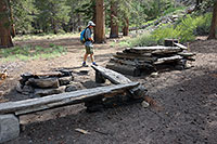
Right after we dip into the woods, there's a surprise: a Cowboy Kitchen. Plus a corral, and the very inviting green grass of Summit Meadow. We've found it: Cow Heaven. With this rich pasture as a reward, it almost seems fair to drive those poor beasts all the way up here from the scrubby sand of Owens Valley. Almost.
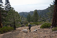
As for Trevor and me, we unfortunately have no steaks nor cans of beans to throw on the fire, so onward we go, enjoying the shade of the pines as we skirt the edge of the meadow. As for the trail, it remains kind of soft and silty, and now I'm remembering soft ground throughout the area when I hiked around nearby Langley.
The soft ground slows our progress, and we do have quite a few miles to go to reach Olancha Peak. It would be a bummer, I think, if the trail never firms up. We're certainly not going to make record time if the ground stays so soft.
The Pacific Crest Trail
I have fond memories of my 2008 Pacific Crest Trail hike from Onion Valley to Cottonwood Pass. That was one of my favorite Sierra experiences—a lifetime highlight, to be sure.
I've been meaning to do another segment of the PCT ever since, but...I just haven't managed to make it happen. So I'm happy to step back onto the PCT now, even if is just for a few miles 'till we get to Olancha Peak. Trevor and I rendezvous with the Pacific Crest Trail just past the end of Summit Meadow, and there it is: a sign pointing the way north and south.
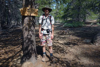
Actually, this is a little triangle bypass, and it's another few minutes before we're on the main through-way, which we find empty save for one lone thru-hiker.
We catch up to him on the trail, and he relates a few adventures he's had so far on his planned Mexico-to-Canada endeavor—one of which nearly ended the whole effort.
He's got a pit stop planned in Independence, and he's obviously looking forward to it, not quite sure if he's going to keep going from there. We offer encouragements, and then gradually pull ahead.
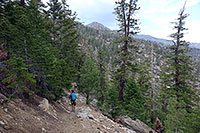
There isn't much climbing to do on this section of our hike, but the grades we do encounter seem stout nonetheless. That grind up to the pass has definitely degraded my energy level.
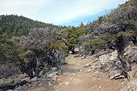
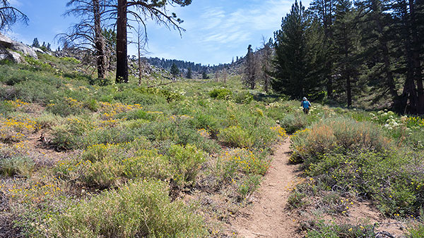
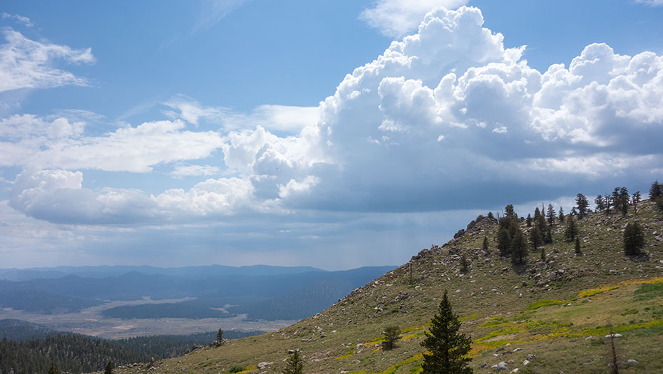
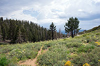
Helping to counteract fatigue, however, is my considerable delight at seeing the interior Sierra again. Things are green and blooming in the South Sierra Wilderness right now.
Bright splashes of wildflowers sprout up through surprisingly thick grasses and green brush, contrasting with a vibrant blue sky overhead, and a scattering of white early monsoon clouds.
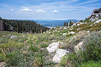
Grey Sierra granite rises to our east, while to the west, we have a fine view of the massive Monache Meadow. Accessed via the highway to Kennedy Meadow, you can use the trailhead at the Kennedy Meadow campground as a starting point for a south Sierra PCT segment, or even as an alternate Olancha Peak approach.
Rumor has it there's also a way to drive remote and rugged 4WD roads very nearly all the way to Monache Meadow itself—which would be by far the easiest way to get to Olancha Peak. This route is said to be viable only during a narrow window after the snows have melted, and the meadows have all gone dry. Otherwise, it's a mud bog, impassible.
West Face Talus
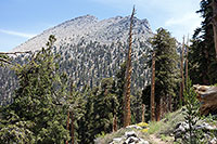
It's 11:38 a.m. I've been expecting Olancha Peak from the west to be little more than a bump along the crest of the Eastern Sierra—an easy walk from the Pacific Crest Trail.
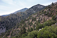
But here's the thing about looking at topo maps: sometimes they don't quite give you the whole picture. Trevor and I top a saddle just past a series of dry springs, and suddenly we get our first good view of Olancha Peak's southwest face. It's big. No: it's huge. And it's still probably a mile and a half away.
We both look at each other, each of us beginning to do time and distance calculations. After all, eventually we're supposed to turn around and somehow get ourselves back home—today.
Lunch break. Sure, my legs are fading, and my anxiety level is rising, but I've got a secret weapon: Pizza. That's right, I've packed several slices of real, honest-to-goodness pepperoni pizza, a salt and flavor extravaganza.
I've been thinking about those pizza slices for hours now, just waiting to unleash them upon my innards to supercharge my body. I'll just open up my pack here and pull them out of my lunch sack and...
Hey, where's my pizza?
I packed it up right here, didn't I? Maybe it's at the bottom of my pack? I'll just pull all this stuff out and—nothing. It must be in my lunch sack. Let me check again. And again. Nothing.
I have no pizza.
Somewhere, three slices of delicious pepperoni pizza are waiting, carefully and individually wrapped, but that somewhere is not here.
Oh crickey, I don't mean to get dramatic, but that was my lunch. I mean, what do I have left? Some cheddar bunnies and a scrap of cheese? I look again at Olancha Peak's west face, which has just grown significantly higher and farther. Well. We'll just have to carry on, I guess. Mental toughness, eh? Good training for Williamson. Now please excuse me while I go cry...
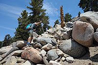
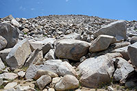
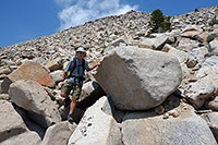
An hour later we're at last at the base of Olancha Peak. No trail here, just a few cairns leading into the thicket of a talus field. It'll be classic Sierra scrambling up big granite blocks from here, a good 1500 vertical feet from the look of it. I pep up a bit with the pleasures of climbing, the increasing views, and the nearing summit, but it's clear now that the return trip is going to be merciless.
Summit Prominence
Climbing Olancha Peak has in many ways been a series of surprises thus far, but we're not done yet. The mountain has saved its biggest—and by far its best—surprise for last.
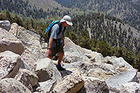
Up the talus field Trevor and I go, each of us warning the other to be careful on this loose block or that, each of secretly pulling as hard as we can to get to the summit first. I give blocks a big smack with my hand as I grab them. A hollow sound means danger: a block that's liable to shift without warning.
I'm grooving into a monster rhythm, running the pace right up to redline, feeling that incredible Sierra charge light me up like a rocket. Full burn!
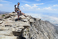
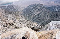
And then the talus flattens and the summit appears, and I'm suddenly skittering to a stop right at the edge of a truly stunning dropoff.
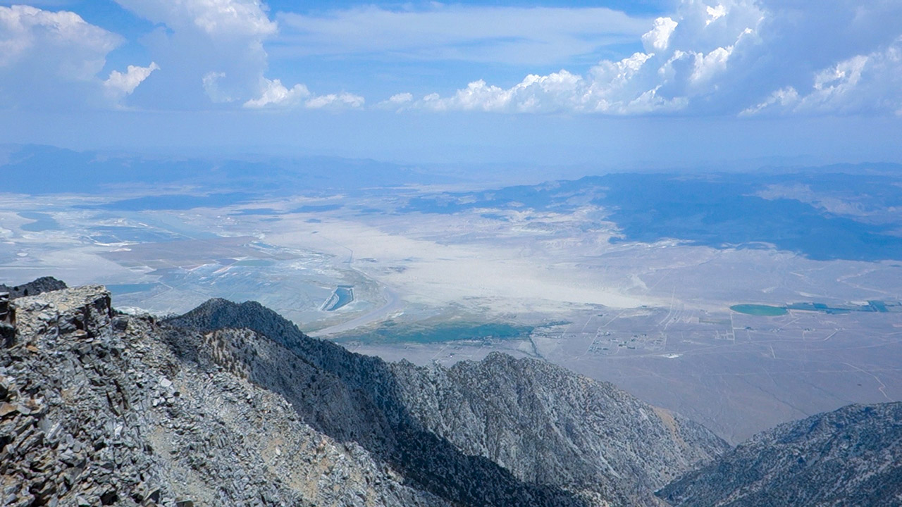
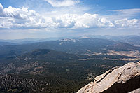
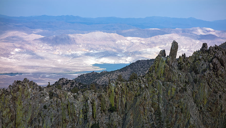
You know, sometimes numbers just don't tell the whole story. Here atop Olancha Peak, in person, what is immediately obvious is that the peak absolutely dominates the range for miles in all directions.
Looking over Owens Valley, and the town of Olancha far below, the vertical relief is simply massive. No, not strictly as big as elsewhere in the Sierra, but the sense of verticality here is eye-popping—and that extends in a full circle about us.
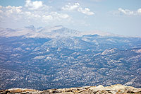
Looking west, the view maintains its airplane-wing quality. I see Monache Meadow, the Toowa range, the Kaweahs, the Kern River Canyon, and the Great Western Divide. And there to the north, of course, is Whitney, Russell, and Langley.
Here is Olancha's Peak's final and greatest surprise: this is one of the signature views of the entire Sierra.
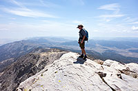
Well, we've sure worked hard to get here. And much as I'd like to stay a while and soak in the panorama, there are thunderheads brewing all about us. And my clock presently says 2 p.m., which means we're going to need to push hard to get to the car by dark, rain or not. I don't expect going down to be much easier than up today.
Trevor and I pack up and say our goodbyes to Olancha Peak's summit. I take a moment to perch myself atop the granite diving board over Olancha Peak's incredible east face. Looking down, I have a feeling I'll be back. I really think I will. But for now, it's time to rally myself for the dismal reverse-scramble down the west face's talus. No doubt about it: this is going to hurt.
Sierra Showers
As we start descending, a small white cloud suddenly sprouts right off the summit of Olancha Peak. I've seen these little white puffs before, and I know they can be anything but harmless.
If there's going to be a thunderstorm, I want to be anywhere but on the exposed open steeps of Olancha Peak's west face, so I do my best to scramble down as fast as safely possible. When we get to the base of the west face, the cloud evaporates: false alarm. My legs, however, are paying the price for our rapid descent.

I've got a bad case of sewing-machine leg. My poor muscles are quaking up a storm. And my feet, which have been doing admirably well until now, are showing signs of blisters.
I tell Trevor I've got to stop and attend to my feet.
Things look worse than expected. I've got tape, which I make generous use of, but the blisters are well underway, and I'm no miracle worker when it comes to field foot medicine.
Luckily we've hit the Pacific Crest Trail, with its mostly-moderate grades. I'm hoping I'll be able to cruise along carefully and do no further damage—until we get to Olancha Pass, at least.
We hit the trail again. Right away, something goes awry with one of my feet. Embarrassed, I signal to Trevor I've got to stop again. I try to make the second patch up job a quick one. Okay, now I think I'm ready.
Rain sprinkles down, surprising the two of us. That on-and-off cloud has switch on again, this time building into a brief but plucky squall.
Should I break out my wind shell? Nah. But I do hide my camera.
Rain, clouds, and afternoon light conspire together to turn our surrounding landscape into an absolute feast for the eyes. Just a light sprinkle, and suddenly everything green has exploded in vibrancy. The flowers are glowing. The sky a piercing blue. Here is the Sierra in its Sunday best, a three-dimensional postcard.
Yes, the feet hurt, but the scenery sure does take the edge off. And the rain sprinkles are welcome on this stubbornly hot day in the south Sierra. The miles pass slowly. There just isn't much kick in my legs now, not on this slow sandy ground. The hard part, I know, is yet to come. How far to the pass, I wonder. And: will I make it back down? This hike is crushing me.
House of Pain
We take our final break at Olancha Pass. Cumulus clouds are darkening in the late afternoon sun, but the storm threat has faded. Sage glows electric green wherever the sun touches it.
Sitting hunched on a rock near the pass's signpost, I fantasize we're already back at the car, taking off our boots, hitting the road, finding a cafe and stopping for dinner. I'm opening the menu and getting ready to order when Trevor suggests we get moving.
Expectations matter, and I totally blew this one. I thought the hike would be hard, sure, but nothing like this. We're far from being done, and I'm already finished.
Right now we've got to descend a steep, long, and sandy 3500 vertical feet to get to the Sage Flat trailhead.
Put it all together, and this is easily among the most grueling day hikes I've ever attempted. I just wasn't prepared for it, and now I'm totally zapped.
As for my feet, there's not much to be done about them. No point trying to re-tape them. All I can do is try to step carefully, place my feet in whichever way causes the least pain, press on until we're done.
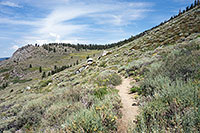
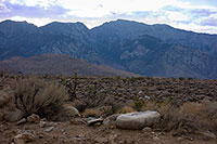
We reach the false pass, which offers a spectacular overview of Owens Valley. I can see the road to the trailhead, and a tiny patch of green which I know marks where the car is parked.
As the sun continues to lower, the sands of Owens valley glow white hot, reminiscent of the view of Death Valley from Telescope Peak. Brooding purple-blue clouds hang overhead, creating streaks of light over the valley.
The magic of the view helps distract me from the misery of my feet. I hobble along, chasing Trevor, trying to find the discipline to pull out my camera here and there to snap a shot of the spectacle. Every fifteen minutes or so, Trevor stops and waits for me, dispensing two peanut M&M's—a reward to keep me moving. And bit by bit, it's working. We're starting to chew through these last grinding miles.
My pain tolerance is being severely tested, both feet just shrieking now, overwhelming all the other aches and pains in my body. I plod on through the sand, baby steps like I'm walking on ice, trying to keep those feet from shifting. A steep section makes me grit my teeth, but I keep moving. Got to grind it out. There's the big corral—getting close now.
Last stretch. There's the trailhead sign. Has it ever felt like this? A few times maybe, those skiing epics on the big peaks, Williamson and Tyndall. I remember nearly passing out at the car. I remember thinking I needed to find an easier sport. Broken by Olancha Peak, but I made it down. Last steps to the car. Boots come off and as long as the engine turns, it's all over—until next time.