Mount Whitney - The Mountaineer's Route
Revisiting John Muir's Classic High Sierra Climb
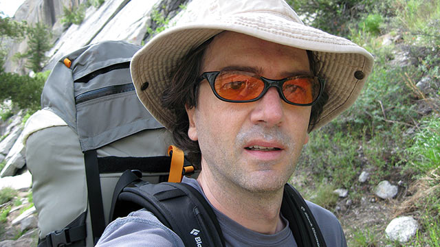
Mount Whitney, California — The Mountaineer's Route was my introduction to Sierra climbing, and it scared the hell out of me. I'd done a bit of scrambling here and there in my travels, but nothing that qualified as official rock climbing.
Still, when a group of friends secured a permit to climb Mount Whitney and invited me to join the party, I said yes without hesitation. Rising 14,505 feet above sea level, Mount Whitney is the highest point in the contiguous United States—making the peak easily one of the most coveted summits in North America.
Most hikers test their stamina on the heavily-traveled Mount Whitney Trail. But our group had a different objective in mind: the Mountaineer's Route, a challenging climb up Whitney's east couloir first climbed by John Muir in 1873.
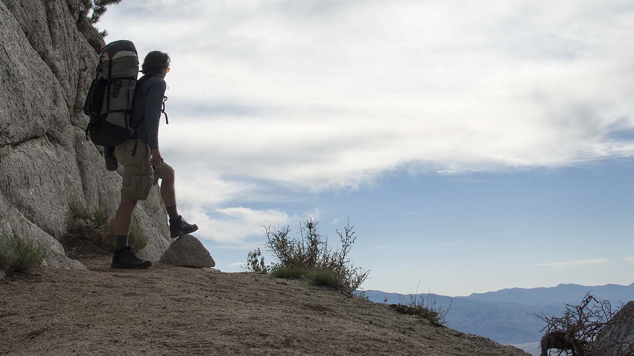
Our guidebook assured us the Mountaineer's Route was no more than a Class 3 climb, which sounded easy enough. And, after battling gullies clogged with willows, merciless talus and scree, heavy packs, and altitude, we at last gained the 'Notch' atop Whitney's east couloir, elevation 14,000'+, expecting an easy traverse to Whitney's summit.
Instead, we found bare ice blocking our path. We talked about turning back, then made a dicey, unroped scramble up exposed rock along the left side of Whitney's North Face.
The experience was harrowing: one slip meant an uncontrolled slide down the icy chute toward a waiting 300-foot high cliff.
When we finally gained the summit, it was with a sense of relief rather than triumph—and we still had to make our way back down. That day made a lasting impression. I learned the Mountaineer's Route is big, spectacular, and, under the wrong conditions, absolutely treacherous.
Hearing reports this year that Mount Whitney was essentially snow-free following our dry winter, I decided to return to the Mountaineer's Route. It had been a while since I'd climbed Whitney, and I was eager to return.
After all, height is but one of many excellent reasons to climb California's highest peak. From the lowly deserts of Owens Valley to the Sierra's lofty summit, climbing Mount Whitney is a diverse journey through an unforgettable, constantly-changing landscape. To follow in John Muir's footsteps as you work your way up the Mountaineer's Route is to truly appreciate the magnitude of Muir's 1873 accomplishment.
And for my own benefit, I was particularly interested in revisiting Mount Whitney's North Face. I wanted to return to the Notch under better conditions to rewrite the terrifying memory I had of it. Without snow and ice, I doubted that section of the route would once again scare the daylights out of me. But then again, you never know.
Whitney Portal
Whitney Portal from the Mount Whitney Trail
Towering some ten thousand vertical feet over the high desert of Owens Valley, the eastern escarpment of the Sierra Nevada surges upward with jarring abruptness.
Blame California's restless geology.
Not-so-ancient fault action pushed up this section of the Earth's crust, giving the state a two hundred mile long granite spine. The dry, dusty basin of Owens Valley could not form a more perfect contrast with the High Sierra's alpine forests and austere rock.
From the tiny but charming town of Lone Pine, California, elevation 3727 feet, is it but a quick 11 mile drive up the Whitney Portal Road to Whitney Portal.
Once you reach the Portal, you'll immediately notice the cooler—and thinner—air.
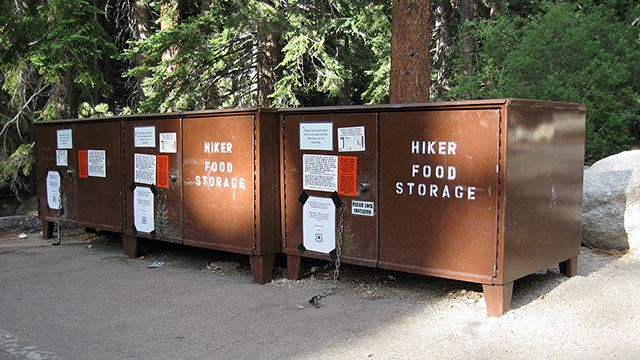
You'll also notice an abundance of signs warning you not to store food in your car. Food lockers are conveniently provided at the parking lots and campgrounds to safely store your food and other scented items (lotions, etc.).
The Whitney Portal bears are getting awfully crafty, however.
Hikers may find it best to empty their cars, as bears may judge anything visible inside as potential food until proven otherwise. In any case, do not leave food anywhere in your car, even the trunk.
Once you've secured your perishables and gear, take time to wander around the area.
The Whitney Portal Store lies at the end of the road. The store is a fine place to grab last-minute forgotten supplies, get current trail information, and even enjoy a tasty meal.
Nearby is a quiet fishing pond and the chilly waters of Lone Pine Creek.
In summer, Whitney Portal is likely to be crowded, and the surrounding campgrounds booked for months in advance. Hikers and climbers in various states of readiness sort through piles of gear, some purposefully, others with a notable look of confusion. Mount Whitney attracts all types, from hardened mountaineers to the most clueless neophytes.
Depending on your outlook, this can make your own hiking experience either a rotten stroll through a three-ring circus, or an amusing look at the diversity and enthusiasm of your fellow human beings. Whatever attitude you choose to adopt, you'll see it all on the Whitney Trail—for better and for worse.
My favorite photo of MWT silliness shows a hiker carrying his tent up the mountain—still in the original box. Less amusing, of course, are images of woefully under-equipped hikers marching upward, oblivious to the danger. We could linger for hours about the Portal and take in the sights. But for us today, Whitney Portal is but a way station. It's time to pack up the gear and hit the trail.
The Mount Whitney Trail
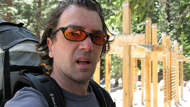
I heft my pack and stroll from the overflow parking lot to the trailhead. After my usual post-ski season break, it's good to be hiking again. I'm thinking about the route ahead, previous attempts, successes, challenges.
Will I be able to find the Ebersbacher Ledges, I wonder? How will the altitude affect me if I camp at Iceberg Lake? What will the North Chute look like? Will I make the summit?
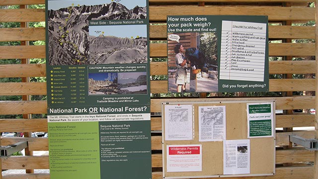
At the trailhead I find a battery of signs and notices, stern warnings of the rigors ahead. Also present is a scale enabling hikers to weigh their backpacks. That's a temptation I can't resist. Minus my usual winter climbing hardware, I've packed somewhat extravagantly for my Whitney hike: a Themarest pad, a down pillow, a coffee mug, extra food, extra clothing, five pounds of camera gear.
How much does it all weigh? The answer is a surprisingly-low 32 pounds. Only 32 pounds? Clearly, summer hiking has its advantages.
Through the wooden gateway I go, and at last I'm hiking up the trail, off to whatever awaits me.
A cheerful squirrel sees me off, which I take to be a good omen (note: if a squirrel actually speaks to you, this is a very bad omen indeed—requiring an immediate descent to lower elevations).
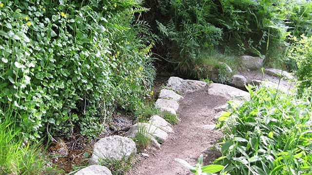
The Mountaineer's Route follows the Mount Whitney Trail for the first mile or so, which begins with a long switch-backing section up the north side of the Lone Pine Creek drainage.
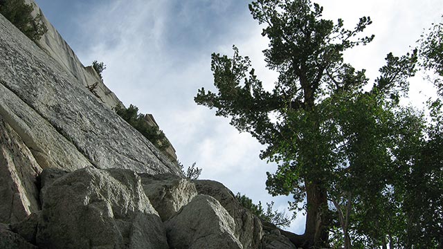
Here the trail is broad, easy, and well-traveled. Hikers quickly gain altitude, and fine views of Whitney Portal abound. The terrain is alternately dry and lush. The Eastern Sierra borders the desert of Owens Valley, and rainfall is scarce most of the year. Consequently the forests have evolved to cope with meager precipitation. Small creeks and springs are common, however, and where these occur sprout bright green glades.
All greenery vanishes at higher elevations, of course, which become austere Alpine environments dominated by gray Sierra granite. Mountains such as Whitney sometimes strike me as instruments of time travel. As I am hiking today, I find my thoughts going back to earlier attempts to hike this mountain, past visits with friends and family, solo ventures (some spectacularly misguided) as well.
I am not alone in finding the Whitney zone irresistible. Many hikers choose to return regularly to Whitney, as if using the peak to mark off milestones in their lives. One such hiker was Hulda Crooks, who ascended Mount Whitney on every birthday from 66 to 91. In 1995, Day Needle, a 14,000' peaklet beside Whitney, was renamed 'Crooks Peak' in her honor.
But perhaps we should not daydream for too long: the first of the Mountaineer's Route challenges is fast approaching—finding the start.
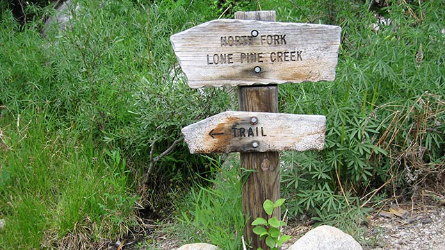
The North Fork
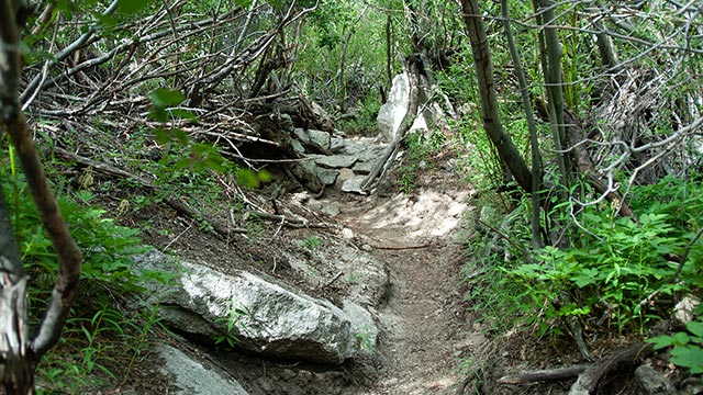
The North Fork of Lone Pine Creek leaves the Mount Whitney Trail and instead veers west, folling a steep, narrow canyon. Here, the Mountaineer's Route proper begins.
While the majority of Whitney Hikers will stay on the trail and cross the creek, Mountaineer's Route climbers will instead begin following a use trail up the north side of the canyon. As you quickly gain altitude in this dense and claustrophobic canyon, it is worth considering the miseries it must have caused John Muir on his first ascent.
Originally, climbers took myriad paths through the willows. Repeated creek-crossings were the rule, as was getting stuck in spirit-sapping dead-ends and backtracking.
In the process, all that tromping around caused a good deal of damage to the fragile environment. Thankfully, a consensus route is emerging, helped along by the Forest Service, which has begun reconstruction efforts in damaged areas.
This, alas, will become a theme for the duration of the Mountaineer's Route: on the one hand, there is a strong argument for maintaining the Route in its original, trailless-state (and thus preserving its high adventure).
On the other, this remains a high-use area, and without a trail, people scramble across it indiscriminately, inevitably eroding and degrading the landscape.
Matters are complicated by the canyon's sides—smooth granite slabs that funnel traffic toward the willow-clogged creek.
The gist of the route today consists of a brief hike up the north side of the creek, staying in a small pine stand to avoid the brush.
Soon, however, the route plunges into the brush, crossing the creek, and then leading high up the south side of the canyon.
Following years of heavy snowfall, these creek crossings can become serious matters, and hikers have drowned in such circumstances. This year, however, the creeks are low, thanks to an abnormally poor winter (which will be of particular benefit on the route higher up). Now on the south side of the canyon, I am treated to fine views of Whitney Portal and the town of Lone Pine far, far below. From here, I can also see the Ebersbacher Ledges, on the opposite side of the creek.
The Ledges have become a clever and infamous part of the Mountaineer's Route, allowing hikers to bypass the worst of the willows—at the cost of a section of exposed travel. If you miss the entryway to the Ledges, it is possible to continue upward, battling your way through the merciless willows. Faced with their formidable barricade, however, many unlucky climbers have simply abandoned the effort entirely and turned back.
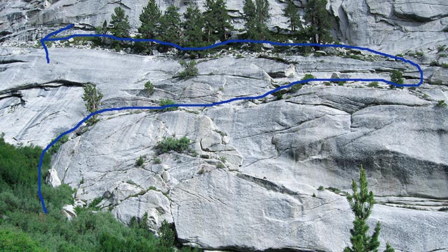
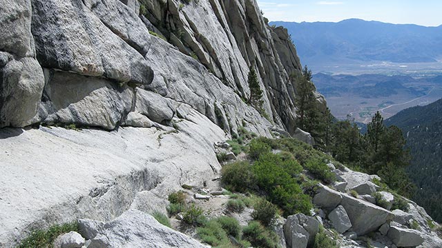
Ebersbacher Ledges
Finding the correct path to gain the Ebersbacher Ledges is a topic of much concern among newcomers to the Mountaineer's Route. In years past, it was indeed challenging to choose the right path.
Now, however, even those with modest route-finding abilities will likely find it easy enough to stay on the emerging use trail, which traverses back and forth across the creek and ends exactly at the short scramble needed to gain the Ledges' start.
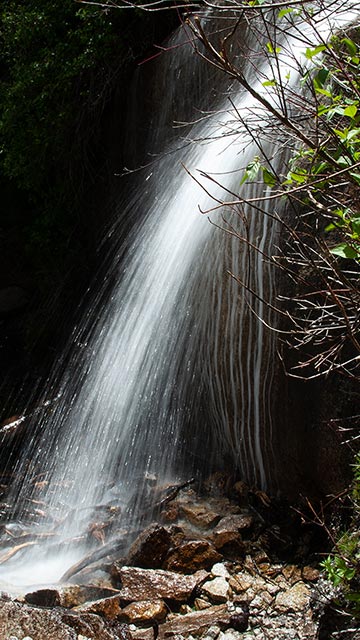
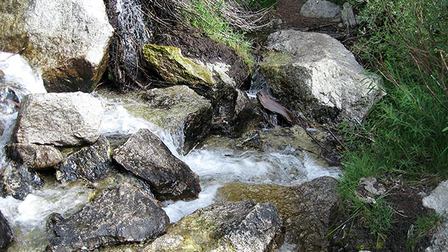
I cross the creek, passing a hidden waterfall, and make my way to the lone Lodge pole pine marking the start of the climb. The sun has turned this east-facing canyon into a solar oven. I'm eager to get higher, hoping for a breeze to cool the air.
An 'easy' Class 3 scramble leads to the start of the Ledges, which then traverse east a hundred yards or so before switchbacking to the west.
Hikers with no climbing experience whatsoever may find the first scramble to the base of the pine tree alarming.
If so, they certainly won't be happy with what comes next: the traverse is undeniably exposed, with a scattering of loose gravel that compromises traction.
For most of the route, climbers can hug the side of the canyon and feel relatively secure, notwithstanding the cliff immediately below.
Be advised, however: one short section of the Ledges narrows to perhaps only 12 inches or so. Unfortunately, this part also happens to be the most exposed.
The standard means of assessing climbing route difficulty struggles to accurately describe a challenge like this.
In terms of difficulty, the section is trivial, Class 1 or 2, no harder than walking along a street curb. But exposure—the prospect of a fatal fall if one slips—changes the equation. I would prefer to see exposed routes assigned a mandatory Class 4 rating regardless of difficulty level. In my mind, this would better advise climbers of the challenge of traversing atop a 100-foot cliff, regardless of how 'hard' the move actually is.
For now, the system remains as it is, and we have no universally agreed-upon way to describe such climbs. Some climbers will find the Ebersbacher Ledges trivial and wonder what all the fuss is about. Others will find them terrifying.
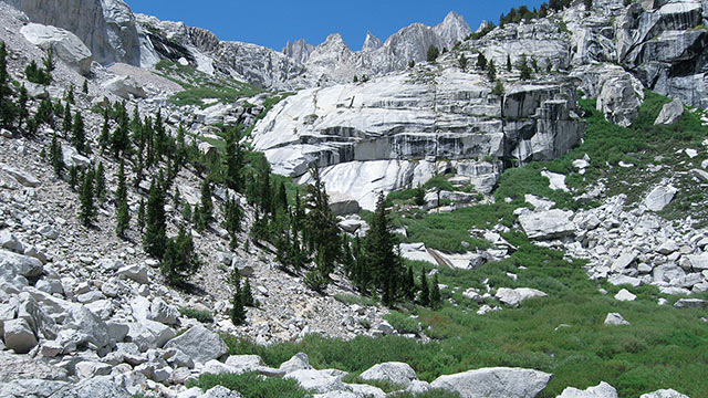
In any case, I'm happy to be across the tricky part safely, then on my way back to the west, traversing through the small patch of forest and then hiking up the final third of the canyon, on my way to the first of the Mountaineer Route's pit stops: Lower Boy Scout Lake.
Lower Boy Scout Lake
After the claustrophobic confines of the north fork drainage, it is a relief to at last reach the open vista of Lower Boy Scout Lake, where Mount Whitney's summit and the two Needles make a brief appearance.
I take the opportunity to pump some water and snack on a handful of pretzels. If it seems like it's taken a while to get here, it has! Lower Boy Scout lake sits at 10,300', fully two thousand vertical feet above Whitney Portal and the trailhead.
That makes the lake an excellent place to stop, re-hydrate, and air out the feet—which is exactly what I do. I find nice grassy spot and settle down for a little break.
Lower Boy Scout Lake is considered the first potential camp site along the Mountaineer's Route. At 10,300', it has the advantage of being at a relatively modest elevation, offering warmer weather and less chance of getting sick at night.
But, the area is buggy in summer, and a long way from the summit, so most people choose to camp higher, either at Upper Boy Scout Lake, or Iceberg Lake. When I pack up and step across the stone path to the opposite side of the lake, I notice a few trout swimming in the shadows.
One of the many pleasures of the Mountaineer's Route is its remarkable variety. The way is broken up into clearly defined sections that bear little resemblance to each other.
This contrast in scenery keeps the route interesting, even in the face of the tremendous vertical distances to be gained. You're always finding something new to look at.
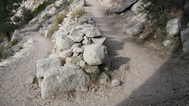
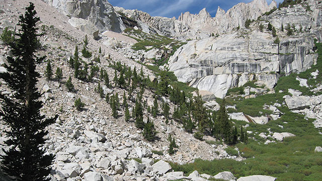
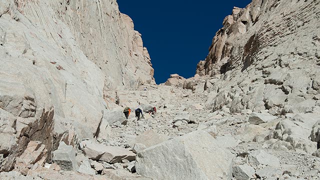
If you're expecting easier going now that we're up above the willows, however, you'll be disappointed. From Lower Boy Scout Lake, a faint use trail quickly leads us to a broad and bare field of talus.
For those of you who are new to talus' pleasures, I won't spoil the fun with too much discussion of it. I will note, however, that for the remainder of the Mountaineer's Route, loose talus and scree will be near-constant companions.
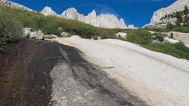
As for routefinding, hikers and climbers can search for cairns to follow through the talus, in hopes of finding easier passage—or you may simply strike off on your own. After about 500 vertical feet of scrambling (that is, after you've had about enough), the route crosses the creek once again, gaining a network of smooth granite slabs.
Here, again, winter snowmelt can be a problem. The slabs lie directly in the creek's path, and in flood seasons, may well be in the creek. Today, however, the slabs are largely bare granite, perfect for avoiding the talus and willows on either side. That eliminates one concern, but I am a little nervous about getting lost in this section.
There is no trail, and there are several critical creek crossings to make to avoid getting trapped in willows, or dead-ended on an impassible slab. Luckily, I stay on-route without having to do any backtracking. Thanks to the hard smooth granite, I make quick time up this section of the climb, and I know Upper Boy Scout Lake can't be far.
The Moraines
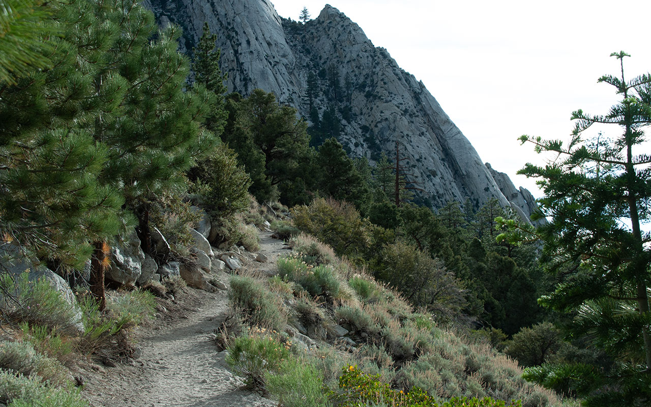
Hikers heading down, Lone Pine Peak in background
Hikers may choose from three potential camping sites during their Mountaineer's Route climb. As mentioned, Lower Boy Scout Lake is the first—and lowest.
Most people prefer to get farther up the mountain for their summit bids, thus they continue on to the second camping area, Upper Boy Scout Lake. Here, the scenery is perhaps not so stirring, but the weather (usually) remains reasonable, and the area is within striking distance of Whitney's 14,497' summit.
More importantly, at 11,300 feet in elevation Upper Boy Scout Lake lies within a much safer window insofar as altitude is concerned.
Sea level residents must concern themselves with this issue of altitude and acclimatization—especially regarding where they choose to sleep.
The highest camping area short of the summit itself is Iceberg Lake, fifteen hundred vertical feet above. At this elevation, some degree of altitude sickness is not a possibility for unacclimatized hikers—it is a certainty.
I strongly recommended camping no higher than Upper Boy Scout unless you are an experienced high altitude mountaineer. Camping lower will increase your chances of making it up the mountain successfully, and getting back down safely.
Today, I am of course ignoring my own advice and continuing upward to Iceberg Lake. This is partially under the guise of research: I want to expose myself to a night at altitude and see how my body reacts.
We'll revisit that experiment shortly.
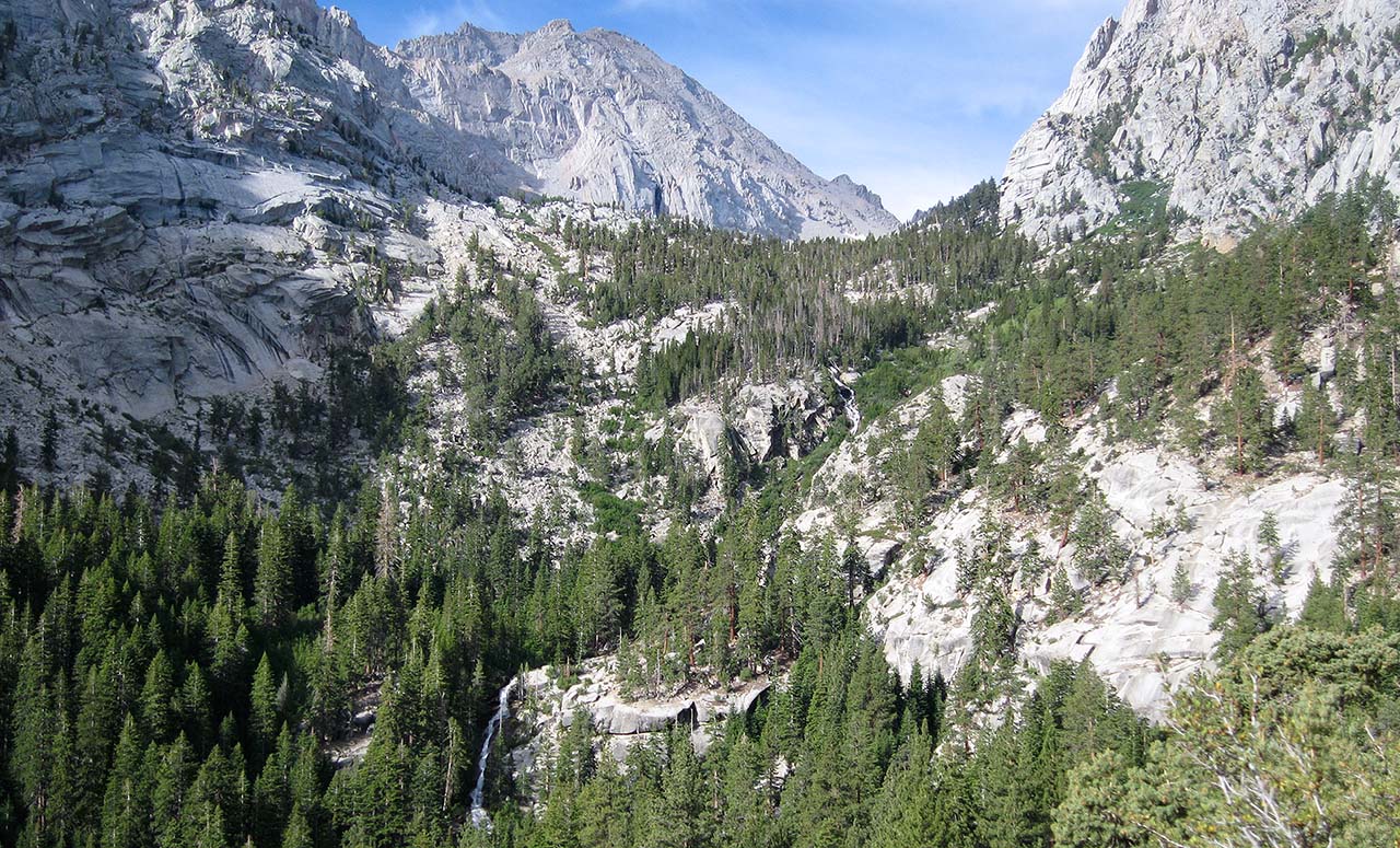
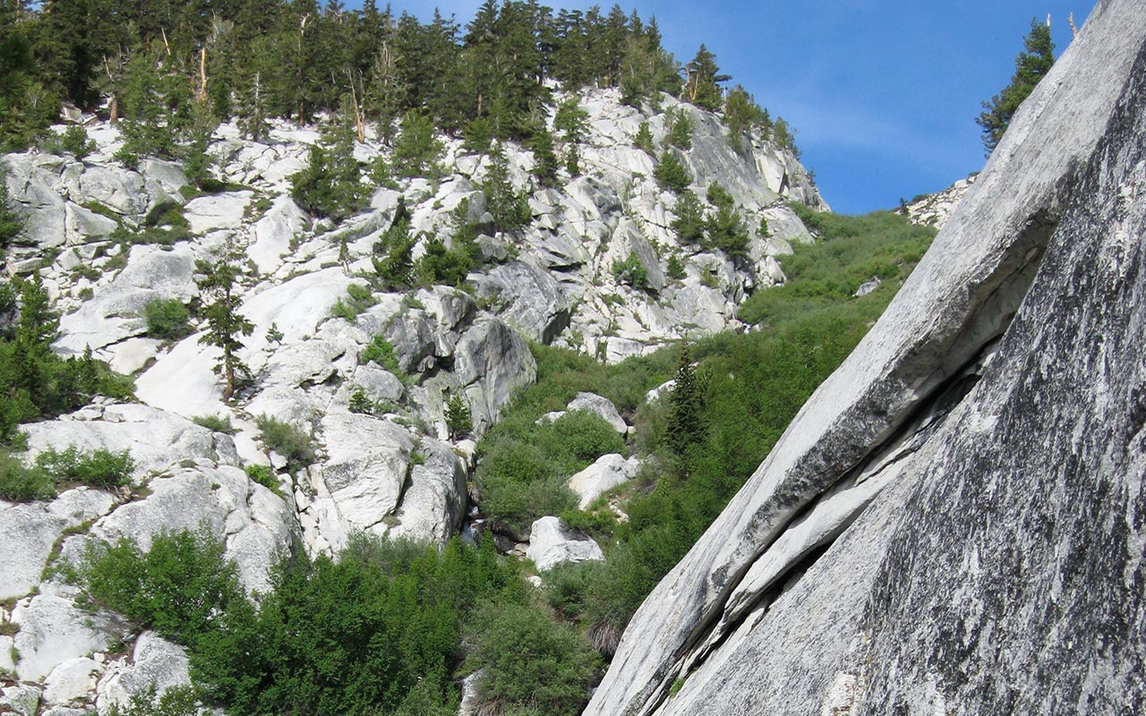
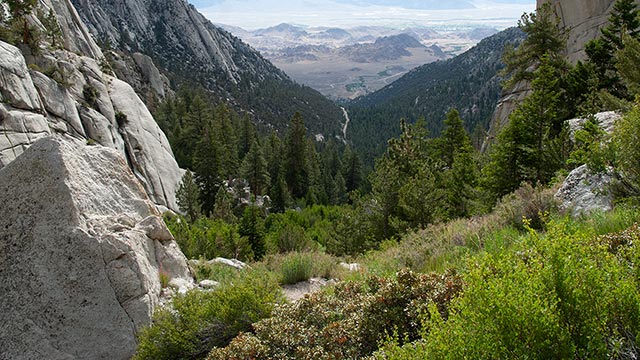
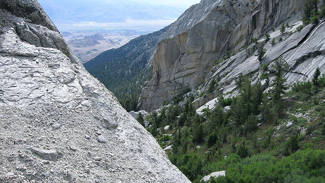
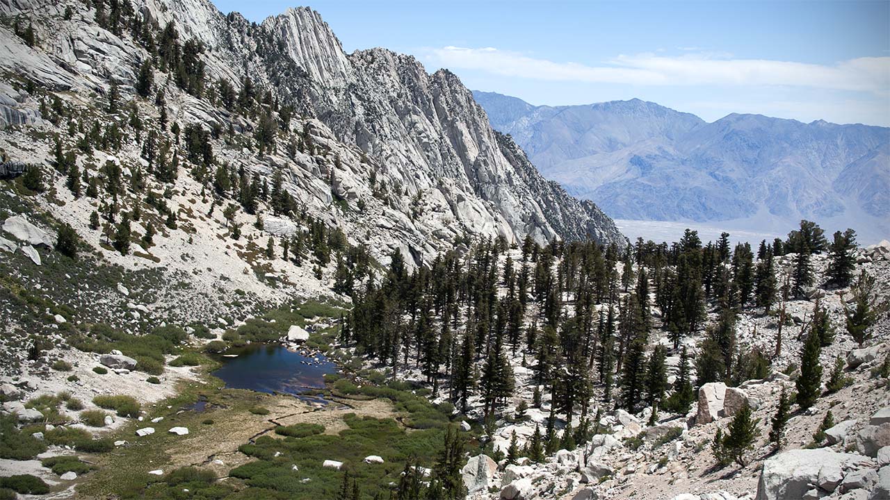
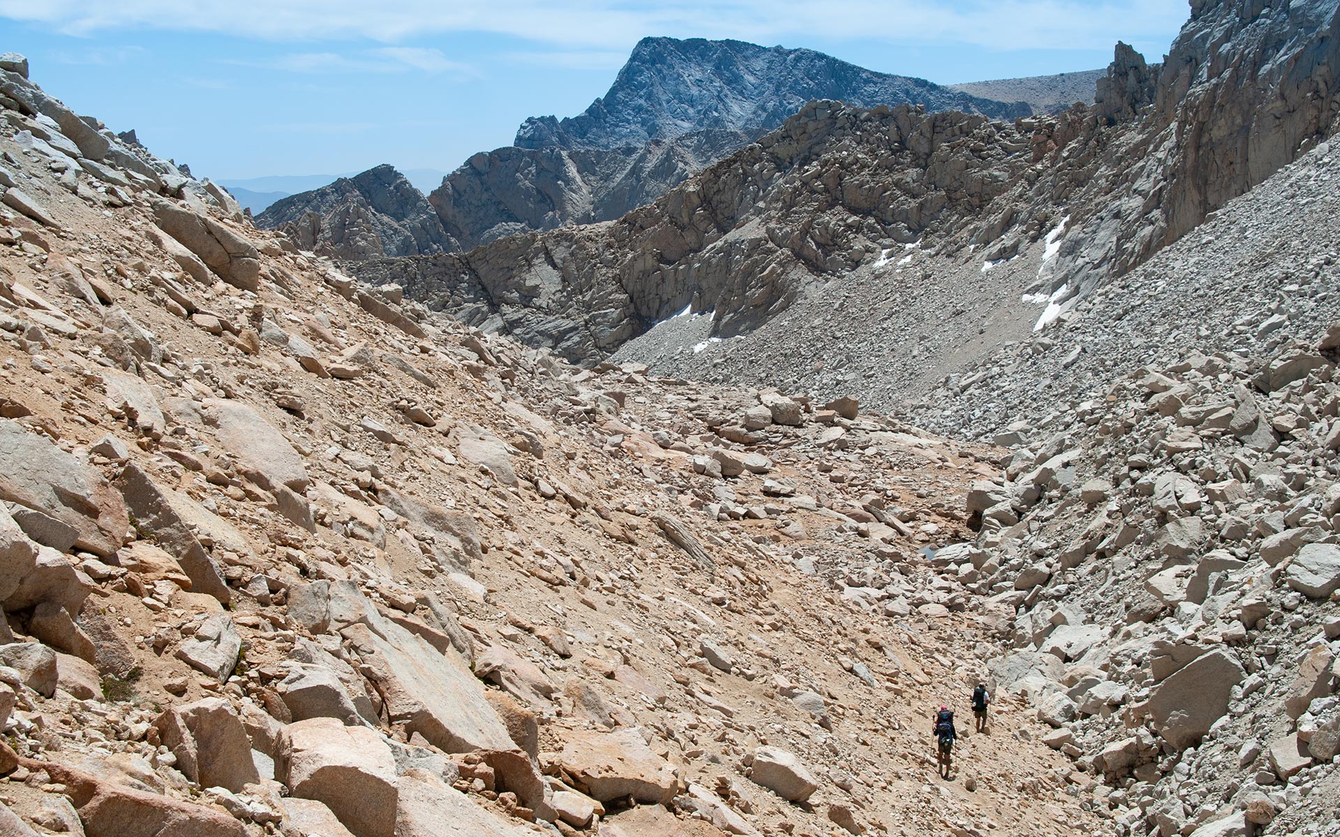
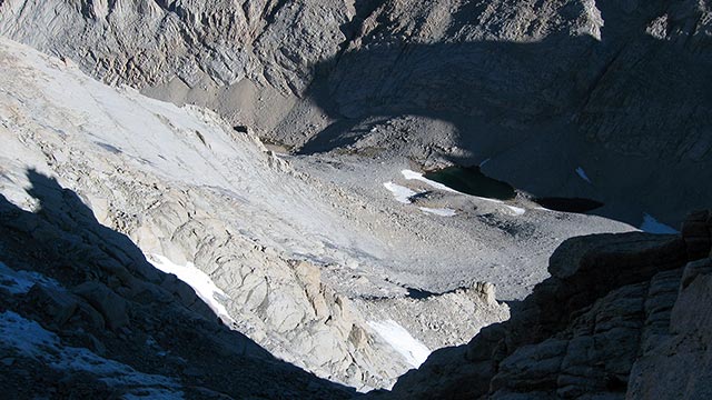
Meanwhile, the day remains hot, even at my present elevation. I am sweating heavily and wishing for a breeze. The landscape has taken on an otherworldly cast, as if I've somehow suddenly climbed up to the moon. These are Mount Whitney's moraines—remnants of glacial action. The route winds through immense piles of debris, carved out and pushed about by long-departed glaciers. The going is slow here: a long, tedious traverse across loose ground and steep rubble.
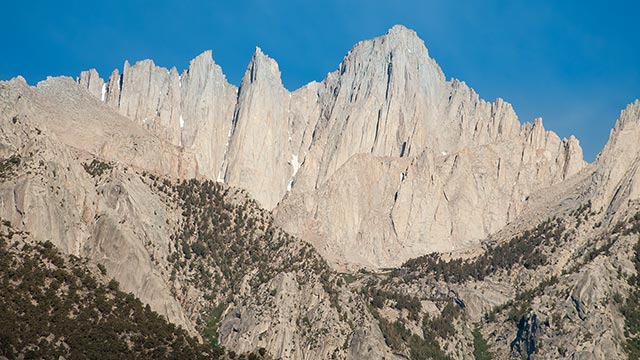
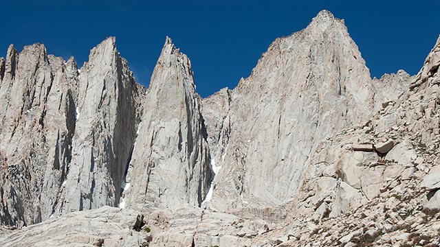
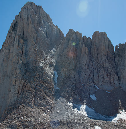
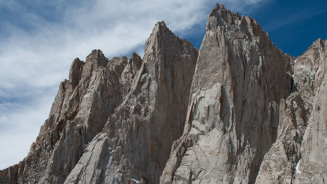
But it is a thrill as Mount Whitney's glorious East Face comes into view for the first time. And I hear shouting now—On Belay! Off Belay!—plus other emotionally-charged climbing terms I'm unfamiliar with. Yes, these distant calls are coming from that great expanse of vertical granite ahead. Someone is up there, somewhere, and from the sound of it, they're having a bear of a time.
I zoom in on the East Face, trying to locate the climbers. At last, I find two tiny dots working their way up a crack toward the center of the East Face route. As I draw closer, I spot more climbers, these on Whitney's East Buttress route. And more shouting leads me to think someone is also attempting the formidable Harding Route on Keeler Needle, though I can't seem to spot them. I continue up toward Iceberg Lake, now only a short scramble away.
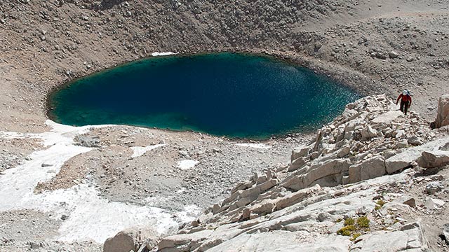
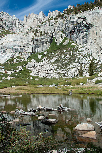
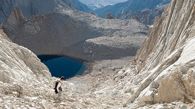
Iceberg Lake
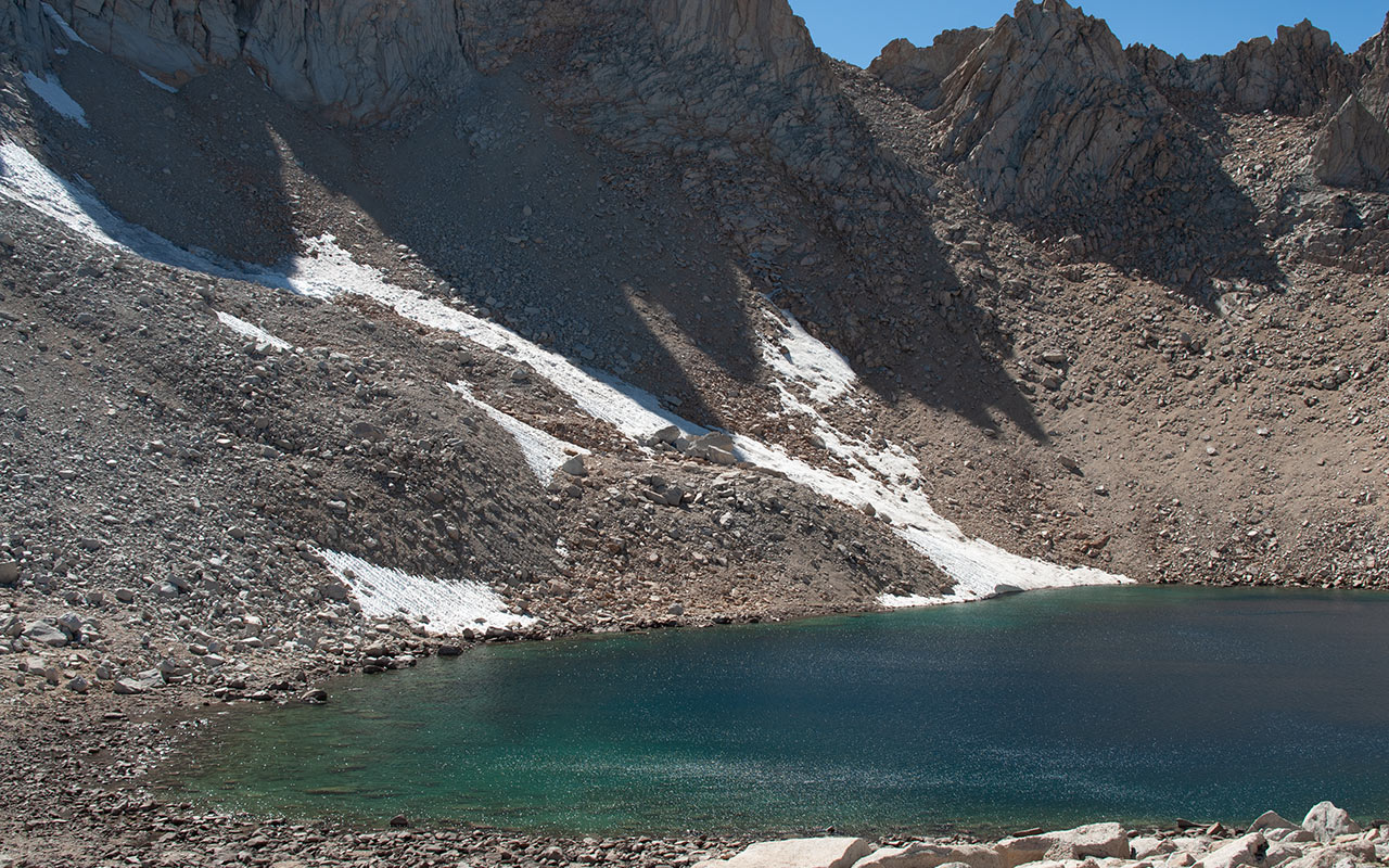
No doubt about it—arriving at Iceberg Lake is a major milestone. Since leaving Whitney Portal, I've climbed over four thousand vertical feet. The air is thin and noticeably cooler.
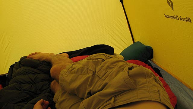
I drop my pack and guzzle water and Gatorade. Almost immediately, I notice a nasty headache developing. Nausea is not far behind. With a struggle, I motivate myself to get my tent up. Then I flop inside, taking deep breaths.
What's happening to me?
Instead of frolicking about the shore with my camera, I'm fighting not to throw up. I'd been expecting the altitude would make for a difficult night—but to be stricken so soon after getting here, in the daytime, is alarming.
Has altitude sickness put an early end to my Whitney adventure?
If so, I'll be making a desperate down-climb in the near future to get lower as quickly as possible.
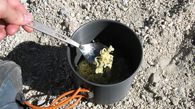
There is another possibility: maybe I'm suffering from dehydration and heat exhaustion. I've been sweating heavily all day.
My body is low on salt. Add the sudden elevation gain to this, and it's easy to understand my condition.
I take ibuprofen, fix a pot of extra-salty ramen noodles, drink water, and wait.
It takes discipline to put food into my queasy stomach—and keep it down—but the reward comes quickly. My head clears and my nausea eases.
I wander outside my tent, relieved and more than a little spooked.
It's a good reminder that we must always be vigilant in the backcountry ('we' meaning me). Trouble can come at any time, from any direction. Usually, it's what we least expect that creates the most havoc.
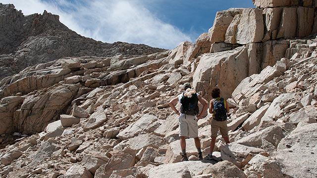
Feeling better now, I spend some time scouting Whitney's East Buttress, choosing the line I'll take tomorrow up the East Couloir.
Several choices are available. The simplest way up is to stay in the main body of the couloir, following it steadily to the notch high above. There is often snow in the couloir, which can be ascended quite efficiently if you've got an ice axe and crampons. This year, however, the couloir is essentially snowless.
Consequently the center of the main couloir is mostly comprised of exceptionally loose talus and scree. Under these conditions, many climbers choose to briefly follow the start of the East Buttress Route to the left of the couloir, hoping to stay on favorable rock before traversing back into the East Couloir. To my eye, this option looks steep and possibly exposed. I've never tried it—and I've no desire to do any class 4 free soloing tomorrow.
Still, I'm not enthusiastic about trying to scramble up the center of the couloir. I decide to climb to the base of the East Buttress in the morning. If I like the look of the variation, I'll keep going. If not, I'll traverse into the main couloir. All that assumes, of course, that I'll make it through the night with no new surprises.
Climbing The East Couloir
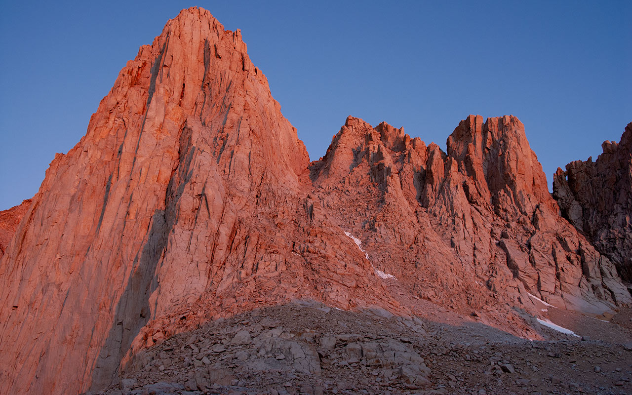
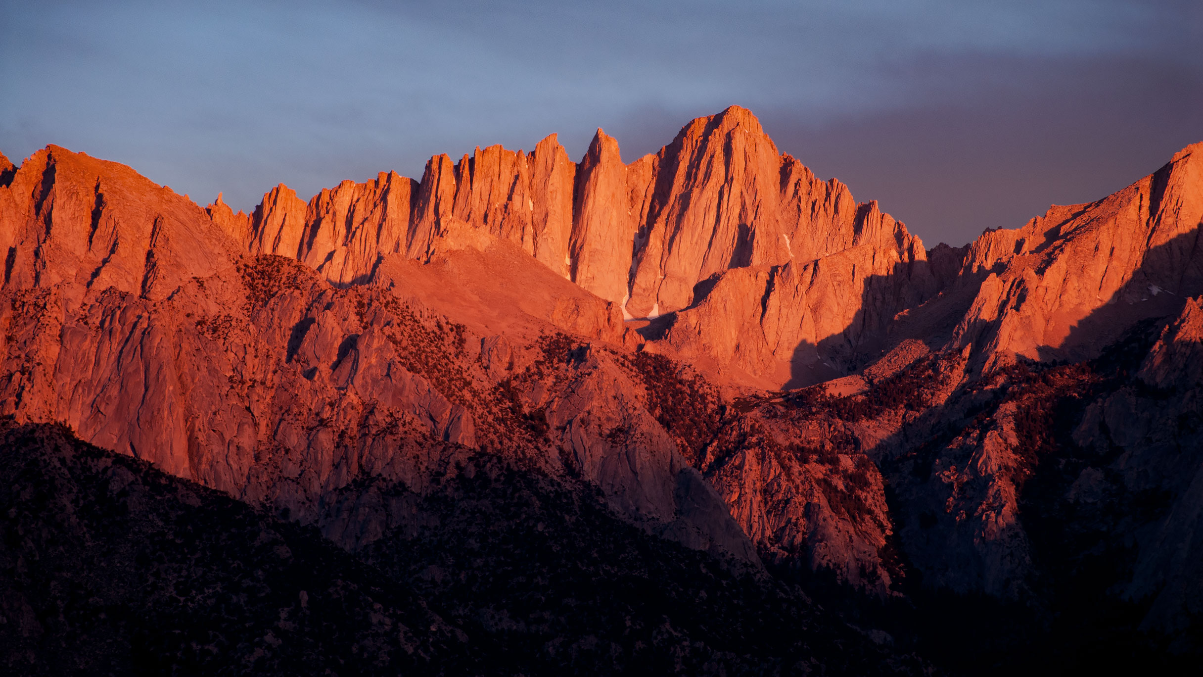
The East Face at Dawn
Morning. Through the wall of my tent I watch as the sky begins to lighten. I rustle about in my sleeping bag, eager to get started. Dawn breaks slowly over the Inyo Mountains.
To the east, the silhouette of Lone Pine Peak stands in sharp relief. This may well be my favorite moment in a hike: the start of a perfect day for summiting. All the external obstacles have been surmounted. Now it is just the mountain and me, no more distractions.
As Whitney's East Face begins to glow spectacular, vivid reds and pinks, I pack my gear. At 5:30 a.m. I leave camp.
I feel strong. I've slept well, with no recurrence of yesterday's unpleasantness.
I have hiked extensively both as an acclimated mountain goat and as a gaspy Sea Level Dweller (which I am now).
Most people will never know the joys of climbing while fully acclimatized. Like me today, they will need to find effective strategies to cope with the altitude.
For my part, I try to keep my respiration up and my heart rate down. That won't protect you from all of altitude's potential effects, but it will keep your blood oxygenated.
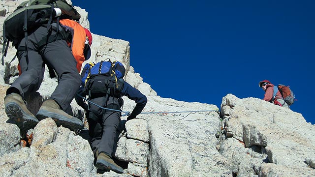
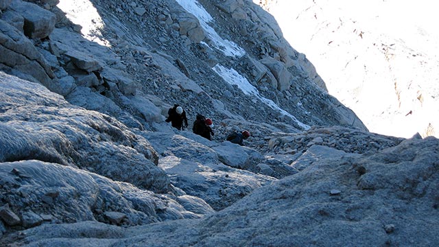
After perhaps fifteen minutes of easy climbing, I catch up to a group of guided climbers who've chosen to rope up for the Mountaineer's Route.
I stop, drink some water, eat more pretzels, and take a photo of the group as they pass a short crux section.
Like me, they've decided to ascend the lower part of the East Buttress, then traverse into the East Couloir.
I wait until they're clear of the tricky part, then follow them into the main couloir, leaving the East Buttress-proper to future dreams. By keeping to the left side of the couloir, I am able to stay on mostly firm ground. Any venture toward the center of the couloir, however, instantly kicks off small landslides. Now high above Iceberg Lake, I stop again to contemplate the view.
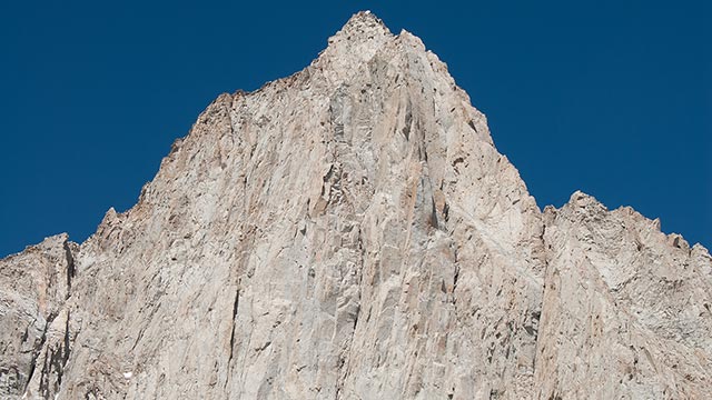
I am struck by the magnificence of this route. John Muir must have thought he was climbing up into the heavens when he first ascended this mighty couloir. Giant striations in the couloir's walls angle diagonally, inspiring feelings of whirling vertigo.
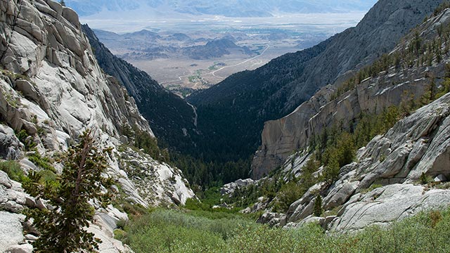
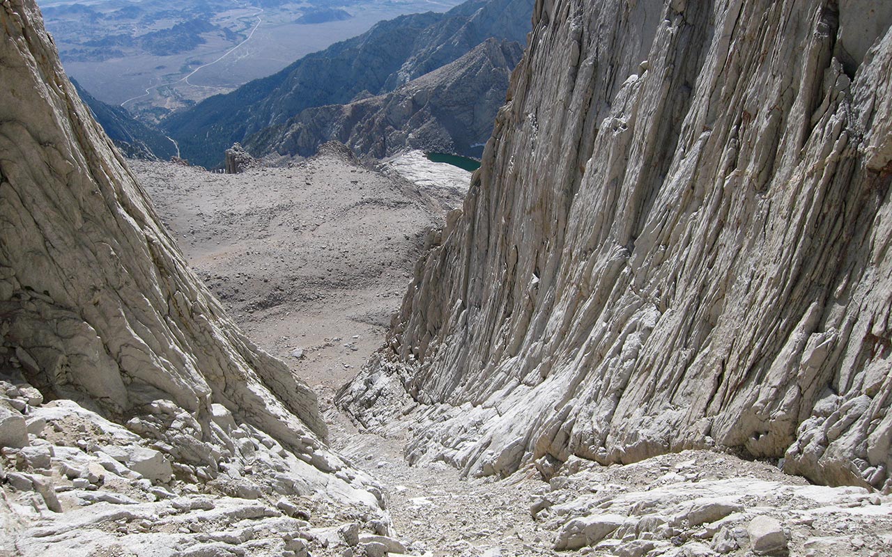
The sky at this early hour is impossibly blue against the hot white of Whitney's granite. The landscape beneath me stretches clear down to the town of Lone Pine in one grand sweep—a distance of some two vertical miles. To reach Whitney's summit there is only one last challenge ahead, of course: the north face.
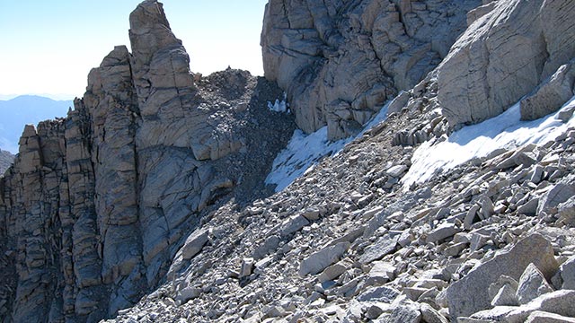
The North Chute
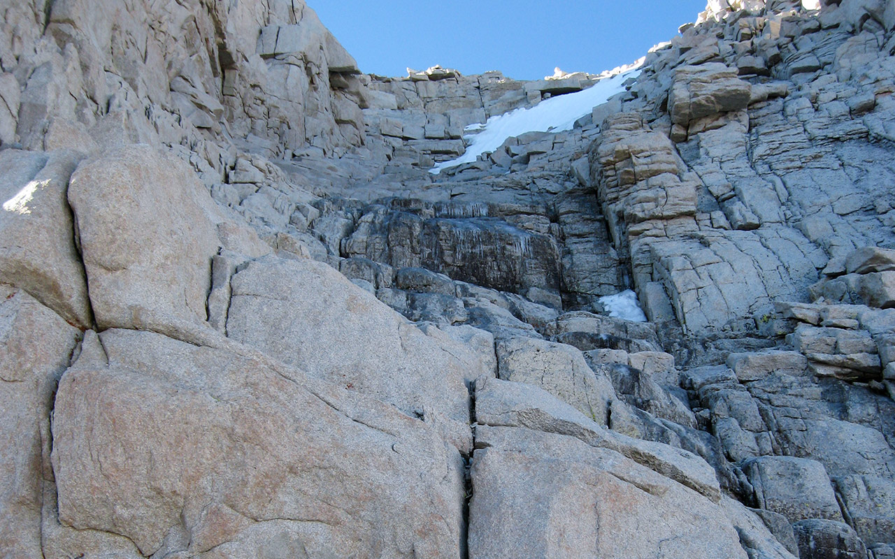
No portion of the Mountaineer's Route generates more discussion and anxiety amongst first-time climbers than Mount Whitney's north face—and deservedly so.
Any month of the year, the north face can be covered with snow and treacherous ice, making an ice axe and crampons mandatory. Faced with such conditions, the unprepared are best advised to turn back at the Notch. I have done so myself in the past and not regretted it.
The temperature drops and the view shifts abruptly as I top the East Couloir.
Hikers may find the sudden sense of exposure at the Notch overwhelming.
We are essentially perched atop a 300-foot high cliff, giving the sensation that one slip will send the unlucky climber all the way down to Arctic Lake, two thousand vertical feet below.
That assessment may not be entirely inaccurate: climbers have slid to their deaths here. Today, thanks to the near-record dry winter, there is less snow on the north face than I've ever seen. Nonetheless, Whitney's north face lies in shadow, and the north chute looks icy through the middle, with dry rock elsewhere.
Climbers may choose to either head directly up the north chute, or else attempt to traverse across the north face toward (hopefully) easier terrain.
Given the multiple threats of cliffs, steep terrain, and ice and snow, one might expect guidebook authors would call particular attention to this section of the Mountaineer's Route. With few exceptions, however, that is not the case.
The traverse is sometimes referred to as 'easy'. And climbing up the north chute often receives little more than an ambiguous Class 3 rating. This is perhaps a consequence of mountaineering literature's long-standing tradition of understating danger and underrating difficulty.
Back to the climb: in order to better contrast the difficulty of the two route variations, I plan to ascend the north chute and return via the traverse. So, up the North Chute I go. Compared to my last Whitney visit, my climbing skills are sharper, and my tolerance for exposure significantly greater. I find it easy enough to work around the ice, and the climbing is enjoyable—though it certainly is climbing in one or two spots rather than just mere scrambling.
A key advantage of ascending the north chute is the directness of the route. In no time at all, I'm nearing the summit plateau. Meanwhile, the group of roped climbers below are making their way up the North Chute below me. They zig-zag around the icy patch, traversing back across the chute to its now-sunny western edge.
I stay in the shadows beneath the eastern arete, though the climbing looks easier where they are. Either way, it is obvious that all of us will be summiting Whitney today.
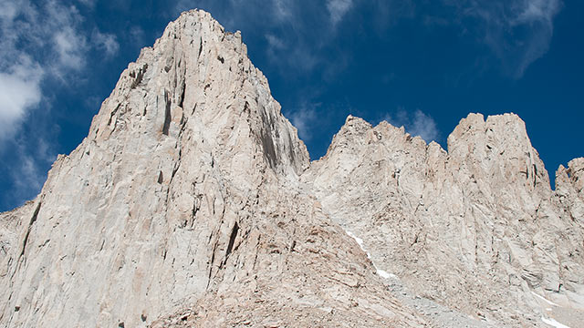
Whitney's Summit
There is one last tricky section to contend with before I gain Whitney's broad summit plateau, and then, just like that, the climbing is over and there is nowhere higher to go.
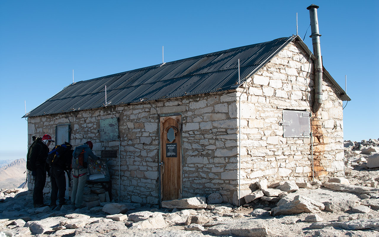
I am the first hiker of the day to reach the summit via the Mountaineer's Route, but others traveling along the Mount Whitney Trail are already here. Some simply stare silently into the distance. Others talk excitedly, complain loudly about the altitude, their legs, their packs.
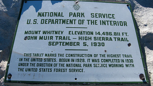
Mount Whitney's summit is marked both by a USGS sign and also a stone shelter built in 1909 for high altitude research by the Smithsonian Institute.
As hikers and climbers sign the summit register, I meander over to the eastern edge of the summit plateau to take a cautious peek at the frightful void below.
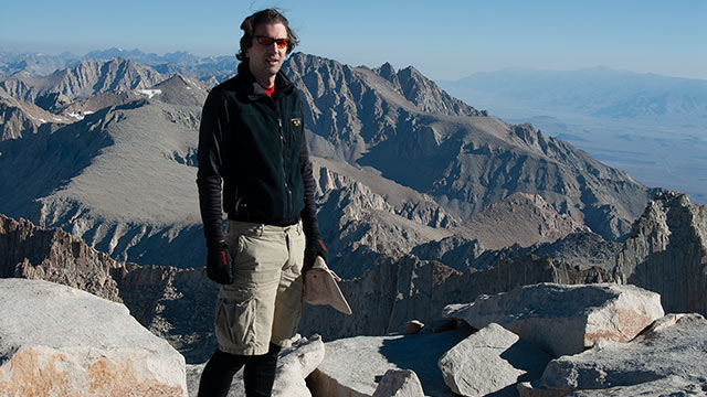
We are right now standing atop the highest point not only in the state of California, but also the entire lower 48. In all directions, everything else is lower—including the many high Sierra summits to the north and south.
And yes, I can feel it. There is inarguably an extra thrill to be had standing here on the highest peak of them all.
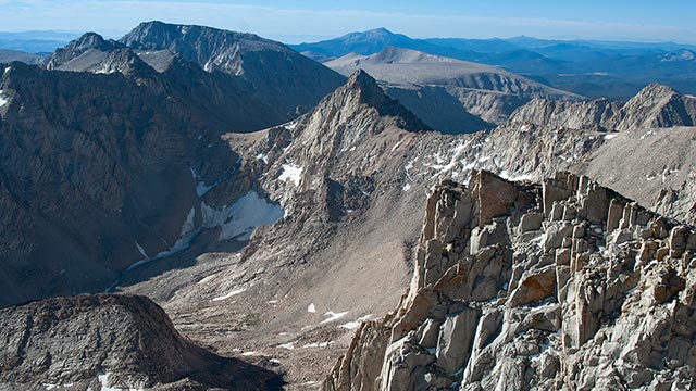
To the south are the inspiring Needles, Mount Muir beyond, and, farther still, Mount Langley, from whose 14,027' summit I skied a year ago.
To the west are the Kaweahs, a striking, brightly-colored range of rock normally well-hidden within the Sierra's center.
Looking northward, I see first Mount Russell, and then the vast bulk of Mount Williamson, fourteeners both. Beyond them are the Palisades, distant on the horizon.
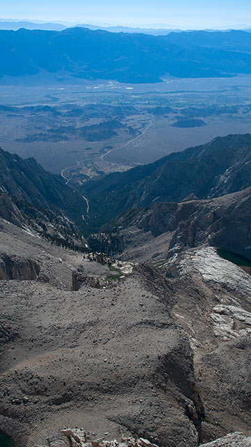
From the tip of my toes, the spine of Whitney's East Buttress rolls off to infinity, leading to Iceberg Lake, which shimmers green-blue, two thousand feet below. I can just barely make out the yellow dot of my tent off the lake's south shore.
It's easy to follow yesterday's route: through the moraines below Whitney's eastern cirque, past Upper Boy Scout Lake, the slabs, Lower Boy Scout Lake, the North Fork Canyon, then Whitney Portal. Beyond that lies Owens Valley and Lone Pine.
I'll revisit all each of these landmarks on my way home today. It will be a long day indeed. But first, I take a lunch break on a nice sunny rock away from the wind. My thoughts go back to my first Whitney climb, now years past, and I'm time traveling once again. The mountain seems the same, but I've certainly changed: older, wiser—hopefully.
I think again of Hulda Crooks. Her unusual means of celebrating birthdays is starting to make sense to me now. With each visit to Whitney's summit, I find the experience more, not less inspiring. I resolve not to let so many years pass again before I return. And with that last thought, I know it is now time to make my way home.
Heading Down
The summit, as they say, is only halfway there—a mantra designed to remind climbers they must not only get up the mountain but also back down safely before the job is truly over.
Though most of the day's challenges appear behind me now, there are still a few areas to downclimb, plus the exposed section of the Ebersbacher Ledges to navigate. And, of course, I must make my way down, down, down, six thousand vertical feet or so. As promised, I try the traverse rather than downclimbing the north chute.
The traverse across the north face proves tedious: steep, loose talus that makes for poor footing. Is it really a better option (without snow) for hikers concerned with the north chute's climbing?
Perhaps, but my guess is such hikers won't be much pleased with either option.
Down the East Couloir I go.
The terrain is steep, demanding constant attention, making this a surprisingly tiring endeavor. The temperature hikes dramatically here on the mountain's east side.
When I reach Iceberg Lake, the sky seems even bluer, if that's possible.
A few white clouds sprout from Whitney's summit, but the desert air to the east is much too dry to allow anything to develop, and soon enough the clouds have melted away.
I take my time packing up camp. This time I make sure I eat enough before resuming travel. The walk down is a long one, sure to leave my muscles well sore tomorrow.
Eleven pages up and one page down...
Hikers should not underestimate the effort involved in climbing down. While it take less physical energy, obviously, it takes far more mental energy, a constant concentration on where to place the feet. And the relentless pounding only adds to the burden, slowly but steadily degrading body and mind alike. Climbers with the extra time to do so may enjoy camping an extra night farther down, perhaps at either Upper or Lower Boy Scout Lake, to divide the long down-climb between two days.
The air thickens noticeably once I've passed Upper Boy Scout Lake, though my feet are starting to protest. Compared to the barren landscape above, the sudden rush of greenery below is a visual treat. As I finally near the end of this magnificent journey, emotions surge through me.
People climb Mount Whitney for many reasons. Some come not knowing whether or not they can climb Mount Whitney, and I must confess I admire them for it. Climbing Whitney, like any mountain, can be a personal test, a challenge to the limits we (or others) place upon ourselves. Some, alas, will leave Mount Whitney unchanged, as if they'd never visited. Others may find within themselves something new, something unexpected.
Tempered with experience and judgment, such strength can carry you not only up mountains, but also across the many, more vexing obstacles which lie strewn across the world below. I do not claim to know why I climb mountains, though I seem to catch a glimpse of it now and then, in these fleeting moments. I find I can't imagine not climbing—and that is enough, I know, to ensure my return.