The Grandest Hike on Earth
Rim to Rim Across Grand Canyon in a Day
Flagstaff Arizona, 3:30 a.m. — The call comes in the middle of the night. In typical form, my brother has pushed this decision to literally the last possible minute.
If he says go, we'll hop in the car and drive to Grand Canyon Village for a grueling but no doubt extraordinary day hike across the Grand Canyon. If not—if his cold has flared up, or if he otherwise just isn't feeling it—I'll get back into bed and that will be that for this year's Canyon ambitions.
Truth be told, I'd be fine with staying home. I'm still recovering from an unexpectedly brutal training hike on Sedona's Wilson Mountain, still pulling cactus needles out of my fingers, still nursing sore muscles and blisters. It's cold outside. It's dark.
Sure, I know I'd be missing out on one of those once-in-a-lifetime wilderness opportunities, but this year has worn me out, honestly. Maybe I just want to go back to bed. Maybe I'm just getting too old for these kinds of things.
And then my phone beeps and the verdict is in: we're on, and I feel my enthusiasm perk up immediately. I don't get to spend a lot of time with my brother these days, hiking or not, and I don't get to spend a lot of time in Grand Canyon, either.
Maybe I've been kidding myself as to just how much I really want to do this hike.
Maybe I want this one more than any other hike I've done.
As an objective, hiking rim to rim across the Grand Canyon offers a rare convergence of the logical and the aesthetic. It's just plain obvious, standing at the Canyon's rim, that the proper thing to do is try to cross it. Indeed, that very question—how do I get across this damn thing?—was probably the very first thought that struck most of the Canyon's first visitors.
But whereas in the time of the pioneers and explorers there was no real choice but to go around, today we have the excellent corridor trails to utilize, offering not just a straightforward (if also strenuous) path, but a way to experience the Canyon, in all its glory, in perhaps the most singularly spectacular fashion. All you have to do is make it across!
I don't have a bucket list but if I did, hiking rim to rim across the Canyon would likely be at the top. It's a hike I've dreamed of doing for a long, long time. And, for no good reason, it's a hike I've never done. Or maybe there are reasons: logistics, effort, planning, training. No matter. It's all come together now, last minute colds notwithstanding. I grab my pack and my boots and I'm out the door into the darkness of a chilly October night.
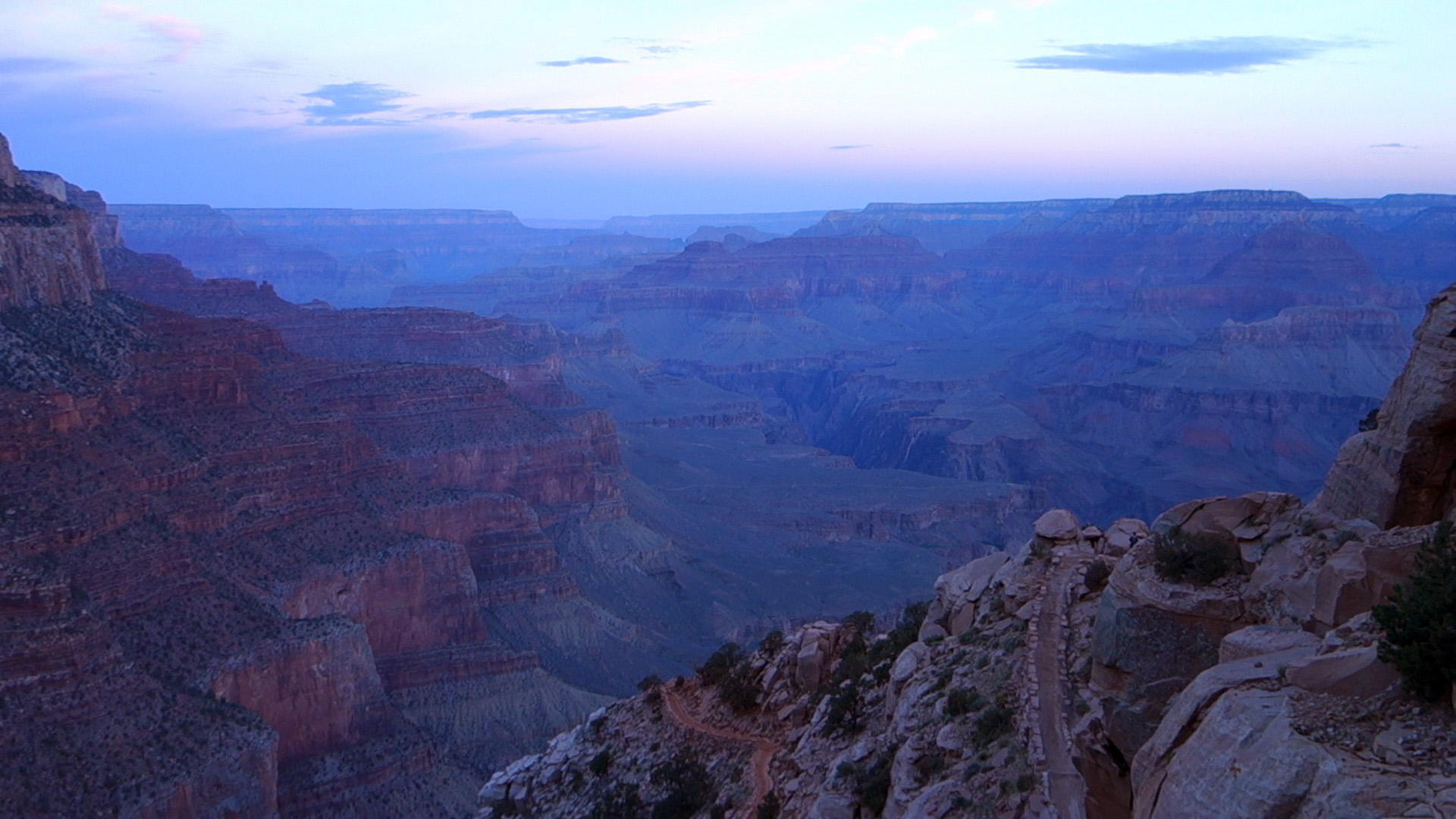
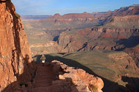
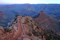
Yaki Point at Dawn
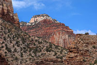
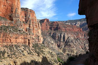
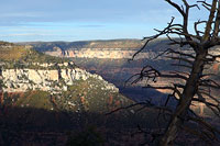
At six a.m. the Grand Canyon is a giant blue cauldron of mists and shadows. I hop out of the car at the Yaki Point parking lot and go straight to the edge, looking out and then down.
Every time I see this plunging chasm in person, the sight of it always seems to freeze me in place, mesmerize me. I am looking at something, my brain tells me, that can't possibly be real. And yet it is. And so I stare at it, boggle at it, shake my head and blink my eyes. And there it remains.
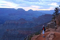
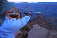
At the car nearby, the other hikers in our group are getting ready to go. I'd better do the same. I snap a few quick photos, then shoot a sweeping video panorama of the pre-dawn Canyon, and then I'm chasing our group as they march toward the South Kaibab trailhead.
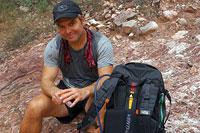
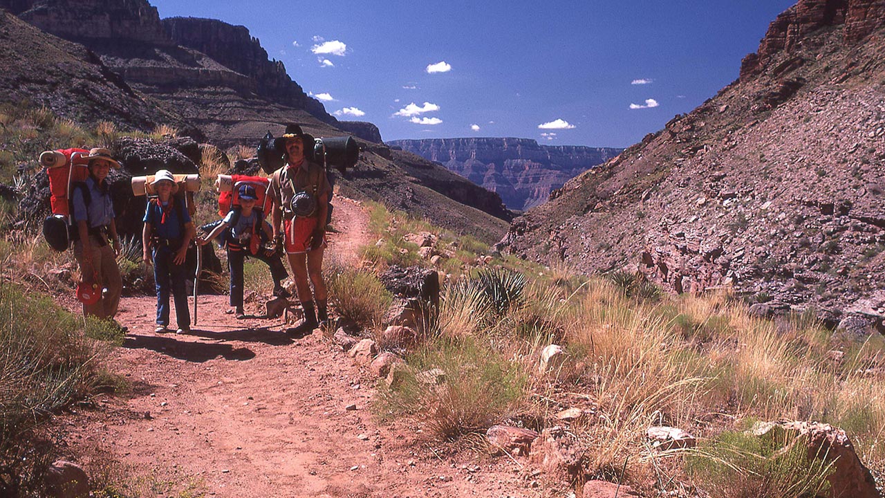
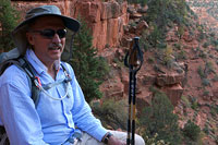
Today's hike has been orchestrated not by my brother but by his neighbor Bruce, who is no young buck but rather in his 60's. For Bruce, this hike—Rim to Rim!—has become something of an annual tradition. Brother Yuri and I are lucky tag-a-longs today, first-timers each of us.
Two more neighbors, Dave and Dan, round out our team. I'm hoping someone in the group will prove slower than me (a hope that will quickly be quashed), as my plan is to shoot video of as much of today's hike as possible, all the way from south rim to north.
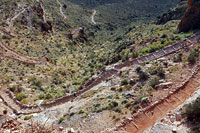
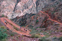
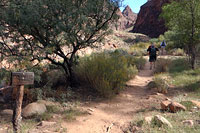
And so I dutifully shoot the start of the hike as our group passes the South Kaibab trailhead, and then I'm already falling behind as they speed down the first section of the South Kaibab's switchbacks.
I realize my video mission is going to make this a real chase today. I'll be starting and stopping nearly continuously, maybe even doing some running to keep up.
No matter. As long as I make it out before dark—and more importantly make it on-time to dinner at Grand Canyon Lodge at 6 p.m., all will be well. On the subject of pace, I want to make sure I stay within range of our group, obviously, but I also want to make sure I don't start off too quickly. Going down, the South Kaibab is steep right away, and therefore fast.
It's easy to race down right out of the gate here, as there's no apparent effort involved, just the steady pull of gravity. And the Canyon itself offers a huge incentive to move fast—every turn brings fresh new views and wonders. But that constant pounding on the downhill does take a toll on the muscles and feet, and we're got a lot of ground to cover today.
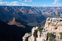
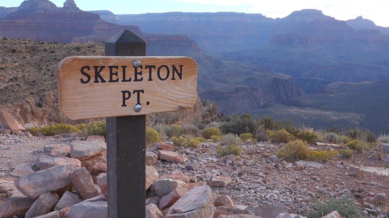
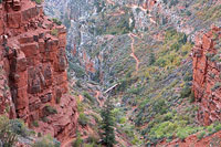
Skeleton Point
I'm a little perplexed, to be honest, why everyone is running such a hot pace today. There are a lot of obvious Rim-to-Rim hikers on the trail, and they're all moving with surprising alacrity.
To my eye we've all gotten a nice early start, so we should be well ahead of schedule with the whole day ahead of us. But the general push of all these hikers, plus my own rapidly disappearing group members, has me wondering if there's something I'm missing.
I know what I don't want to miss: my mission is not to race through this wondrous landscape as quickly as possible, or, alternately, to get so focused on photographing it that I fail to actually see it.
Once upon a time, I lived in nearby Flagstaff, where we viewed the Grand Canyon as a right-in-our-own-backyard kind of asset. Oddly enough, I took for granted that I could visit the Canyon anytime I wanted, and yet I almost never did.
Today, living some five hundred miles away, this strikes me as a travesty of sorts. Maybe I didn't need to be a teenage version of Harvey Butchart, but surely I could have done better than two hikes over nearly two decades!
In any case, I'm here now, and I want to savor every moment—as much as I can given the logistical realities of a 21.2 mile day hike. And, damn it, I'm also rapidly discovering just how much time it takes to stop, shoot video, and then get moving again.
I find myself leapfrogging the same hikers over and over again. I'll pass them but soon stop to shoot another 10-20 second clip of video, and then they pass me. And again. I try boosting my hiking speed, which mostly just seems to make a few blisters flare up. Eventually, I reach Skeleton Point, high atop the Redwall layer and the Tonto Plateau.
Here I've got to stop to attend to my feet—even though my own companions are completely out of view. I pull off boots and socks and tape up the hot spots. Now also seems like a good time to eat a snack, put on some sunscreen. It's quiet. The rush of day hikers heading down has receded, leaving me plenty of open space all to myself.
I suppose I ought to be a little more worried about my pace, but you know what? It just feels so good to be here. I needed this hike. There are changes speeding toward me and my family this year that I'm reluctant to confront. Here, in the quiet of the Canyon, I find a moment of peace and freedom. But, as with all good things, this moment cannot last. I'll try to move a little faster, I decide, as I eye that distant North Rim. But first, I'm going to take a few more pictures...
Tonto Plateau
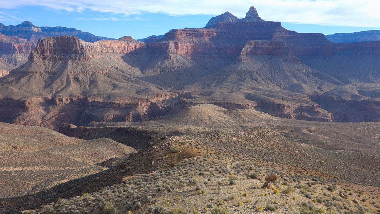
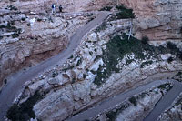
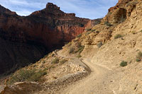
The Tonto Plateau is big and it is flat. Following a dramatic section of switchbacks through the Redwall below Skeleton Point, the Tonto confronts hikers with a most unexpected landscape.
That such a wide and open plain exists within the depths of the Grand Canyon offers us an eye-popping reminder of the Canyon's true size. I've seen this view before on my South Kaibab loop hike, but still...it feels a bit as if we're taken a wrong turn somewhere and ended up on an old-west prairie.
All that's missing here is a saloon town and some tumbleweed. Check that—we've got the tumbleweed.
The Tonto's flat ground affords me the opportunity to make up some time, or so I hope, though everyone else is probably moving faster here as well. Alas, despite my best scampering, my brother and friends remain out of view, probably already descending the Inner Gorge ahead.
What strikes me about the Canyon—and what makes it likely the finest place on Earth for humans to hike—is the way the landscapes are ever-shifting. Often within the span, seemingly, of only a few feet of trail, the view changes so completely it's as if you've just been beamed into another world.
The colors change—sometimes vivid yellows and oranges, sometimes chalky whites, sometimes rich-hued reds, greens, blues.
The verticality itself changes—and this is a nifty trick. Sometimes we're inches away from massive drops over seemingly-impenetrable cliffs, sometimes we're high on a ridge top, sometimes we're wandering across expansive flat ground that seems to stretch off to infinity.
And then of course there is the magic of that Arizona sky.
It, too, is ever-changing. As the landscape below shifts so too does the light—sometimes mysterious, dark, brooding, sometimes hot and piercing. I suppose as a photographer I should be delighted by all of it, and I am, but that delight is also tinged with a measure of despair, for I realize that photos and even memories of this place are only shadows in comparison to real thing.
That makes a Canyon hike more ephemeral, perhaps, than any other. It is like a stage performance rather than film, a one-time-only show never to be repeated in quite the same way ever again. But alas! Why dwell on such somber thoughts? I am here and I am hiking.
And the Canyon's finest act is yet to come.
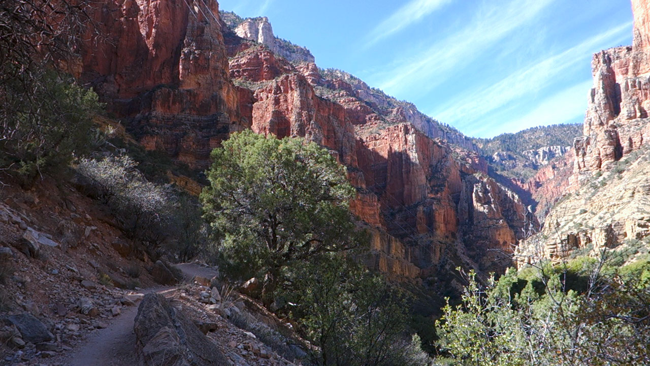
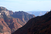
Inner Gorge
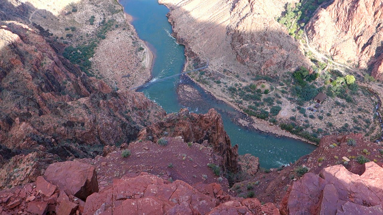
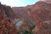
The South Kaibab Trail is flat across the Tonto Plateau and then suddenly it isn't. The horizon drops and the Grand Canyon reveals its big secret: a hot pink center.
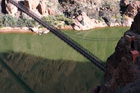
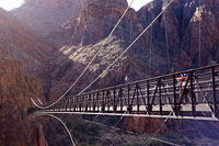
Winding through the middle of it is the blue (today) ribbon of the Colorado River, distant yet also close enough, if you listen carefully, for us to hear its roar. Across the river is an inviting grove of cottonwood trees—Phantom Ranch, the very bottom of the Canyon.
No matter how times I see this view, I will never be tired of it. I walk right up to the edge of that incredible chasm and stop for a minute to just plain gawk at it.
These are the Canyon's oldest rocks, seabeds nearly two billion years old, transformed by time and unfathomable pressure into today's metamorphic schists and granites and neisses.
While the landscape above is open and expansive, the Inner Gorge is constrained and narrow, intimate even, offering the Canyon's deepest and perhaps most striking color palate.
From my perch atop a rocky ledge, the river is close in absolute distance, but still some fifteen hundred vertical feet below. The South Kaibab is visible ahead, descending back and forth repeatedly on its way to Black Bridge and the Colorado River.
It is a pleasure today to find moderate temperatures inside the gorge. This isn't just the deepest part of the canyon, it's also the hottest, usually shockingly hot, often life-threateningly so.
Today intermittent cloud cover mitigates the sun, and temperatures seem to be hovering nicely in the seventies, making for flawless hiking weather. My camera comes out repeatedly as I work my way down toward the river—there's just too much to pass up.
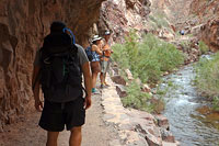
And it may be worth noticing here that there are two kinds of people, though of us (like me) heading down, and those who are coming from the bottom and heading up. While those of us on the downhill are generally still a fresh and peppy bunch, people hiking up are already red-faced and breathing in great gasping whooshes.
I feel a slight twinge of anxiety knowing I'll be joining them soon, but for now, the pleasures of the descent are too great to ignore. Down, down, down the switchbacks I go. Though the river remains stubbornly distant, the rush of its rapids grows ever more prominent, mixing with my boots thumping on red sandy ground and the murmur of other hikers along the trail.
Phantom Ranch
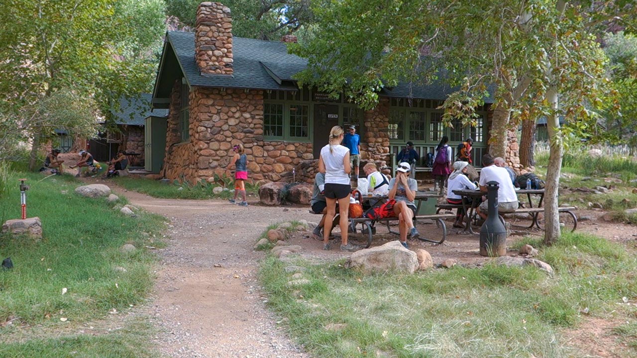
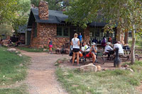
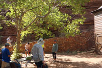
It is 9:31 a.m. when I reach the general store at Phantom Ranch, Arizona, bottom of the Grand Canyon and not-nearly-halfway-point of our rim to rim journey today.
All things considered I'm pleased with my pace thus far, though the rest of my group are already rested and recovered and ready to go. I need a solid fifteen minutes to eat lunch and refresh myself, so after a quick reunion I head into the store to buy a lemonade and eat lunch.

Hiking a vertical mile downhill has an insidious effect on the legs and feet, slowly but inexorably breaking down muscle. You know that quivery feeling you get when you've done a set of squats and pushed a little bit too hard? That's how my legs feel right now.
For me, this anxious-exhausted feeling is a familiar one.
As much as Phantom Ranch is a serene and beautiful Shangri-La hidden in the bottom of the canyon, it is also a place where very-nearly-spent hikers must confront the alarming reality that they are now a long, long way down and must climb their way out.
My brother joins me inside, and finally I discover the reason why we've all been on such a quick pace—it's over fourteen miles to the north rim from here!
Well, that's auspicious news. I confess to this point I'd just naturally assumed the North Kaibab was roughly the same distance as the South Kaibab from rim to river, some seven miles. Hearing we've got double that to go does pull the wind out of my sails a bit.
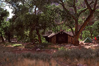
So. What I'd love to do is spend the night, either here at the Phantom bunk house or nearby at the Bright Angel Campground, with the added perk of eating a hearty cooked dinner and then breakfast here at the general store/dining hall.
Breakfast, dinner, and overnight lodging, ranch house or campground, all require reservations, however, and the wait lists are lengthy—say a year or so. And the purists will no doubt argue the proper way to do a rim-to-rim hike is in one day, regardless. Either way, my fantasy of spending a day here at this oasis is exactly that. The reality is it's time to start climbing.
I fill my water bottles and ready myself to get back on the trail. Bruce leads the gang ahead, starting up the North Kaibab, 14 miles and six thousand vertical feet to go—yes, the north rim is a full thousand feet higher than the south rim. And if I'm a little bit concerned about that I'm also excited. As I step on the lower North Kaibab trail, I am steeping on brand new ground, a path I've never before traveled. I'm ready to go.
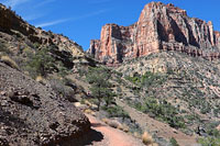
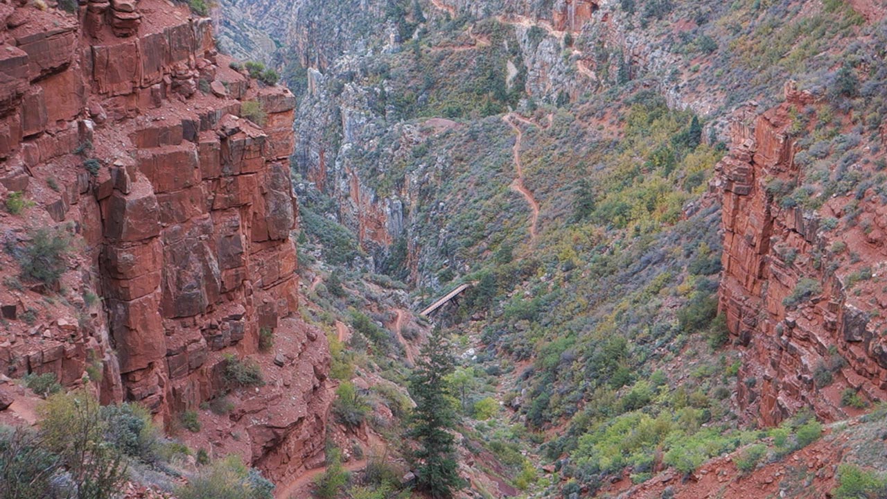
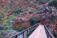
Bright Angel Creek
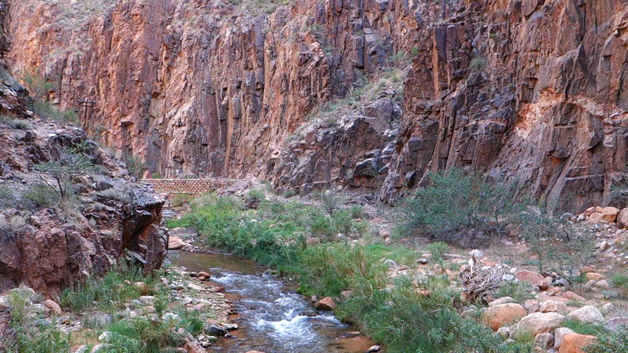
Bright Angel Creek & North Kaibab Trail
Where trails (and therefore safe passage) are concerned, the story of the Grand Canyon involves two key factors: the geologic feature known as the Redwall, and water.
The Canyon's layer of Redwall limestone is the most consistently vexing barrier to human travel, presenting itself most often as an 800 vertical foot wall, impervious to scrambling. A little human engineering aside, trails tend to take advantage of geologic faults across the Redwall for easier passage.
But water remains the ultimate arbiter of Grand Canyon trail design, for without regular access to it, hikers simply cannot carry enough to survive.
And so the North Kaibab begins by following Bright Angel Creek northward, winding in and out of shadow mercifully provided by towering walls of rock—a stretch of trail known as 'The Box'.
This early part of the hike covers mostly flat ground, ascending ever so slowly alongside the gentle babble of the creek. Unseasonably mild temperatures and low-angle October sun make for truly pleasant conditions today, but beware: The Box is an entirely different beast in summer.
Due to the extreme heat and surrounding rock, which absorbs and then radiates the sun's heat, the National Park Service calls this a particularly dangerous section of the canyon—like crossing a blacktop parking lot in Phoenix in summer, they say.
In other words, in summer, stay away.
Seven miles of sand eventually make themselves known. My legs start protesting. My brother and I stop for a recharge break, drinking water and downing energy and electrolyte packs. Our spirits may be sagging a big, but it's still good to be here—and especially good to be here together.
Our conversation soon turns to the long-ago past. We're approaching Cottonwood Camp, somewhere not too far up the trail ahead. As kids, my brother and I hiked with our parents from the north rim to Cottonwood Camp and Ribbon Falls, where we spent two nights before hiking back out. Neither one of us has been back to Cottonwood Camp since.
We're both eager to revisit this part of the canyon, walk that same trail, and see how it compares to our childhood memories. We're also parents now ourselves, and we're both more than a little curious how our parents managed to pull it off—an overnight hike that deep in the Canyon, with the two of us youngsters in tow.
Yesterday
Grand Canyon, September 1978
September 1978. My parents decide to do a three-day hike from the north rim to Cottonwood Camp, deep in the Grand Canyon, with their two young children—my brother and me.
Our packs, my dad recalls, were bigger than we were. From behind, he says, all you could see was a giant backpack with two legs sticking out. Our kid packs might have been big, but my parents' packs, filled with 70's-era backpacking gear, must have been crushingly heavy.
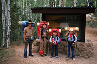
My Dad took a shot of us at the start of the hike, at the North Kaibab Trailhead, looking clean and fresh and ready for adventure. Our uncle, who joined us on the hike, is there also.
In every shot after that, my parents look increasingly exhausted (my brother and I remain fairly peppy throughout). And, indeed, on the hike out, my brother and I hiked far ahead of them and emerged from the canyon first.
My Dad admits it was not their intention to let their kids hike unaccompanied up the steep and often cliff-bound North Kaibab trail. No, they just couldn't keep up with us.
Weight must have been on their minds when they decided not to take a tent. It was September, also, and there would have been every reason to feel confident that the chance of rain was negligible.
But, on day one, as we descended deeper and deeper into the canyon, the sky grew darker and darker. It was completely overcast that first night when we arrived at Cottonwood Camp, the skies full of approaching thunderstorms.
My dad had brought a tarp to sleep on. As the rain began to fall, I remember trying to rig that tarp as a shelter between two trees over a sandy ravine where we planned to camp.
That ravine, it turned out, was actually a wash, and soon it was in flood, sending us scrambling to salvage gear and find high ground. As for the storm, it was no quick squall. Rather, it was a ferocious all-nighter that pounded the canyon with heavy rain. Rangers at Cottonwood Camp were kind enough to open up their bunkhouse that night for shocked and soaked backpackers.
My brother, mother, and I spent the night sharing a cot in the bunkhouse, along with a rowdy group of adults who'd apparently come to the canyon to party. My dad and my uncle spent the night on the floor of the men's restroom, nearby. The following dawn and indeed the rest of the trip was sparkling and clear, but the damage had been done.
Though we had fun exploring Cottonwood Camp and nearby Ribbon Falls, though in my memories the trip was a resounding success, my parents would never again do an overnight hike with their sons in the Canyon. And it would be far too many years before my brother and I would return as well.
Pumphouse
After a short rendezvous and rest at Cottonwood Camp, our group is back on the trail again, continuing upward toward the Kaibab Trail's Pumphouse Residence, elevation 4600 feet.
In contrast to the long, shallow climb along lower Bright Angel Creek, the trail past Cottonwood soon becomes steeper. Here, we will do the bulk of the climbing necessary to gain the North Rim, which remains thousands of vertical feet above. Here, also, Grand Canyon changes character yet again.
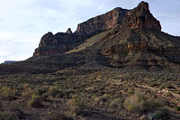
At these mid-elevations, the canyon's north aspects are much greener than the desert landscapes we've long since passed along the South Kaibab. Scrub brush and juniper begin to appear. With dark red and orange-hued buttes towering above, the land looks to me a lot like Sedona.
My thoughts remain on that long-ago hike into the canyon with my parents. The last time my feet touched this ground, I was, what, eleven years old?
That trip, though perhaps not quite the experience my parents were hoping for, sticks in my mind to this day as one of the bedrock foundations of my brother's and my love for hiking and the outdoors.
So I'd say it was a huge success!
On the trail, meanwhile, I feel like I've settled into a slow but steady pace. My legs are tired but holding together; my feet are about the same.
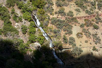
Bright Angel Creek seems bigger here. Maybe it's just that it's flowing faster over steeper ground. The North Kaibab continues upward, shadowing the creek, steadily gaining elevation, and soon I've traversed the mile and a half between Cottonwood Camp and the Pumphouse Residence.
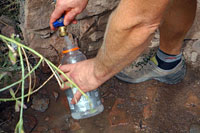
As part of the corridor trail project, the National Park Service built an impressive network of pipelines to deliver water (seasonally) to stations spaced along the North Kaibab and Bright Angel trails. These stations might sound like overkill, but in fact they're what make hikes like today's possible, even in mild weather.
Sourced from Roaring Springs ahead, pipelines deliver water across the entire breadth of the canyon. Thanks to the water stations, I need only carry about two liters of water at any given time today, making for a far easier and safer hike. In other, more remote parts of the canyon, hikers must often stash large caches of water in key locations to be sure they've got enough to get out.
As for Pumphouse, it is both a pumping relay station and a watering hole. Artist and park employee Bruce Aiken lived here for decades, overseeing the pipes and pumps. When he wasn't manning the machinery, Aiken made good use of his downtime, trying to capture the Canyon's ever-changing grandeur on canvas—an obsession I can readily understand.
Roaring Springs
For us, the Pumphouse marks the start of the most significant section of climbing on today's hike—nearly four thousand vertical feet in a very short 5.4 miles.
Our group's pace, to this point, has been quick, taking advantage of the gentle grades of the lower North Kaibab Trail. But these steep grades plus many miles of wear and tear behind us make it feel as if we're all suddenly dragging anchors.
I try to find the right groove of pace versus pulse, timing my breaths to my footsteps, seeking the speed that will get me up and out on these tired, tired legs. And I'm still crazily determined to finish out my video mission.
I've put too much effort in already to give up now.
For the past mile or so I've been warily monitoring my camera's battery level (hindsight reveals I should have brought a spare), which is hovering in the dreaded One Bar zone, leaving me unknown minutes left of crucial shooting time.
What a shame it would be if my camera died, so close here to the end of this incredible day!
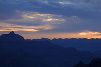
Or perhaps I'm not as close to the end as I think. As I approach Roaring Springs, the rim still towers overhead. Elevation here is right around 5000 feet, meaning I'm still over three thousand feet below the rim.
I take a moment to gauge the height of the sun, trying to guess what time it is. Long shadows are beginning to reach across the canyon, creating bright contrasts of light and darkness. I begin to wonder whether or not I'm actually going to make it out of the canyon before sunset. There's nothing I can do about that now—I'm going as fast as I can.
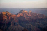
Meanwhile my brother and the rest of our group has once again pushed ahead up and out of view. I chug upward steadily behind them, enjoying the solitude, stopping occasionally to pull out my hanging-in-there camera and shoot yet another section of trail. The colors here, as we gain the base of the Redwall, are bold and saturated, postcard views in all directions.
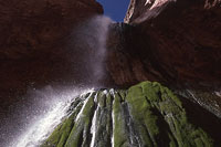
As I recall, Roaring Springs—a thundering fall of water which shoots straight out of solid rock on the opposite side of Roaring Springs Canyon—is where my family and I stopped for lunch during our long-ago hike to Cottonwood Camp. I am comparing and contrasting the memory of that hike with this landscape I see today, puzzling over the tremendous bridge of years that connects them.
Indeed, for me and my brother, today's hike is not just a trip back in geologic time, it is also a trip back in personal time, a way to measure the ever-marching years. As much as my feet are aching and my lungs are bursting and my legs are burning, I'm seeing the wisdom of doing this hike annually, as our leader Bruce does. I have a feeling I'll be back again next year, if I can manage it. And if I can manage to get out today.
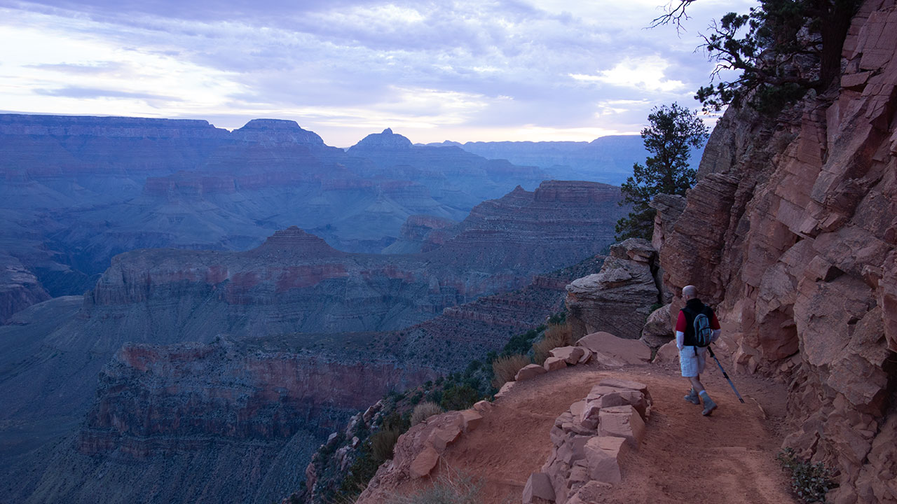
Supai Tunnel
Lungs and legs are protesting mightily as I pass the last bridge crossing Roaring Springs Canyon. Somewhere high above is Supai Tunnel, last of the watering stations, elevation 6800 feet.
I've been grinding upward steadily, but for all my effort, the rim feels as if it will never get any closer. Even passing the Redwall layer is taking much, much longer than expected. This, at last, is the final secret of Grand Canyon revealed: going up is incomparably harder than going down.
The trail above switchbacks endlessly along the north aspect of Roaring Springs Canyon. I can see the distant figures of my brother and the rest of our group working upward ahead, and I get a mental boost as I realize I'm drawing closer to them.
The climb, at last, has evened our uneven hiking paces, bringing us all together in what is perhaps most fairly described as no small bit of misery.
But misery isn't quite the right word. Effort. Getting out is all about a complete, consuming effort, a focus of mind and breath and body. Eek out as much from the legs as possible without making them cramp. Keep that heart rate from climbing too far into the red zone.
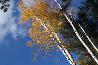
We're so lucky there's no heat to contend with today. In fact, the air is actually chilly now. Fall colors are showing in the leaves of the surrounding trees. Higher up, I see bursts of yellows and oranges—Aspen groves.
As the day grows longer, I'm starting to realize that this final show of colors—a brilliant blue sky, rocks glowing fiery-red beneath the afternoon sun, bright yellow Aspen leaves—will be the most impressive of the entire hike.
Grand Canyon has saved the best for last.
So, yes, my body is yielding slowly to exhaustion. But my spirit is soaring. And gradually, ever so slowly, I am making progress toward the rim. Stopping on the corner of yet another switchback, I find myself looking down on the footbridge, looking down on the the North Kaibab Trail as it winds its way into the depths of the Canyon. Can't be that much farther now.
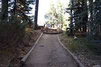
Just beneath Supai Tunnel, I'm reunited with my brother and friends. They're resting on a big rock, looking out over the canyon and the trail below. No one wants to stop too long here. We can taste our exit up ahead, and we don't want to give spent muscles any opportunity to lock up now. So it's a quick break to drink some water and eat a snack. And now, the final act begins.
Bright Angel Point
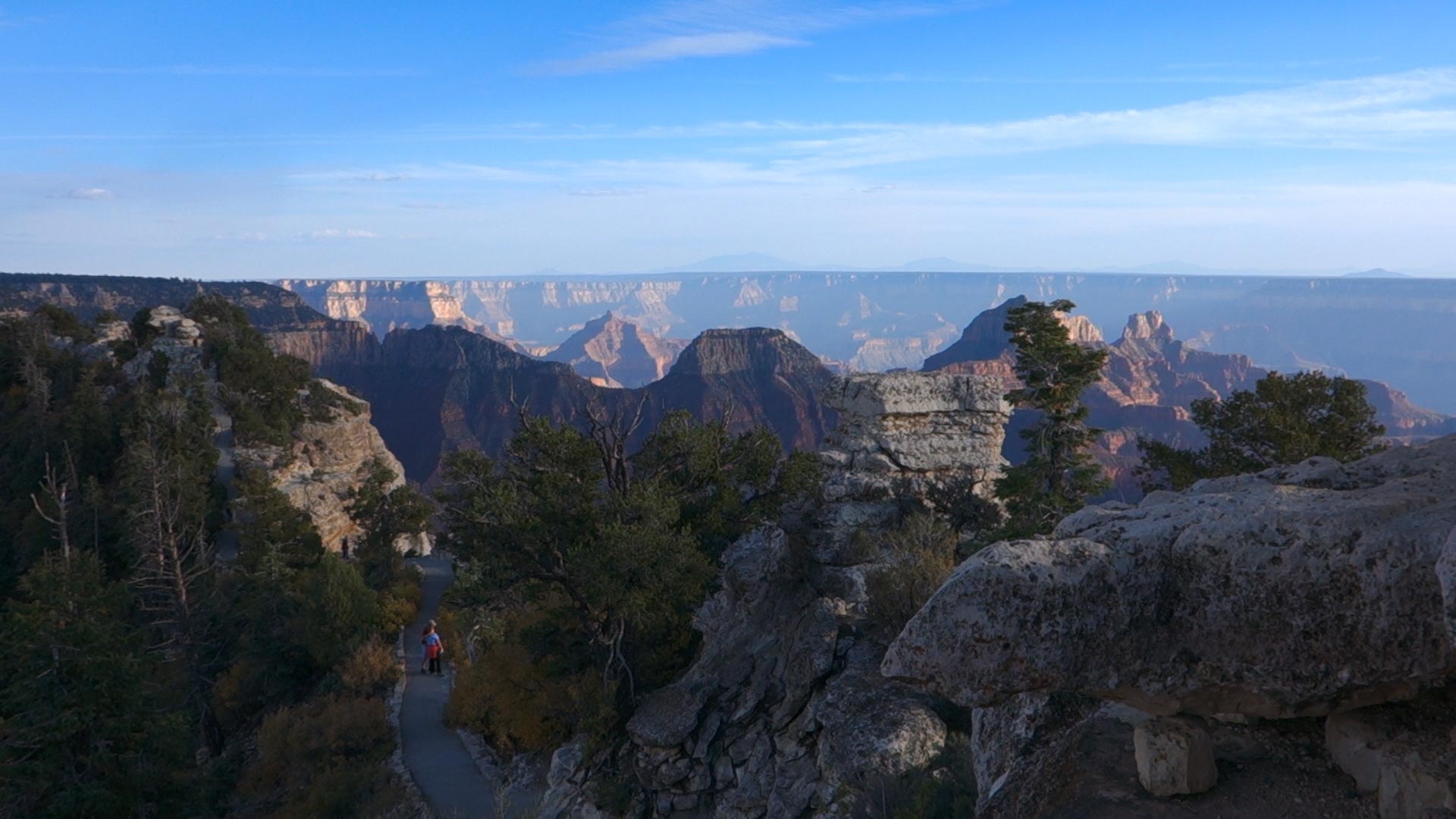
Though it seems immutable, Grand Canyon is in fact in a permanent state of change. Once upon a time, there was no canyon, just a great plain. Someday, in the distant future, there will be no canyon again.
It is a happy and remarkable coincidence that we humans are here, in this moment, to experience it. But if there is a problem with Grand Canyon—if such a thing can be said—it is that the place simply is not easy to process on a human scale.
Visit it and stand atop either rim—yes, by all means. But if you can, if you are lucky enough to have the opportunity and the ability to do so, hike it. Hike the Canyon.
In this way only, putting boots to ground, are we able to begin to grasp what our otherwise overwhelmed brains are trying to understand.
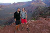
And so I am nearing the end of this great hike across the divide, south to north, and feeling very proud and very privileged at this accomplishment, when my brother and I are greeted by unexpected hikers—his wife and two sons.
They've driven from Flagstaff to the North Rim, then hiked down the Kaibab Trail to nearby Coconino Overlook to greet us. And doggone it, what's this sudden rush of emotion in me? It's good to share a moment like this with family.
One boy wants to stay at the overlook with dad; the other wants to hike back out. So Uncle Andy gets an escort for the final lap on his hike today.
The trail makes one, last sweeping traverse beneath the rim, and then nephew and I are out of the canyon, joining the rest of our group to bask in the brilliant afternoon sunshine at the trailhead. It's hard to believe, really.
I want to call this the most perfect hike I've ever done—the grandest hike on Earth, in fact. And no small part of what makes it so grand is the fact that it's doable. Hard, yes, but also entirely doable, and if you have a dream of walking this same path yourself, let me encourage you right now to give it a try. Be smart and be safe, please, and build up a solid resume of training hikes in preparation.
But if you put your mind to it, I think you can do it. I really do.
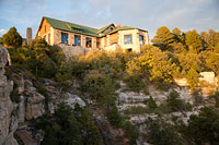
From the North Kaibab Trailhead we gather our scattered forces and pile into cars to drive to Bright Angel Point and Grand Canyon Lodge for dinner and the the incomporable spectacle that is sunset at the north rim—I won't even try to describe it. But I will say thank you—a most heart-felt thank you!—to Bruce and my brother for bringing me along on this wonderful journey.
Put me down for next year.