The Walter Powell Route
Off the Map at the Grand Canyon's Confluence
Grand Canyon, Arizona — unless you have stood at the rim and looked down, it is impossible to understand how rugged and impenetrable Grand Canyon is.
From horizon to horizon, the Canyon presents a continuous labyrinth of plunging chasms, soaring buttes, and sheer, multicolored walls. Early explorers in this water-starved land must surely have felt despair as they gazed longingly at the Colorado River, an all-but impassible vertical mile below.
For over two hundred fifty miles, this wild stretch of the Colorado River was a giant blank spot on the map, prompting Samuel Bowles' famous 1868 quote, "Is any other nation so ignorant of itself?"
To answer that challenge came Major John Wesley Powell, a one-armed veteran of the American Civil War who sought to be first to navigate the length of the Colorado through the Grand Canyon.
From the headwaters of the Green River, Powell and his men made it all the way to the confluence of the Colorado and Little Colorado Rivers on August 10, 1869.
They had already faced many hardships in their pioneering journey, including the loss of one boat and a third of their provisions. Now, at the gateway to the Grand Canyon, Powell knew he and his men faced an uncertain future.
In his journal¹ he wrote:
"We have an unknown distance yet to run, an unknown river to explore. What falls there are we know not; what rocks beset the channel, we know not; what walls rise over the river, we know not. The men talk as cheerfully as ever; but to me the cheer is somber and the jests are ghastly."
While camped at the Confluence, Powell's brother, Walter, decided to try to find a way up to the rim. Ostensibly, this was to measure (via barometer) the height of the cliffs above the river. Given the expedition's precarious circumstances, however, it seems reasonable to suppose Walter was also looking for an escape route.
Of course, there were hidden routes from rim to river in the Grand Canyon, discovered through the ages by native peoples. But at the time of the Powell expedition, most of these routes had been long forgotten. As Powell and brother Walter scouted the canyon's walls from the Confluence, they would have seen little to suggest any possibility of exit.
Thanks to Powell's journal, we know Walter succeeded in reaching the rim—a remarkable achievement without a map in any era. After a few days of rest, John and Walter Powell and the rest of the expedition resumed their journey down the unexplored Colorado on August 13, 1869, and so ensured their place in history.
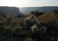
Today, Walter's climb from the Confluence to the rim is known as the Walter Powell Route, and it remains a challenging but obscure scramble in perhaps the most remote, rugged, and scenic part of the Grand Canyon—if you can find it.
¹ Exploration of the Colorado River and Its Canyons — John Wesley Powell
Navajo Roads
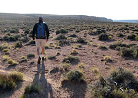
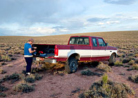
We're lost. Bouncing somewhere along a remote dirt road on the Navajo Reservation, my brother and I decide it's time to pull over and check the map—again.
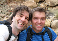
Being interested in obscure canyon hikes best suited for fanatics, we have decided to retrace Walter Powell's not-so-famous route. For now, we're just trying to find the right road to get there.
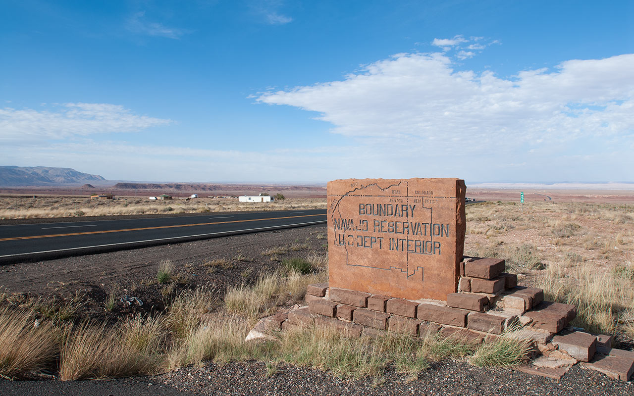
The eastern edge of the Grand Canyon borders Navajo land. Unlike the developed tourist centers at the North and South Rims, amenities in this part of the canyon are limited.

From the trading post of Cameron, Arizona, we have to navigate a good sixty or more miles of dirt roads to reach the Powell Route's so-called trailhead.
For directions, we've got Michael Kelsey's Canyon Hiking Guide to the Colorado Plateau. Kelsey's book is long on warnings and short on details, which is probably for the best.
In addition to being remote, reservation roads are notoriously hard on motor vehicles.
Should you break down, you can expect to walk all the way back to Highway 89 without seeing another soul—so don't skimp on water!
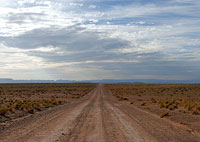
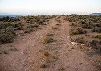
We begin on a nicely-graded road that heads off toward a featureless horizon.
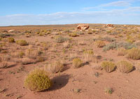
Alongside the road are small washes and ravines that bear close watching.
In the span of a mile, these can grow into bona-fide canyons, making it important to stay on the correct side.
We are making good time when we abruptly notice one such ravine has blossomed into a bottomless gorge to our north.
Unfortunately, we need to be on the other side of that canyon, which leads to an hour of backtracking.
Back on the proper (we hope!) road, we've still got at least thirty miles to go. I eye the sun anxiously. We surely don't want to be driving around out here at night. The roads, of course, grow progressively rougher. We keep a sharp lookout for landmarks such as water tanks, hogans, and abandoned tires, which point the way ahead.
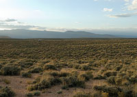
With such an immense landmark as the Grand Canyon just miles off our shoulder, it would seem to be an easy matter to navigate to our destination. Unlike mountains, however, canyons are not necessarily visible from a distance. Incredible as it may seem, we can't see the canyon at all—just a featureless plain leading toward a series of nondescript buttes and rises on the horizon.
This quirky phenomenon enables one of the greatest magic tricks on Earth: we've found the right road, we've battered our truck over mile after mile of rough going, and now, as we drive slowly up a short rise, that featureless plain is about to split open, and the enormity of the Grand Canyon will suddenly appear—presto!—in its entirety, at our feet.
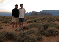
My Own Private Canyon
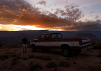
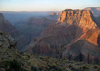
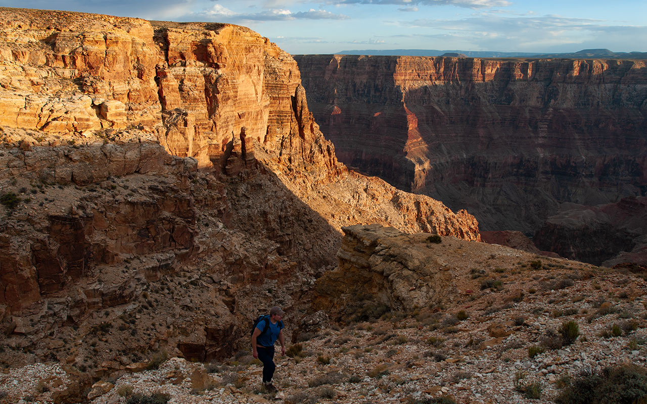
The dirt road ends in a simple cull-de-sac atop a narrow finger of rock that extends outward into space, 3400 vertical feet above the Colorado River.
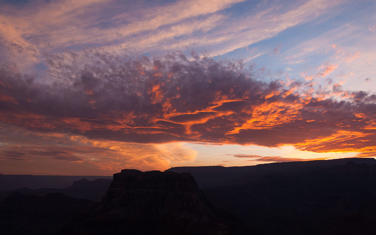
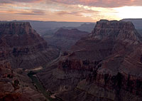
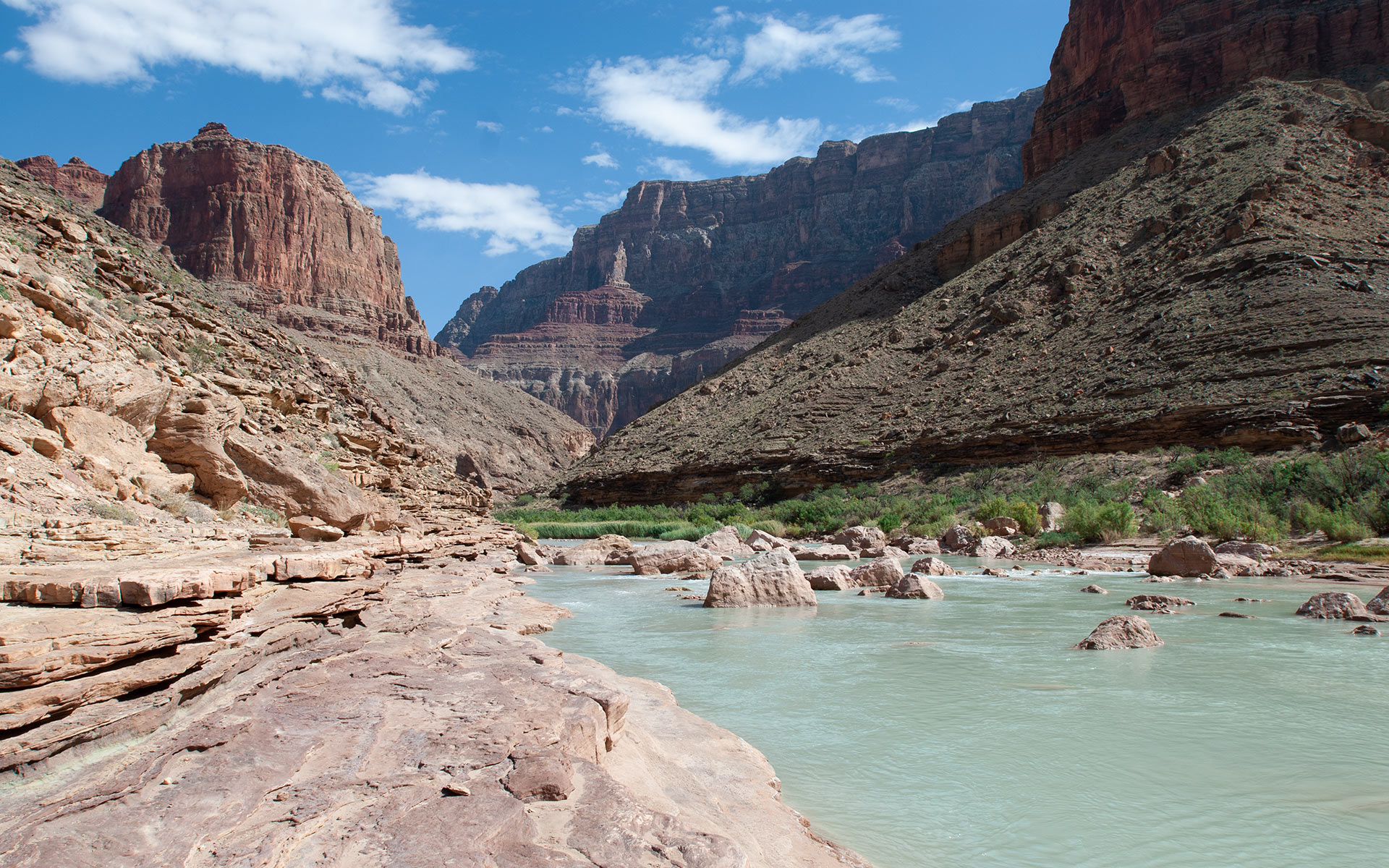
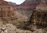
We are high above the intersection of the Colorado and Little Colorado Rivers, confronting a view that has defied description since humans first gazed upon it.
The sky is on fire. The ground has split wide before us. The sight is almost too wonderful to bear. I turn to my brother, and the excitement in my heart makes my voice shake. 'Everyone should get to see this at least once in their lives,' I say.

My brother is silent.
We park the truck and get out.
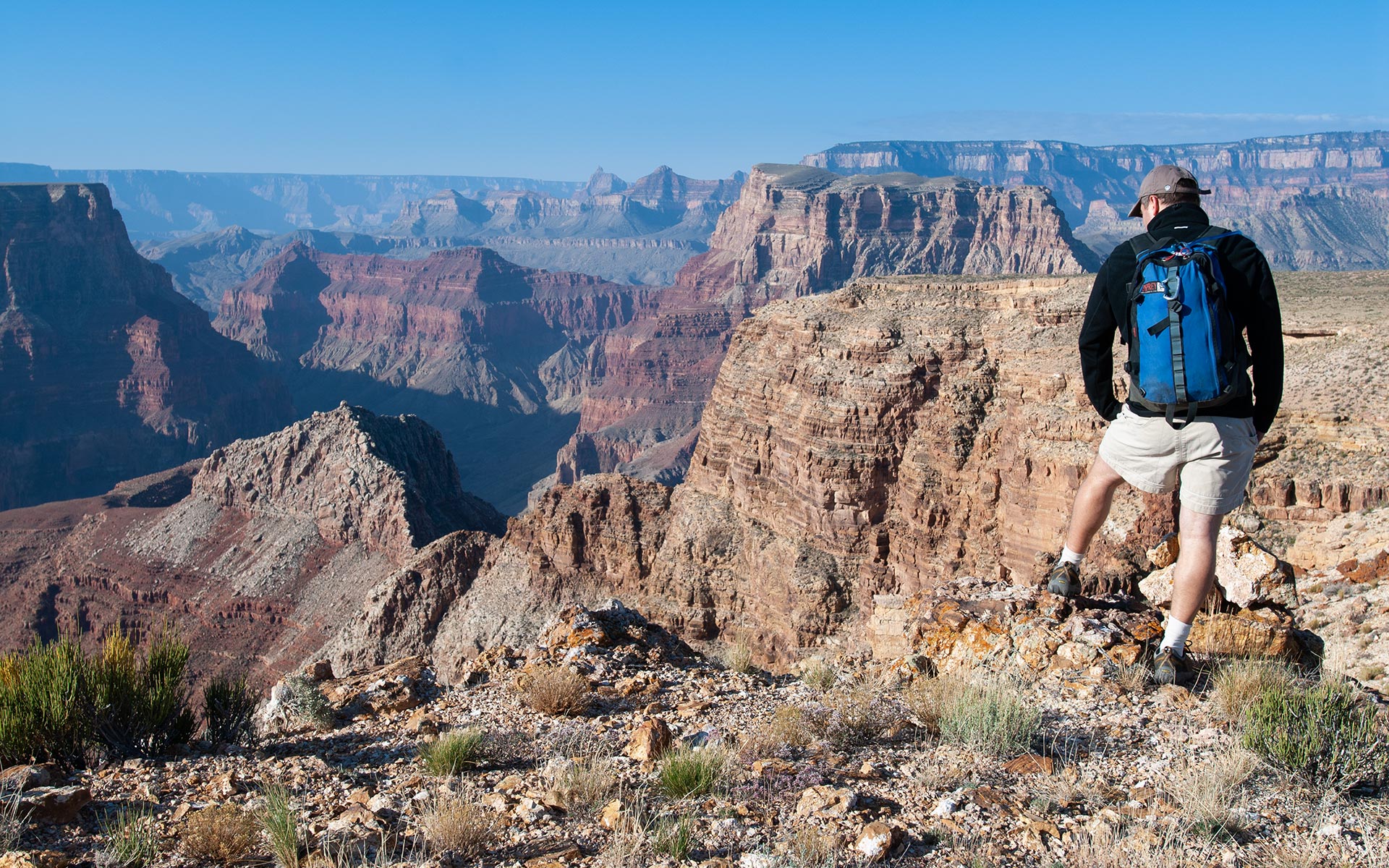
As perhaps the most popular natural wonder on the planet, privacy might seem to be hard to come by atop the Grand Canyon's rim.
But there are no crowds here. No guard rails, nature trails, concession stands, t-shirt wearing tourists, sidewalks, streets, nor signs.
There is nothing but the naked rim of the Grand Canyon and the wind's whisper.
We are utterly, gloriously alone.
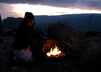
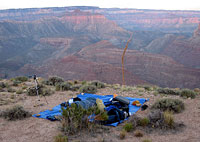
This is where we will camp tonight, beneath the stars, grateful guests of the Navajo Nation.
We can thank the Navajo people for being such good stewards of this unspoiled land.
The Navajo have resisted many of the sort of exploitive development projects that other tribes have embraced (ie, Casinos, Outlet Malls, Sky Bridges).
Unquestionably, such big-money projects would be of some economic benefit to an otherwise impoverished people.
But the Navajo have a unique relationship with the land, a respect that has thus far exceeded the allure of the bulldozer. Perhaps they value this landscape so highly because they know what it is like to lose it. Shortly before John Wesley Powell's river voyage, the Navajo embarked upon an adventure of their own, courtesy of the U.S. Government.
In 1864, the Navajo were forcibly marched from this, their homeland, to Fort Sumner, New Mexico—the Long Walk. President Andrew Jackson's 'Indian Removal Act' also forced the Navajo to leave many elderly and young children behind to die. Six disease-plagued years later, they were released from internment camps and allowed to return to their homeland in Northern Arizona. The government had decided that 'caring' for the Navajo people in New Mexico was too difficult and costly.
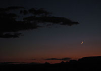
Red and orange hues gradually fade from the sky as my brother and I finish our dinner. The Grand Canyon recedes behind a hazy veil of shadows. We unroll our sleeping bags a few feet from the rim and settle down beneath the stars.
Tomorrow, we will search for the narrow chute that breaches the Canyon's uppermost layer of cliff—Kaibab Limestone—and then follow Walter Powell's route down to the two rivers. My brother and I talk for a while of the upcoming hike tomorrow, but gradually drift toward sleep. If there are ghosts wandering the darkness in the canyon tonight, they are silent.
Dawn Over the Little Colorado
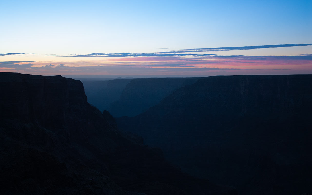
The eastern horizon over the Little Colorado River Gorge begins to glow, a masterpiece of delicate pastels that chases the stars from the sky.
To the west is the Grand Canyon itself, where the sun's first fiery rays strike the top of 6400' Chuar Butte. I grab my camera and do a walkabout.
We are camped about a mile west from the start of the hiking route, at the tip of a narrow finger of rock that points toward the magnificent chasm below.
With such sights in all directions, I do my best to record a few snapshots, none of which will do the scene justice.
It's time to roust my sleeping brother.
He grumbles about his aging body. I grumble about mine.
Two hours of rough dirt roads have left both of us a little stiff this morning. The chilly morning air doesn't help. But we need to get moving.
We have a big day ahead—especially if we hope to make it to the Confluence and back.
We pack up the truck and drive eastward, looking for the start of the route.
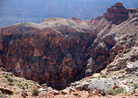
The Canyon, as they say, provides a journey back in time, with each 300-600 vertical feet changing to an entirely new layer of rock strata.
This has special implications for would-be travelers.
There is no one single barrier to descending the Canyon—there are many. Often, it is possible to breach one set of cliffs, only to find yourself hopelessly trapped above the next.
Connecting rim to river thus entails finding and linking a series of unlikely passages through multiple cliff bands. This can easily entail miles of circumnavigation, especially in the Canyon's more rugged aspects, such as our present location.
Kelsey offers ambiguous directions when it comes to finding the start of the hike.
You'll have to do some route finding on this one, he writes.
Indeed!
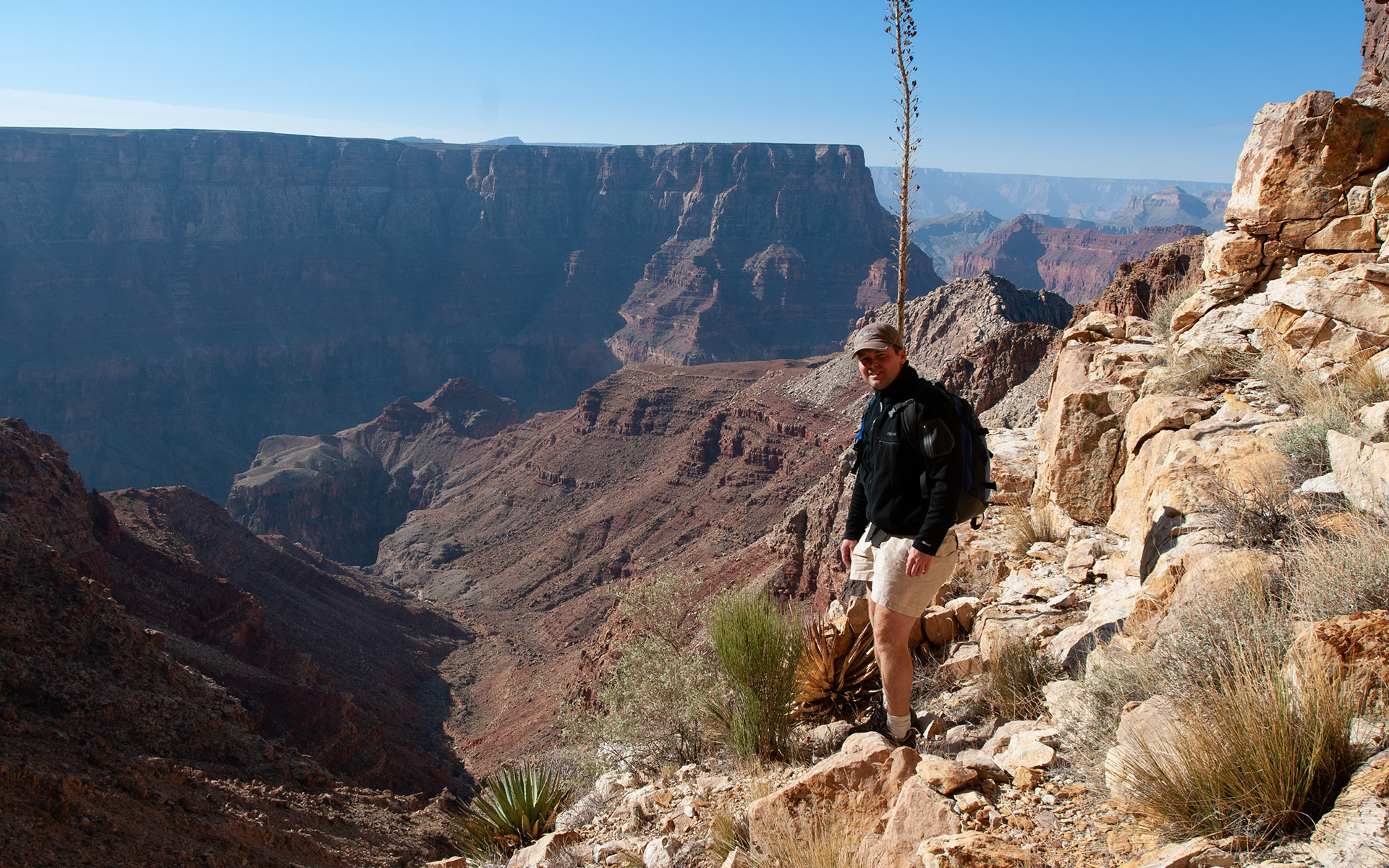
My brother parks the truck. To our left are the benign high plains adjacent the rim.
To the right are the impossibly-sheer drops of the Little Colorado River Gorge.
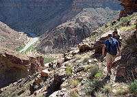
We traverse the rim, looking for a viable route down. Of the two of us, I have evolved into the mountain climber—but Grand Canyon is my brother's domain. Some years ago, he actually attempted to solo the Walter Powell Route (today, this strikes us as a rather daring effort). On his own, my brother found the entrance to the route and descended about fifteen hundred vertical feet before getting hung up on the Redwall and being forced to turn back.
This adventure at least enabled my brother to scout the route's upper section, though at the moment his memory has gone stale. One of the oddities of "Canyoneering" is that everything happens in reverse. It is certainly of no benefit to begin one's day by hiking downward. Fresh leg muscles are quickly fatigued by the relentless pounding of the descent, which is all done via negative load—eccentric muscular concentration.
Aerobically, of course, it is easier to go down.
This can lead to a potentially dire trap, as the unwary hiker quickly descends thousands of vertical feet with deceptive ease. Then, of course, he or she must climb back out. Now, tired leg muscles begin to cramp. And the heat—not apparent on the descent—materializes as if all at once. Heat especially is a deadly-serious threat in the Canyon. The Forest Service refuses to issue permits for certain sun-exposed sections of the Canyon in summer.
All of these issues presume you've actually found your route. When there is no trail, canyons again pose a unique quandary: you must down-climb your route without being able to see it first. Thus, as we traverse the rim, we're peering largely into the unknown. We can't really see what lurks beyond that first drop—so choose wisely!
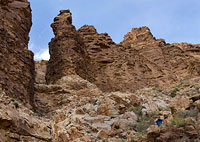
The Entrance
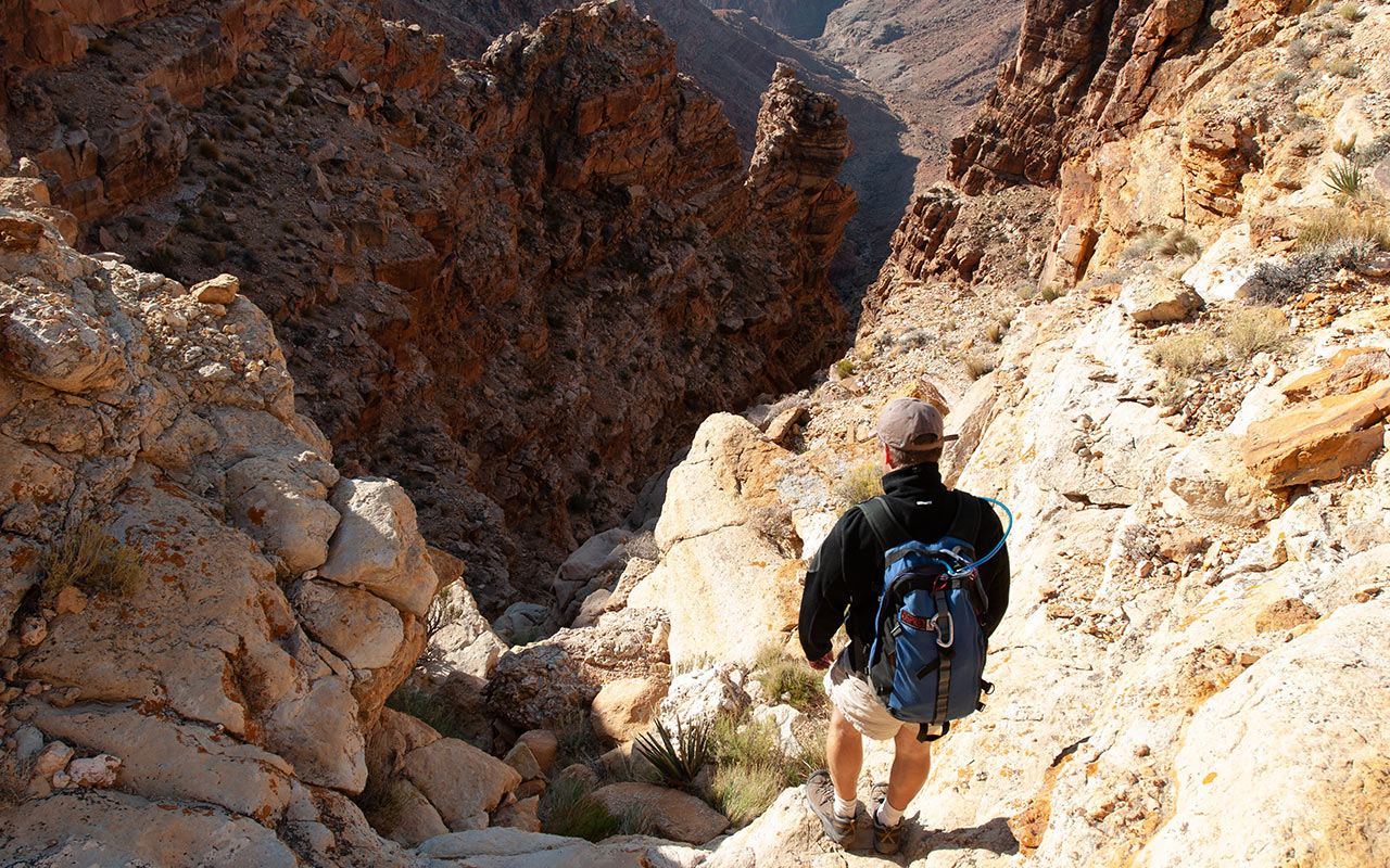
The rim of the Grand Canyon, 8:30 a.m. My brother's memory leads us to a small cairn of rocks piled atop the rim. Immediately below, a not-especially welcoming gully leads sharply downward.
This is it—the start of the Walter Powell Route. A quick check to the east reveals a narrower companion gully nearby. Going by the very sketchy information we were able to dig up, the eastern gully is the harder of the two, so we choose to stay with the western option.
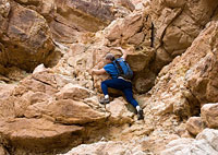
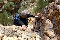
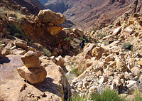
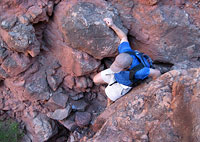
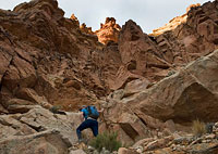
We dive right in to what will be the hardest climbing of the day. The chute is comprised of a series of waterfall steps, each of which must be downclimbed.
Exposure on these steps is modest, though certainly enough to make a fall nasty.
Some climbers report using a rope to rappel down the spicier sections.
If you're not interested in rappelling, having a rope along at least permits you to lower your pack down first.
We, of course, have no rope.
But allow me to go on record here as saying the climbing is tricky.
California convention requires me to rate the climbing Class 3 in difficulty, but many of these steps are twenty feet tall or higher, necessitating long reaches over alarming drops to connect holds.
That's enough to make my brother nervous.
In his eyes, his earlier solo effort is starting to look downright reckless.
As for me, the climbing seems manageable.
To be fair, however, this is perhaps more due to my recent high-exposure adventures on California's Mount Russell rather than to any semblance of ease on the Walter Powell Route's upper rock.
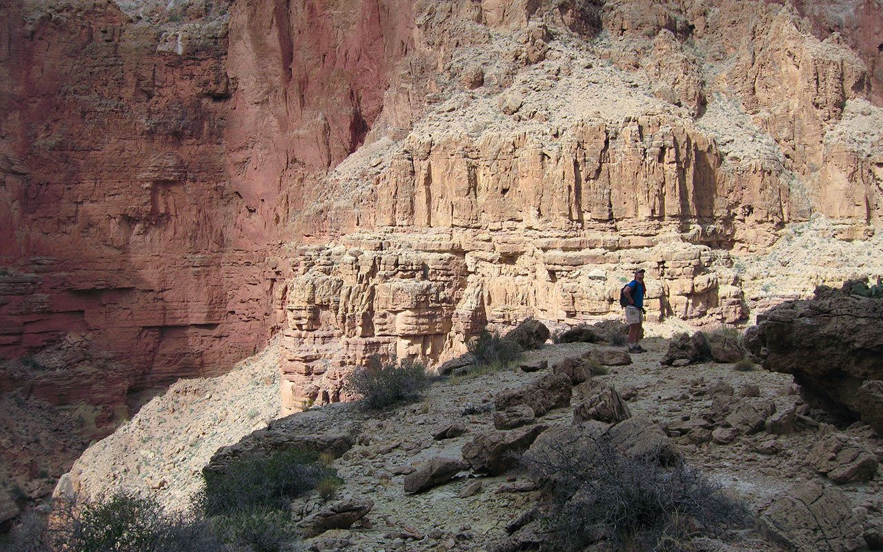
This upper cliff scramble is roughly three hundred vertical feet high, but there are numerous steps to be passed—and each one seems a little harder than the last. To me, the big issue here is one of remoteness. Save an extraordinary coincidence, we will not see another person in the Canyon until we reach the Colorado River far, far below.
Any sort of accident therefore puts us a long, long way from help.
Despite my own soloist tendencies, I am forced to agree with my brother: this is no place to travel alone. As we carefully work past the various steps and scrambles, I contemplate Walter Powell's 1869 adventure in this same gully, and that of the Powell Expedition itself. Their sense of isolation and vulnerability must at times have been overpowering.
Back in the present, my brother and I aim for a prominent pinnacle of rock—a good landmark to remember in spotting the route. Thanks to the steepness of the terrain, we've made quick progress down the canyon, and the gully we're following comes to a pinch. Beneath the rock pinnacle, we must now traverse eastward to avoid an unclimbable step.
Below us, there will be a few more sections requiring modest climbing. But the day's challenges are far from over.
Esplanade Traverse
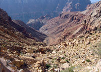
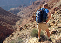
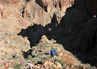
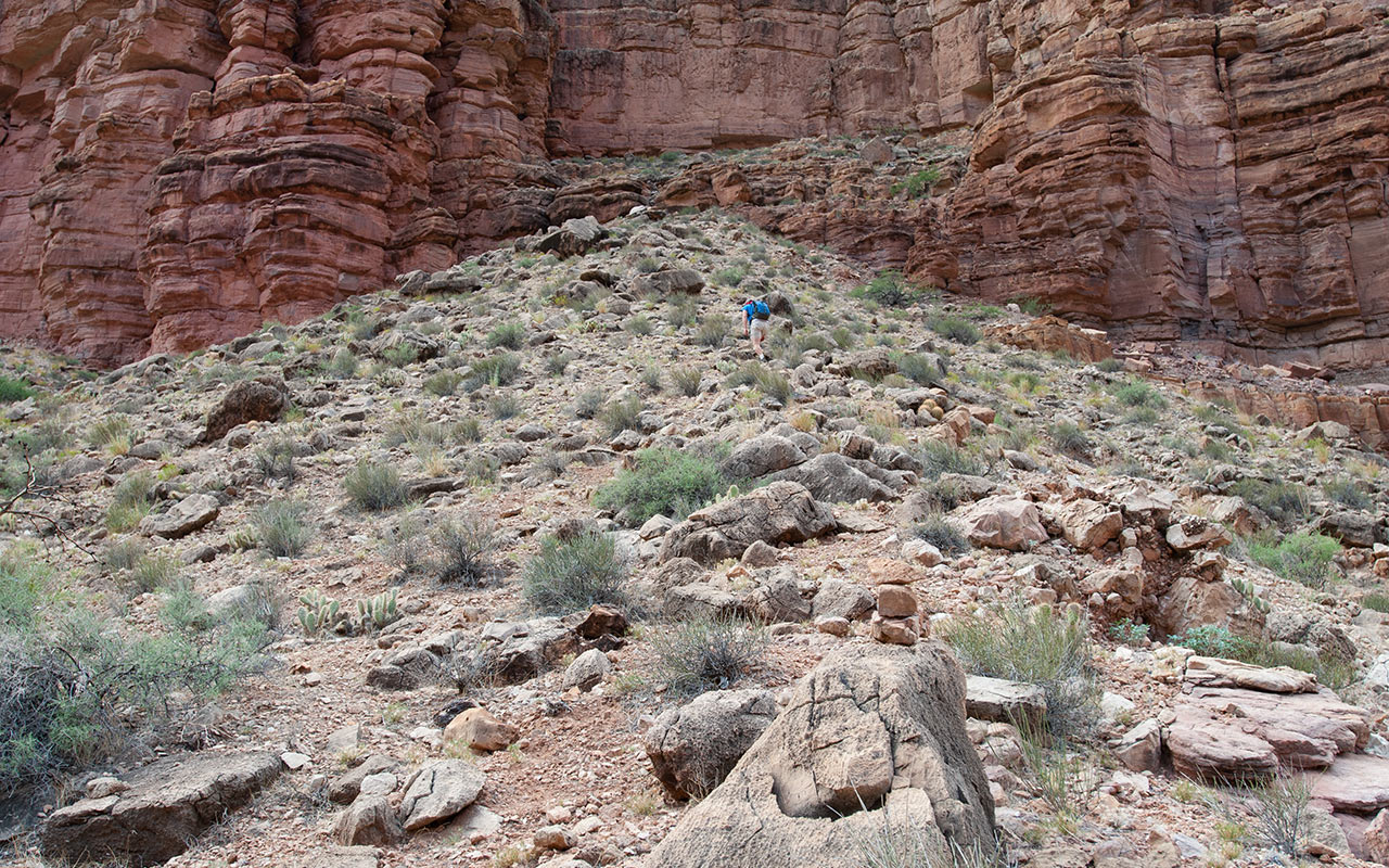
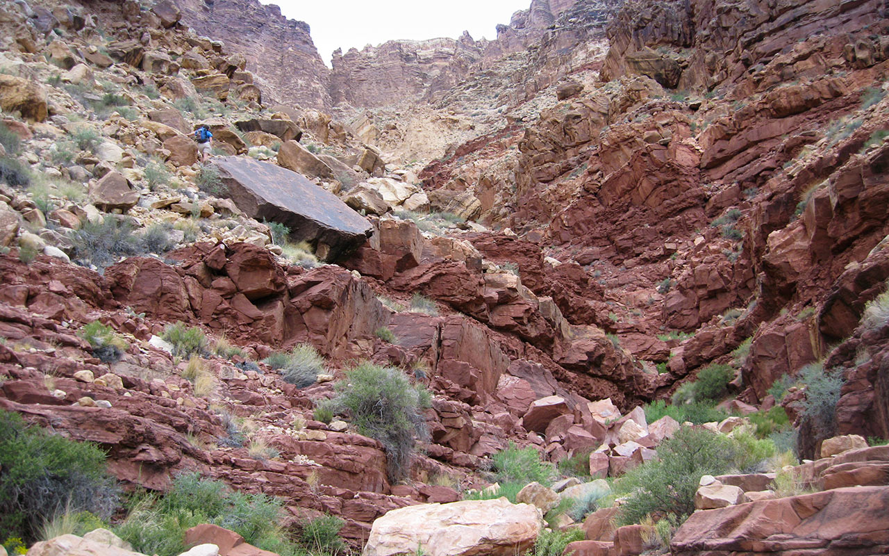
After climbing down through Coconino Sandstone, we emerge from the base of the rim gully and traverse east toward the center of the drainage.
The route finding will be straightforward for a while now. We must simply follow this vast drainage as it winds its way downward through the Canyon's various layers of rock.
As the crow flies, it's a little more than a mile from the rim to the Little Colorado River, another 1.3 miles to the Colorado, and a one-way vertical drop of approximately 3400 feet.
This certainly makes for a steep hike, but let's face it: by Sierra standards, these are modest numbers. The numbers, however, simply don't reflect the hike's actual difficulty.
This is soon apparent to both my brother and me.
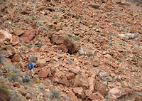
We scramble down a talus of Hermit Shale mixed with loose blocks of Coconino Sandstone fallen from above.
The terrain is exceptionally steep and loose, yet the rocks themselves are razor-sharp.
This makes footing unusually challenging. Our shoes alternately slide and stick, making for a jarring descent.
We both take a few spills here and there, falling into thick spiny brush and cactus.
My brother shouts a warning to be on guard for rattlesnakes. Funny—I was just about to call the same out to him.
But back to the terrain: the Walter Powell Route hikes bigger than it is.
Double the Powell Route's 3000' gain, and you might get a sense of how fatiguing the hike actually is.
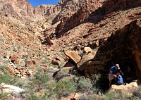
We continue down this improbably steep upper drainage, nearing the red rocks of the Esplanade.
Here, immense blocks rest precariously over crumbling soil, vivid evidence of erosion at work. This is also a reminder that attempting this route in the rainy season would be an exceptionally poor idea. I call for a pit stop at a shady patch behind a rock. We eat a quick snack and drink water. Looking up, I survey the ground we've already covered. Interestingly, there is no apparent route to the rim from our present location.
This again makes me think of Walter Powell's climb. It was August when he made his way up this drainage to the rim. The heat would have been oppressive. How many tries did it take Walter to find a way out, I wonder? It is a cruel reality of the Canyon that viable routes often do not materialize until you're right on top of them.
Conversely, what seems to be a promising avenue through this layer or that may prove impassible only after you've committed yourself to climbing it. Modern Canyoneers thrive on this challenge, which is not unlike solving a vast puzzle. Yes, the landscape does offer clues: a fault line here, a broken talus slope there. But I would certainly not want to be dropped at a random point on the River and have survival depend on finding a way out.
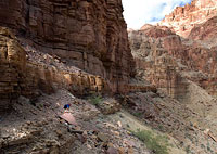
The Redwall
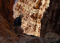
Getting to the Redwall layer below means a long, arduous traverse across the Esplanade, via the drainage's western aspect. My brother and I slowly wrap around to the west, hopping boulders and talus, heading toward an immense amphitheater carved out of the Redwall.
Perhaps no layer of rock in the Grand Canyon causes more trouble to hikers, climbers, and would-be scramblers than the Redwall Limestone.

The Redwall gets its name, obviously, from its magnificent red color. The Redwall's color, however, comes not from the rock itself but rather from above—namely erosion of the iron-rich Hermit Shale.
Left to its own devices, the Redwall Limestone is actually a greenish-gray. This gives the Redwall an eerie cast, for wherever water has recently eroded the limestone, the rock's color shifts toward green.
Additionally, unlike sandstone, the Redwall Limestone's greater strength permits the water to mold it into spires and hanging sheets of rock.
My brother tends to find the Esplanade the most striking layer in the Canyon. My preference tilts toward the Redwall.
Where it occurs in the Canyon, the Redwall typically forms a high, impassible band of continuous cliff. Indeed, the location of nearly all trails in the Grand Canyon is determined by the Redwall—and whether it permits passage.
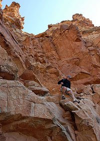
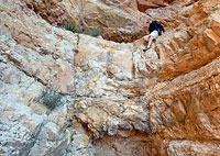
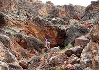
Happily for Walter Powell—and us—the amphitheater can be breached at its western end. This is not readily apparent from above, however. We spend a few moments contemplating the route ahead before committing ourselves to it.
Once again, we're on a steep section of scrambling and climbing, following a narrow drainage over talus blocks and waterfall steps. The climbing here proves easier than above. However, this section is not without route-finding challenges. Descend too far, and you will quickly find yourself trapped above a waterfall pinch deep within the Amphitheater.
That's exactly what happened to my brother during his earlier solo effort. Though he was forced to turn back, he did scout the key to successfully completing the route: a hidden traverse above the lower cliffs. This traverse is quite exposed and not particularly obvious until you're on it. Narrow ledges alongside the cliffs seem to materialize at the last possible moment, allowing relatively safe passage.
Still, as if on cue we both stop and warn the other to be wary here. This is no place to be careless—especially on fatigued legs. Keep the faith. Assuming you find the correct ledges, the traverse skirts the big drops, leading to a high bluff overlooking the Little Colorado.
From here, it is only another five hundred vertical feet or so to the bottom of the gorge—though the Colorado itself lies some distance farther.
The Little Colorado River
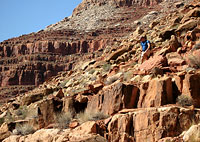
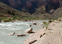
It's a joy to see the pale blue waters of the Little Colorado River, but downclimbing the last 400 vertical feet of steep Bright Angel Shale to get there proves a chore.
Like the limestone high above, the Bright Angel Shale is razor sharp—sharp enough to slice open skin. Here too, the ground manages that odd combination of loose sand and grabby rock.
We proceed with caution, not wanting to have to catch a fall. The bluff overlooking the river is broken by numerous cliff bands, but these are easily bypassed.
Still, the sun is hot overhead, and we look longingly down toward the Little Colorado.
After the long dry hike down, the gentle (if smelly) waters of the Little Colorado make for a fine place to soak away one's troubles—unlike the swift and unnaturally chilly Colorado, which is hazardous to swimmers year-round.
This time of year, the Little Colorado is fed almost entirely by a spring.
Water rushes from the Redwall some miles upstream at Blue Spring, a place sacred to the Hopi.
When the rainy season hits, the Little Colorado grows muddy-brown.
In the dry months, however, its color is a delicate, almost eggshell blue.
Any time of year, unfortunately, the water is not potable.
This leads to an unexpected dilemma when we reach the Little Colorado:
My brother decides we should go no farther.
It has taken us longer than expected to get this far, and we are both starting to tire.
My brother is very reasonably concerned that we will run out of daylight on the way back out—and he has no desire to climb the upper cliffs by headlamp. I meanwhile am afflicted with what might be called upside-down summit fever: I want to make it all the way to the Confluence, and the Colorado River. This conflict of interests leads to a spirited discussion in the tamarisk grove beside the Little Colorado.
I play my trump card: in order to have enough water to climb out, I have to pump water at the Colorado. I tell my brother to wait beside the Little Colorado while I go on by myself. Relying on making it all the way to the Colorado for water now seems like a bad plan, but there's little I can do about it but push onward.
The importance of carrying enough water in the Canyon cannot be overstated. Reliable springs are few, making your option often only the piped-in sources at the rim visitor centers or the Colorado far below. Hopefully, the 2-3 mile round trip to the Confluence will take me less than an hour.
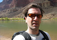
Neither of us is happy about splitting up, but it seems the most prudent choice. I offer to top off my brother's water bottle, but he insists he has plenty to make it out safely. So, off I go toward the Colorado, trying to hurry as much as possible on the soft, sandy shore to keep my brother from waiting too long.
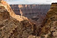
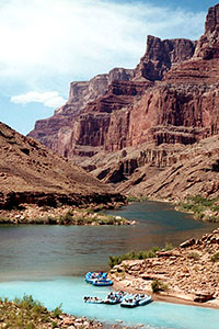
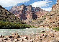
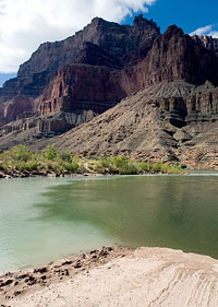
The Confluence
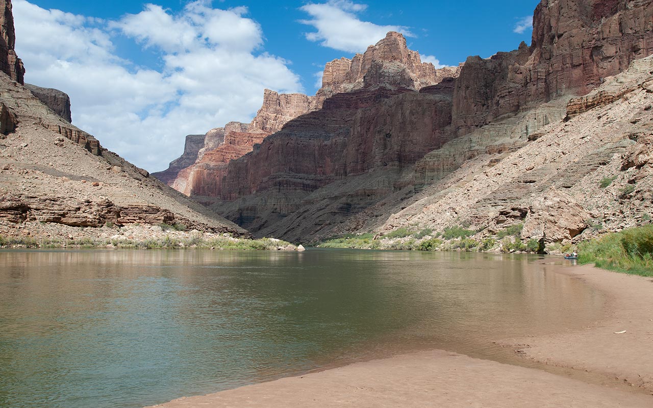
Pale blue water swirls into dark green where the Little Colorado and Colorado Rivers meet. I've reached the Confluence, elevation 2700'.
I've done it—successfully connected rim to river. I wander to the shore of the Colorado and drop my pack in the sand.
The time is 1:24 p.m. It's taken longer to get here than I'd like—nearly four hours. While that's by no means a snail's pace, neither is it a record.
I'm alone at the Confluence today, which seems a bit unusual. Normally, this is a popular lunch spot for river rafters.
It would be nice to bum an ice cold soda; maybe a bite to eat.
Since leaving my brother at the Little Colorado River, I've pushed the pace as much as possible, even jogging a few flat sandy sections to get here.
Now, I'm hot, tired, and thirsty.
My legs are starting to ache.
With the vast majority of the day's work still ahead of me—getting out—I feel my own twinge of anxiety.
The rim seems spectacularly high above.
I pump water, fill my belly, pump some more, and fill my two liter bottles.
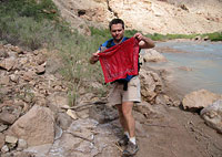
I'd like to stretch out in a shady spot and take a nap, but I know my brother is right. We don't want to climb out in the dark. So, I chow down half a peanut butter and jelly sandwich, soak my feet in the 40° Colorado for a few minutes, and then pack up.
This river touch-and-go is guaranteed to cause me trouble, and sure enough, as soon as I heft my pack and begin trekking back up the marshy sandbars alongside the Little Colorado, I find I need to slow my pace. The sun is cooking me, and that bellyful of water is making me queasy. Again, I wish I had time to lie down and rest.
I find myself wondering whether the Walter Powell Route could reasonably be done as an overnight, rather than a heroic single day push. But camping permits in the Grand Canyon are not easy to come by, I know, and camping in the region of the Confluence itself is prohibited.
Consider also the difficulty involved in lowering a heavy backpack loaded with gear down through the cliffs above. All would seem to make day tripping the most logical, if not ideal, option. It's the only option today, at least, so onward I go.
Climbing Out
It takes almost an exactly an hour for me to return to where my brother has been waiting in the shade beside the Little Colorado River.
I somewhat sheepishly admit that the walk to the Colorado took longer than I expected. He somewhat sheepishly admits he's run out of water. What? This is alarming news. Apparently my brother's camelback wasn't nearly as full as he thought it was.
In the mountains, this is normally the time when the bulk of the physical work—going uphill—is done for the day.
But instead of slogging downhill to get home, we've got to climb 3400 vertical feet to get to the rim—and we'll have to do it on my two liters of water.
Less than ideal, to say the least.
Well, keep the pace slow and steady, I reason, and two liters should be barely enough.
My brother starts up the talus slope above the river. I follow.
I'm not exactly a stranger to hiking in the Canyon. Even so, those first few steps up the steep Bright Angel Shale over the Little Colorado are eye-opening.
My legs are tired. My pulse is soaring. I'm hot, soaked in sweat and my own salt. This is going to be a tough one.
My brother says he's tired as well. As usual, however, he sets a blazing pace upward.
We work our way toward the Redwall, then make the long traverse into the Amphitheater, following a few strategically placed cairns to stay on-route.
Thankfully, clouds build overhead, keeping the worst of the sun off our necks. Once we round the edge of the Redwall Amphitheater, we are treated to a view of the entire route ahead.
I stop, hit with a sudden sense of hopelessness as I tilt my neck upward. How did 3400 vertical feet manage to grow so big? Even my supercharged brother seems taken aback. How are you feeling, he asks? He's getting a fluttering in his quad muscles—the first twinge of cramps.
I'm not cramping (yet!), but I've got a headache, and our water is already running low. The terrain is absolutely punishing, and I'm feeling it with each step. We push up through the Redwall, then scramble about on the steep traverse above.
Here, loose ground and relentless boulders force a pitifully slow yet exhausting pace. In summer's heat, this section would be positively deadly. Now, even in late Fall, with the sun behind a welcome layer of clouds, it's still uncomfortably warm.
I'm trying to convince myself that there really isn't that much farther to go—a mere 2200 vertical feet, actually. But the numbers just don't tell the story. Crawling over these boulders, poked by cactus and brush, slipping on the loose ground, traversing these steep drainage walls, early-stage dehydration, salt imbalance, heat: it's starting to add up.
Gut Check
Just below the start of the Esplanade, I call for a rest. My brother and I plop down on a flat boulder and take stock of our situation.
I certainly don't feel chipper, but I'm hanging in there, fighting off a headache and a touch of nausea. Unfortunately, my brother's legs have continued to worsen. He's battling cramps with every step now, and his anxiety level is rising.
I know I'm going to make it out, and given my brother's formidable canyon hiking experience, I have full confidence he'll make it out, also.
Then again, the rim still towers above us, and I'm not the one with leg cramps.
I take a few Advil for my headache and hand over the rest of my water.
After all, what are older brothers for?
I encourage my brother to slow down, take his time.
We've got lights if we need them. We'll make it out.
Onward we go.
And wouldn't you know it—now my legs are threatening to cramp.
This is undoubtedly the consequence of my speedy jaunt to the Colorado plus salt and water loss. Unlike my brother's quads, however, it is my flexor muscles that are threatening to seize.
That makes it tricky for me to lift up my legs—say for climbing—but it's easy enough for me to change the angle of my feet while walking and shift toward other, more solid muscles.
In this manner, I keep the cramps at bay.
My poor brother, though, is really getting hit hard. He stops every few feet or so, trying to stretch out his legs, grimacing.
He knows if his legs go all the way, we'll be spending the night out here. It's gut check time. But we are making progress. Cramps or not, my brother's pace is still on the speedy side, at least as far as I'm concerned. I'm playing rousing anthems in my head, envisioning an ice-cold soda in the cooler at the truck, doing what I can to motivate myself.
And so, layer by layer, we continue to work our way upward. When we finally reach the traverse-in to the gully that leads the final few hundred vertical feet to the rim, I wonder how my brother will do through this section of climbing. And how will my own legs fare? It's a real struggle to lift my legs, guaranteeing trouble on the many mantle moves that lie ahead in the gully.
Being so close to the rim, however, seems to give both of us a shot of energy. We scale the steps one by one, careful to avoid overtaxing the legs. The sun breaks free of the clouds to the west, lighting the top of the rim just above us. In no time at all, we'll be basking in its glow.
Songs of the Grand Canyon
Those last few steps to the rim sure feel good. And just like that, the hot vertical realm of the canyon gives way to a gentle green plateau and cool breezes.
We've made it out. The time is 5:30 p.m., just under nine hours since we began hiking (Kelsey claims he made the round trip in less than seven. Bastard). Both my brother and I are relieved to see the truck is still parked in the distance with all four tires full of air.
Despite its brevity, this is easily one of the hardest day hikes I've ever done.
It's also one of the most satisfying.
As the sun continues its journey toward the horizon, and the shadows lengthen, I and my brother marvel at the sublime vista before us.
We should hike the Grand Canyon more often, we decide.
But perhaps an easier route? One with a trail? Yes, that sounds like an excellent idea.
We pull ourselves into the truck, fire up the engine, and begin the long, punishing drive home.
I gaze back at the Canyon, unwilling to let it slip away from view.
In his epilogue to Exploration of the Colorado River and Its Canyons, John Wesley Powell writes:
"The Grand Canyon is a land of song.
Mountains of Music swell in the rivers, hills of music billow in the creeks, and meadows of music murmur in the rills that ripple over the rocks.
All this is the music of waters.
The adamant foundations of the earth have been wrought into a sublime harp, upon which the clouds of the heavens play with mighty tempests or with gentle showers. The glories and the beauties of form, color, and sound unite in the Grand Canyon—forms unrivaled even by the mountains. It has infinite variety, and no part is ever duplicated.
Its colors, though many and complex at any instant, change with the ascending and declining sun; lights and shadows appear and vanish with the passing clouds. You cannot see the Grand Canyon in one view, as if it were a changeless spectacle from which a curtain might be lifted, but to see it you have to toil from month to month through its labyrinths.
It is a region more difficult to traverse than the Alps or the Himalayas, but if strength and courage are sufficient for the task, by a year's toil a concept of sublimity can be obtained never again to be equaled on the hither side of Paradise."
WARNING: the Walter Powell Route is a remote and dangerous hike not recommended for any but the most experienced and determined Canyoneer. Please note permits are required both for camping and hiking on the Navajo Reservation. Contact Navajo Nation Parks & Recreation for the most up-to-date information.