Hiking White Mountain
Experiments in High-Altitude Exposure
White Mountain, California — It would perhaps be misleading to call White Mountain an easy fourteener (is there such a thing?). But it's not unreasonable to call White Mountain California's easiest fourteener.
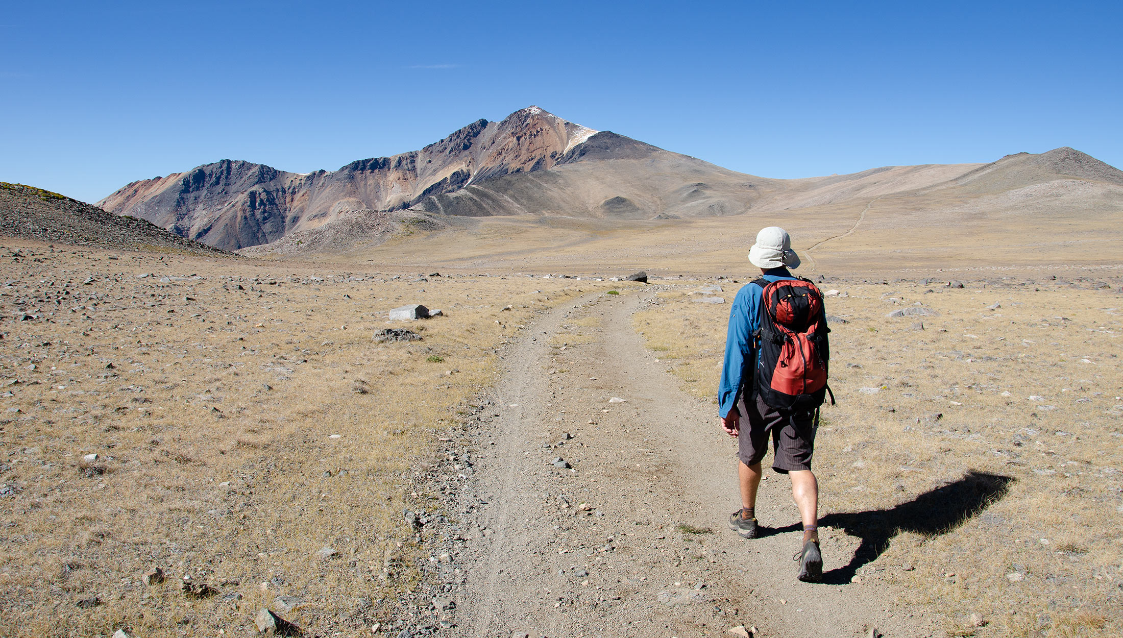
Which is kind of funny, because from three directions—north, east, and west—White and its massive vertical offers just about as grueling a climb as can be had in North America. Thankfully there is also the south approach, via White Mountain Road, which will today zip hiking partner Trevor Benedict and I from our sea level city up to 11,700 feet in a scant few hours.
From there we'll park my car at the locked Barcroft gate and walk along a true Class 1 road all the way to White Mountain's 14,246-foot summit (bicycles optional).
What could possibly go wrong? Well, aside from White's somewhat longish 7-mile trek, one-way, the big threat is the quick elevation gain. You couldn't build a better laboratory to deliver a debilitating dose of altitude sickness.
For my own preparations, I've spent the past two weeks frolicking in the cool pines of Flagstaff, Arizona, elevation 7000 feet, plus a few days of smog exposure back home in L.A.
My hope is that this pre-acclimatization preparation will not only prevent me from getting struck by A.M.S. myself but will also counterbalance the inarguably superior fitness regimen of my partner Trevor, who would otherwise run circles around me, all things being equal. For now, driving above 9K, I seem to be breathing easy, but there's a long way to go. So: we'll see.
After the long and dusty drive up White Mountain Road, we park at the Barcroft gate and stretch our legs. My first impression is that this sunny September day is colder than expected. The air, too, seems a little thin. How much clothes to bring? We're starting this hike at a very lazy 2 p.m. The late start is intentional, in hopes of catching sunset glows over the Sierra as we're hiking back down.
Located in the lee shadow of the great Sierra to the west, White Mountain features one of the most exotic climates on Earth. Where you'd normally expect Alpine forests and streams there is only barren, high-altitude desert. At high noon the whole place is chalky-dry, with the flat, featureless look of an over-exposed photograph. Unique, to say the least. Last-minute sunscreen goes on exposed skin. I lace up my shoes, grab my hat and sunglasses, ready to begin.
Barcroft
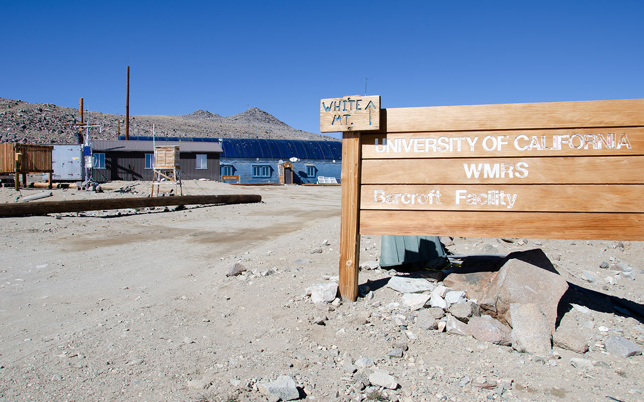
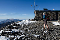
Past the gate we go, and we're on-trail, or, more accurately, on-road, first stop California's Barcroft Research Facility. The road climbs a quick 800 feet over the next mile or so, and soon Barcroft's buildings are in view.
White Mountain's Barcroft Station is one of several nearby University of California research facilities, permanently occupied by scientists engaged in various high-altitude experiments—or so goes the official story. Looking around the area, one can't help but notice how remote and private it is. A perfect place for researching Alien technology far from prying eyes, no?

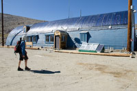
Once a year, Barcroft unlocks its gate and its secretive doors for a public open house, welcoming visitors for lectures and even refreshments.
Of course, they don't let you see any of the facility's vast underground levels, unless you happen to be one of those unlucky solo visitors randomly chosen to replenish the ranks of the human test subjects—so eye those cookies and soda cups with care!
Today, with Trevor pushing the pace beside me, I'm not worried about any abductions, but I am a bit concerned about the elevation.
Despite my preparations, I'm already feeling a little light-headed, and, disconcertingly, pretty colored sparkles are manifesting at the corners of my vision. Trevor and I call a short lunch break at the edge of the Barcroft complex to refuel and chew a few ibuprofen tablets. Truth be told, these sea level-to-summit jaunts are a tremendous strain to body and brain.
Recent research (some of it perhaps conducted right here) suggests the brain can suffer permanent damage at elevations far lower than previously suspected. In fact, brain scans of Mont Blanc climbers have found irregularities associated with brain damage. These irregularities were most prevalent in unacclimatized mountaineers.
If brain damage can occur at Mount Blanc's 15,774-foot elevation, it would seem reasonable to suspect it can also occur around 14,000 feet—especially when dashing up from the lowlands as quickly as White Mountain permits. So I find myself regularly checking the color of my fingernails and pushing my respiration rate—the poor man's acclimatization strategy. The sparkles persist.
McAffe Meadow
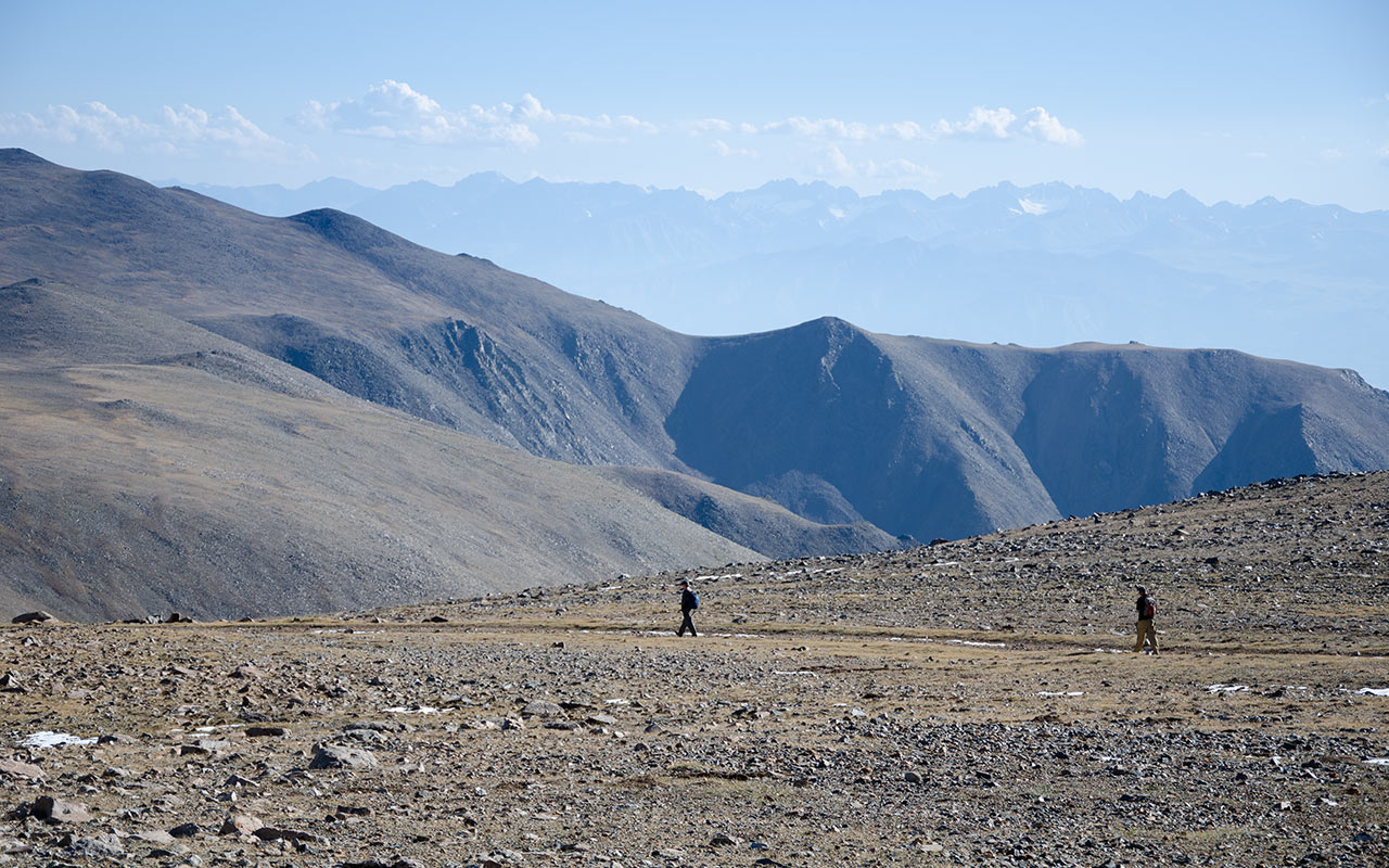
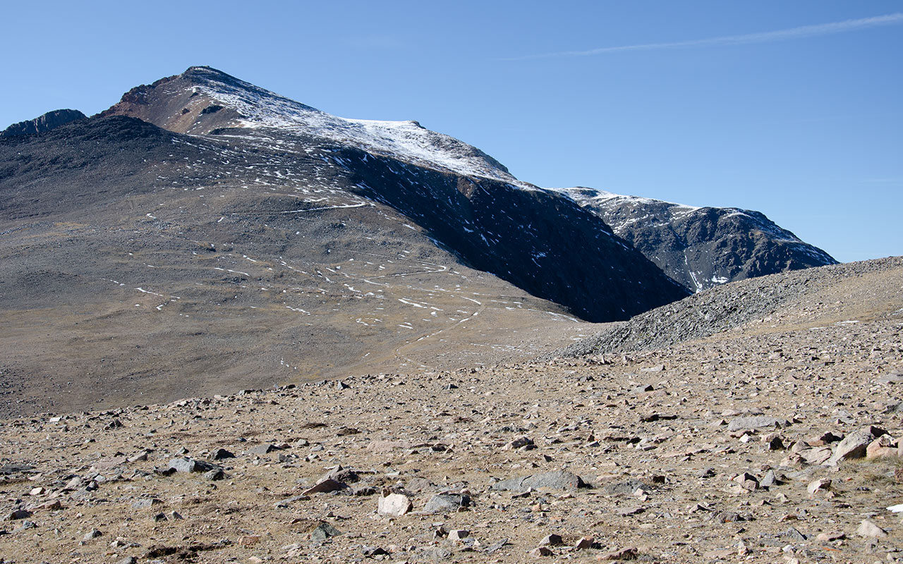
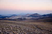
Just past Barcroft Station the trail/road crests a rise, and the vast plateau of McAfee Meadow appears, with White Mountain Peak looming on the north horizon. This is indeed a strange, austere landscape. 'Arid' doesn't really do justice to the place.
Let's call it preternaturally dry: not too far removed, maybe, from the surface of the moon. One source says this is the driest air measured on Earth. White Mountain reportedly receives most of its moisture, such as it is, in Winter. Summer thunderstorms are not unheard of, and White Mountain does have a reputation for sudden and very nasty storms, but clearly there is no monsoon season to speak of.
This bone-dry weather comes with a number of consequences, including, surprisingly, diversity of flora. White Mountain's unique and localized climate reportedly houses over 200 species found nowhere else in California.
The most famous of White Mountain's plant life is no doubt the Bristle-cone Pine tree.
Located principally in two groves a few miles back down White Mountain Road, these trees are themselves the subject of study and research, and are said to be among Earth's oldest living creatures, with some trees' lifespans exceeding 4000 years.
Here on the McAfee Plateau, however, there are no trees. Just dull yellowed grass and an inexplicably large population of rabbit holes. Perhaps the coyotes have never bothered to venture this far up the mountain. Given that they can't use the road and motor vehicles to get up here, as we did today, I say it's understandable.
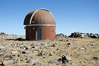
With White Mountain's extremely dry climate and its very high elevation, you would think this an ideal location for an observatory. In fact, there is a lone and rather decrepit observatory tower nearby, but nothing like the state-of-the-art facility found atop Hawaii's Mauna Kea. Why not here? The answer seems to be weather—winter access, via the long, high-altitude White Mountain Road, is too problematic.
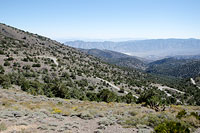
Meanwhile, White Mountain's south face remains stubbornly distant, despite our best efforts to put some kick in our steps. There are inspiring views to be had of Owens Valley and the Palisades to the west, but crossing this broad flat meadows proves to be no small grind, especially as the altitude continues to wear away at us.
The South Face
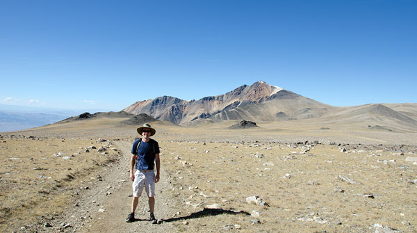
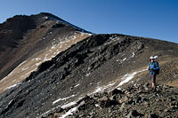
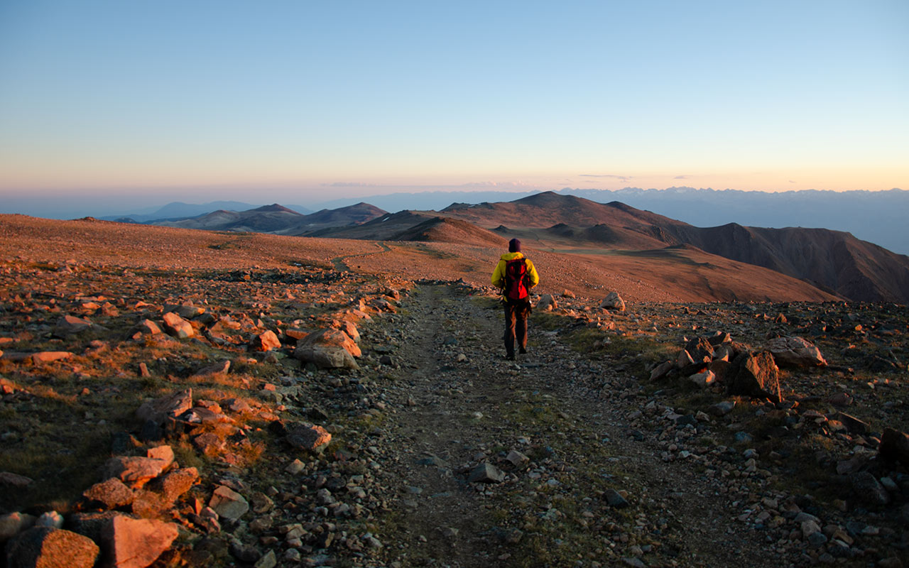
At last we cross the meadow. The road here drops a bit, giving back precious altitude before climbing aggressively via a set of long switchbacks up the south face proper of White Mountain Peak.
From the saddle at the base of the south face Trevor and I speculate as to our present elevation, wondering how much higher we have to climb. The truth is we're at 13,000 feet right now, leaving us a little over a thousand feet to go. Though the road goes all the way up, that last thousand, of course, will not prove to be easy.
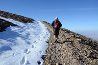
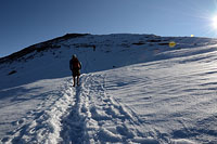
The story of the moment is snow. This is not left-overs from last winter, it is fresh snowfall, perhaps only a few days old, and several inches deep.
The snow is a welcome sight to this skier's eyes, but it also makes for a bit more of a challenge in my running shoes than I was expecting.
Lengthening shadows, meanwhile, indicate that we've been hiking for a while, now. What time did we leave the car? It's nearly five o'clock now.
We're still pushing the pace up this hill, but I'm more than ready to reach the summit and put today's climbing to rest.
As we wind up the right-hand side of White Mountain's south face, we are at last treated to views of Nevada, to our east. The vertical relief in that direction isn't quite as high as the nearly 10K gain to our west, but it's still significant.
From this vantage point, you can clearly see that White Mountain is a great fin of a hill, a longish north-south ridge that drops aggressively to either side. As the shadows push eastward into Nevada, the colors come out. Rich dark hues streak the rocks, and the sky deepens. Though the summit hut atop White Mountain is now clearly visible, it stubbornly refuses to get any closer.
A bit of a wind has kicked up. The air feels colder. My legs, bare to the wind, begin to get sluggish. Have I been drinking enough water? I'm definitely hungry. I pull my gloves from my pack, and I also take a moment to stuff some snow into my water bottle to replenish my water supply, gasp a few deep breaths of crazy dry thin air. We've got to be getting close, now.
The Great Divide
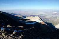
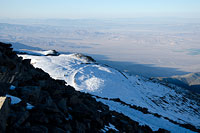
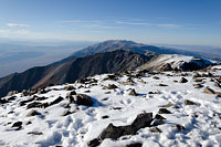
The view from the summit, looking south
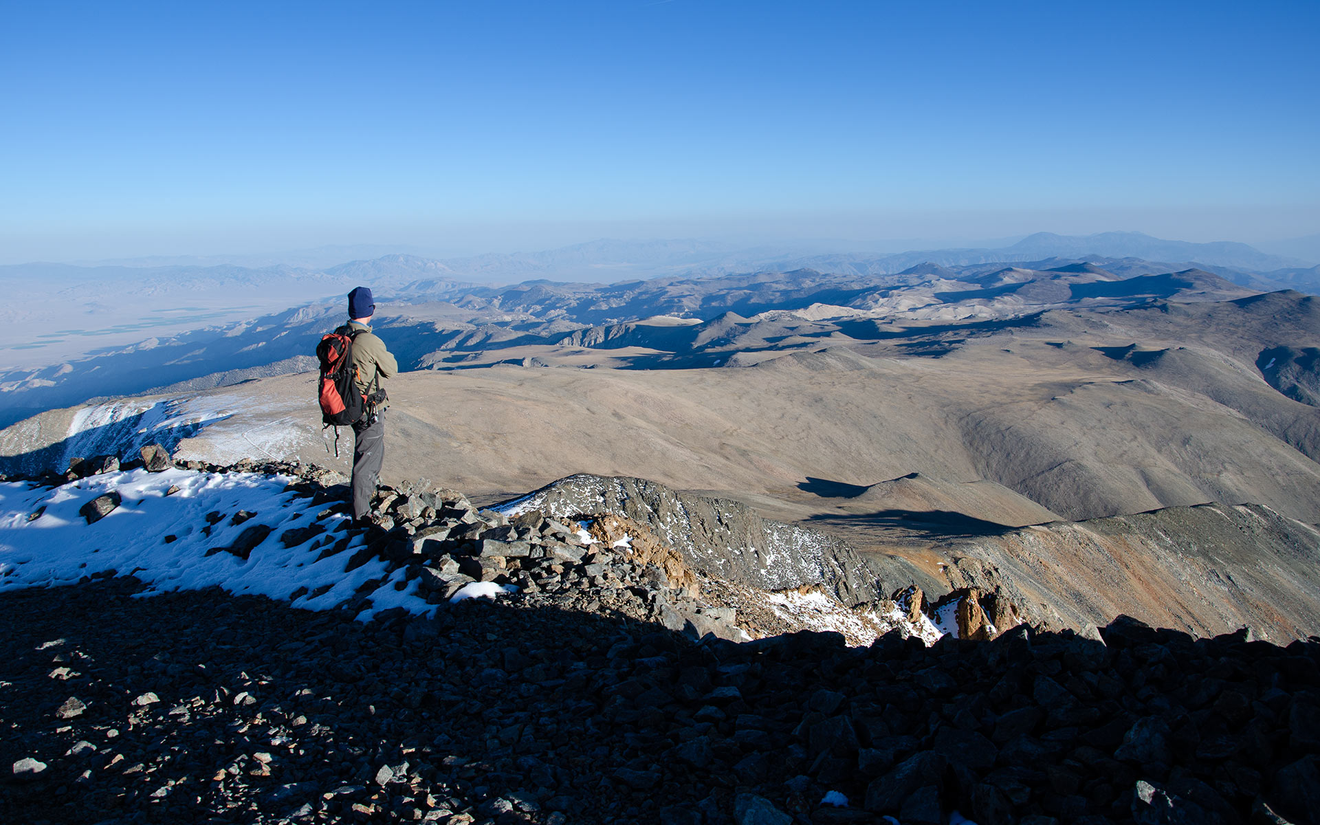
From atop White Mountain's summit, elevation 14,242', it's strikingly evident how sharply the range rises to either side, east and west, splitting the surrounding landscape like a great dividing line.
5:42 p.m. It's cold and I'm tired. Though I've mercifully been spared a headache thus far, experience is telling me that our stay atop White Mountain today is best kept short. Trevor and I pile on all our remaining clothes and then find a sunny perch against the summit shelter's west side to enjoy a short lunch break.
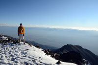
We've arrived at the summit just as the light seems to be growing more angular. The sun hangs low over Owens Valley and Lake Crowley to our east, backlighting the haze above Bishop.
I eat my meager snack lunch, glad the wind isn't blowing. It sure feels like winter is coming.
With my camera in-hand, I make a slow circle around the summit shelter—actually a high-altitude research laboratory, part of Barcroft, closed to hikers.
To our east, dark shadows push deep into Nevada, like outstretched fingers. Far, far below, the desert glows bright in the late-afternoon sun. Still hot down there, I bet, in contrast to the crisp air up here.
The snow in the shadows is developing a noticeable crunch beneath my feet. I continue wrapping around the summit, now looking south toward the Inyo Mountains.
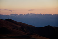
A little turn westward and there's the Sierra, with the range's big peaks just barely visible but still recognizable on the horizon.
Like Telescope Peak to our south, White Mountain's summit offers a dramatic and unobstructed 360° panorama. East-to-west, the entire range is a slim 15 miles across.
The day seems to be fading a bit faster than expected. I confer with Trevor, and he agrees it's time to head back down. We'll be hiking back to the car in the dark, I realize. That probably means it's going to get a lot colder, though the upside is we'll enjoy a no-doubt unforgettable show of colors as the sun fades beyond the western horizon.
I take a moment to lace up my trail runners, tight as I can get them, for the hike downhill. That headache seems to be ready to bloom, now. Have I been drinking enough water? I pull out my water bottle for a last swig, noting that there's still snow sloshing around inside. The rocks to our east are starting to turn orange in the late sun. I snap a last few photos, and then we're off.
Sundown
Seven miles to go above 12,000 feet. Trevor and I push the pace down the trail, not quite racing, but wanting to get as far down the mountain as possible before darkness sets in.
The sun seems to be in a bit of a race of its own, crossing the last gap of sky above the horizon with considerable alacrity. My headlamp, of course, is sitting in the car. Days are getting shorter, I tell myself. Will there be a moon tonight? I don't think so—at least, not soon enough to be helpful.
But still, it is inarguably a pleasure to be here, now, watching the sky change as the sun begins to kiss the horizon. The light takes on an electric, pinkish quality, raking across the land like some kind of radioactive death ray.
Where that great beam touches everything seems to freeze, motionless, caught in its grasp.
All around us, this previously flat landscape erupts with texture, contours and features emerging as if coming to life. Meanwhile, as the sun's last beams grow sharper, the shadows grow darker, beginning to assert their control over their land.
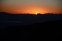
I stop, turn my face westward, and watch that last sliver of sun touch the tips of the Minarets. Below, Lake Crowley gleams in the distance.
Just a bit south, the snow of Palisade Glacier catches the light. To my surprise, I can clearly see it with my naked eye, as well as the narrow gully of the U-Notch Couloir.
The sun drops below the horizon. The colors begin to fade from the sky. Time to get moving, again. How many miles more to Barcroft, the gate, and the car beyond?
I catch up to Trevor.
Like me, he's been admiring the very same show. It's always easier (and safer!) to time your hikes to correspond with maximum daylight, I know, but there is also a reward to be had by venturing out in the backcountry when the sun isn't atop the sky. Of course, now we'll be pounding the trail well after dark, in the quickening cold, to get home. But, today at least, it's been well worth it.
And as the day continues to darken, it feels like the end of a short summer hiking season, for me at least. Most of my other hiking and climbing plans will have to pushed back to next summer. But that's okay with me. Fall is here, and winter is fast approaching. I'm ready for it...