Mount Harwood: Northeast Ridge
A Southern California Ski Mountaineering Adventure
Los Angeles, California — for a range surrounded by the cities and suburbs of Southern California, the San Gabriel Mountains can prove maddeningly inaccessible.
The easiest path to Mount Baldy's north face, for example, requires one to climb the mountain from the south, descend the north face, and then climb back up to the summit. In other words, to ski one of the most coveted lines in Southern California, you've got to climb the mountain twice.
Welcome to Southern California Ski Mountaineering.™
If adventure is your game (as in, gruel, slogs, and unexpected misery), you'll find none better.
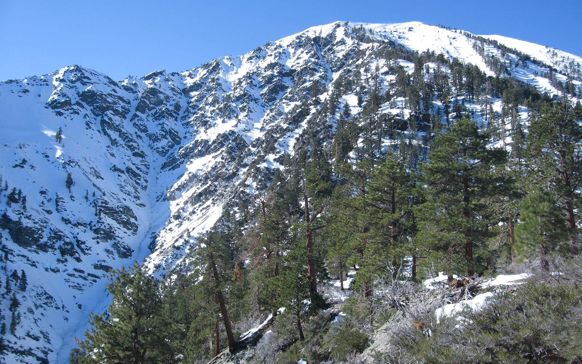
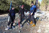
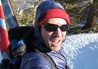
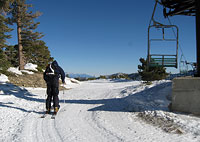
My compatriots Bill, Dan, and I are gathered somewhere in the bowels of the San Gabriel Mountains, elevation 6000 feet, on an exploratory mission seeking out north face access.
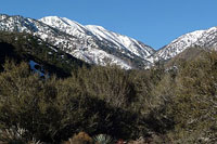
Ostensibly our target for the day is Mount Harwood and its north aspects. The real goal, however, lies just around the corner: those pristine steeps on the range's high point, 10,000' Mount Baldy.
Should we prove successful in accessing Mount Harwood from the north, neighboring Mount Baldy and its sublime nordwand would seem to lie within easy reach as well. This bit of magic is to be accomplished not ala helicopter or space time warpage, but rather via a nondescript dirt road passing through inarguably shady places en route to Stockton Flats and the east face of Mount Harwood.
The preliminaries have been handled by Bill, our intrepid pathfinder. One week earlier, he scouted up the road in his 4x4 to verify its plausibility. Yes, the remote (but perhaps not remote enough) Stockton Flats area is disturbingly garnished with broken glass and empty shotgun shells...but road access is road access, so we lock our car doors and cross our fingers.
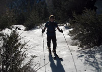
Then, as a cold January wind blows up the mountain, we don boots and skis and prepare to hike inward, bold explorers buoyed by the hope that we have at last found the Holy Grail of the San Gabriels: north face access to Harwood and Baldy.
Secret Hidden Canyon
Often the crux of a ski mountaineering route is simply finding a way to get yourself and your gear atop the slope of snow you hope to ski. That is certainly the case today.
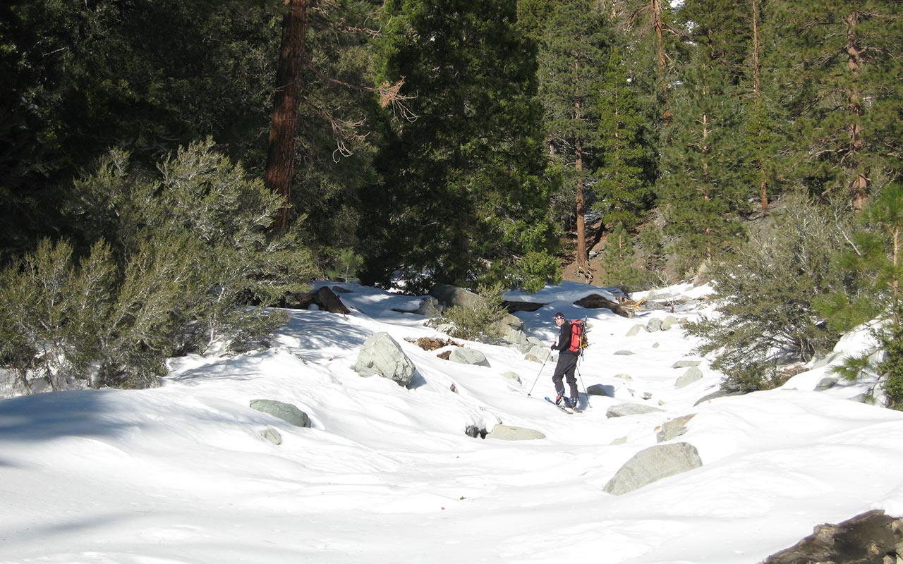
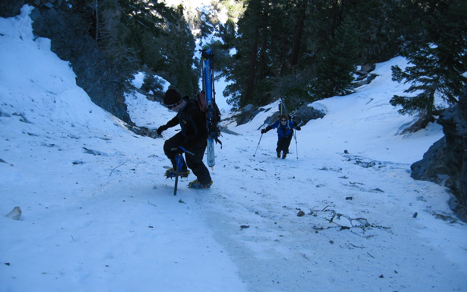
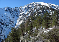
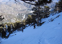
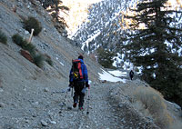
Separating us from Harwood's inviting north slopes are 3500' of vertical and an equally daunting gauntlet of cliff-bound terrain. From Bill's truck we skin easily up the flats of Stockton Flats, contouring around what is a large, debris-strewn drainage.
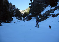
Soon after, we veer westward, into a strikingly narrow gully that penetrates the deep divide between Mount Harwood and Dawson Peak.
Make no mistake: this is rough country.
Thickly forested here at the entrance, there is in fact no guarantee that this currently-invisible gully will even open enough to allow us inside.
But oh, how I'm hoping!
I follow Dan into the thicket of trees, as steep walls of rock shoot up instantly to either side of us.
These steep, loose, crumbly cliffs are a ubiquitous feature here below Harwood's east face—and indeed below Dawson Peak's south face as well.
We are pinched between the two peaks, and as we progress the gap is narrowing.
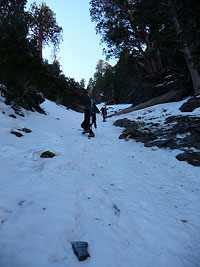
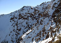
Then—surprise!—the trees part and we're in a credible though sunless gully leading theoretically right to the heart of those north aspects we've been dreaming about. In no time at all we're a couple hundred yards farther, already congratulating ourselves on this spectacular find.
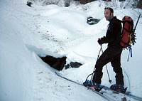
Secret Hidden Canyon (as I've come to name it) is offering an easy highway into the heartland of the San Gabriels. Things begin to collapse—literally—moments later. Dan skins onto a hidden snow bridge and gets a fright when a 10' by 10' section of it collapses into deep rushing water.
He backs carefully away without further incident. But I've been looking ahead, where I see the canyon we're following appears to close to two feet or less in width. Can we get through? I press ahead, suddenly forced to take off my skis because of ice and more water.
I punch through a stand of willows, where I get the outrageous verdict: the way is blocked. A tiny waterfall blocks our path, protected by a four-foot-deep pool of water. There is no way around save a swim, and even that looks questionable, as a good ten feet of slick rock covered in rushing water must somehow be gained to pass through the notch to the open gully beyond.
I can't believe it. Our highway has been ruined by a miserable three-foot-high waterfall. Climbing to either side above the fall looks unpromising: impossible to the left, dicey to the right. And just like that, our north-side mission appears to be over.
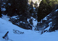
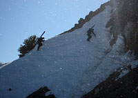
Chute No. 1
It's barely 8:30 a.m. and I'm already fully disgruntled. I'm game for trying the right-side scramble, but consensus sends us left instead.
Bill suggests we climb a steep chute fifty yards back down the gully. It looks like it might get us up Harwood, or at least offer a bit of skiing, and that's enough to clinch the choice. The chute vanishes high above in a maze of cliffs and headwalls. The guts of it are comprised of rock-hard crust and ice garnished with rock shards.
The appearance of it is not particularly what I'd call promising, but we're all feeling a little miffed by now, and that's pushing our stubborn buttons.
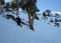
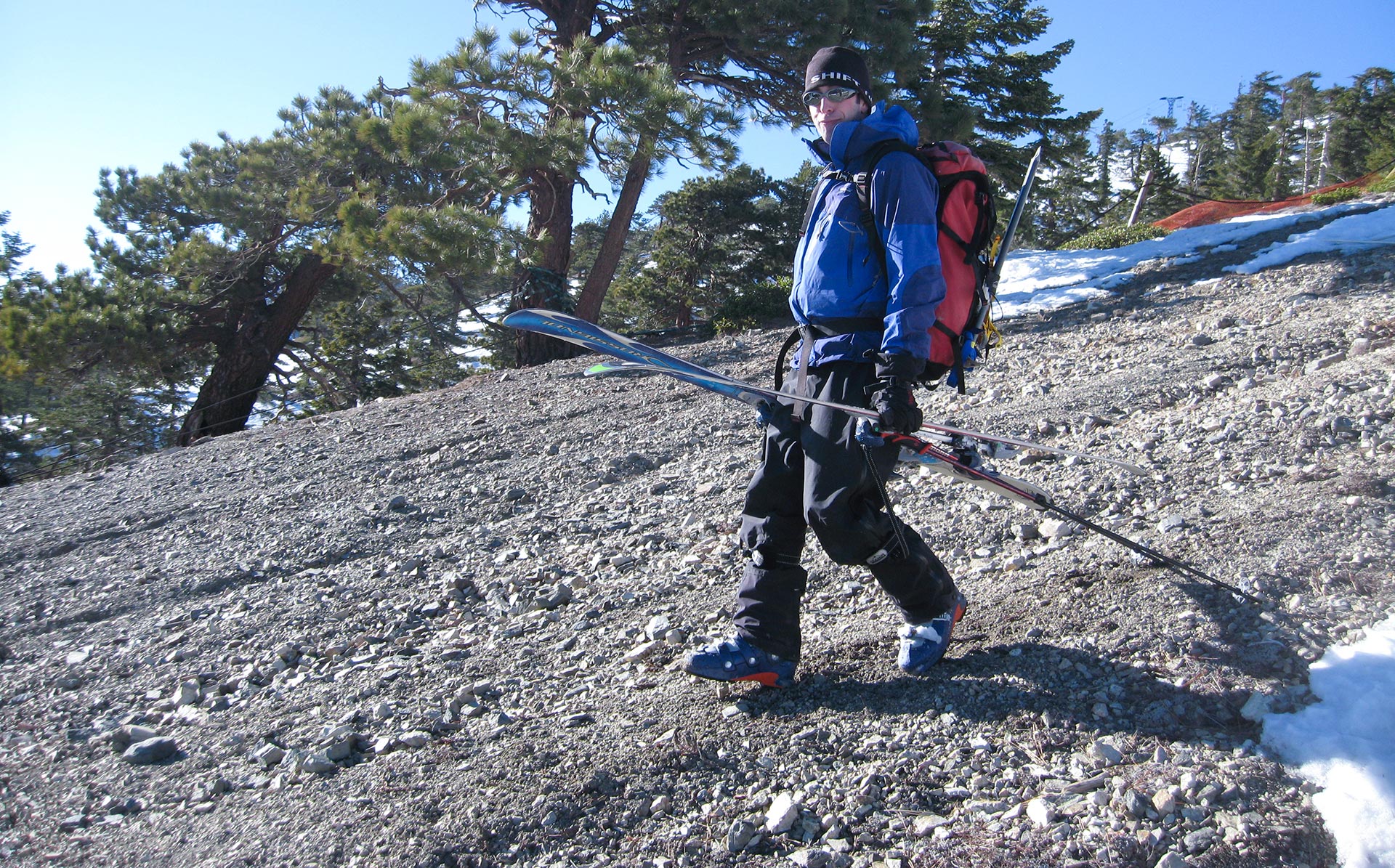
I switch to crampons and axe and begin ascending the chute.
The wind is kicking up now, sending clouds of rock shards down at me every few steps or so, and the steep snow, I see, is actually glazed with clear frozen water.
It occurs to me that there's no way in Hell I'm going to try to ski down this chute.
That means we'll either be downclimbing it to get home—or we'll have to find another escape route. Neither option is particularly compelling. I stop and relay my thoughts to Bill and Dan.
They're lower in the gully, perhaps not as intimate with the chute's exposure yet. They want to continue upward, and truth be told, I don't really want to bail either, so up we go. Worst case, I figure, we'll be forced to ascend all the way to Harwood's wind-blasted summit, from which we can descend the Devil's Backbone to the Mount Baldy Ski Area, and then ski the backside back down to Stockton Flats and the truck.
As a fallback plan that leaves much to be desired, but it seems plausible enough, which successfully meets my minimum criteria of never advancing where there is no possibility of retreat. Of course, higher up, the chute begins to close out on us, and we are forced to shift our plan yet again.
Climbing the Ridge
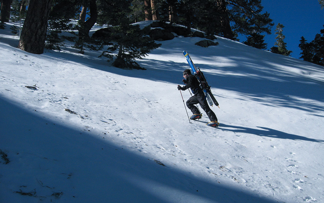
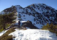
As the chute we're climbing gradually appears to close out, we traverse to our left, hoping to find easier ground along Mount Harwood's Northeast Ridge.
Away from the chute, the snow softens. This is at first a welcome development. Continuously climbing on hard, exposed snow wears at my nerves. But now we're starting to post-hole in deep, sugary snow, coated by an inconstant crust. Sometimes we punch through. Sometimes we don't.
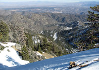
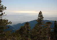
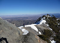
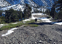
Climbing 2000' feet of it promises nothing but grief. We gain Mount Harwood's Northeast Ridge, opening up fine views of Stockton Flats, I-15, and Victorville far below.
Here, there are a new set of considerations.
We stop for lunch overlooking the steep drop into Harwood's east drainage, and talk things over.
Lengthening January shadows plus tough post-hole climbing plus ripping ridge top winds suggest that making a bid for Harwood's summit (still high above) is off the agenda.
Still, we'd like to ski something, having gone through all this effort already.
We agree to climb for an hour, then (hopefully) ski back down. One big concern: what's our exit?
As mentioned earlier, I'm trying to stay true to my don't-paint-yourself-into-a-corner rule, and as far as I'm concerned skiing the chute below is out of the question.
Bill suggests an alternative: attempt to find a route through the cliffs and talus to our left down into the Harwood drainage, which would give us easy access back to the truck.
There is a bit of a leap of faith to this idea.
Bill thinks he sees a viable scramble beginning from a saddle just ahead. I take a look. I'm not as optimistic. Picture a giant horseshoe. Topographically, the shape reasonably corresponds to the drainage beneath Mount Harwood's east face.
We're on one side of the horseshoe—the Northeast Ridge—and our challenge is to make our way down into the center. But now add a confusing tangle of cliffs, spines, gullies, trees, and loose talus to our mental model. The lower reaches of the San Gabriels can be utterly impassible if you happen to be in the wrong spot.
Because of the trees and the angles, we can't see enough of this potential escape option to verify whether or not it actually exists, though the odds seem to favor it. Still, this is exactly the sort of situation that ought to trigger a mountaineer's warning bells. Placing your bets on an unknown exit can easily come back to bite you.
Respect the Wind
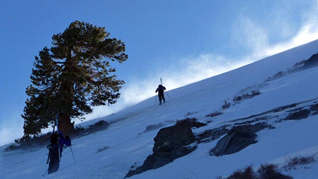
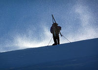
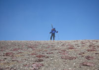
The wind is shrieking so loud in my ears it hurts. Blowing snow races past me, shooting straight up the hill to the summit, where it streaks off brightly into space.
The wind is a constant, hammering force, and I am trying not to panic as it blasts around me. How hard is it blowing? I estimate the gusts here, just below Mount Harwood's summit, are topping 70 mph. Maybe even 80. Our plan has changed yet again; conditions on the upper ridge have proven extremely variable.
Shallow, powdery snow alternates with breakable crust alternating with ice-glazed hardpack. Somewhere in the midst of it, I decide once again that conditions on Harwood's north face aren't safe for skiing.
This thought seems to occur to Dan about the same time. We talk it over, then talk to Bill.
We agree the best option is to climb Mount Harwood, pass over the summit to connect to the Devil's Backbone Trail, hike down to the Mount Baldy Ski Area, and then find a fire road to connect back to Bill's truck.
This plan has two primary advantages.
First, it allows us to claim a complete ascent of Harwood's Northeast Ridge—nice for posterity's sake. Second and more importantly, it offers a guaranteed viable (if tedious) passage back home tonight—provided we can get past the wind.
At the moment, there is some doubt about that last point.
The wind is like a living, breathing force, wild and menacing, utterly beyond our control.
It is, frankly, terrifying. There is luckily a small grove of trees extending up the right side of Harwood's north face.
I use the trees as windbreaks, zigging and zagging across the hill to stay in the wind shadow of these poor, mutilated pines. Climbing exposed to the full fury of the wind is beyond comprehension.
And yet, that's exactly what we'll have to do to get over the summit ridge, where we will not only encounter the strongest wind gusts, we will be wholly unprotected from it. It would not be possible but for the fact that the wind is squarely at my back. This makes it possible for me to see, and to move forward, and for the most part not get knocked off my feet.
All bets are off, however, as I leave the safety of the last tree-induced wind shadow and make for the summit ridge, some fifty vertical feet above. The wind becomes enraged, driving me to my knees, then lower still. I crawl upward on my belly, heart pounding in abject terror as nightmarish thoughts race through my head.
I envision the wind simply picking me up and carrying me off to San Diego. Or—and this is an even darker thought—what if I crest that ridge and find not Harwood's gentle south slopes, as expected, but rather the naked cliffs of the east face, topped by ice? In this wind, I wouldn't have a ghost of a chance.
Atop Harwood
My God, that was awful! I am huddled in the relative safety of Harwood's leeward slope, waiting for Bill and Dan to appear over the lip of the summit ridge.
One moment I was redlining my pulse in panic, groveling upward, and then the wind cut dramatically as I crested the summit ridge. I am relieved. Though the skiing ahead will likely be awful, and there is yet a long way to go, I now know we'll make it safely back to the truck.
The wind on Harwood's south slope remains formidable—enough to knock you over.
But it is a far cry from the merciless assault barely fifty yards to my north.
The sun helps warm my wind-frozen fingers, and pastoral views of the Los Angeles Basin to the south calm my frazzled nerves.
Soon, I see the tottering outline of Dan materialize through the maelstrom of contrails as he crests the summit ridge.
I shake Dan's hand when I see him. Bill comes next a moment later.
He seems about to get through the worst of the wind unscathed, but suddenly gets slammed to the ground by a final, fitful blast. His favorite ski hat goes flying off to Orange County—gone.
Luckily, he's unharmed.
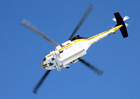
A Sheriff's helicopter shoots overhead, as if checking on us, and then aggressively dives straight over Harwood's north face.
I'm glad I'm safely on the ground.
Bill, Dan, and I exchange war stories of our battles with the wind.
None of us have ever attempted to climb through gusts that high.
We each of us hope never to have to do so again. Experiencing high-altitude wind in all its naked fury quickly instills a profound sense of respect in mountaineers. Wind on exposed ridgetops is a mortal threat, and though we are all safe now, I am privately angry with myself for putting myself and my group at risk today.
I just didn't take it seriously enough, I guess, which is a hazard all too common in the Southern California ranges. We assume because we're so close to beach and city that we're not in real mountains. We get lulled into a false sense of security here, so close to home. Would any of us have attempted something similar in the High Sierra, with obvious winds nuking the summits?
Of course not—to the contrary, we would decry as fools any who even dared consider it.
Skiing?
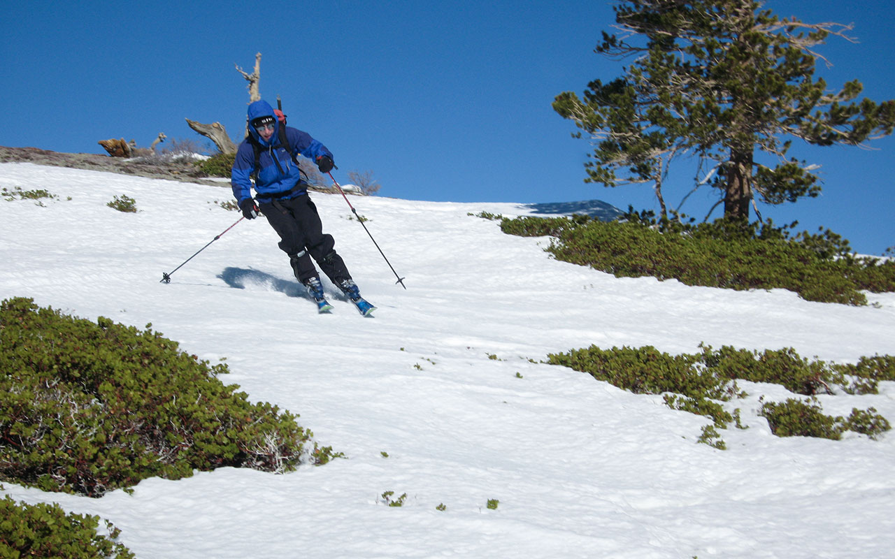
Originally, this was supposed to be a ski outing, though my sales pitch for the day was 'challenging terrain and crappy skiing.' Item one has been delivered.
As for the skiing...we snap into our bindings in a wind-protected stand of trees to the south of Harwood's summit. I make several jittery turns on rock-hard snow, until abruptly the snow vanishes, leaving only bare dirt ahead. Yep: looks like I called the day perfectly.
Off come the skis. We scramble down loose, brush-covered ground until we join the Devil's Backbone trail.
From here, it's an easy walk to the Mount Baldy Ski Area—just a good old fashioned mud slog in ski boots, with the occasional jarring wind blast to keep you honest.
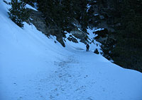
Easy, that is, except for the Backbone Trail's one bona fide tricky spot, a.k.a. The Step—a shady patch where ice and exposure create 25' of grief every winter.
We switch back to crampons and ice axes for this short but nasty section before returning to safer ground.
Safe, however, remains relative.
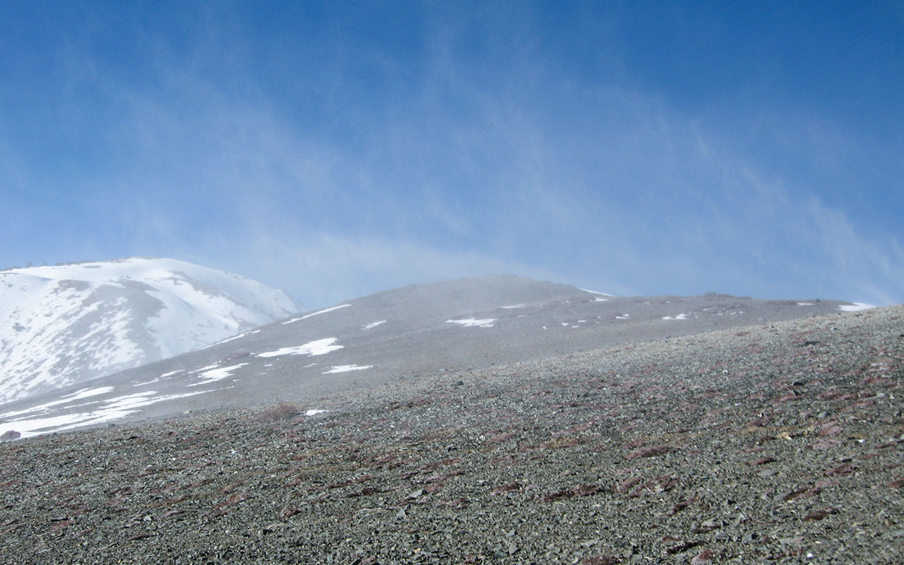
By now, Harwood's east face and indeed every north aspect on the mountain is deep in shadow.
No doubt the snow is frozen hard as battleship armor.
Where the ridge narrows to a knife edge we must walk a tightrope of icy snow perched over blue steeps leading down to the abyss.
The wind seems to anticipate these exposed sections of trail, and rages with extra intensity wherever they appear.
Looking down into that blue shadowed world below, I am thinking about how we're going to descend the over-3000 vertical feet down north slopes to get back to Bill's car. Our salvation depends on a winding Forest Service road, closed to vehicles, which ends (we think) somewhere in the vicinity of the Mount Baldy Lodge.
This road, we believe, will eventually take us right to the doors of Bill's truck. Find the road, goes our thinking, and we find our way home. It's a relief to finally put the Devil's Backbone Trail behind us. We return to skis for a short slide down toward Mount Baldy Ski Area's Chair 4.
Here's an odd experience: sneaking under the rope to get in to a ski area. It feels not unlike breaking into jail, or at least I assume that's what it feels like, since I've never broken in or out of the slammer—as yet. Oh well, after the bare ground above, I'm looking forward to easy turns on a nice, gentle groomed run.
I promise the boys the best backcountry skiing of their lives—inbounds—and shove off for greener pastures below.
The Road Home
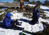
Dan unimpressed with the ski conditions
Well... heh heh heh heh... wouldn't you know it... ha ha ha!... there's... ha!... why, there's no snow on these here ski runs! No snow at all!
Of the three of us, Dan seems to be doing the best job maintaining his sense of humor. In fact, he claims he's glad there's no skiing. According to Dan's convoluted logic, good skiing now would wreck the trip. Luckily for Dan there appears no chance of that.
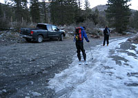
In fact, since here at the Mount Baldy Notch we are currently at 7800' in elevation, to get back down to the truck Dan's got a nice big fat 1800 vertical feet of non-skiing to enjoy.
Bon Appetite!
In truth there is snow on our Forest Service road, though it is heavily laced with rock shards and dirt.
Fear not, however, because as the road winds around Coldwater Canyon, it constantly changes aspect.
Consequently, long stretches of the road are bone-dry.
During these portages, as Bill calls them, we pop out of our skis and walk.
Occasionally, if the section of dirt is short enough, I just walk across, skis and all, which seems to amuse my companions.
Hey: these boards of mine are Southern California Backcountry Skis. The retirement plan leaves something to be desired.
On, off. On, off. Again. Again. Again-again-again.
How many times have I popped in and out of my bindings? How many more vertical feet to go?
I'm reaching the point where I can't bear to snap back into my skis, even where snow appears. I just carry my skis dully on my shoulder, thudding down across rock, snow, whatever. There comes a time in a select few of my ski mountaineering adventures where I honestly begin to question my own sanity.
Who but madmen can claim to enjoy this sport, I wonder? This, I decide, is the litmus test—when I'm convinced of my own craziness, the trip has officially become a Classic. So now, I agree with Dan. Yes, for heaven's sake, whatever you throw at us, keep good skiing away. Don't spoil it!
The road turns westward across a dark north slope, and I realize a final irony is about to occur. Here, at the very bottom, there is skiable snow connecting to the parking lot. Skiing these last few manky hundred yards on Jello legs, we are able to get within 20' of Bill's truck. The sheer evil genius of it puts an unhinged grin on my face.
We've made it! Back safe and sound—more or less. Bill's truck is unharmed, which is a big relief, but when we motor down to Dan's car and mine, we see that someone has smashed out one of my windows. Broken glass covers the back seat. A sudden, terrible fear strikes me, and I pop the trunk to discover my most expensive camera is gone—stolen. The price tag of this trip has suddenly skyrocketed.
It's not always good to wish for a Classic.