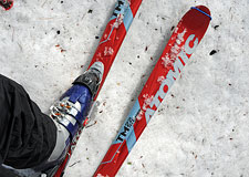
Skiing Lone Pine Peak
Summit to Desert: is a Ski Descent of Lone Pine Peak's East Couloir Possible?
Lone Pine, California — Who am I? I am not used to asking this question, but today it has taken on a ferocious intensity. I am pushing through brush and brambles, elevation 6400'.
Skis plus overnight gear weigh upon my back, here somewhere beneath Lone Pine Peak's massive Northeast Face. I am searching for a ski route that almost certainly does not exist. This much I understand. But I didn't expect I'd also be searching for myself.
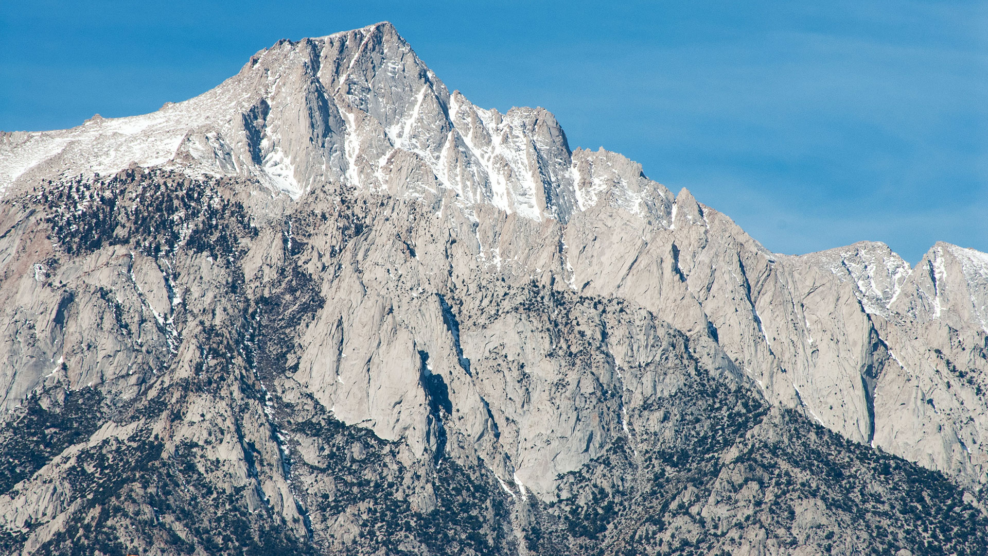
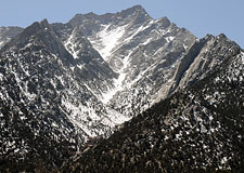
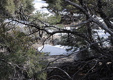
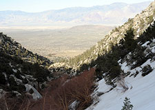
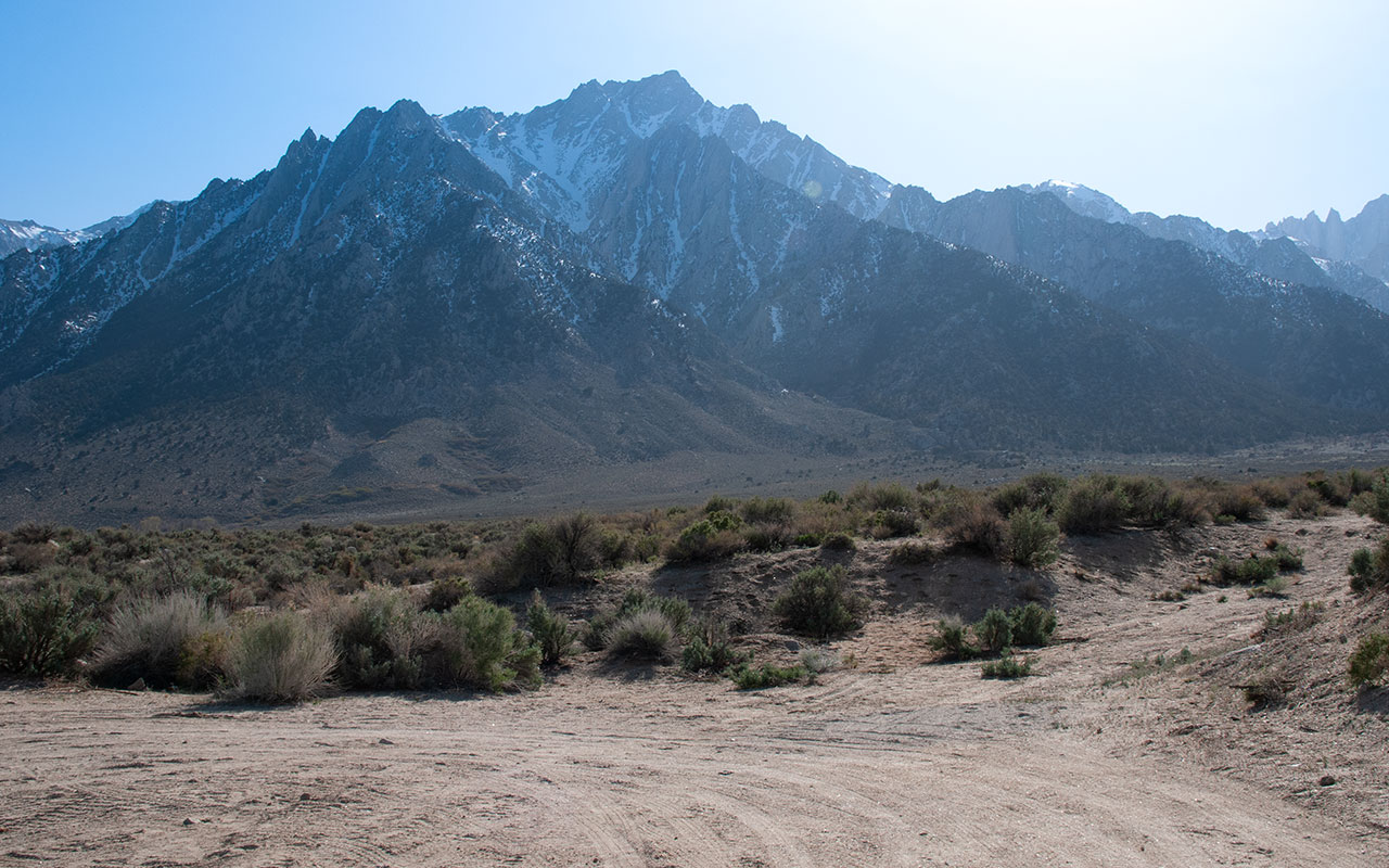
I first saw it driving Highway 395 just south of Lone Pine. In the midst of Lone Pine Peak's immense northeast headwall, there appeared a thin line of snow angling down from the very summit.
The mere existence of such a line seemed so unlikely an apparition as to demand further inspection.
So I pulled over in Lone Pine, expecting to survey the couloir.
Surprise: the chute had vanished.
Only sheer, merciless rock remained, calling into question whether my eyes had deceived me in the first place.
I call them madman's lines: here and there in the Sierra, you find discontinuous ribbons of snow that make for tempting ski fantasies, until you contemplate the dead-end drops below. As I continued staring at Lone Pine Peak's northeast headwall and the immense cirque below, it seemed all but certain there was no skiable route connecting the summit to the northeast face.
In any case, I'd never heard about anyone skiing Lone Pine Peak via any route. Given the peak's prominence and proximity to Highway 395 (Lone Pine Peak is often mistaken for Mt. Whitney because it appears higher), you'd expect the mountain to see occasional ski attempts—unless it just wasn't skiable.
In R.J. Secor's guidebook, The High Sierra: Peaks, Passes, and Trails, Secor grades Lone Pine Peak's northeast face Class 4 A0, noting a 200' rappel is required at the headwall. That would seem to rule out any skiing possibilities—at least without a very long rope. Still, from that day on, whenever I drove past Lone Pine I found myself twisting my head out the window, looking for that phantom couloir. It tickled my imagination, even if I had no intention of ever trying to climb and ski it.
Granite View

I am sitting in my car at the intersection of Granite View Drive and Horseshoe Meadows Road when a Sheriff pulls alongside and asks if I need help.
"Just Looking," I say, startled. The Sheriff gives me a friendly smile and drives off. How long have I been idling here, staring at the snowy peaks of the High Sierra? I have no idea. I return my attention to the view to the east.
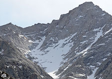
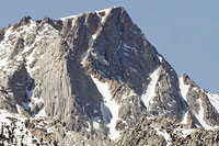
Granite View Drive happens to sit uniquely within the narrow angle from which Lone Pine Peak's east couloir is visible.
My car is stuffed with skis, camping gear, climbing gear.
I am trying to decide whether to put all that hardware on my back and climb 6700+ vertical feet to find out whether the east couloir will go.
How did this come to pass?
I had hoped to do an easy tour in the Meysen Lakes region, but Whitney Portal Road is closed, and with the Portal no longer an easy option, everything in sight is in play—including Lone Pine Peak.
I have driven back and forth along these roads, scouting Lone Pine Peak from various directions.
Each angle offers a tantalizing but incomplete view.
Via memory and photographs, I have tried to mentally assemble the pieces.
My suspicion (200-foot rappels notwithstanding) is that there might currently be a skiable line down the northeast face. Unfortunately, several key portions of the route—including the headwall interface—are hidden no matter what the vantage point.
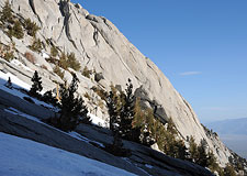
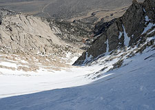
These sections will make or break a ski attempt. What is certain is the undeniable severity of the route. The Northeast face is massive, with a lowly 6400' starting elevation shooting up to near 13,000' in a mere 2.5 miles.
Just about the entire route looks steep, exposed, dangerous. Name an objective hazard and you'll probably find it in abundance here. That plus the route's unknowns make this a very difficult decision. A highly tempting alternative is to simply turn my car around and head home. And yet, I can't stop looking at Lone Pine Peak. Does that crazy couloir connect to the northeast face? It might. It just might. And there's only one way to find out.
Misgivings
Self-doubt is an inseparable part of this game. At the start of every trip, I always feel a little jittery, a little pre-adventure nervousness. But this feels different.
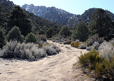
I'm really not sure about this one. I park my car near the end of a dusty dirt road below the entrance to Lone Pine Peak's northeast canyon, elevation 6400'. I pack my gear, taking my time, in no particular hurry to get underway.
Not without reluctance, I heft the load and start up the mountain.
Normally, my doubts quiet once I start hiking.
Today, however, my mental alarm won't stop clanging.
Everything seems like a bad omen today.
I press on gamely through the brush, trudging up sandy, steepening slopes, trying to calm myself.
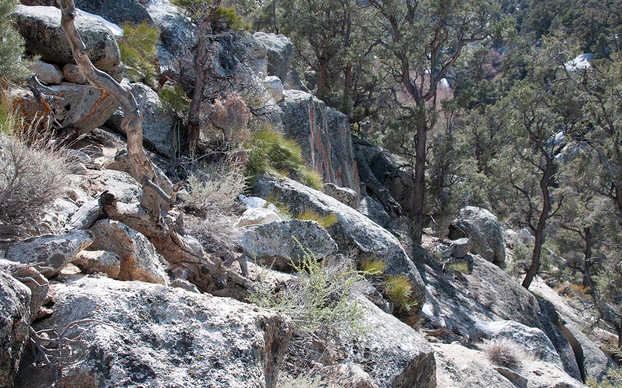
The route quickly deteriorates as I confront the bluffy east rim of the canyon, which offers exposed class 3 climbing mixed with pine trees.
With skis strapped to my pack and ski boots on my feet, the terrain is hardly inviting—and it does nothing to quiet my rising internal storm.
There is something inherently difficult about undertaking an activity that makes no sense.
That's the heart of the matter, isn't it?
None of this makes any sense.
I've already written off the possibility of success.
The best motivation I can find to keep climbing is just to satisfy my curiosity—maybe get in a little skiing in the upper canyon when I find snow.
None of that justifies the effort involved, or the risk. As my experience and my skills increase, my tolerance for risk seems to grow steadily smaller. It is a grim paradox with no easy resolution. Working my way above the bluffs, scrambling as needed, I find smoother ground above. Despite my anxiety, I'm making good time.
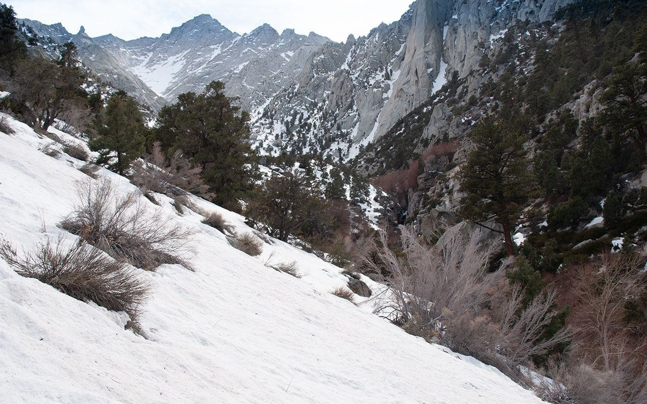
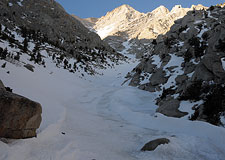
The relative stretch of flat soon gives way to more steeps, but this time, thanks to the northerly aspect, snow appears. I estimate my current elevation between 7000 and 7200 feet, meaning—if all somehow goes miraculously well—I'm looking at the possibility of a 6500 vertical foot summit ski descent.
I'd planned to camp right at the snowline, but the afternoon is still early, and I'd like to get father up this deep, winding drainage. The terrain looks exceedingly rough. It's still not clear whether the next thousand vertical feet will even prove passable. That would be a fine irony—if I can't even make it into the lower gully.
Deeper and Deeper
With the typical Southern Sierra approach, just getting to the start of the route can be a bigger challenge than anything that happens farther up the hill.
If you make it to the snow, you may still never ski your intended route. The walls of the drainage are growing ever steeper, and I'm approaching an obvious bend, making it impossible to see what lies ahead.
One nasty close-out is all it would take to abort this venture.
Until I see this narrow gully open up into a broad spit of snow streaking upward, I'm taking nothing for granted.
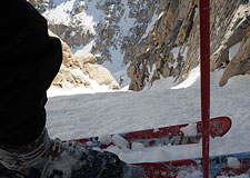
It's a pleasure to get my skis off my back and switch to skins.
But the drainage is quite steep and exposed.
Thankfully I've got ski crampons with me today, and they prove invaluable.
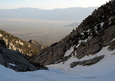
Shadows are starting to creep toward Owens Valley.
I work my way carefully upward, choosing to stay in thickets of trees rather than risk a fall on more open slopes.
Looking back, I see I've already gained quite a bit of elevation.
But Lone Pine Peak still towers overhead, a constant reminder that my ultimate objective remains far, far away. Patience is a virtue here. I focus on keeping my skins firmly attached to the snow, breathe deeply, put one foot in front of the other. Time passes, and the shadows grow longer, now pushing their way across Owens Valley.
I'll need to find a place to camp soon, but I still want to get over that bend in the drainage, so I press on. The drainage presents a series of false rises, forcing me to keep going until at last I see I'm about to crest the final wall. What I see on the other side will in no small measure determine what happens next. Will I be able to go higher, or is it time to turn back?
Camp Doom
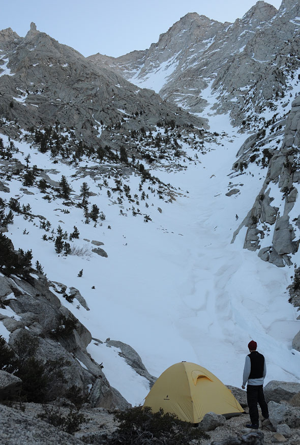
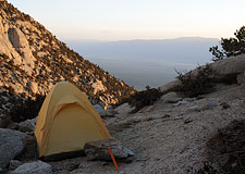
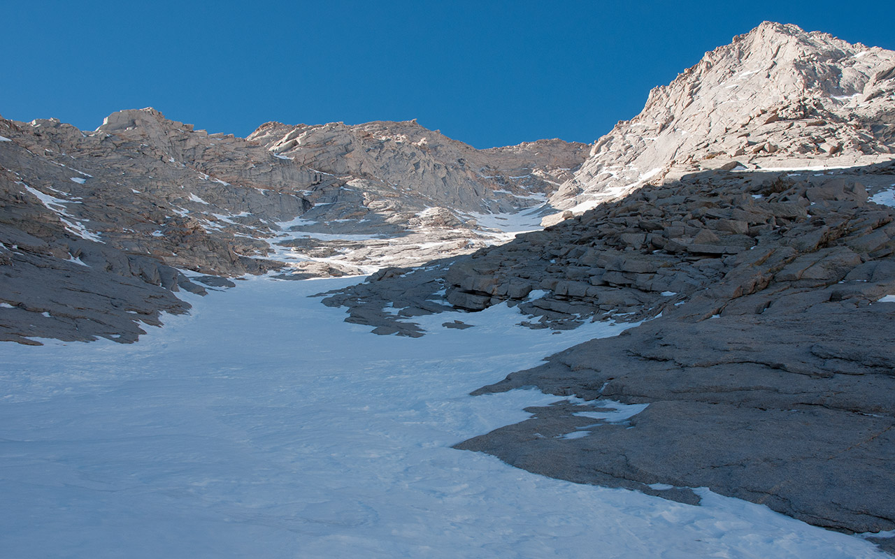
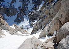
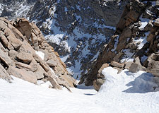
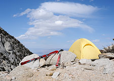
A few exhausted steps get me atop a broad hump of snow and rock, and Inyo creek's claustrophobic drainage suddenly opens as if an epic curtain has been drawn.
I find a flat, dry patch of ground to pitch my tent. From this spot, I have a perfect vantage of the route ahead, as well as easy access to snow both up and down. Shockingly, it is perhaps the best campsite I've ever had in the Sierra. I set up my tent and start melting snow for water.
Tomorrow, I have only to down-climb a 40' slope of rock and sand, and I'll be standing on a great sheet of snow leading up to the great unknown.
From here it's still not apparent whether or not the headwall connects to the summit couloir, or even if this great gully of snow is continuous through Lone Pine Peak's steep granite slabs ahead.
But to this point, at least, I can ask for no better.
The sun goes down, the wind picks up, and the air cools.
Traveling solo has its own special set of pleasures, but in my opinion spending the night alone is not one of them.
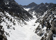
Left to myself and my thoughts in the fading light, feelings of impending doom begin to rise within me. In my mind, all the unknowns of Lone Pine Peak have metastasized into a nightmarish void. And gazing up, up does not in the least inspire feelings of security.
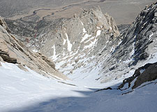
The face ahead funnels into one single, winding gully—a massive terrain trap through which avalanches of incalculable size undoubtedly sweep like the hand of a wrathful god. It is easy to imagine rockfall tumbling down that face as well. And the landscape is strikingly steep! From where I stand here at exclusive Camp Doom, solo mountaineers always welcome, Lone Pine Peak's summit is 4700 vertical feet above but less than 1.2 horizontal miles away.
What the heck am I doing here?
Ordinarily I would confront these fears head-on, take it step by step, stay within my limits, know I would turn back if needed. But tonight I am not comforted by that plan. I see it is all a lie. It is nothing but foolishness to believe, for all my might, that I am somehow capable of controlling these forces of chaos. In this vast and uncaring darkness, surrounded by granite and ice, I am but a tiny, fragile spark of life, clinging to an illusion of safety that never was and never will be real.
The Hardline
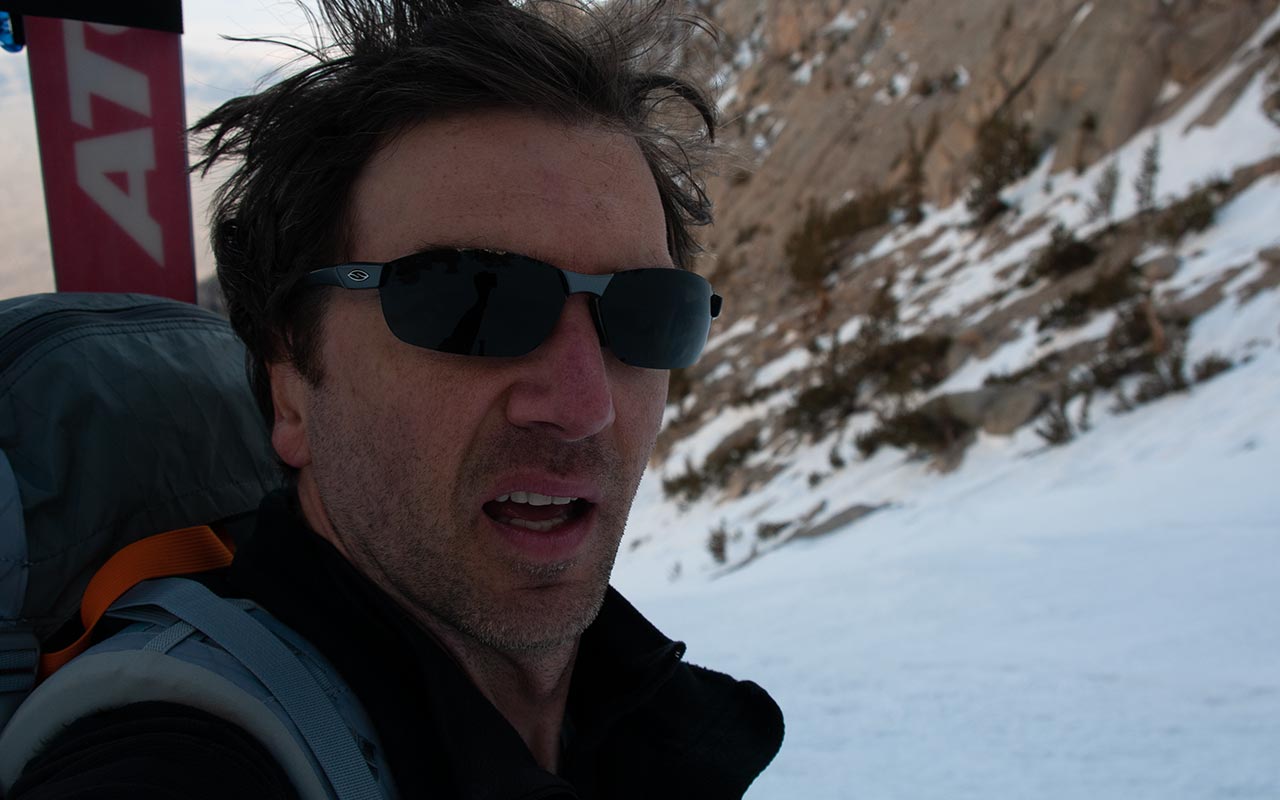
After a long, restless night, I am eager to leave Camp Doom behind and face whatever lies ahead. As dawn paints the landscape, I pull on my boots.
It's an easy scramble down to the snow. My thoughts remain unsettled, but dawn has awakened something else in me today: a hard-edged climber who knows it is time to attend to business. When I snap into my skis, I feel something change inside me.
The climber says it's time to climb. Not for the sake of curiosity, or exploration, or delusions of glory, or any other external reason, no.
We will climb because climbing is what we do.
Climbing is who we are.
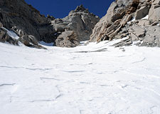
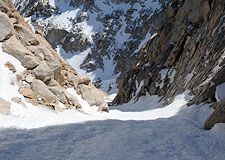
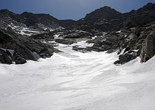
Starting at 8300', the lower gully has the appearance of being moderate in pitch. This proves to be an illusion. The route is steep right from the start, making skinning up challenging.
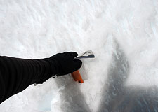
Once again, I am very glad to have ski crampons to increase the bite. Even so, the hardness of the snow, plus the angle, means I'll soon need to change to crampons and boot up.
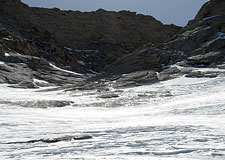
An area of concern on Lone Pine Peak's northeast face are the ever-present granite slabs. These smooth sheets of rock channel rivers of water beneath the snow's surface that freeze into icy waterfalls.
Looking up, it is easy to see the impact of this on the snowpack. When the sun hits, instability will be a concern on these sections.
Without sun, the ice itself is the problem.
With a somewhat detached eye, I careful monitor the exposure below. At the same time, I look ahead for flat sections which will allow a safe transition to ice axe and crampons if needed.
On skis, skins, and ski crampons, it is actually quite easy to trap yourself. If the snow is too hard to punch your boots into, you can suddenly find yourself unable to climb higher, unable to take off your skis, unable to go down. What do you do then? Good question. Start carefully side-stepping down, keeping those ski crampon points firm to the hill, hoping you don't suddenly pop loose and go zipping down on your back.
So why play this tightrope game at all? Why not just put the skis on the back, and climb up with the security of ice ax and crampons? The ease and efficiency of ascending on skins is always a temptation. On skins today, I quickly gain a thousand feet of elevation with relatively little effort.
This gets me closer to the next big twist in the gully—and the next big unknown. If that twist reveals bare slabs of 40° granite, the climb will be over. If the section stays snow-covered, however, I'll be able to ascend all the way to the base of the great headwall. Come on, I say, as if willpower alone can put snow on the route. Make it happen.
The Headwall Revealed
As I climb above 10,000 feet in elevation, now via axe and crampons, several things of significance are happening within and without.
A fierce wind is blowing up the face. When the gusts hit, I have to stop and wait for them to pass. Drifting snow whips up the face past me. Then, as the gust dies, the snow comes cascading back down. Despite the low overall risk, this does raise the specter of slab avalanches.
I've also passed the second major twist in the gully.
The route is indeed snow-covered, and if my earlier scouting proves correct, I now know there will be snow all the way to the headwall.
There is a chance—a chance!—I'll be able to connect with the summit couloir.
It's almost too much to dare hope for.
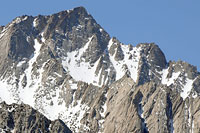
Lone Pine Peak's northeast face is revealing itself to be a route both bigger and more spectacular than I could have ever imagined.
If a skiable route exists from the summit, it would indeed be a Magic Line, one of the most remarkable descents in the entire Sierra.
If, if, if...
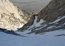
Ahead, I can see what I believe is the entrance to the east couloir at the eastern base of the headwall.
It looks like it might just go.
Crazy!
My euphoria is interrupted, however, by my Little Voice, which decides at this moment to inform me I'm not coming home.
What?
I've learned, over the years, that my Little Voice has a knack for being right, so it's not easy to dismiss this warning as mere Camp Doom leftovers.
How? I ask.
Slab Avalanche?
No. Well, that's a relief. That's certainly been at the top of my worry list. I still don't like the wind-sculpted look of the snow in this upper section, but I do think the danger is manageable. Do I fall while skiing? No. Rockfall, maybe?
No—but something about the word 'rock' makes the voice nervous. Something involving rock. Well, that hardly narrows it down, but it's a start, at least. I'm not sure it makes sense to keep going in the face of this warning, but there's at least as much hazard below as above, now, and I am a climber. My business today is unfinished.
Besides, just a little bit farther, and the great mystery of Lone Pine Peak's east couloir will be solved. Will I see a smooth stairway of snow leading up the final 500 vertical feet or so to Lone Pine Peak's summit—or will I come to an impassible wall of rock?
Continuity
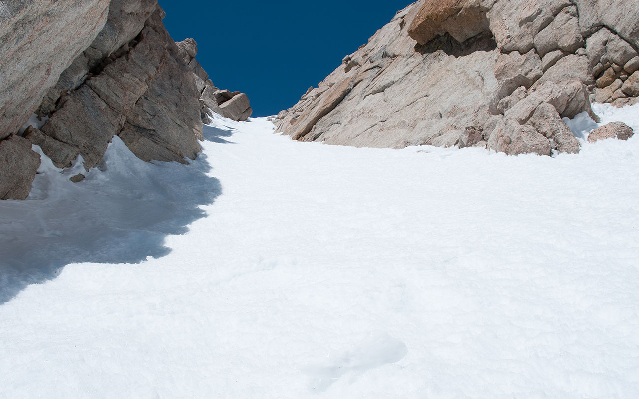
My attention is focused upward, so I actually pass alongside the true entrance to the east couloir before I notice it. There it is: the Magic Line. I stare at it, not yet daring to believe.
Continuity. The line goes. But for a trivial step of rock, Lone Pine Peak's northeast face is skiable from the summit all the way down to the Owens Valley desert below. All I have to now is climb the last few hundred feet of it, ski it, and survive.
No Problem.
It's funny, but at the entrance to the couloir, I notice a big rock with a nasty-looking moat to its left.
Climbing up the couloir unaware, it would be possible to fall through the sun-weakened snow bridge hiding the moat, and as I peer into the black void beneath, I see that would make for a very nasty fall indeed.
Something involving Rock.
Thank you, Little Voice, I say.
Though, given that I'm surrounded by rock, you'll get no points for clairvoyance from me.
Resuming the climb, I give the moat a wide birth.
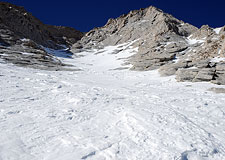
The snow in the east couloir, in contrast to the headwall gully, is sun-burnt, sun-cupped corn.
It's soft enough for skiing, but I wouldn't want to be anywhere near it if it froze.
Nearing 13,000 feet now, I'm pretty well spent.
I push up the couloir, burning deep into my reserves now, fueled by spirit alone.
I easily climb the minor rock step (this would likely be snow-covered in better years), and find only snow between myself and the summit.
The angle of the couloir averages a quite-reasonable 45 degrees or so—steep, but not terrifying.
Considered in its totality, I am looking at the ski descent of a lifetime.
This is pure magic.
It's as if mother nature decided to create the most unlikely, most aesthetic big line imaginable.
And then she hid it in plain view on one of the most prominent peaks in the Sierra Nevada. Magic.
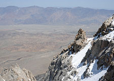
The wonder continues when I crest the top of the couloir and stumble a few steps higher to Lone Pine Peak's 12,944' summit. Mount Whitney and the Whitney Crest pop into view, along with Mount Russell, Mount Williamson, Mount Langley, Mount LeConte. At my feet is Lone Pine Peak's vertiginous North Ridge, considered one of the finer ridge routes in the range.
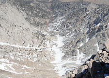
Mindful of my Voice's rock warning, I give that sheer edge a wide berth. Still, I have to take a least one photo of the view down Lone Pine Peak's northeast face. There it is: all 6700 vertical feet of the route. The scale of it is so utterly massive that the enormous field of snow I've followed all the way up the gully now looks like a pitifully small little afterthought—though I know it actually connects all the way down to the desert.
I find a sunny rock and plop down to rest for a bit. I'd like to give the sun a little more time to warm up the snow in the East Couloir, making the descent a little easier. Plus, to be honest, after all the mental convolutions I've gone through getting here, I'm still getting used to the idea that I'm actually going to ski this mountain.
The Magic Line
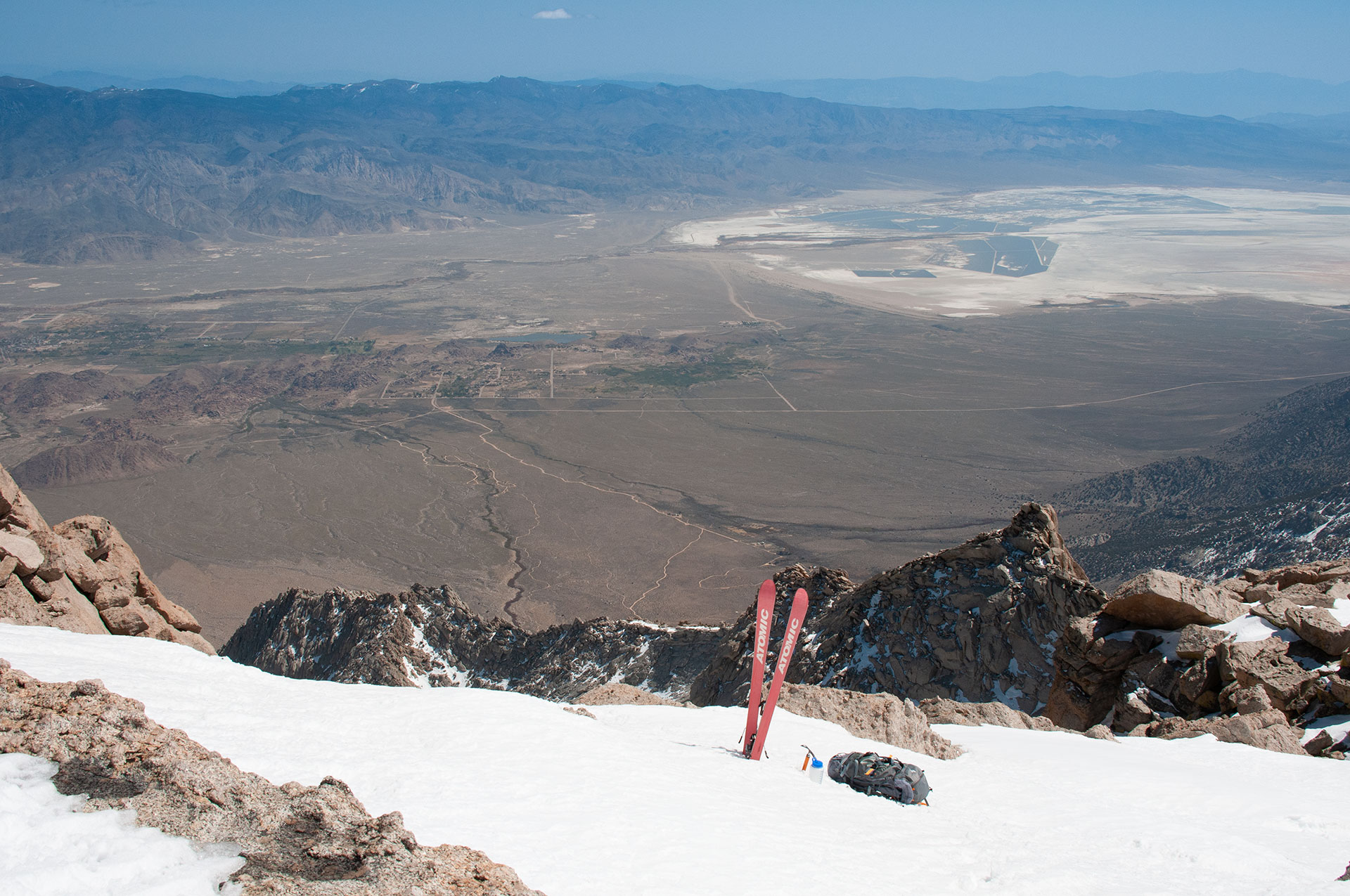
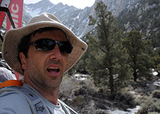
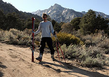
Andy's skis, LPP's summit, & Owens Valley
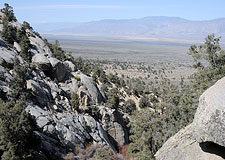
Lone Pine Peak is a front-range summit. The mountain lies well east of the main Sierra crest and stands in relative isolation over Owens Valley. The view atop the summit is thus is a vertigo-charged juxtaposition of alpine and desert landscapes.
One can only dream of a moment like this: I am here with my skis, standing atop a hidden pathway of snow leading all the way from summit to desert nearly 7000 vertical feet below. And it is time to ski.
I carefully step into my bindings, check and double check my gear.
I am ready.
I slide over to the east couloir's entrance, and there it is: a passage through Lone Pine Peak's east headwall.
Shadows are now crossing the couloir's snow.
This is unexpected.
I had hoped the sun would continue warming the snowpack.
Instead, with a cold desert wind racing up, the snow is hardening with every passing minute.
There is no more time to waste.
I drop in.
It's possible to imagine conditions in which the skiing here would be sublime, but that is not the case today.
And really, if I was seeking sweet turns alone, I would have kept driving all the way to Mammoth.
On this steep, hardening corn snow, I make slow, careful turns, each one with great deliberation.
Thoughts and doubts recede as I flow into the task of skiing, repeating motions I've made so many times my body knows them better than my mind does.
It's almost surprise I feel with each turn—that such a thing should be possible as descending a snowy slope with boards strapped to feet.
Where the sun remains on the snow, I make easy steep turns, enjoying the buttery-choppy feel of snow beneath me.
Where the shadows cross, I am more cautious, feeling that sudden transition to icy-crunch.
The view to the east, meanwhile, is stunning.
Blue sky over red-orange desert, the Inyo Mountains, Owens Valley and the tiny town of Lone Pine, the striking rock fin of Lone Pine Peak's northeast ridge.
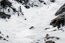
With each turn I slowly lose altitude, descending to the rock step, which I down-climb, then resuming the ski descent.
Some time later, the east couloir ends, and I rejoin the main gully at the base of the northeast headwall.
Here the slab concerns remain, and indeed the thin crust of wind-blown snow does break loose in small sections.
I choose a careful route down this section, which remains jarringly steep.
The uneven surface and varying consistency of the snow make for admittedly challenging skiing, and my legs are soon protesting the extra work. The route, however, is far from over. Just to get back to Camp Doom, I've got to descend nearly four thousand vertical feet, all of it very steep. Once again, I feel dwarfed by the route's massive scale.
Farther down, the air warms, and the snow softens to more familiar spring corn. Here, it's possible to let the skis run a bit. I carve big, swooping GS turns across the width of the gully. It's been a while since I've smiled like this. I think I can honestly say I did not expect any of it. I began this hike all but convinced that success was impossible. From that optimistic beginning, I soon questioned my own motives, my judgment, my identity. As if that wasn't enough, next came feelings of certain doom.
Despite the spectacular success this endeavor has proved to be, I cannot say whether pressing on in the face of my misgivings was wise or not. That is something I will have to contemplate in the time ahead. In this moment, however, the climber/skier in me is happily immune to introspection. As the wind races through my hair, and my skis race across the snow, there is only the perfection of the next turn to contemplate, and the next one after that.
Perspective
Some unknown number of turns later, I at long last come to a stop below camp, where I pop off my skis and scramble up the rocks to my tent.
Here I drop my pack on sandy ground and stare back at ski tracks, following them higher and higher until they simply vanish in the distance. If I hadn't just come from that summit, I would not remotely believe such a route was possible. Heck, I'm still not sure I believe it.
It is beyond question the most stunning line I've ever skied.
It is also one of the most challenging, technical, and committing.
And I've still got 2000 vertical feet to go.
I'll be able to ski half that, I figure, making for a relatively easy out.
Baring a spectacularly unlucky mishap, I will indeed be coming home, ambiguous warnings notwithstanding.
But already I feel a heavy dose of soul searching coming on.
I pack up my tent and gear, toss it all on my back, and begin a cautious ski descent down the steep slopes of the lower canyon. Time to head home. The snow is soft, making for challenging turns with a heavy pack.
I take my time.
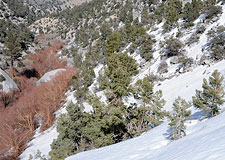
Around 7000 feet the snow comes to an end. The skis go back on my pack. I find my footsteps from yesterday. Today I hope to find an easier way down, so I traverse a little higher, and I'm rewarded with a faint use trail that bypasses the worst of the bluffs over Inyo Creek.
This adventure is almost over. I tromp downhill through the scrubby trees, angling east to find my car. There it is. My car is parked a hundred yards off, in a grove of trees at the edge of the desert.
Kicking up little clouds of dust, I pick up the pace, eager to get this heavy load off my back. And then something seizes me. I stop, turn around, look back at the rocky spectacle looming behind me. The High Sierra.
A surge of raw elation sets me ablaze like a lightning strike. I raise my poles over my head, bang them together, shout in triumph like a lunatic. I have done it. I have found a skiable route from Lone Pine Peak's summit to the Owens Valley desert. Whatever comes next, whatever happens in the unknowable future, I will never forget this day.
I've found my route—but have I found myself?
People climb mountains for many reasons. Some believe that mountains provide a path to enlightenment. Not being much enlightened myself, I cannot say if this is so, but I do find that mountains have an uncanny ability to boil away one's illusions.
The process is not always painless. In the darkness of Camp Doom, it was thoughts of my family that sustained me. I am eager now to return to them and share this adventure, even if they won't understand. Even if I don't understand. After all, this is who am I.