The Bridge to Nowhere
Audacity, Inevitability, & A Southern California Landmark
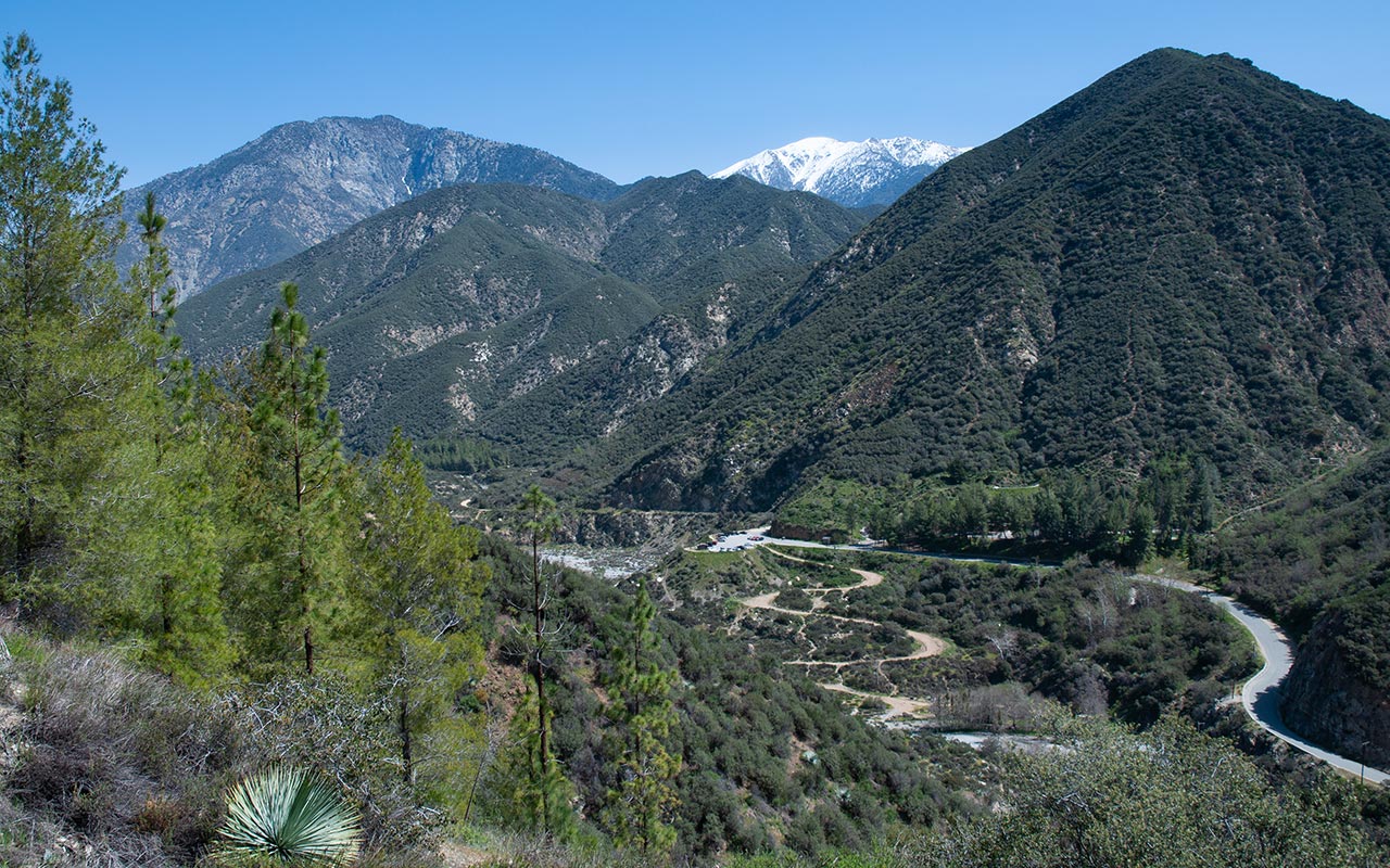
You have to admire the audacity of the attempt to build a road through San Gabriel Canyon connecting Azusa, in the San Gabriel Valley, to Wrightwood, high in the rugged San Gabriel Mountains.
The planned route, along the East Fork of Southern California's San Gabriel River, passing beneath the immense west and north faces of Iron Mountain and up the dramatic narrows of the East Fork canyon, would have cut through the very heart of the San Gabriels. All they had to do to realize their dream was build it.

The resulting highway would surely have ranked among America's most scenic, a feat not only of engineering, but also beauty. And it would have shaved hours off the drive from the city to the Wrightwood-area resorts.
Even today, to drive from Los Angeles to Wrightwood you must choose from one of two lengthy options: either traversing or circumnavigating essentially the entire San Gabriel Mountain Range.
The absolute necessity of a more direct route is debatable.
But there can be no doubt the road would have perfectly fit the then-booming public recreational interest in the San Gabriel Mountains.
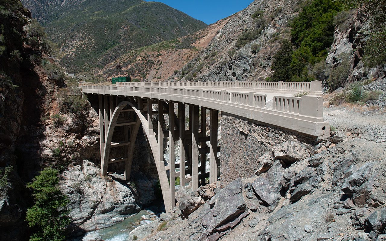
And so, work began on the East Fork Road project in the late 1920's, achieving its proudest moment with the completion in 1936 of a state-of-the-art bridge in the canyon's narrows.
Two years later, winter storm floodwaters utterly destroyed the road, leaving only the bridge as a reminder of the folly of the attempt. The 'Bridge to Nowhere' still stands today, in remarkably unblemished condition, and its name could hardly be more apt.
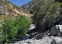
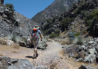
The bridge sits isolated in a steep gorge beneath Iron Mountain, and it takes more than a little imagination to picture how possibly a road could be connected to it from either direction. Driving to the bridge may be impossible today, but hiking to it requires only a modest 4.5 mile stroll from Heaton Flat along and across the cool waters of the East Fork of the San Gabriel River.
The combination of quick metro access, varied and breathtaking scenery, and countless fine swimming pools is alone enough to place this among the upper ranks of Southern California day hikes. And then there is the main attraction: the Bridge itself.
When you do reach the Bridge to Nowhere, you may find the sight both inspiring and tragic. It's hard to avoid contemplating the collision between grand dreams and nature that took place here—and the inevitability, perhaps, of the outcome.
Heaton Flat, Revisited
Suburban Azusa, California is a short twenty miles from downtown Los Angeles. From here, Highway 39 dives north into San Gabriel Canyon and the San Gabriel Mountains.
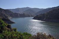
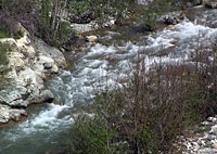
City concrete and smog recede quickly as you enter the canyon, passing Morris Dam and Reservoir, followed by the slightly larger San Gabriel Dam and Reservoir. Both, of course, are fed by the San Gabriel River. It should by now be obvious that the San Gabriel River is actually...a river.
Most times in Southern California I've found anything with the name lake, river, or stream attached to it to be at best a pitiful muck of mud.
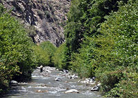
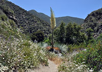
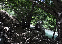
Here instead we find a most unexpected abundance of running water (in the otherwise parched San Gabriels, of all places!) transforming arid brush into a surprisingly green landscape.
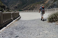
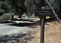
I follow the winding Highway 39 north, turning right onto East Fork Road, then watching for the turn north again to Heaton Flat.
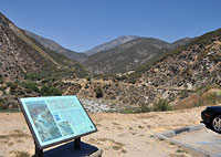
Eventually, I reach the Heaton Flat parking lot, where I shut off the car and hop out, to gaze northward at the brooding summit of Iron Mountain, towering some 6000' overhead.
Following this past winter's Iron Mountain Adventure, I find myself very relieved to know I'm not heading up there today.
There is no climbing at all on the agenda this morning—just a leisurely four mile hike upstream to the Bridge to Nowhere, total gain a very easy 600 vertical feet or so.
Two things leap out at me: first and most obviously, this is a high-use area, heavily populated with hikers, campers, and wary-eyed figures skulking about with shovels.
Second, where water touches land there is lush greenery, but everywhere else is bone dry, making for a dramatic contrast very reminiscent of the canyons in my home state of Arizona.
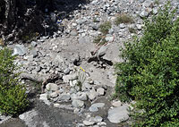
I pull my hiking boots on and start hiking along the dirt road (closed to vehicles) to Heaton Flat proper, where today on this first day of the 4th of July weekend I find a veritable tent city popping up in the campground beneath the cool pines ahead. Past the tents and trees, hot sun returns, and I see more shovels. Believe it or not, the banks of the East Fork are often busy with gold panners seeking to strike it rich.
Exactly how much gold they find while sifting through the river's silt is unknown, but it is obviously enough to keep them coming back for more. And, for more adventurous explorers, Iron Mountain's slopes are home to not one but several old gold mines, some of which remain active (though unworked) claims—trespassers beware.
A Mystery
As I have come to better know the trails and canyons of the San Gabriel Mountains, I find myself puzzled by a mystery that has gradually presented itself.
Almost wherever you go in the San Gabriels, you will encounter the remains of an apparently once-formidable hiking, camping, and outdoor recreation infrastructure that existed some fifty or more years ago.

But where has it gone to now—and why did it vanish in the first place?
That's not to say that the San Gabriels are today abandoned. But clearly, there was a golden age of usage that is now long past, so the question remains: what happened?
It is hard to believe that Americans of the early Twentieth Century were more passionate about the great outdoors, or that they had more money to spend on outdoor recreation, than their modern counterparts (that is to say, us).
Certainly there were far fewer people in Southern California then as compared to now. It would therefore be reasonable to expect to see many more people today in the San Gabriel wilderness.
Instead, the opposite is true.
And in addition to a decline in the outdoor population, the most dramatic reversal lies in the vanishing of camps, buildings, and resorts (such as they were).
What is often surprising is how deep this infrastructure penetrated. Camps and lodges existed throughout the range, often in places that are today far removed from roads.
When passing the ruins of these structures, I always find myself imagining them in their heyday: filled with the smiles and laughter of people who have themselves vanished.
And as I puzzle over their disappearance, it seems to me that not one but many factors are the culprits. If we assume the golden age to have taken place in the years prior to and perhaps including the second World War, its decline corresponds to a dramatic shift in the wealth of Americans, during the post-war boom.
In the 1950's Americans saw a huge increase in mobility brought about by improvements in roads and vehicles—they suddenly had the means to travel farther and the money to do so. Perhaps this led to a shift in expectation, from vacationing close to home in the San Gabriels, to farther destinations like, for example, the Sierra and the central coast.
What else was taking place in this era? As the 1960's began, a national environmental movement was gaining traction, leading to the creation of wilderness areas that were off-limits to development. Finally, no doubt the harsh environment of the San Gabriels themselves is to blame. Fires and floods wreaked havoc on man-made structures wherever they were built.
With Americans increasingly driving to farther destinations and rebuilding becoming ever more difficult in the face of tightening environmental regulations, perhaps it is no surprise that the camps of yesteryear are no more.
Still, it is hard to shake the sense that something special has passed along with them, even as the land inexorably returns to its rugged, unaltered beauty.
Crossings
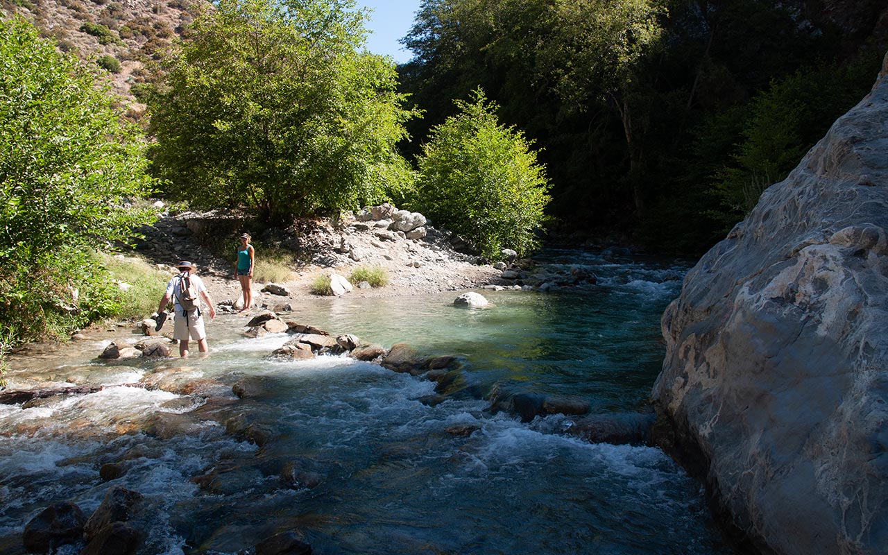
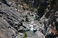
San Gabriel Canyon's Bridge to Nowhere is a wet hike, meaning as many as twelve (or perhaps more) water crossings are involved depending on how well you stay on-route.
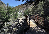
There is a trail all the way to the Bridge to Nowhere, but the river's tendency to flood every winter means in practice that staying on the trail can be a bit tricky. If you do lose the trail (I certainly did) you'll simply end up trudging up soft sand along one side or the other of the river until you get back on track.
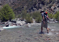
As for the crossings, hikers can choose a variety of strategies, including trying to find alternate crossing points to hop along rocks, taking off shoes and socks at each crossing to stay dry, or just wading across, shoes and all.
Generally on hikes like this your crossing strategy will evolve as the day wears on, and as the preferred method—staying dry—gradually proves more and more futile.
So, save yourself the trouble and just dive right in, I say.
But first, an important safety note: do not attempt this hike in high water!
In Winter and Spring, and also during heavy thunderstorm activity, the river can turn into an angry torrent sweeping away trees, boulders, and anything else foolish enough to get in its way.
Remember the road to Wrightwood?
Ideal times to try the hike are summer when there is no active monsoon in the mountains, and fall and early winter before there is any snow on the higher elevations.
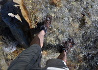
Warnings out of the way, your ideal footwear for the hike is not waterproof boots, which will simply keep your toes soaking in water all day, but rather the lightest, most breathable shoe you can comfortably hike 9 miles in.
A good choice might be something like a Teva or Keen hybrid sandal/boot, paired with light wool socks to keep the sand and grit from bothering your feet. In this way, your feet will get wet but have a chance to dry out again on the trail's dry sections, which should prove a lot more comfortable than squishing in water the whole way.
As for routefinding, it may be helpful to remember that the bulk of the trail lies on the east bank of the river. When forced to do so, the trail cuts across to the western back, but for the most part the trail either is or wants to be to the east.
So, if you find yourself wandering a wiggly use trail through brush, it's probably time to figure out how to get back across to the east side.
Swan Rock
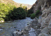
Two miles up the East Fork Trail, I come to the first of the hike's two major landmarks: Swan Rock, a whitish formation (quartz?) embedded in the dark granite of the canyon's west wall.
The feature does indeed resemble a swan, though if you're not actively looking you may walk right past without ever noticing it. In any case, Swan Rock is a popular turnaround point for those not heading all the way to the bridge, as there are plenty of fine places to sun and swim in the near vicinity.
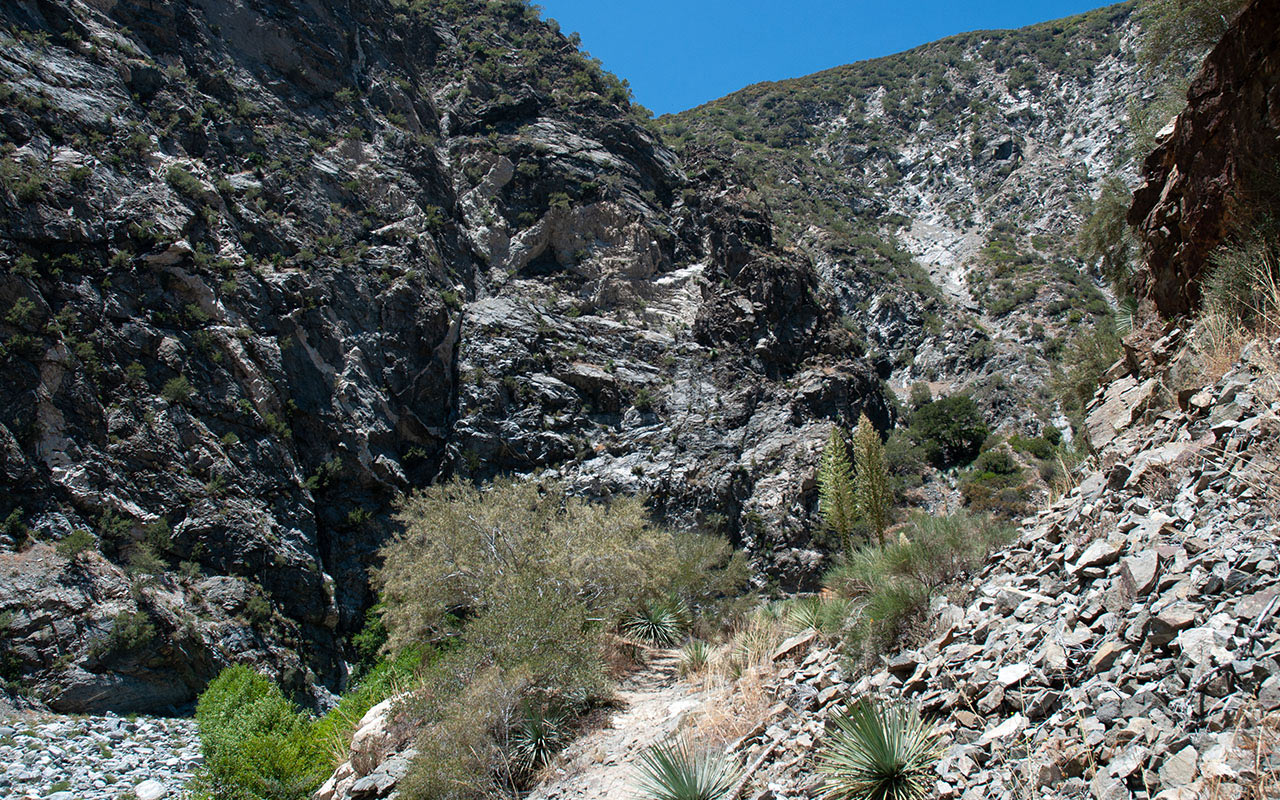
Swan Rock also marks the point, more or less, where the walls of San Gabriel Canyon begin to steepen and narrow.
Compared to the more open and gentle terrain of the lower canyon, the land here becomes more rugged, and already-dubious Road-to-Wrightwood schemes begin to look quite a bit more fanciful.
Also notable along this stretch of the canyon is the way the high desert pushes right up against the river's green belt.
Stray no more than twenty feet above the high water mark of the San Gabriel's rushing aquamarine waters, and desert takes over at once, replacing the river's verdant ecosystem with sand and spiny cactus.
But thanks to the previous winter's abundant snowfall, the desert is today abloom, making a compelling case for itself in nature's ongoing beauty contest. Having never hiked through this area before, I am quite taken with the diverse and inspiring scenery. But, I'm also eager to get to the main attraction of today's adventure—the bridge.
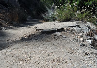
Not too far past Swan Rock, the canyon opens up yet again. Now, the path of the doomed 1930's road is clearly evident along the canyon's eastern wall.
Along this section I see considerable evidence of flood damage to the region. Though most of it is dry now, the river's bed extends far across the floor of the canyon, populated with countless rotting driftwood, including more than a few mature trees, ripped from the ground this past winter, and now sitting high and dry on the upper banks of the river.
As you'd guess, the road's pavement is long gone, but the graded-flat outline of the route remains, as here it was high enough to stay above the flood waters. After making its final crossing, the trail wisely joins the flat ground of the road high above the river, where the view now allows longer gazes in either direction. But: still no bridge.
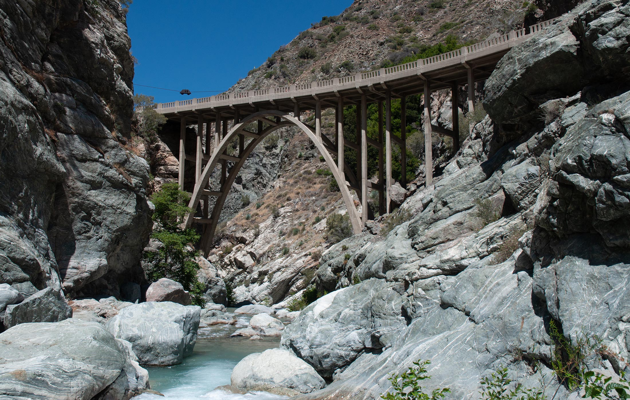
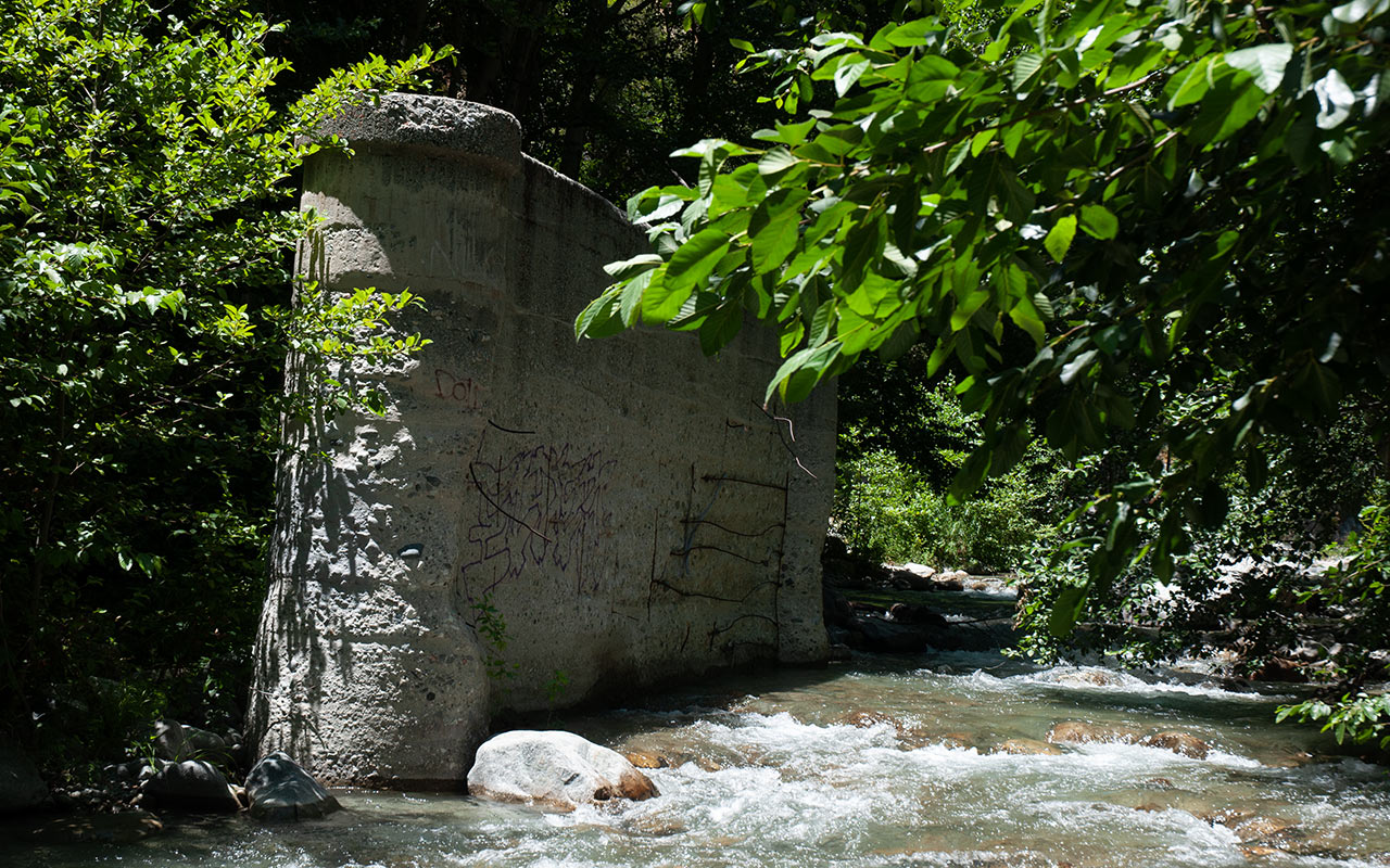
Bridge to Nowhere
Near "The Narrows" of the East Fork of San Gabriel Canyon, the canyon closes dramatically. The trail is now high above the river—in several places, high enough to make a fall fatal.
To the right of the trail is the incredible northeast face of Iron Mountain, shooting seemingly straight up more than a vertical mile. A sign warns that we're entering private property—a mine inholding within the Sheep Mountain Wilderness—and then at last the Bridge to Nowhere comes into view.
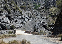
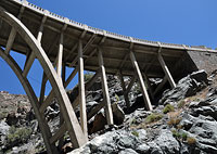
That first impression of the Bridge is in fact the least impressive—it simply looks like a concrete platform extending across the canyon.
Is is only as you get closer that you realize how big—and how high—the bridge actually is.
Though built in 1936, the Bridge to Nowhere still looks brand new, a consequence perhaps of it having never seen active duty. No cars nor trucks ever crossed its span.
Surveying the area, we can clearly see where the road existed (briefly!) to the south of the bridge.
To the north, however, there is not a shred of evidence of the old road.
In fact, imagining putting a road through here today and up into the Narrows conjures an engineering challenge on the order of I-70 through Colorado's Glenwood Canyon.
Of course we're supposed to celebrate the fact that the wilderness here remained pristine.
And yet...
The backcountry skier in me can't help lamenting the loss of what would have been the holy grail of access to the interior north faces of the San Gabriel Mountains's most coveted peaks.
It would indeed have been an engineering marvel had they succeeded in building the road, but nature had the last word on that subject. And as I stare at this impressive structure, in all its man-made glory, rendered now so perfectly isolated and useless, I find myself feeling oddly melancholy.
I imagine the reactions of the Bridge's boosters when they learned of the calamity to their project. Denial must have been first. Then, as surveyors reported back on the true and devastating extent of the damage, there must have been a furious push to rebuild despite the obvious futility of it all.
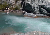
And then, in the end, acceptance, such as it were, that the road would never happen. The bridge would sit as it is today, until such time as nature eventually sweeps the last gleaming-white blocks of concrete away. I scramble down the steep loose ground north of the bridge, where I find a swimming hole to flirt with, and a flat rock upon which to eat my lunch.
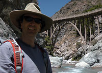
The Bridge to Nowhere looms high above me, both beautiful and sad, a superlative monument to human ingenuity and impermanence. Lunch concluded, I recross the bridge, stopping at the opposite side to take one last, long look at it.
I feel a moment of admiration for the Bridge's builders despite the end result. And then, just like their grand plans, I'm gone.