Silver Mountain
As you might expect there are a lot of 'silver' mountains in Colorado, but for our purposes this is 13,470' Silver Mountain (aka Silver B) that towers over Ophir, and forms the massif that includes Telluride's Palmyra Peak.
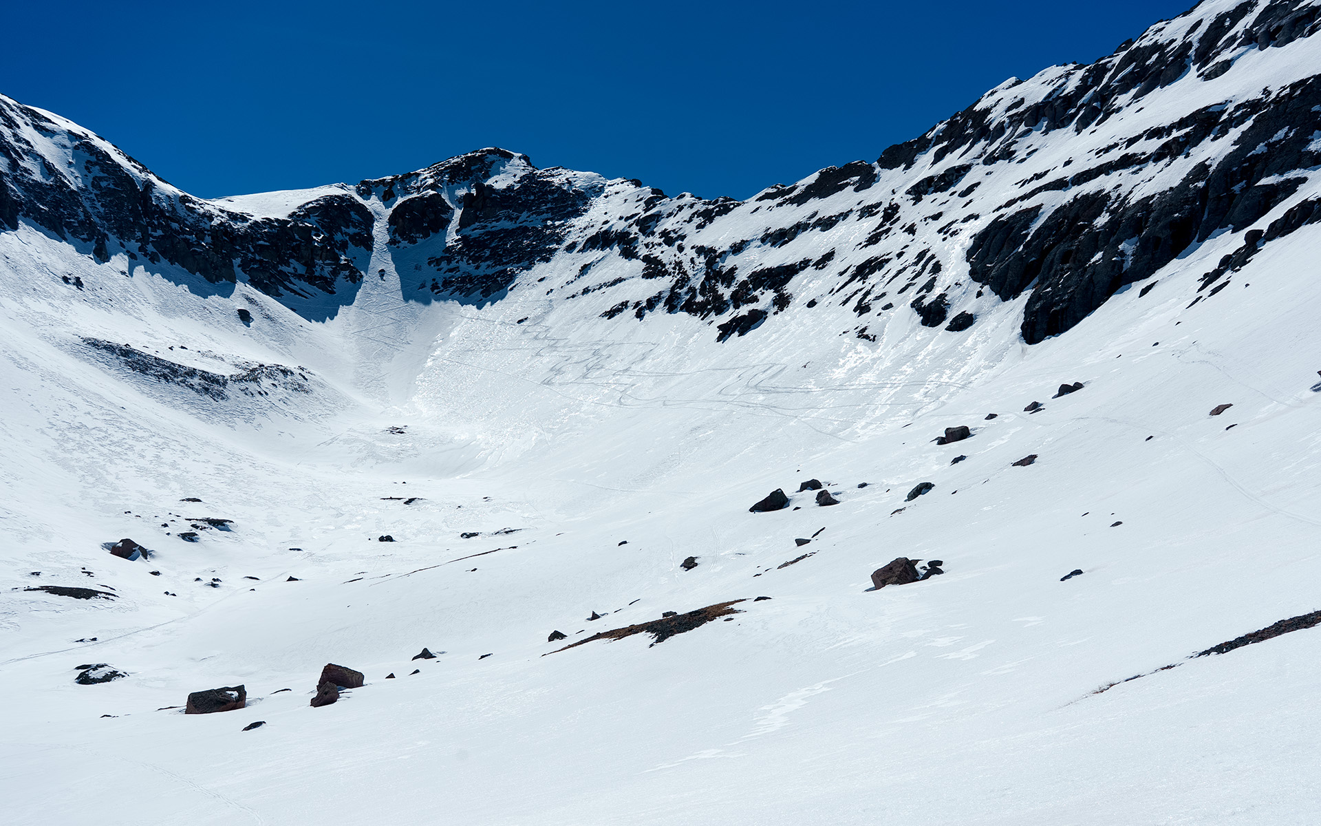
We skied this right from the summit, descending the peak's NE couloir into Lena Basin. And the experience was... interesting.
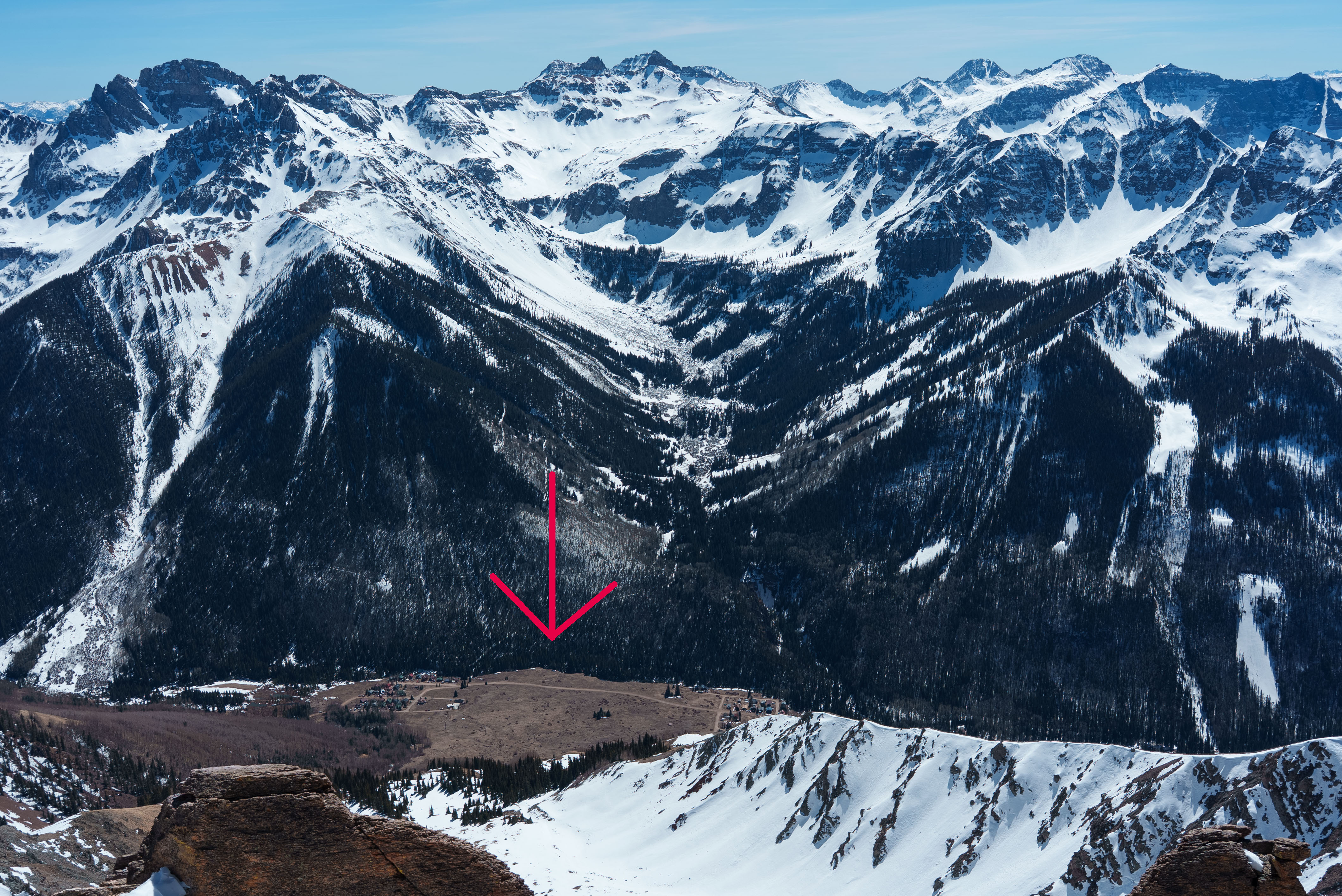
For me the most striking part of the day was standing on Silver's summit looking down at tiny Ophir, pop ~150, some 3700 vertical feet below. Ophir, Colorado, is a town with a suspiciously-missing middle.
This is apparently the result of a series of large 20th-century avalanches which over the years not-so-gently encouraged residents to divide the town into east and west-Ophir corridors.
The backcountry terrain surrounding Ophir (and Telluride) is stunning, but as the town's geography demonstrates, this is not a benign snowpack. The San Juans deserve every bit of their notoriety.
Which makes me wonder: how do the locals operate? What models do they use? Knowing virtually every aspect will feature a shallow snowpack undermined by depth hoar virtually all season long, what does the decision tree look like?
I have my own theories, of course, but I'd love to go out there with a long-timer and watch how they approach it. If you're interested in studying avalanches, the San Juans are certainly very fertile ground.
For us, the most dangerous part of the day was probably descending the short, steep SE entrance to Silver's main north chute—it was getting soft in there, thanks to record-high temps, so presumably there was wet-slab avalanche potential.
On the way back, we veered onto legitimately south and west-ish aspects, and those did indeed occasionally collapse beneath us. The angle was shallow, so there wasn't much potential, but we did kick loose a tiny climax slide. As I say: interesting!
— March 30, 2026
Andy Lewicky is the author and creator of SierraDescents
Dan Conger March 30, 2026 at 5:29 pm
If I could live in any mountain town in the world, it would be Telluride. However, I'm not made of money so that will probably never happen.