Williamson Creek
By reputation the Shepherd/Williamson Creek drainage is impassible—there must be some reason, after all, that they began the Shepherd Pass trail in an entirely different drainage.
But of course as part of my ongoing Sierra hellish drainage project, I've long wanted to hike up there and see what happens. I've even created strange handwritten top-secret maps of the area using Google Earth and USGS topos.
There is a rhythm, I find, to these drainages, and with time, you can learn how to dance with them.
But. Probably, for the record, you should (1) stick to trails and (2) not expect me or anyone else to tell you how to try to sneak through them.
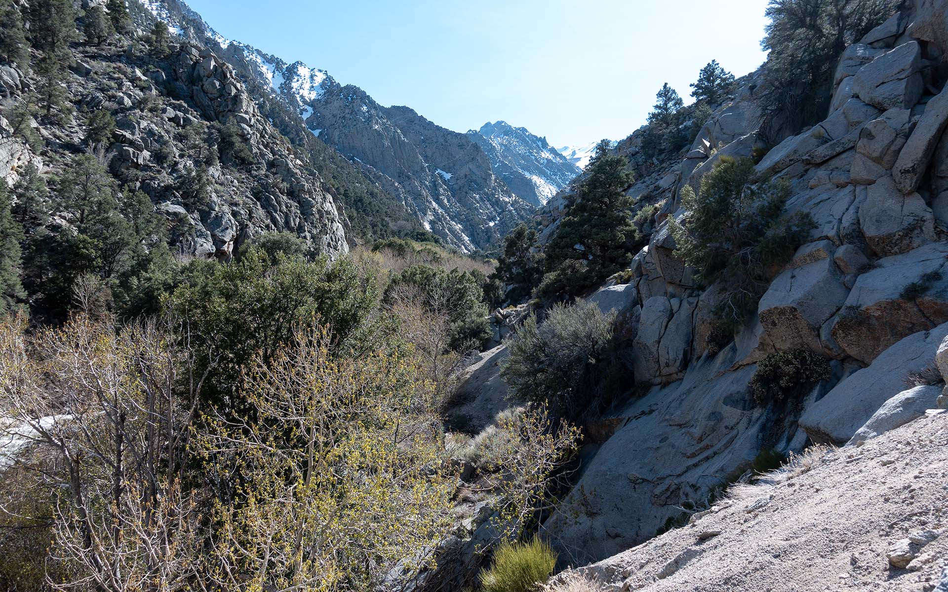
Disclaimer aside, I did successfully navigate to the confluence and then the snowline in the Williamson Creek drainage. It was hard, but then it usually is. Not as bad as Division, if you're wondering, but probably worse than Bairs.
In addition to the rewards of esoteric pointless suffering, Williamson Creek of course affords access to the north face of Mount Williamson, which for some of you weirdos has an inexplicable allure. I of course was there purely for research purposes.
In fine Sierra tradition, I made it to the snowline and then turned back and went home, because as I keep telling you, We Are Perfectly Normal People.
I can report, however, that two of my friends kept going, and eventually made an attempt on Giant's Steps. They skied the upper portion but then climbed back up and out because they found the couloir wasn't filled in enough.
Given what I know about those two, that probably means GS is currently unskiable. UPDATE: word is it was icy and completely blocked by rock—super-sketchy.
— April 29, 2023
Andy Lewicky is the author and creator of SierraDescents
Dan Conger April 30, 2023 at 5:46 pm
After this year it isn’t filled in enough???
Andy April 30, 2023 at 8:08 pm
I've got a May 2006 photo of Giant's Steps and it was way fatter then. My theory is because the storms have more energy now, peak wind speeds are higher, which tends to scour out Sierra north faces rather than blanket them. This was happening back in 2011 also -- another huge year where Williamson's north face and GS looked marginal.
Matt D May 1, 2023 at 9:24 pm
NWS LA issuing their first ever blizzard warning for the San Gabriels would support that, though fortunately for us it was super strong south winds, blasting all those faces and loading the north sides. I think this is why Islip’s south side went out so fast, even while there was still feet of snow at Crystal Lake.
Andy May 2, 2023 at 12:44 pm
I wonder if anyone's tracking that over time? I'd be really interested in seeing that data.
Matt D May 4, 2023 at 10:17 pm
That sounds like something that would be up Brian Brettschneider’s alley. He did a map showing where April winds have increased but I don’t think he ever got around to the other months
https://twitter.com/climatologist49/status/1642376561872736257?s=46&t=zD1LBWTdUstcCiqMvqKfpw
Dan Conger May 8, 2023 at 9:06 am
That wind hypothesis is interesting. Climate change is certainly making things more “interesting.” Do you think snowcreek will stabilize enough for you to make another descent there?
Andy May 9, 2023 at 9:30 am
I’d ski the face and hike back up, but at this point I probably wouldn’t do the entire route. Too many deep hollows & snowbridges in the debris piles down low