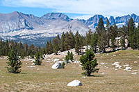
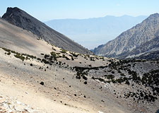
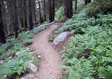
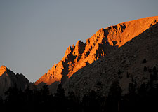
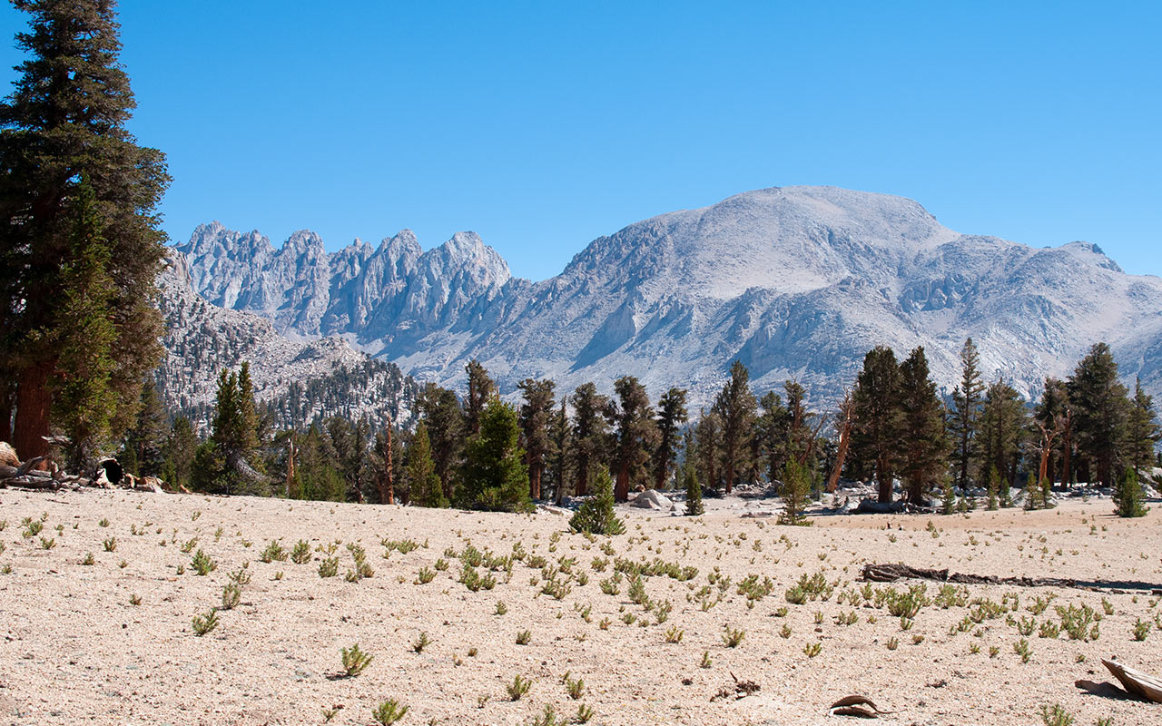
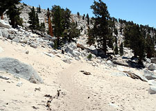
Onion Valley to Cottonwood Lakes
Five Days and Fifty miles on the Pacific Crest Trail
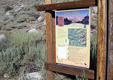
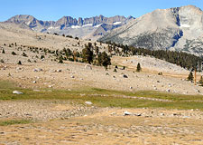
Horseshoe Meadows, California — I take one last look inside my car, checking to be sure I've left nothing that will appeal to the bears, and then I lock the doors.
It feels kind of spooky as my hiking partner Bill drives us back down Horseshoe Meadows Road in his truck, heading east to Highway 395, then far north to Onion Valley. From there, all we'll have to do is hike back to my car—fifty miles through the High Sierra via the Pacific Crest Trail.
The Plan began as an alternate route to climb Mount Whitney. I was interested in approaching Whitney from either Cottonwood Pass, to the south, or Onion Valley, to the north.
Either option involves extra miles and extra days.
But it's much easier to get an entry permit for these approaches compared to Whitney Portal, and the thought of a little extra adventure appealed to me.
As the hike took shape, however, I received news from several friends who'd just completed long, multi-day hikes through the Sierra on the Pacific Crest Trail.
Around the same time, a new issue of Backpacker Magazine arrived focusing on a new wave of elite thru-hikers.
I wasn't interested in trying to hike from Canada to Mexico in one go, but the idea of hiking a substantial section of the Pacific Crest Trail through the heart of the interior Sierra sounded tempting.
And so, infused with a sudden spirit of adventure, I called up a friend and proposed a six-day hike from Cottonwood Pass to Onion Valley.
To my surprise, he accepted. That committed both of us to the longest hike we'd ever attempted. Simply organizing the logistics of food and gear proved an adventure in its own right—driven by the imperative of keeping our pack weights as low as possible. As the actual day of departure grew nearer, we furiously bounced emails back and forth, trying to glean out the other's every last tip, technique, or trick.
As climbers go, I'm more sprinter than marathoner. How do you train for over fifty miles of hiking? What do you do, after all, if you turn an ankle in the middle of the Sierra? Or bruise your feet? How would I keep myself well-nourished and well-hydrated without crushing my back beneath an unwieldy load? And what of my hiking and skiing partner, Bill?
Would we slowly drive each other insane over such a long haul? Would we eventually refuse to speak to each other? Resort to cannibalism? The greatest mystery of all, however, lay beyond the Sierra's crest. What would we find there?
In truth, my Sierra wanderings were mostly limited to short east-side scrambles and ski descents. The vast and remote interior of the Sierra Nevada mountains was undiscovered country to me—and I was eager to explore it.
Onion Valley
Packing up my belongings in Lone Pine the night before, I was simultaneously concerned I'd packed too little and too much food. In the end, I overstuffed my pack.
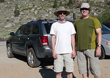
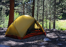
Now, in the last few moments before our departure, I reverse myself once again and reluctantly pull a few items from my pack and stash them in a bear locker. It's eight a.m. Bill and I are ready ourselves at the Onion Valley trailhead. Neither of us seems especially eager to get moving.
Food, weight, gear.
These are the thoughts swirling through my head as I lace up my boots, slap on some sunscreen.
I've got a new one pound nine ounce sleeping bag.
Bill's got a new Granite Gear pack that weighs a mere two pounds, six ounces.
I'm bringing a microfilter (9.9 ounces).
Bill plans to drink his water straight from the source.
I'm carrying a little over eleven pounds of food—close to the unofficial recommendation of 1.5 lbs per day.
Bill, crazy radical that he is, is carrying seven pounds of food. Not including Gatorade, he's budgeted himself an exceedingly meager 1580 calories per day. He plans to make up the difference by burning up a little extra fat each day—the Survivor™ diet plan.
I'm convinced he'll be gnawing pine cones by day four.
In any case, the end result is that Bill's pack comes in a few pounds lighter than mine (significantly lighter, if you factor in my camera gear). As crazy as his food strategy sounds, I find it hard to argue with the result—especially when I heft my own alarmingly-heavy pack.
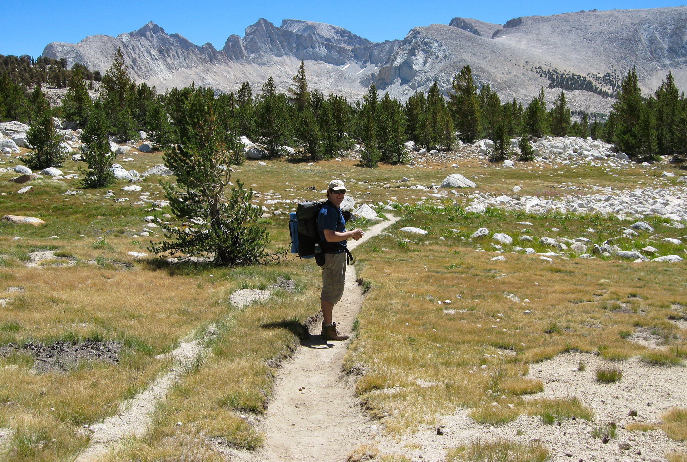
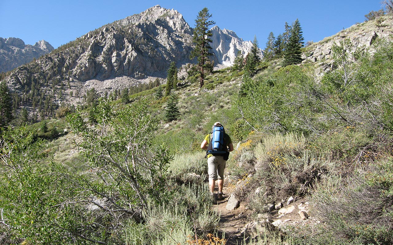
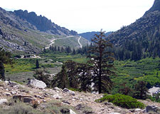
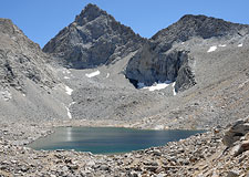
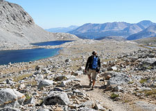
Up the trail we go. Today we will climb from Onion Valley, elevation 9200', up and over Kearsarge Pass, 11,760', and back down to the Kearsarge Lakes. Continuing westward, we will then junction with the Pacific Crest Trail, and from there hike south to our first camp near Vidette Meadows, elevation 9532'.
This lengthy Day One itinerary entails a substantial amount of vertical gain and loss, plus 9.4 miles of travel. With these first, few, slow steps, it's probably best not to dwell too much on the many miles—or days!—ahead.
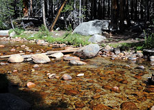
Despite the early hour the sun is already hot. After an hour so of switchbacks up a mostly arid landscape, pine trees appear, and Bill and I pass the first in a series of lakes. The air is cooler here. We stop for a short break: so far, so good.
Back on the trail, I try to focus on walking efficiently with my pack—not bouncing or swaying side to side any more than necessary. Pacing seems like it will be a critical factor on this adventure. More than anything else I want to avoid wearing myself out prematurely. That's the primary fitness goal today—conserve energy.
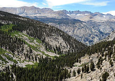
Kearsarge Pass
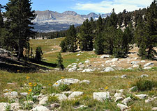
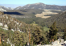
A big part of the appeal of our hike down the Pacific Crest Trail is the opportunity it affords us to explore at least a part of the Sierra Nevada's vast, hidden interior.
The depth of the Sierra is not easily appreciated from either east or west. To truly understand how far in the range goes, one must hike inward, gaining access to a vast, undeveloped wilderness full of unexpected sights.
At least, that's what we hope to find.
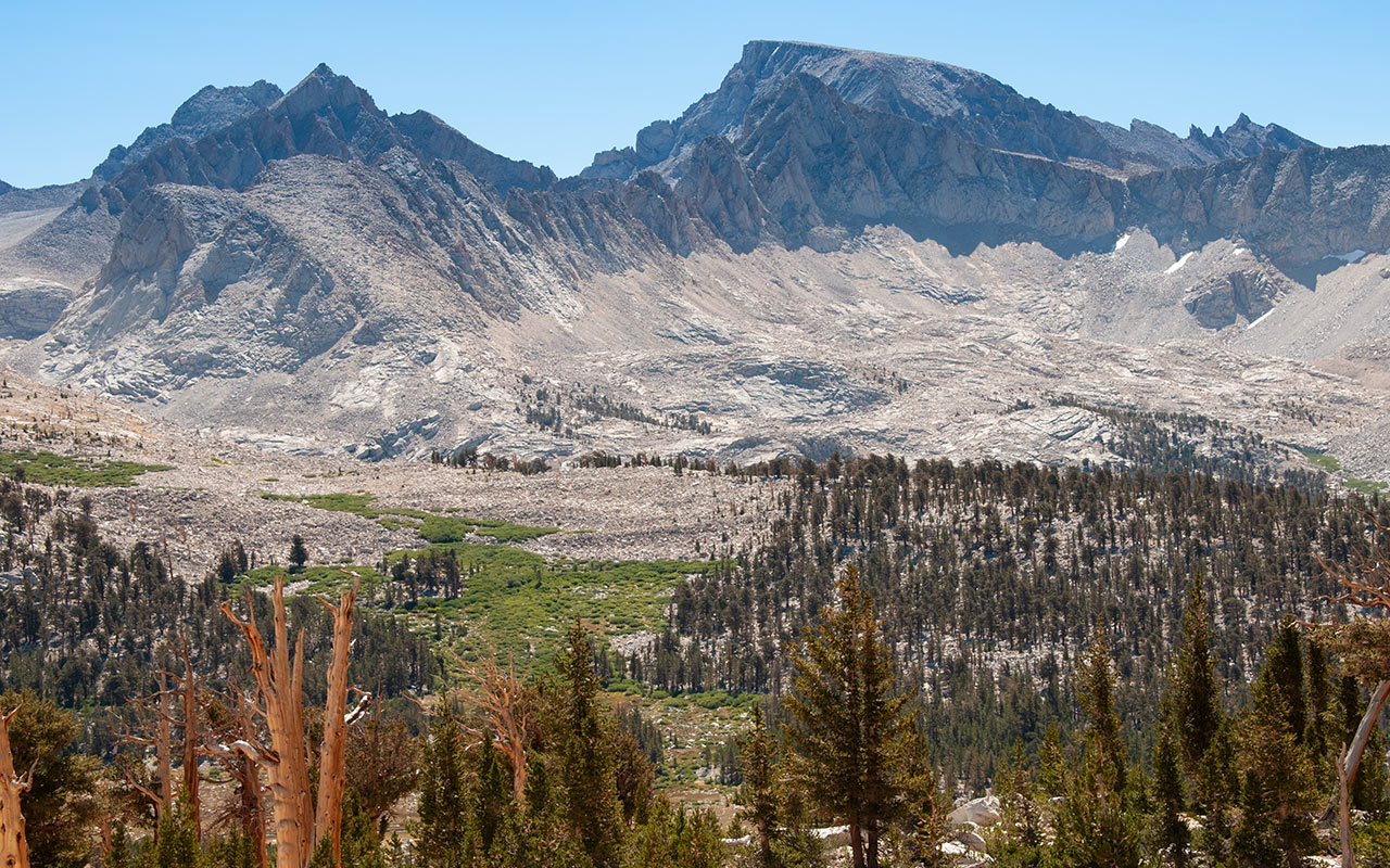
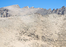
A long, bare talus field traverses beneath Mount Gould, leading us slowly upward to Kearsarge Pass.
A few puffy clouds have appeared overhead, and the wind is picking up.
Bill arrives atop the pass first.
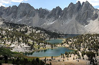
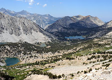
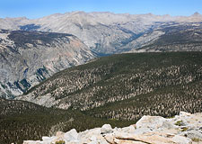
When I join him, I get my first glimpse of that hidden interior: the view does not disappoint.
Compared to the barren desert of Owens Valley, behind and below us to the east, the contrast to the west is startling.
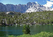
We see a lush landscape of alpine lakes, meadows, and ferny forests. In the distance below are the blue gems of the Kearsarge Lakes. Beyond them rise the impressive spires of the Kearsarge Pinnacles. And beyond that...rugged, mountainous wild country as far as the eye can see.
Bill and I descend a steep series of switchbacks down dry, loose talus to get out of the wind.
Several hundred feet down, we stop for lunch, marveling at the westward views. The Sierra, from this vantage, looks rightfully immense, sweeping north, south, and west as far as we can see—all of it wilderness. It doesn't take long, once we resume hiking, for greenery to sprout all along us. This is the first big revelation of the interior: the abundance of lush meadows, misty air, and running water.
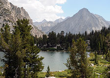
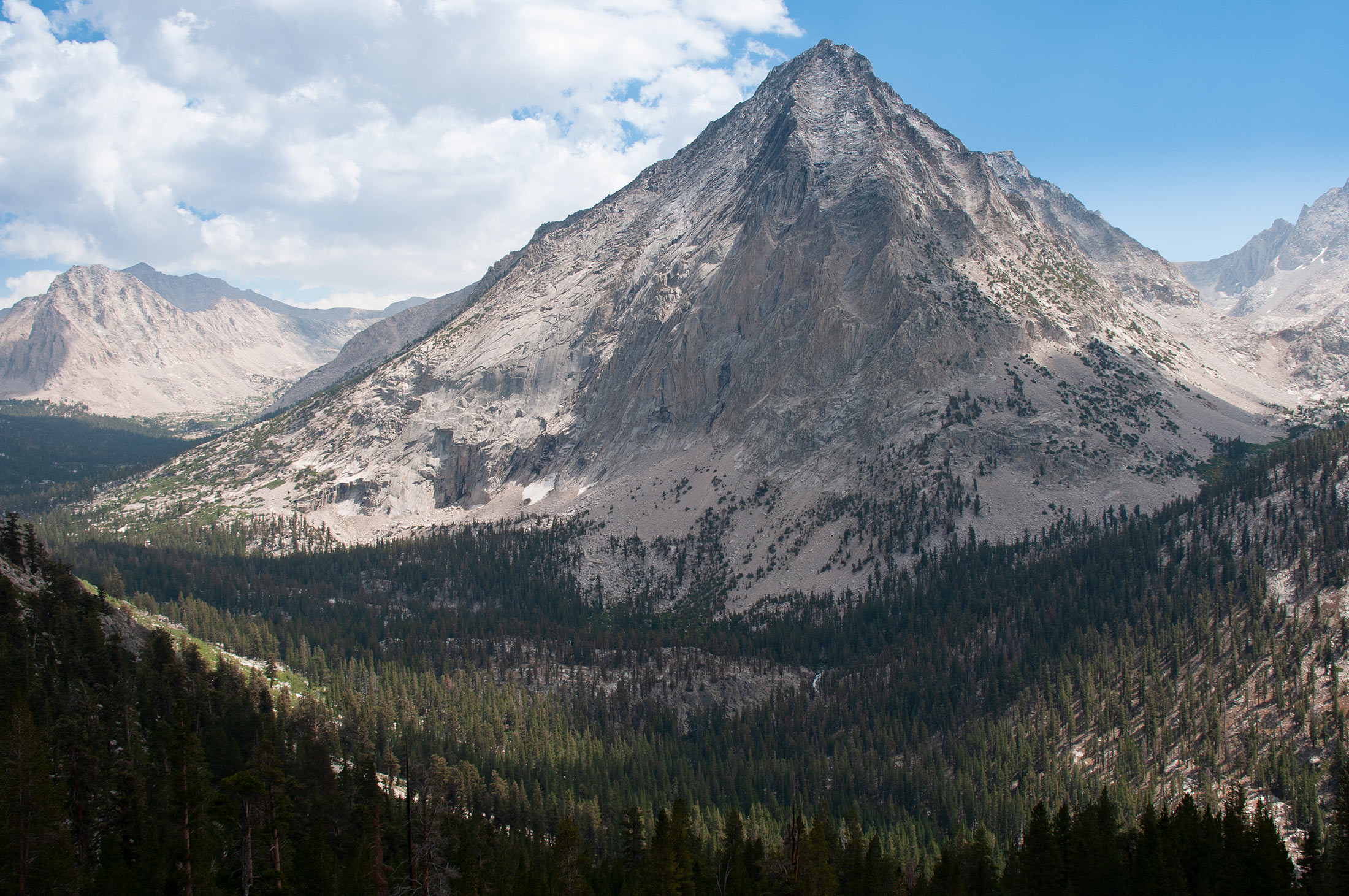
Adding to the ambiance are puffy white clouds overhead, which give the horizon a magical glow. Marveling at this new landscape, dominated by the towering peak of East Vidette on the horizon (beneath which we'll camp tonight), I feel a bit as if we've wandered into the cinematic realm of Tolkien's Lord of the Rings.
We work our way steadily downward, mile after mile, passing Kearsarge Lakes, then Bullfrog Lake, until at last we rendezvous with the Pacific Crest Trail (which here is also the John Muir Trail). This is it! Despite the eight miles or so we've already traveled, this feels like the start of the hike.
Bill and I turn south onto the PCT, and our adventure is now officially underway.
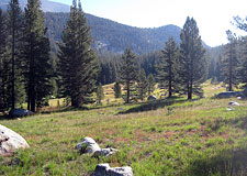
Vidette Meadows
East Vidette Peak
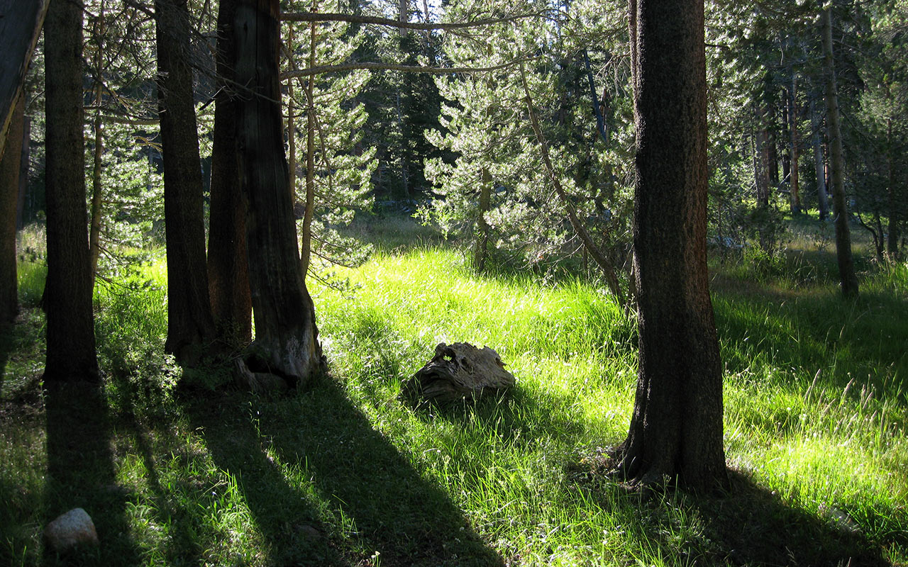
As we descend into the Bubbs Creek drainage, the humidity rises. Muted afternoon sun pokes lazily through thick green treetops overhead. The ground, meanwhile, is now blanketed with a vibrant layer of ferns and grasses.
From the junction of the Pacific Crest and Kearsarge Pass trails, we still have another thousand vertical feet to descend, all of it in the shadow of East Vidette.
East Vidette has an almost hypnotic look to it.
With its sheer north walls and elongated, symmetrical lines, the prominent East Vidette Peak commands our attention.
Bill and I have left open the possibility of summiting side peaks, as time and energy permits.
But as much as I'd love to try to scale East Vidette today, my body is letting me know in no uncertain terms that it's time to find a place to camp.
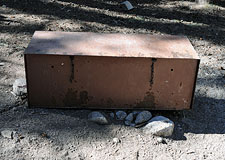
At last we reach lower Vidette Meadow, where we pass the first of two local bear lockers.
In Kings Canyon National Park, bear lockers are placed at roughly 10-12 mile intervals along the Pacific Crest Trail.
I myself find the boxes a welcome and unobtrusive answer to storing food in bear country. It would be fine with me if the US Forest Service made an effort to place them at popular camping spots throughout the Sierra—but this is not the case.
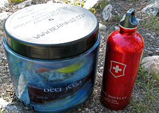
As we travel the Pacific Crest Trail in the days ahead, we will pass through several designated high-activity bear zones (Vidette Meadows included). With some ambiguity, hikers are required by law to have a personal bear canister in their possession at all times in these zones, though obviously where there is an available bear locker they may use that instead.
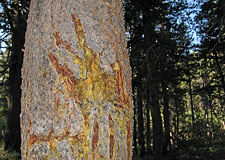
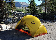
To comply with the law, Bill and I both carry BearVault Solo canisters—though we do occasionally grumble about the extra weight. We stake our claim on a fine campsite near Bubbs Creek and set up our gear. I notice an odd, claw-shaped scar on a tree near Bill's tent, and point out the marks to him.
It appears Bill has unknowingly chosen to sleep beneath a bear scratching post. Hmm. Maybe the bear canisters are a good idea, after all, we decide. In any case, the tree serves as a potent reminder that we are, in fact, traveling through bear country.
Later, I lie down in my tent, eyes wide open, feeling sore and queasy from the day's effort. My hips feel bruised from my pack's waist belt. My feet are sore. My head hurts. I can't help but contemplate the tremendous distance that lies between us and Horseshoe Meadow.
The reality of this hike hits me—we've got a long way to go.
Forester Pass
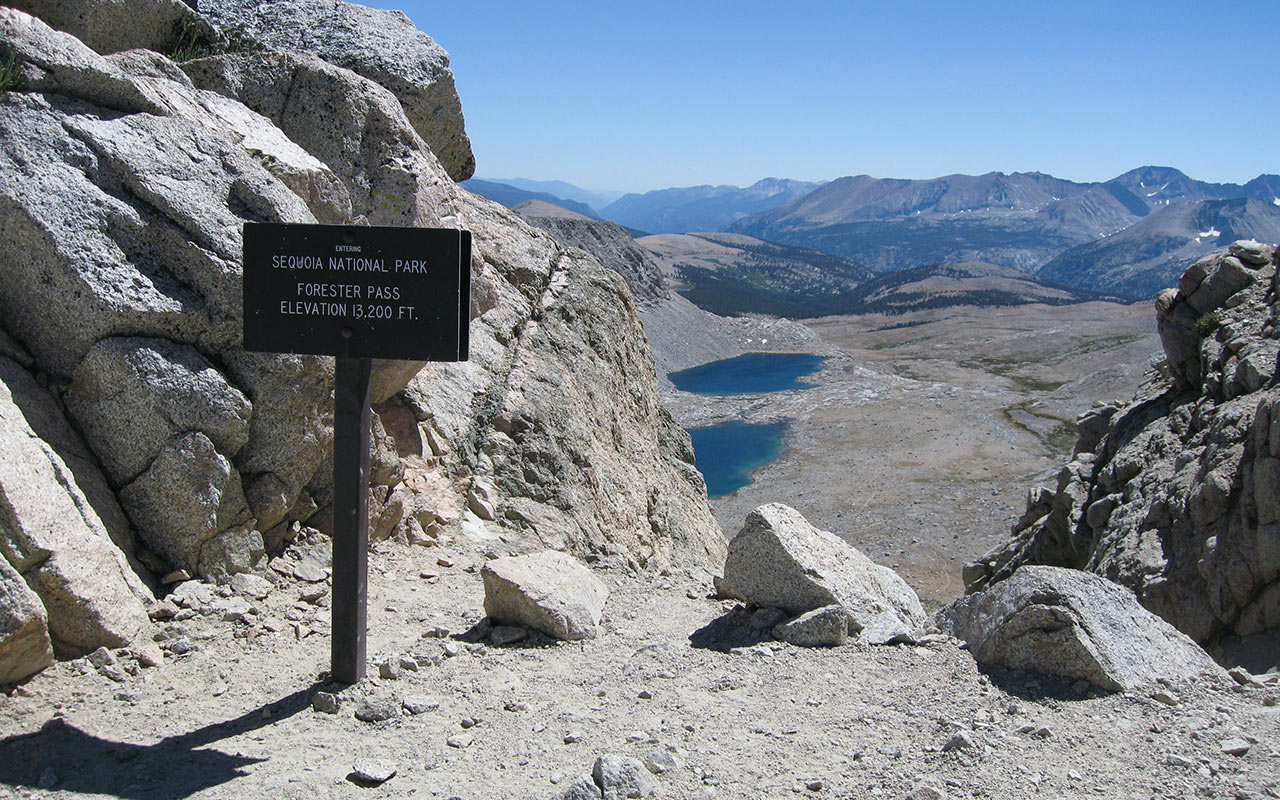
From either north or south, Forester Pass, which breaches the Kings-Kern Divide, poses one of the Pacific Crest Trail's most formidable challenges. It's Day Two. Following a chilly but bear-free night, Bill and I have packed up and are back on the trail, heading south.
From Vidette Meadows, we plan today to climb up and over Forester Pass, elevation 13,180'—a distance of seven and a half miles. Then, we'll keep hiking toward Tyndall Creek (five more miles) until we get low enough to safely camp.
Any way you look at it, it's going to be a long haul.
The view to the south is dominated by Center Peak, whose lofty 12,760' elevation we will easily surpass today.
Forester Pass, for the moment, is hidden beyond the horizon.
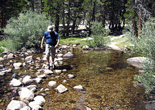
We follow the trail alongside Bubbs Creek, stopping as needed to refill our water bottles.
Our pace is slow and steady.
We try to stop every hour or so to stretch the legs and air out the feet.
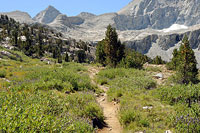
As we slowly make our way upward, the verdant terrain begins to shift, becoming drier and more alpine.
Gradually, Bill and I settle into our own paces, at times hiking together, at times wandering apart.
I find myself flowing into the simple rhythms of the trail.
Yes, the pack is heavy and my feet are sore, but the sun is shining and the day is glorious.
There is a refreshing clarity to the task at hand, I find.
Rather than face my usual list of daily chores (which I never quite manage to complete), here in the Sierra backcountry we must only put one foot in front of the other.
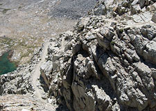
That said, the climb up to Forester Pass does indeed seem to go on forever. We pass a few hikers heading down, plus one group heading up. To the north, I can now see the distant dark granite of the Palisades. When I at last crest Forester Pass, and survey the dramatic cliffs on the opposite side, it is with much relief.
It's nearly three o'clock. Getting atop the pass has consumed the better part of the day.
I take a moment to enjoy the sweeping view of the Sierra south of Forester Pass. For the first time, the Kaweahs come into view, along with the Kern River Gorge, winding off to the southern horizon.
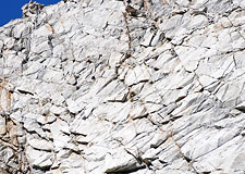
Here atop Forester Pass I overlook a steep slot gully plunging through an 800' high headwall. The trail beyond has been carved out of solid Sierra granite, following the slot down.
With its sudden mixture of steepness and exposure, the route is reminiscent of a Grand Canyon hike.
This impression is reinforced when I start down the south side, switch-backing across the slot gully, then traversing across that bold headwall. Despite the vertigo, it's a relief to be heading down. I work my way to the series of small lakes at the base of the headwall. Here, I pull of my pack, find a nice flat rock to bask on, and wait for Bill.
When I spot him, he's a tiny dot inching across that immense granite headwall. If you didn't know there was a trail there, you'd swear he was free-soloing 5th class rock. When Bill arrives, we celebrate our relief at having crested Forester Pass. With abundant water and several outstanding potential campsites in the immediate vicinity, the temptation to stop and call it a day is strong.
The only downside to camping near Forester Pass (on either side) is the elevation. We are presently relaxing at just over 12,500 feet. As this is only day two for us, a pair of sea level-dwellers, camping this high seems like a poor idea. I'm tired but not spent, so I suggest we keep moving. So, once again, the packs go on our backs and we hit the trail.
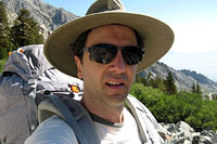
I hang my bandanna from my hat to shade my face and neck from the sun. Soon, we get our first glimpse of Mount Whitney, as well as rousing views of California fourteener Mount Tyndall, to the east, and of course the Kaweahs, to the southwest.
After the steep up and down of the pass, the Pacific Crest Trail now descends at a gentle, consistent angle. This allows us to pick up the pace a bit, and the five miles to Tyndall Creek pass with surprising ease. Forester Pass is behind us.
Our most difficult day of hiking is almost over, and we've survived it with spirits and bodies mostly intact.
Whitney From the West
The big-ticket attraction between Onion Valley and Cottonwood Pass is of course Mount Whitney, at 14,496' the highest point in the continental U.S. Faced with the year-long wait lists and permit woes of Whitney's east-side approaches, both trailheads are often used as alternatives by would-be Whitney hikers.
Obviously, coming at Whitney from the west adds a significant number of miles to the potential challenge. But both the Onion Valley and Cottonwood Pass approaches offer their own special charm as well.
It's Day Three, and Bill and I are once again on the move, heading toward Crabtree Meadows—gateway to Whitney.
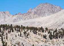
After a relaxing night camped at Tyndall Creek, we are now climbing up Bighorn Plateau, where we get our first unobstructed views of Mount Whitney.
We're already seen two days' worth of stunning landscapes, but the views from Bighorn Plateau surely deserve their own special category.
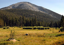
A high, dry, grassy plain, Bighorn Plateau provides a 360 degree view of the interior Sierra Nevada.
Behind us is an uninterrupted panorama of the peaks of the Kings-Kern Divide—remote gems like Thunder Mountain, Mount Jordan, and Mount Ericsson.
Climbing any of these would make for a rousing mini-expedition.
To our west are the Kaweahs, now appearing much closer. White permanent snowpacks gleam against the Kaweah Ridge's darkish red and brown granite.
And dominating the eastern horizon are the high peaks of the Whitney Zone, from Mounts Tyndall and Williamson to the north to Russell, Whitney, and Langley (hidden) to the south.
As Bill and I slowly climb the plateau, Whitney pushes higher and higher against the sky, clearly establishing itself as the Sierra's highest point. Atop the plateau, we take a break beside a quiet alpine lake, enjoying the magnificent views all around. Every few minutes, we rotate our positions to gawk in a different direction.
Perhaps the single greatest advantage to taking either the Cottonwood (or Army) Pass or Onion Valley approach to climb Whitney is that it allows you to fully appreciate how big Mount Whitney is. Seen as it most commonly is from east and the town of Lone Pine, Mount Whitney appears subordinate to the surrounding peaks of the Sierra crest.
Gaze however at Mount Whitney from the west, and you see at once that Whitney is not only by far the highest point in sight—the massif itself is immense. From no other direction do you gain such a clear sense of the mountain's scale compared to its neighbors.
True, all of the west-side approaches (including Shepherd Pass, or even traversing the range from Stony Creek or Buckeye Flat) are long and arduous. But they are also not without reward, and I resolve someday to hike one of these routes up to Whitney's summit myself.
Crabtree Meadows
From the arid high-altitude prairie of Bighorn Plateau, Bill and I drop down once again into lush greenery as we enter the Wallace Creek drainage. We have a bit of up-and-down work ahead.
After we cross Wallace Creek we'll have to climb again to crest an unnamed pass (10,988') before descending into Crabtree Meadows and camp, roughly five miles beyond. These gentle climbs and descents would ordinarily pose little challenge.
But I'm discovering that they become quite a bit more significant with an overnight pack on your back. Today's itinerary thus remains strenuous despite the relatively modest total distance.
That said, both Bill and I are getting more comfortable with this idea of hiking ten or more miles a day, day after day, with all our gear.
It's not only doable—it's a heck of a lot of fun.
Onward.
To our west, a series of broad green meadows push toward the Kaweah range—one more spectacle of natural beauty. The Wallace Creek Drainage also affords us our first good look at Kern Canyon.
That this vast, deep gorge exists within the Sierra is news to me, exposing my ignorance about the interior Sierra's geography.
Suffice to say, Kern Canyon is huge—yet another of the mighty Sierra's secrets.
You could lose yourself in here. I find myself thinking—with envy—of Norman Clyde's wanderings. To dedicate one's life to exploring as much of the Sierra as possible strikes me in this moment as a fine endeavor.
Of course, I'm also quite fond of all the creature comforts awaiting us back home.
Back up we go, a longish 500 hundred vertical climb along the opposite (south) side of the Wallace Creek drainage. Here, we encounter yet more meadows, plus occasional glimpses of major peaks to the east, including—surprise!—no less than Mount Williamson's rugged west face.
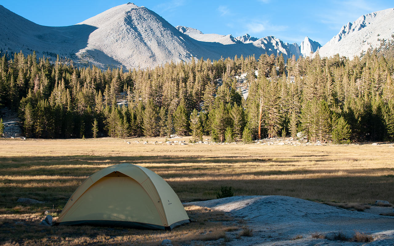
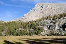
And then, at last, a rather steep section of switchbacks lead us down to Crabtree Meadows. The Pacific Crest Trail seems a little busy here, as Whitney-bound parties camp about the meadow.
Crabtree Meadow itself is a large, somewhat boggy expanse of grass with a fine view of Mount Russell. Bill and I choose campsites right on the edge of the meadow and unpack our gear. It's already late afternoon. A bit of rest would be nice, but I always find myself in perpetual motion when I get to camp. First, there is the search for a place to pitch the tent.
Then I must unpack all my gear, find a place to hang wet clothes, shake the dust off everything. Set up the tent, unroll the sleeping bag, inflate the pad. Go get water, soap up the hands and face to make myself human. Dry off, swat a few mosquitos. Simple tasks, all of them, but they each take time.
Setup the stove and brew some tea before dinner. Cook dinner and eat it—pile in those calories to replace as much as possible what was lost on the trail today. Keep drinking water and tea: hydrate for the coming night. If you can, steal a minute to get into the tent and stretch stiff muscles before they turn to rusty springs overnight.
When all these chores are done, I see the last rays of sun glowing orange on Sierra granite overhead. I grab my tea and join Bill, who is reclining on a rock, watching the sunset. Another day is done.
Interlude: Mount Guyot
Another Chilly night. A lattice of frost crisscrosses Crabtree Meadow in the early morning, and ice bits cling to the outside of my sleeping bag. It's Day Four.
I fire up the stove and brew tea, waiting eagerly for the sun to crest the Whitney massif to the east and warm my shivering body. Our pace thus far has actually put us ahead of schedule—we're roughly a half day farther than we thought we'd be by now, which gives us a little wiggle room to add in a side hike.
So, when Bill proposes we climb Mt. Guyot, elevation 12,300', I'm all for it.
Guyot's summit is a little less than a mile west of Guyot Pass, which we must climb anyhow.
We pack up after breakfast and hit the trail once again.
From Crabtree Meadows we begin the day right away with a 600 vertical feet climb to Guyot Pass.
Here, Bill and I take a lunch break, enjoying a fine overlook of the Rock Creek area (today's eventual destination).
Then we stash our packs and make for Guyot's summit.
Climbing without overnight loads is a pleasure—like suddenly being supercharged.
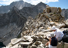
I aim for a granite spire, and soon enough, a bit of class 3 climbing gets me to the top, where I find a USGS benchmark.
But look to the west: there is another point along Guyot's broken summit ridge that appears higher. Alas, Guyot Peak turns out to be one of those annoying mountains that can't quite decide where its true high point lies.
I traverse westward, topping the next high point where I find another USGS Benchmark. But again, another point westward looks higher.
Well, we've gone this far...
The third time proves a charm: one last USGS Benchmark, plus a stunning view of Kern Canyon. Mount Guyot affords a 360° view of the surrounding Sierra, allowing us to see almost the entirety of our Pacific Crest Trail hike.
We can peer all the way back to Forester Pass, distant on the north horizon, track our route across Bighorn Plateau, down to Crabtree Meadows. Looking south, we see Olancha Peak on the horizon. Beyond that lies the Southern terminus of the Sierra. And yes, looking east, we have a grand view of Mount Whitney's summit and western flank.
Crooks Peak (Day Needle) and Keeler Needle are there as well, as is Mount Muir's modest pinnacle. Rounding out the view to the north, we can spot the summit of Mount Tyndall, and we can now see Williamson's summit, as well as its twin horns. All in all, I'd say we got our money's worth.
It's time to descend to our packs. I've nearly run out of water here on Mount Guyot, but there are a few snowy patches on the peak's north face, allowing a refill of sorts.
The trick to replenishing your water supply with snow is to add just enough snow to make a slushy mix. Add too much snow and you get a big ice chunk. But mix carefully, and the water will act as a conduit, transferring ambient heat to snow, slowly turning it into drinkable water.
If the temperatures are warm and there's an abundance of snow (say, on a spring backcountry ski tour), you can use this trick to nearly double your water supply by dribbling in snow over the course of the day. Just be careful not to get too dependent on it.
If temperatures drop, or a wind comes up, your snow will stop melting—and you'll run dry.
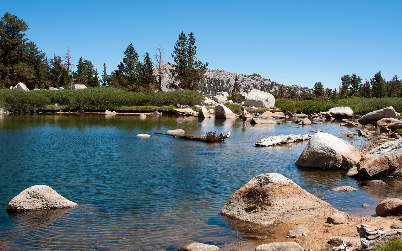
Rock Creek
From the lofty summit of Mount Guyot, it's a quick and easy descent to the green meadows and shady forests of the Rock Creek area. We find a bear box at the first crossing of Rock Creek.
Nearby are several fine campsites on the edge of yet another scenic meadow. Time to drop the packs and set up camp. Despite our side hike up Mount Guyot, it's still early in the afternoon, allowing us to slow our pace and take our time.
The gently babbling Rock Creek is immediately adjacent our campsite.
I wander around the area, taking photos of the creek and the nearby meadow that leads toward Forgotten Canyon.
Also to the south is an unnamed peak that looks like Mount Guyot's twin.
Here at camp, our present elevation—roughly 9600 feet—is the lowest we've been since Vidette Creek four days ago.
Lower elevation at camp translates into greater comfort.
The air has a pleasant thickness to it (we've begun to adjust to the altitude), and the temperatures are more mild.
I take advantage of the warm air by grabbing my soap and making an extra effort to wash up before dinner. We've been on the trail for four days now, and both Bill and I are starting to accumulate an impressive coat of dust.
Normally bathing in a mountain creek is a tenuous affair: a race to clean up before you freeze or before greedy mosquitoes devour you. But here at Rock Creek, the few mosquitoes don't seem much interested in me, and the mild air allows a downright leisurely bath.
After washing up I fill my canteen with pumped water for the night. As an added bonus, there's time for a quick catnap in my tent before dinner. I also take the time to stretch out my legs and back. During these lazy hours Bill has been gathering firewood.
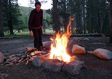
Since we're below 10,000', we're allowed to build open fires. I join the quest for wood, demonstrating my own formidable foraging skills. Together, we put together a healthy pile of everything from tinder to coal-producing logs that will burn well into the night. After a hearty dinner, we stack a few branches and set it alight. Soon, we've got a cozy little fire going.
This is a rare treat. I sit at the edge of the fire, feeling its warmth through my clothes, moving as necessary to avoid getting smoke-cooked. Memories of camping by a fire come bubbling up from the past. Both Bill and I stay up well into the night, hypnotized by the fire, until at long last, reluctantly, we know it's time to go to sleep.
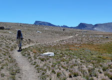
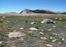
The Siberian Outpost
The 'Siberian Outpost' is a remote, high plateau —a long, sandy, waterless stretch of the Pacific Crest Trail that we've been advised to avoid. But our mission is to see the PCT through, not bypass its more interesting segments, so we drink a little extra water before leaving camp, then hit the trail, undaunted.
Welcome to Day Five. Our plan today is to hike across the Siberian Outpost until we reach Chicken Spring Lake—roughly ten miles away. Once there, we'll either camp for the night, or push all the way to the car, depending on how tempting the Carne Asada Plate in Lone Pine sounds.
After meandering alongside Rock Creek for about a half mile, I encounter a group of hikers who are emerging from their tents.
Bill and I aren't exactly paragons of cleanliness, but this crew is covered head-to-toe in ashy dust, making them look like coal miners who've been lost in the mines for a decade or two.
Their leader approaches me with a vacant, wild look in his eyes.
I'm momentarily terrified he's going to ask if we've come to rescue them.
But no, he's just saying hello.
I ask if they've come from Cottonwood Pass or Army Pass. 'No, no,' the man says emphatically. 'We came from Army Pass.'
'Ah'.
I learn this is their second day on the trail, which leads me to wonder what they'll look like in another few days or so. Meanwhile, Bill appears along the trail behind us, momentarily distracting the man.
I take this as an opportunity to resume moving, and with a hearty 'Good Luck!' to this ragged bunch, that's what I do. A little over a thousand vertical feet of climbing gets Bill and me up onto the Siberian Plateau. As expected, the few water sources marked on our map are all dry.
We are treated to a stunning view of Mount Langley's west face and the Corcoran Pinnacles to our east. Below Mount Langley is the green haven of Soldier Lakes—an alternate route that circles around the long, dry stretch of the Siberian Outpost.
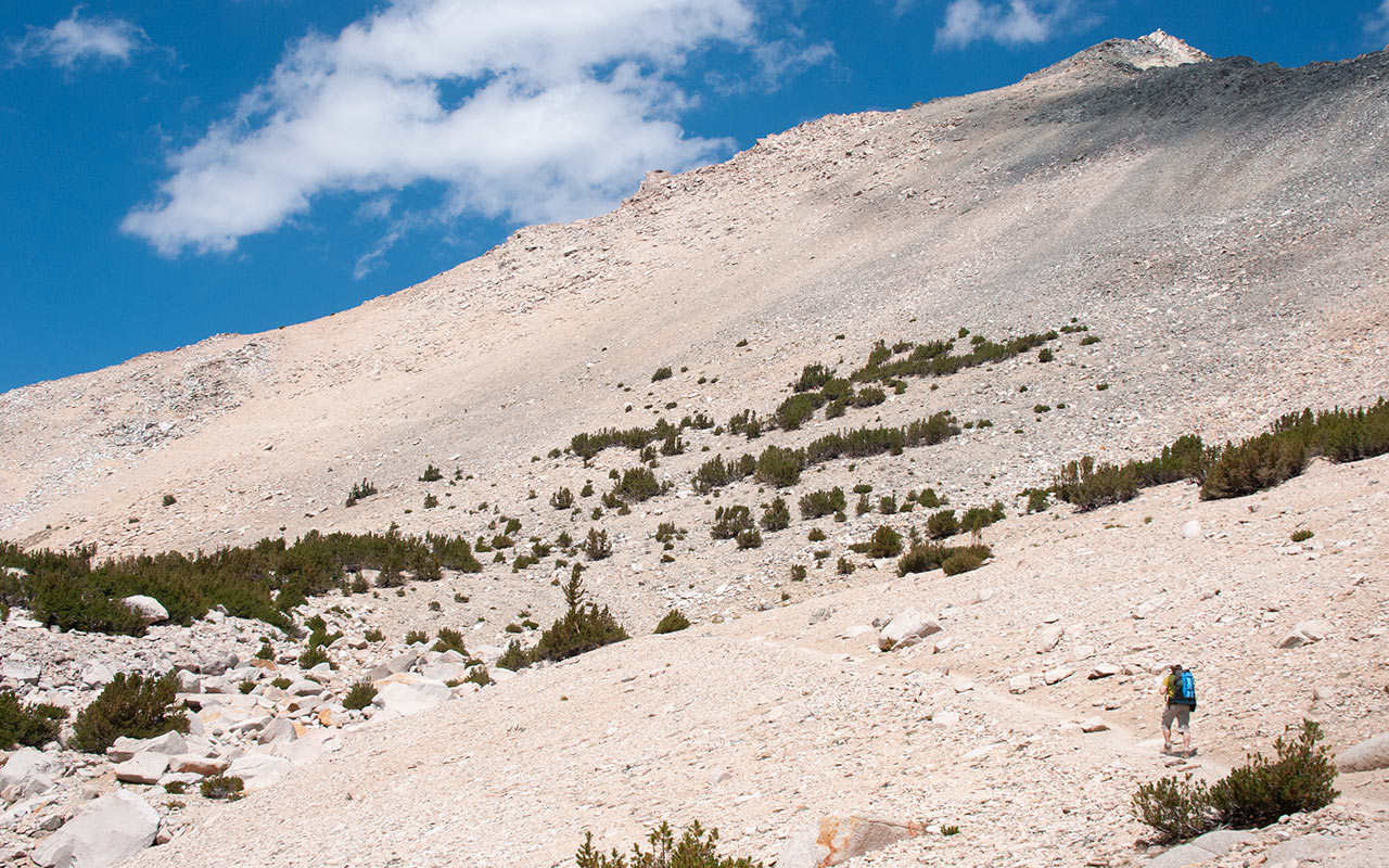
The sparsely forested landscape now offers little protection from the sun, and the ground is indeed sandy. Though the plateau is quite flat, the sand slows our pace. The air is much warmer than we've encountered elsewhere, and the sand itself radiates heat upward.
Over the course of our trip through the Sierra, we've passed repeatedly through microclimate zones: wet, alpine, barren. Now, on the Siberian Plateau, we seem to have returned to the typical arid Southern Sierra landscape—hot and dry.
Chicken Spring Lake
How far is it to Chicken Spring Lake? We've been traversing across an interminable stretch of sand around Cirque Peak, and it seems to go on forever.
The sand is soft, deep, and hot enough to heat the toes through our boots. The green glades of Rock Creek and places past are now just a distant memory. We've been steadily climbing since leaving the Siberian Plateau—gaining nearly 500 vertical feet instead of the mostly-flat ground our map seemed to indicate.
As expected, we've run out of water, providing an extra incentive to reach the lake as soon as possible.
Water is the crucial consideration along this part of the trail.
Some authors recommend traveling the Siberian-Cottonwood leg in early spring.
The southerly aspect of the trail melts away winter snow early in the hiking season, and the creeks and springs are still running.
This allows for a variety of possible campsites, unlike now, where everything in sight is dry.
Bill and I know we're traversing around Cirque Peak, but the landscape is deceptively constructed.
It feels like we're constantly about to round the corner and spot the lake, but instead, each ridge just offers another long dry stretch leading to the next high point.
The sand, meanwhile, saps our energy and slows our steps. Also entering the motivational picture now are thoughts of food—real food. The effects of Bill's semi-starvation diet are starting to kick in: Bill's hungry.
And even though I've eaten relatively square meals thus far, I'm starting to focus on a variety of caloric delights as well.
This is popping up, appropriately enough, in our inability to correctly remember the name of our present destination. Where the hell is that damned Chicken Wing Spring? I mean Chicken Fingers Lake...
What's it called again?
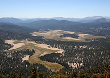
The combination of heat, sand, repeated up-and-down traversing, and tasty chicken obsessions is turning this section of the Pacific Crest Trail into a real grind. Helping ease matters a bit are the fine views to the southwest, including the big expanse of Big Whitney Meadow, which we overlook.
At last, we crest the last high point of our entire hike, and the blue waters of Chicken Spring Lake spring invitingly into view. We descend several hundred vertical feet to the lake, then fill our bellies with crystal clear Sierra water. We take an extended break at the lake. After about an hour, it's still only 2 o'clock.
Bill and I make our decision: we're going to keep going.
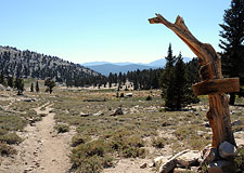
Cottonwood Pass
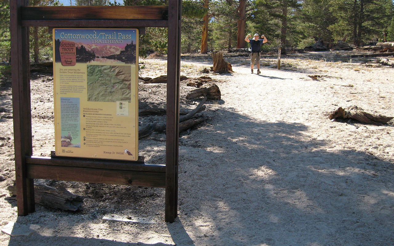
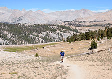
From the top of Cottonwood Pass, elevation 11,140 feet, it's just three point eight miles to the car and the end of this five day, fifty-plus mile adventure. I pick up the pace on this last stretch, which after all the miles we've traveled thus far feels now like a victory lap.
My body has held up much better than expected. Still, I'm glad to be heading home, back to my family and that happy land of warm beds, drive-thru windows, and indoor plumbing.
We must drop a little over a thousand vertical feet to get to the Cottonwood Pass trailhead, where our carriage awaits.
This last thousand, combined with the ten miles we've already hiked today, makes these last few miles far from effortless.
My mind drifts here, contemplating the sights we've seen over the past week.
In every way, the hike has been a stunning success.
Both Bill and I are still mobile, which is good.
We've not been sidelined by a turned ankle or diaper rash or starvation or any of the other worries that swirled about in the weeks when we planned this trip.
And traveling the undiscovered country of the Sierra's interior—the high plateaus, the meadows, the remote peaks and passes—has in every way exceeded my expectations.
This hike has opened up new vistas and new possibilities for me. I find myself thinking up new hikes to follow: a trans-Sierra walk, perhaps. Maybe a peak-bagging trip to the Kaweahs?
And, yes, next year I think another stretch of the Pacific Crest Trail will come calling.
Onion Valley to Mammoth, perhaps? Really, what strikes me more than anything is that multi-day hiking like this is not just for the hardcore thru-hiker. It's for anyone who wants to see the Sierra (or somewhere else) in a brand new way—and maybe see themselves a little differently also.
For these past five days, Bill and I have returned to the nomadic ways of humans from ages past, carrying all we needed to survive on our backs. To be sure, modern gear and tactics have made things a great deal easier. But the principle—self reliance—still holds.
I finish descending Cottonwood Pass's many switchbacks. From here, there is but a long but flat stretch of trail across Horseshoe Meadows between me and the end of the trail. For a moment, I have a crazy notion of turning around and heading back into the wild: hiking all the way to Canada, maybe, and then beyond.
But no, it's time for me to return home, and share these memories and experiences as best I can.
The parking lot is just ahead—I can see my car waiting. With one final look at the Sierra behind me, I complete the last few steps from Sierra granite to SoCal concrete. It's time to go home.