Sandstone Peak
Finding Inspiration atop the Santa Monica Mountains
Los Angeles — For most Angelenos, the Santa Monica Mountains are perhaps best known as the ever-present, indistinct brownish hills on the city's horizon—an airy realm of mansions, wildfires, and mudslides.
Preservation efforts, however, plus the terrain's natural ruggedness have left considerable pockets of unspoiled wilderness in the Monicas. According to the National Park Service website, the Santa Monica Mountains National Recreation Area is the world's largest urban national park.
Traveling from east to west, the Santa Monicas include Griffith Park and the Hollywood Hills, Beverly Hills, Bel Air, Topanga Canyon, and Pacific Palisades.
Inextricably entangled with the vast Los Angeles Metropolis, the range eventually terminates at Malibu and the shores of the Pacific.
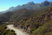
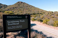
The highest point in the Santa Monica Mountains is 3,111-foot Sandstone Peak, part of the Circle X Ranch. Perched over Malibu and the Pacific, the peak features expansive views, making it a fine getaway from the constant rush of the surrounding city.
The surrounding Ranch was purchased in 1949 and given to the Boy Scouts (more on these enterprising souls to come).
Today, Circle X Ranch is part of the National Park system, with a small visitors center, a campground, and an extensive network of easy hiking trails. Unlike other parts of the Santa Monica Mountains, most of these trails are closed to bicycle traffic. This, plus the region's somewhat out-of-the-way location help keep the trails quiet, if not deserted.
Hikers can expect warm temperatures any time of the year. The Santa Monicas' climate is classified as 'Mediterranean', which translates to long, hot summers and mild but wet winters. Paired with a thousand vertical foot gain, that can make hiking Sandstone Peak in mid day uncomfortably warm.
Summer visitors in particular are advised to schedule their visits in the early morning or late afternoon. As an added benefit, hiking at these times treats visitors to the best light. At lower angles, the sun adds much-needed contrast to the often hazy Southern California sky, transforming a faded, sun-burnt landscape into a vivid palate of color and shadow.
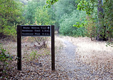
The Mishe Mokwa Trail
You're never far from the city in the Santa Monica Mountains, but they can make feel as if you are far, far removed from the streets of the nearby metropolis—and this is a rare gift indeed for urban dwellers.
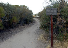
From the Sandstone Peak trailhead, hikers briefly join the Backbone Trail—a fire road, really. The Backbone trail is nothing if not efficient, and you'll soon feel your pulse quicken on this immediately steep road. Roughly a half mile farther, the way forks, with the Backbone branching left and continuing its sharp ascent of Sandstone Peak.
We'll use that route for our descent later today.
But for now, our path goes to the northeast, via the far less hurried Mishe Mokwa Trail.
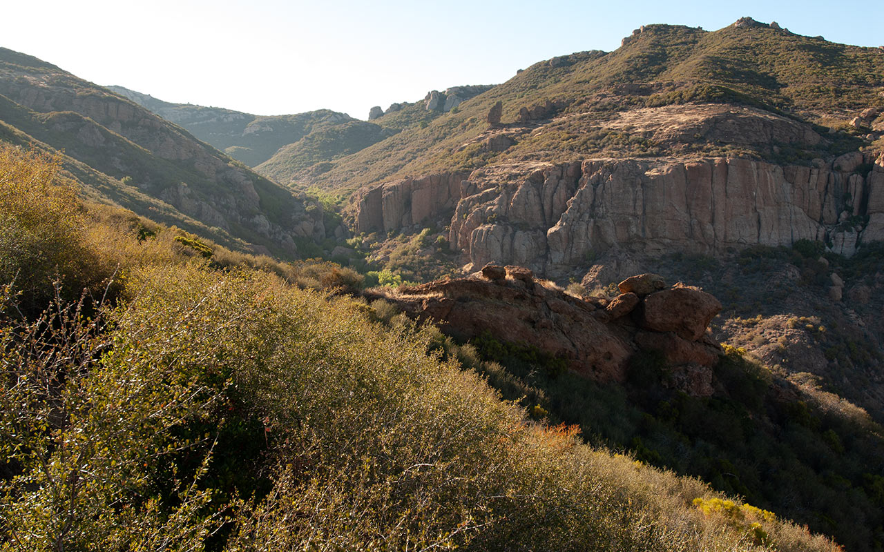
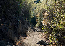
The memorably-named Mishe Mokwa traverses Sandstone Peak's east flank before plunging into neighboring Carlisle Canyon.
Here the city does indeed seem to vanish, replaced with a remote and rugged wilderness quiet enough to satisfy the most demanding of hermits.
This is certainly not the fastest way to gain Sandstone Peak's summit, but it does make for a meandering loop through surprisingly diverse terrain.
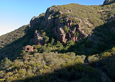
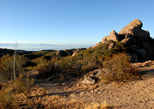
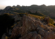
Local rock climbers seem to find a few lines to climb in the region of 'Balance Rock', a prominent feature near the canyon's east rim resembling the mysterious stone statues of Easter Island.
At this point, you may be noticing a suspicious lack of sandstone in the area. In fact, the entire Sandstone Peak massif (such as it is) is composed of metamorphic rock, from ancient volcanic action—not sedimentary layers. The rock is red, however, and that was apparently good enough for whoever named the place.
As the trail works its way along the length of Carlisle Canyon, the brush thickens to the point that cross-country travel is nearly impossible. Seeing all this bone-dry tinder up close, it is easy to understand why brush fires are such a dangerous phenomenon in the Santa Monica Mountains. The brush does provide shade, however, and this will almost always be welcome.
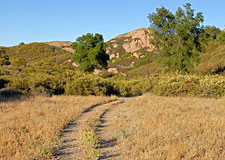
The Mishe Mokwa continues along in this manner for some two miles, meandering up and down the west side of the canyon, repeatedly disappearing and emerging from the thick chaparral, working its way past interesting volcanic rock formations. Eventually, the trail arrives at a pleasant glade of Sycamores.
This is the Split Rock trail camp, and there is a creek here, though in summer it may be little more than a trickle. In any case, the sudden shift from parched brush to green grass and shady glen forms a rather delightful little oasis at the bottom of Carlisle Canyon—making it an ideal spot for a picnic or just a brief rest.
On the Backbone
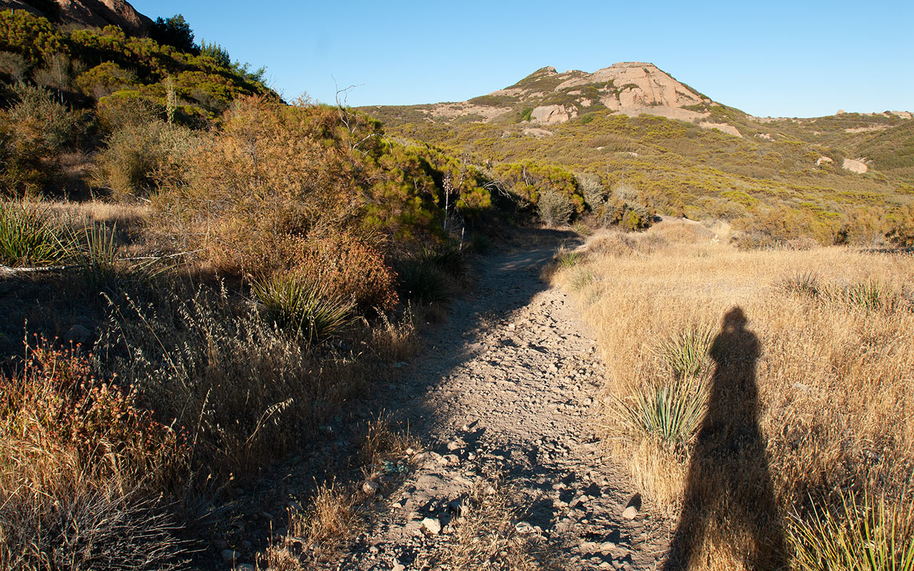
From the shady sycamores of Split Rock, the Mishe Mokwa Trail climbs out of Carlisle Canyon, gaining a high plain where the late afternoon sun casts long shadows across dry grass.
The junction with the Backbone Trail isn't far, but Sandstone Peak's summit remains a good two miles away. Weary hikers may find themselves wishing they'd simply stayed on the Backbone Trail and long since reached their destination.
Taking the full loop, however, is not without its rewards.
The dusty Backbone Trail now traverses atop the spine of the Santa Monicas, skirting Sandstone Peak's impressive south escarpment.
We'll be peering over the edge of that high bluff soon enough.
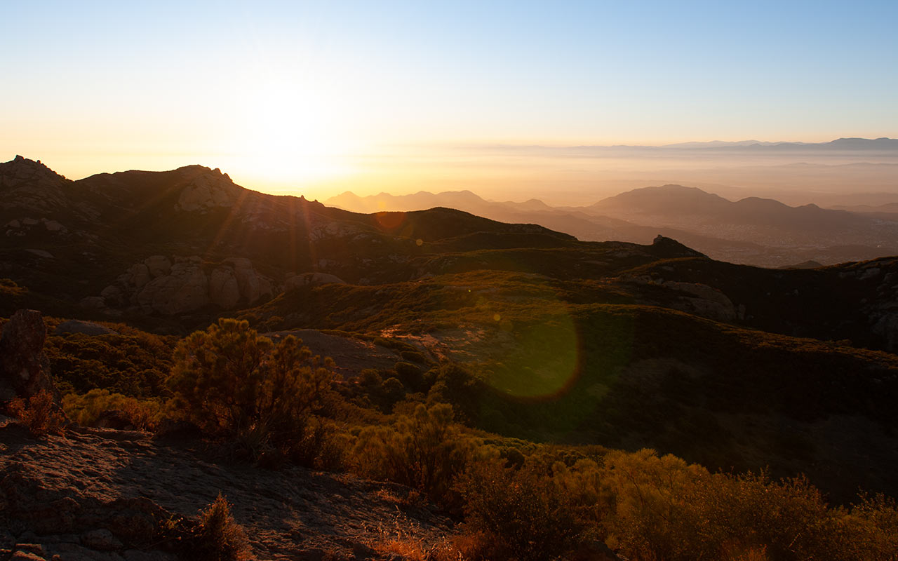
Meanwhile, my plan to arrive at Sandstone Peak's summit at sunset appears to be on schedule.
To the north, the hazy lowlands of Thousand Oaks and Simi Valley—populated to the gills with suburban sprawl—await the coming dusk. Southward, I see the blue waters of the Pacific running off to infinity. Here and there along the Backbone Trail sprout lesser volcanic summits, each worthy of exploration: Tri Peaks, Exchange Peak, and Boney Peak.
But the sun is hot and the day long.
I'm eager to get there, already, so I push my pace a bit and march through the alternating thickets and plains toward the high point of the Santa Monica Mountains.
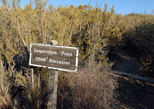
Inspiration Point
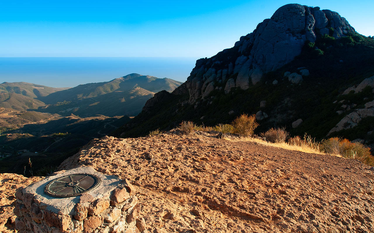
A mile or so up the Backbone Trail, I come to an innocent-looking sign advertising the way to 'Inspiration Point', elevation 2800'. This technically is not on the day's agenda, but I've a mind to be inspired.
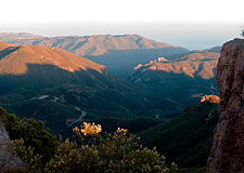
I detour through an innocent-looking thicket that gives way to a sudden, sweeping vista. Inspiring? Indeed. This may be the marquee view of the entire hike—orange, glowing rock contrasts with the blue Pacific, while the foothills below settle into the deepening shadows.
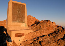
Here atop the point is a understated monument built in memory of a young scout who perhaps once stood upon these same rocks and watched the sun drop beneath the Pacific.
The stone pillar features a compass at its top pointing to various visible features in the Southern California region, including the San Gabriel Mountains.
The colors in all directions have grown bright and vivid, happy fodder at last for my camera.
Seen at high noon, this same landscape can appear as drained as a faded photograph, the victim of the interaction of coastal humidity and Southern California smog, which flatten the light.
Now, as the day's end draws near, everything seems alive.
This is a welcome sight for a transplanted Arizonan, used to the nation's purest, most photogenic light.
In this moment the Santa Monica Mountains reveal their oft-hidden beauty. It is a small miracle, perhaps, to be standing here so close to Los Angeles, enjoying a sunset in the wilderness.
But it is a miracle nonetheless.
I could easily remain here at Inspiration Point past sundown, but Sandstone Peak's summit beckons. What new sights will it offer, I wonder? I don my backpack and return to the Backbone Trail.
Sandstone Peak
Here is my recommendation: bring a date. Sandstone Peak's modest but well-placed summit may be among the best places in Southern California to watch the sunset.
Equally important, when done via the Mishe-Mokwa Trail, the hike is long, hot, and tiring. If you and your partner are still on speaking terms when you arrive atop the mountain, you may well have found yourself a keeper.
It has been a long, dusty hike, and I am quite happy to arrive at last at the last short scramble that leads up to Sandstone Peak's summit.
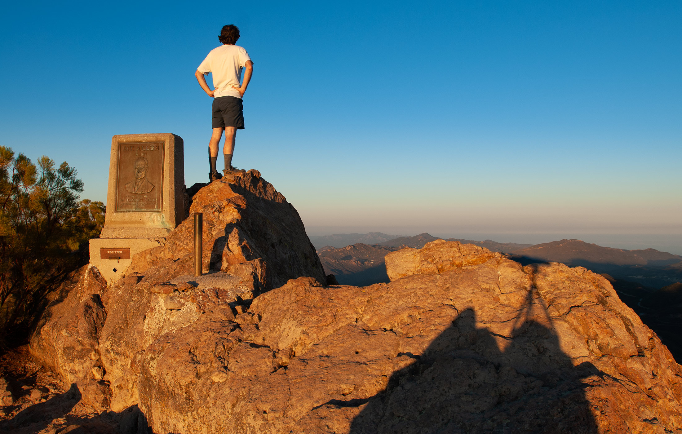
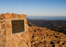
The 3,111' top of the Santa Monica Mountains is home to an imposing monument which informs me I've reached the top of 'Mt. Allen'...
What, you say??
Ah, those plucky Scouts!
In the 1960's, the Boy Scouts sought to honor Circle X benefactor Herbert Allen by renaming Sandstone Peak.
They were thwarted, however, by the U.S. Department of the Interior, which cited its policy prohibiting naming geographic features after living persons.
In their enthusiasm, the defiant Scouts held a dedication ceremony anyway, capped with a impossible-to-miss monument.
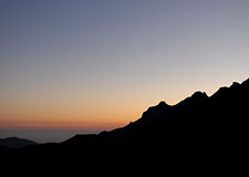
In any case, we can be happy the Scouts chose not to rename any other nearby summits. Meanwhile, after its slow journey across the sky, the sun seems now in a hurry to reach the horizon.
The rock shifts abruptly from orange to red, and haze across the valleys below seems to thicken. I perch myself on the spiny summit, feet pointed toward the 100' precipice of the south escarpment, watching the day come swiftly to a close.
The sun drops beneath the horizon, and the lights of the surrounding city begin to make themselves known. I find myself wondering what the view might look like at night, when the lights and city glow are at full strength.
But that adventure will have to wait for another day. I'm ready to head back down, via the quick Backbone Trail. It's scarcely a mile to my car, and I jog most of it, pounding down the steep fire road in the deepening twilight. The air remains warm as I descend, leaving this enchanting island of wilderness to return again to the immense jungle of the city.