Bloody Bike & Ski
Testing the Steeps on Bloody Mountain's Bloody Couloir
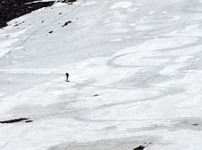
Bloody Couloir, California — How steep is it? I'm working my way up Bloody Mountain's impressive north face, trying to gauge the angle of the couloir at its steepest point.
Normally, I'd just eyeball the hill and call it 40°, but today I want a more objective assessment. I stop, belay myself, and pull out my inclinometer. To my surprise, the slope measures quite a bit steeper than my casual estimate. That view beneath my crampons suddenly looks a lot more intimidating...
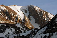
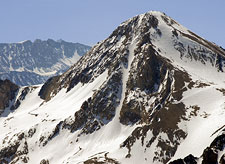
Bloody mountain's north couloir—the 'Bloody' Couloir—is easily one of the Sierra's marquee backcountry skiing descents.
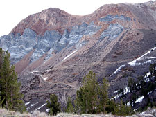
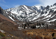
The striking, multi-colored rock of 12,552-foot Bloody Mountain rises prominently above the town of Mammoth Lakes, and the couloir is easily visible from Highway 395.
Bloody Couloir is usually the first things skiers and snowboarders notice when they exit highway 395 en route to Mammoth Mountain.
A central buttress divides the couloir into two main chutes, (climber's) left and right.
The left chute offers the best skiing—broad snowfields and a more moderate angle. But it is the right-hand chute, dropping sharply beneath the mountain's western summit, that attracts aspiring extremists seeking to test their steep-skiing skills. This narrow swatch of snow is usually hidden in shadow, looking steep and menacing from below. Beyond its apparent difficulty, of particular appeal is Bloody Couloir's easy access from Mammoth Lakes.
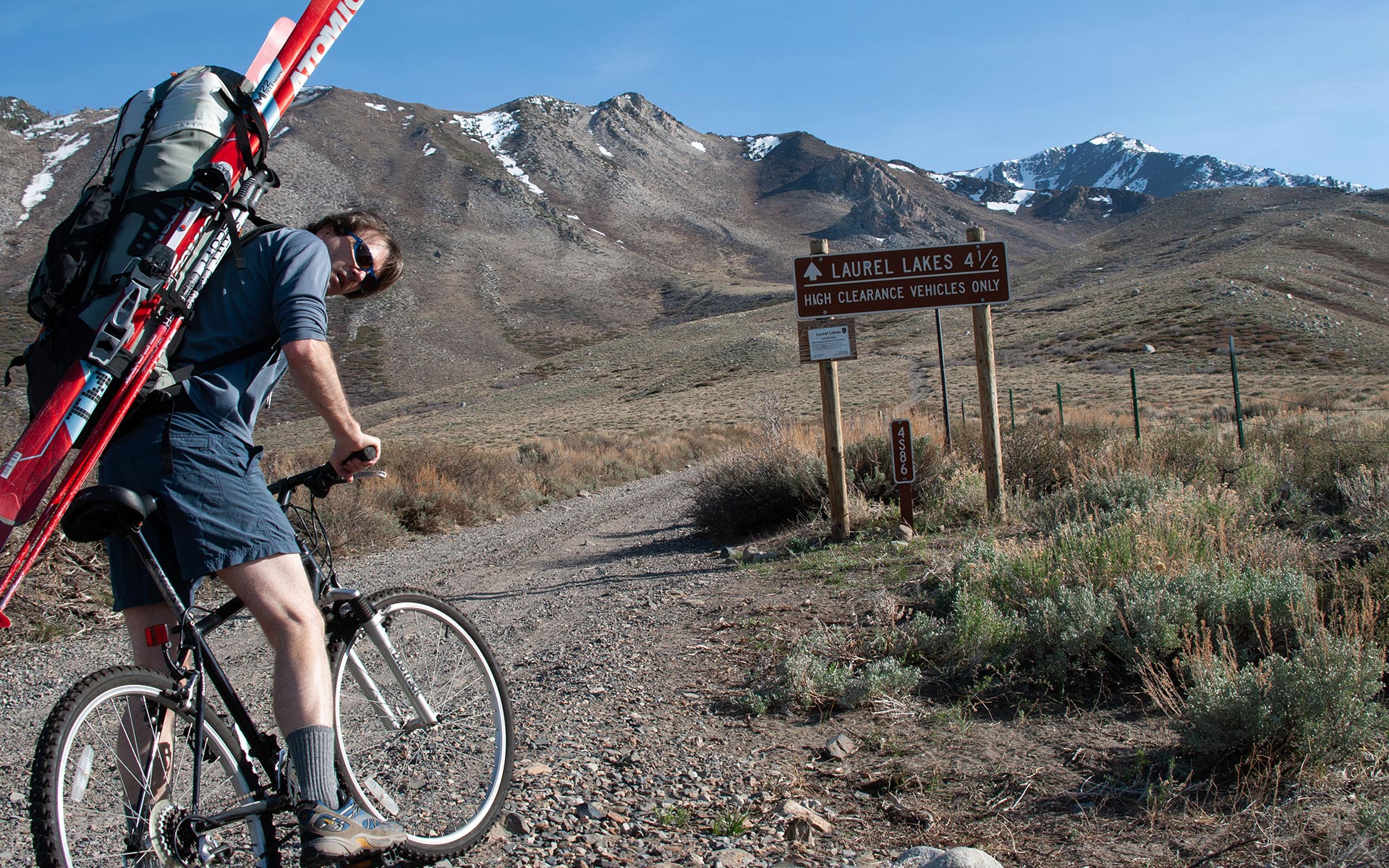
Depending on how much snow there is, it's possible to drive nearly all the way to Laurel Lakes, and the base of the couloir, elevation 10,000'. Regardless of snowfall, however, the drive requires a four wheel drive vehicle (or an ATV), due to significant quantities of loose rock and boulders.
Naturally, I'd been interested in skiing Bloody Couloir for some time. But I didn't have 4WD, necessitating an extra 2200 vertical feet and four and a half miles of hiking. Trudging up a dusty road while four-wheelers cruised past just didn't sit well with me, so I hatched a scheme of sorts: I would try to bicycle up the road, with skis and gear, to ease the approach.
The plan sounded good—at least in theory.
Biking Up Laurel Lakes Road?
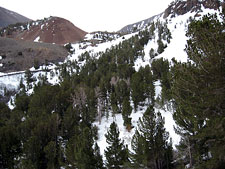
There are many jeep trails in the Sierra. Few sport their own sign warning travelers that four wheel drive is required. Laurel Lakes road is close enough to the town of Mammoth Lakes to warrant such a posting.
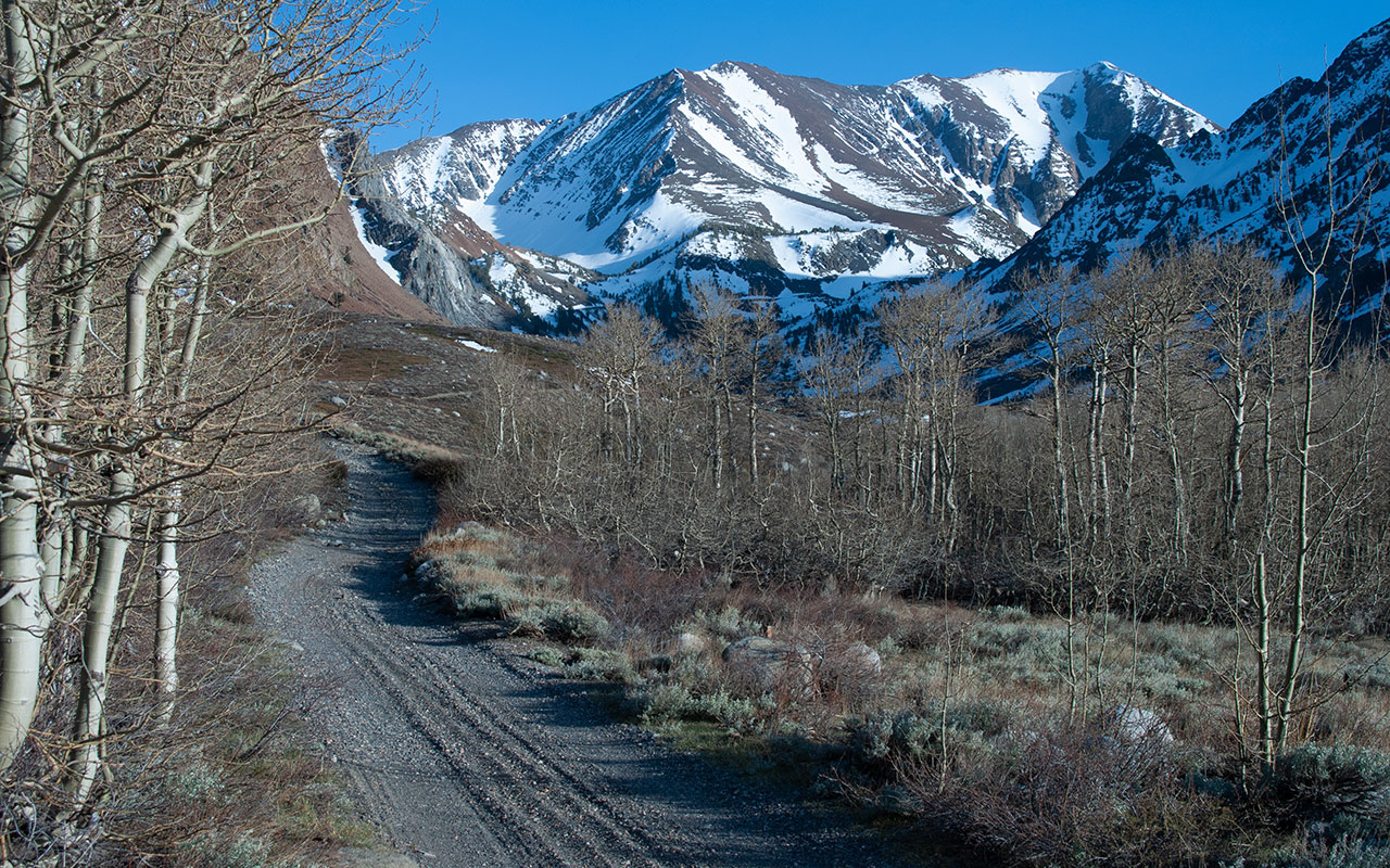
The road begins harmlessly enough, with a straightforward climb into the foothills of the Sierra. Soon enough, however, the road degenerates into a slow, tedious grind up steep switchbacks coated with loose gravel and shale shards, plus the occasional boulder to snap an axle.
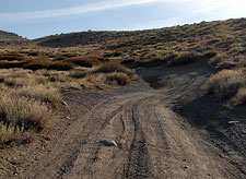
Should you decide you've had enough and attempt to retreat, you'll discover the only way out is to put it in reverse and back up—often several hundred yards or more— to a rare turnaround.
If you've got a high-clearance vehicle and a good deal of patience, the road is certainly passable. If you've got a regular passenger car, you've really got no chance.
With four and a half miles of road to get to Laurel Lakes, that makes Bloody Couloir much less appealing for the vehicularly-challenged.
I'd heard reports of people using bicycles to shorten an approach, and, frankly, the idea appealed to me. What could be better than cruising a mountain road on a bicycle, effortlessly ticking off the miles, no gasoline required?
Of course, somehow I'd have to carry my skis and gear with me. And I really didn't know whether or not I could bike uphill with any degree of efficiency.
But, if I could somehow make it up the road, I knew I'd be able to coast back down.
At a bare minimum (I reasoned), taking along a bicycle meant cutting the hiking distance in half. Surely that was worth giving it a try? And so, along came the bicycle. Call it a test run. If biking proved viable, the potential impact seemed unlimited. I envisioned biking up Tioga Pass Road before the gate opened. Or even (dare I dream of it?) White Mountain Road.
Such delusions of human-powered grandeur end shortly after I heft my 50-pound pack and attempt to mount my bicycle. The modest grade at the start of Laurel Lakes Road is too steep to allow me to get rolling. I am forced to point downhill, start cycling, then turn around and head back up. This strategy, of course, will only work in the parking area.
My mountain bike's tires soon sink into the loose dirt and gravel of the road. In the lowest of low gears, it takes a red-line cardio output to make any headway up the road. A hundred yards of this, and I finally grind to a halt. Reset. By locking my brakes, then hopping on and pedaling like mad, I am able to resume forward motion.
The effort is of course doomed. The grade is just too steep, the road's surface too soft. The weight of the pack unbalances the bicycle, making it extremely difficult to steer. My ski tails catch on the bike frame. And just to seal the deal, a gusty cross-wind keeps tipping me over.
The reasonable course of action is to abandon my grand experiment—hide the bike at the side of the road and hike up. But really, are backcountry skiers on the whole a reasonable bunch? I hop off the bike and push it uphill. It's not too terribly difficult. I still have to come back down, I reason, and at least going downhill I'll be able to ride. Right?
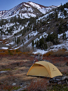
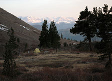
Laurel Creek Camp
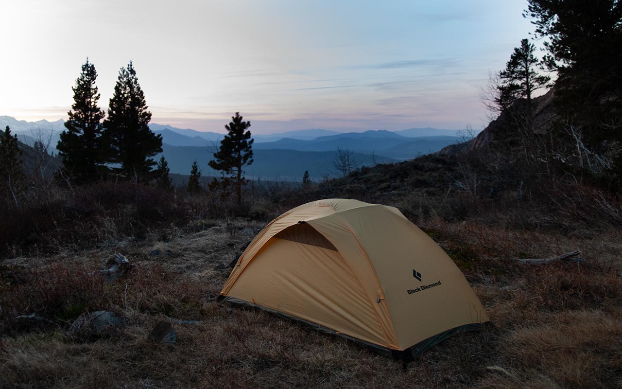
My unsuccessful stint as a backcountry bicyclist leaves me far behind schedule. I won't be making Laurel Lakes tonight. Instead, as the sun begins to set I camp lower in the drainage, in a boggy valley around 9200'.
From my campsite, tomorrow's route is far from obvious. The Laurel Creek Drainage curves westward, out of sight. The mining road climbs high to the east, then vanishes into the snowfields due south. I see ski tracks going in both directions.
My more pressing concern, however, is how to get to the snow. Coverage is spotty ahead, but there is a tree-protected patch along the banks of Laurel Creek.
I'd like to follow the creek straight up, but the terrain looks especially willow-choked.
Bushwhacking concerns aside, if that snow doesn't freeze overnight, ascending it could easily become a nightmare.
But, with a cold wind howling through the drainage, I'm confident the temperature will drop enough to harden the snow.
I hope.
The other, less appealing option is to backtrack to the road, and hike on foot up the switchbacks on the opposite side of the drainage.
This adds distance over dry ground to the journey, but has the advantage of being straightforward, with no brush, scree, or other obstacles to contend with.
In the meantime, I set up camp, then wander about the boggy meadow, looking for a way through the willows. As night falls, I'm still not sure whether to stick to the road, or try to climb directly up the drainage. I'll decide in the morning, I guess.
Off-Route Adventures
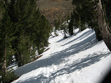
As dawn breaks I am headed up the western side of Laurel Creek Drainage, trying to quickly get on snow rather than hike up the road to the east.
Despite the fact that a road leads all the way to base of Bloody Couloir, it is not impossible to get lost in this area. The drainage curves in a giant "S", and Bloody Mountain's summit is not always visible. Ski tracks may lead in a variety of directions.
Additionally, of course, there's always the possibility you might decide to abandon the road and strike off on your own. From my camp site I march due south through the bog, trying to keep my feet dry.
Once I reach the edge of the meadow, the snow is tantalizingly close—but the willows aren't going to allow any trespassing.
I bang around a bit in the thicket, get turned back, turned back again, and finally decide to cross the creek. That puts me on the western side of the drainage—opposite the road.
In general, it's not good to be on the opposite side of your route, but all roads lead to Rome, don't they?
The payoff is supposed to come right away as I step onto the snowfield that leads up the floor of the drainage.
I plan to snap on my crampons and hike right up the frozen spring corn. Instead, when I step on the snow, it's just absolute fracking¹ mush, bottomless mank that I plunge waist-deep into, filling my ski boots with snow and willow-twigs.
Did I mention I left my climbing skins at camp? I'm not even going to attempt to explain the thought process that went into that decision. Suffice to say, sometimes I really, really annoy myself. Thirty minutes in, it looks like this hike is over. I'm wallowing in snow and willows with all the grace of a legless gazelle.
My strength and determination succumb to sheer reality: I can't continue post-holing up snow this deep. The only possible way up is to abandon the snow, heading farther west toward bare talus. If all goes well, I'll gain enough altitude to reach harder snow, which I'll then be able to cross to rejoin the road and get back on route.
It's always a bad sign when talus is better than snow. But, talus it is—and finally, I'm making some upward progress. I pass ancient rusted cans and pipe sections—remnants, no doubt, of miners past. That, at least, explains who built the road. But where is the mine, I wonder?
By skirting the edge of the snowfield, I am able to top a small saddle roughly 500 vertical feet above the meadow where I camped. The saddle is snowbound, but the snow is indeed harder here, enough so that I can trudge across it without falling to my waist. Instead, I plunge to my boot-tops with each step. But it's enough to let me cross the drainage and regain the road.
Up the Apron
Bloody Mountain & Bloody Couloir
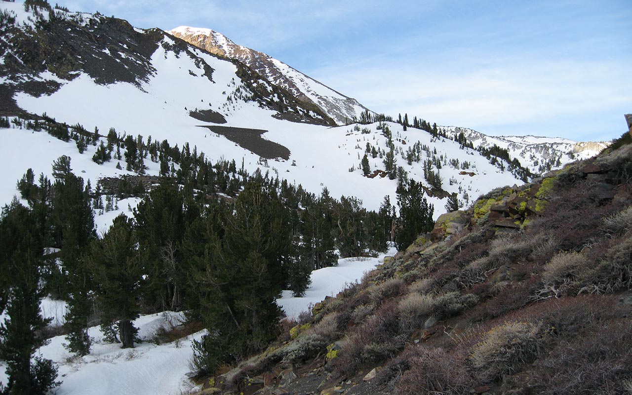
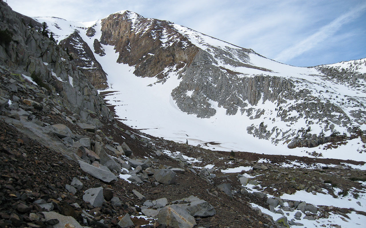
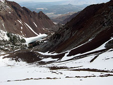
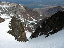
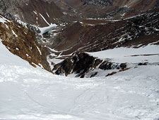
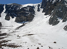
From the saddle above the lower drainage, the road traverses west a short hundred yards or so, and for the first time the entirety of Bloody Couloir springs into view.
About 400 vertical feet below-right are the scenic and currently-frozen Laurel Lakes. But the attention-grabber is the Couloir itself: 2500 vertical feet of snow. How steep is that headwall, I wonder? Two prominent rock buttresses split the Couloir, dividing it into Bloody Left and Bloody Right.
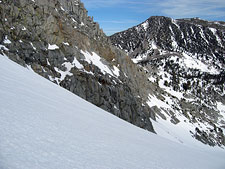
Left is broader, its angle moderate, and (thanks to better sun exposure) more favorable snow. Bloody Right, on the other hand, sits deep within a shadow-well of rock walls. The chute looks steep, narrow—and irresistible.
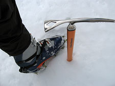
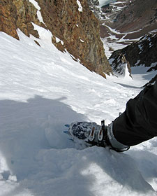
Out come the axe & crampons, and soon I'm climbing up Bloody Couloir's broad apron.
The snow is softer than I'd like. I veer left and right, trying to find harder snow to keep from post-holing.
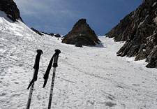
Here on the couloir's lower slope, ascending via climbing skins and skis would be ideal.
My ascension skins, of course, are sitting in my tent right now.
But I'm too happy to be disgruntled—it just feels good to be back in the mountains, on-route, with nothing between me and the summit but good old-fashioned effort.
And so I settle into the rhythm of kicking crampons into snow, timing my breathing, heading up.
Thankfully, despite my misadventures below, I've no need to hurry.
High clouds above keep the sun from baking the snow, buying extra time for the ski descent.
Bloody Couloir's topography also helps protect the snow—high cliffs line both side of the Couloir, hiding it from the sun.
While the extra shade keeps the snow cold, it also slows the consolidation process—and that's quite evident today.
I was expecting to see nothing but well-consolidated spring corn here on Bloody Mountain.
Instead, even on the lower reaches, the snow is still in a transitional state: crusty on top, softer underneath.
Would it be too much to hope for powdery slopes above?
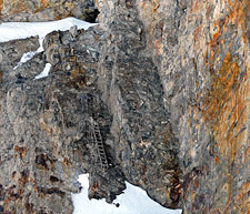
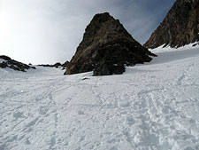
The going is slow: 900 vertical feet of broad apron (the triangular-shaped debris field typically found beneath a chute) to get to the start of the Couloir, proper. I stop to take a few photos, drink water, and snack on something salty. When I reach the entrance to the Couloir, I finally spot the missing mine. A dark hole lurks in the rock buttress immediately to the east.
Say what you will about those old prospectors—they were certainly a hardcore bunch.
I see a sketchy network of rotting ladders leading to the mine, with even more exposed ladder-remnants leading to another tunnel above. The though of climbing up and down this Class 4 deathtrap every day to get to work does not sound appealing. Of course, I have my own climbing to do as part of today's work.
Bloody Couloir awaits—and another 1600 vertical feet to the summit.
Climbing Bloody Couloir
The angle steepens once I pass beyond the mine tunnels and enter the snowy gully between Bloody Mountain's north buttresses. I spot a faint boot trail and veer toward it.
Climbing in the footprints is much easier than breaking trail myself—though the steps occasionally vanish, obliterated by recent wet slides. The snow is unexpectedly quirky: a blend of winter snow (from a recent storm) and poorly-consolidated spring corn.
Mixed in are frozen Rollers (balls of snow) of various size. This is not the kind of surface that makes for favorable skiing. It also merits a close look for safety considerations. I note that the snowpack, in general, is well settled, and fluid, rather than brittle.
The surface is frozen into a thin crust, and when I probe beneath, I find the density below generally increases the lower I dig.
My somewhat primitive assessment is that the primary danger today will be radiation-related—as the sun warms the snow, it will destabilize.
Given the cloud cover above, the shadows cast by the couloir's cliff-bound walls, and my early start, I expect to be up and down before any problems materialize.
As for the skiing, perfect corn snow would be nice, but I'll take what I get. Anything but ice is my motto on the steeps.
So the climb continues.
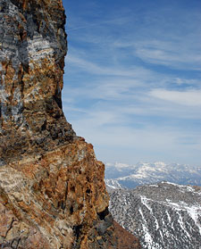
No discussion of Bloody Couloir would be complete without mentioning the region's spectacular coloring.
The dark rock of the buttresses and pillars bear veins of red, yellow, orange, and gray.
With the sun hidden, these colors have been mute.
But, as I slowly gain altitude, the sun begins to poke out from behind the cirrus clouds above, and the colors spring to life.
My approach route is visible below, with the Laurel Lakes a vivid blue in the distance.
The angle through the couloir's midsection strikes me as moderate: in-bounds expert.
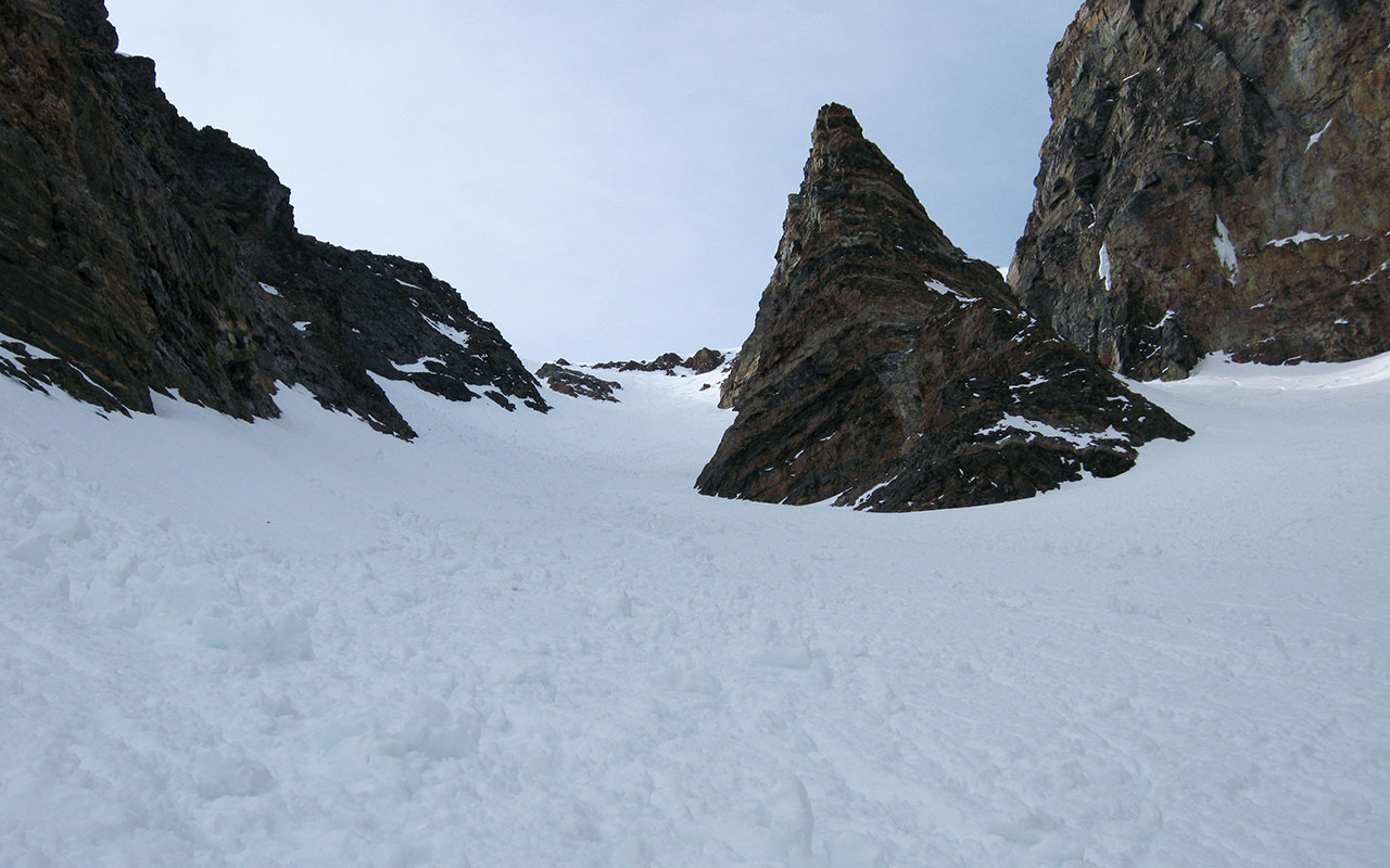
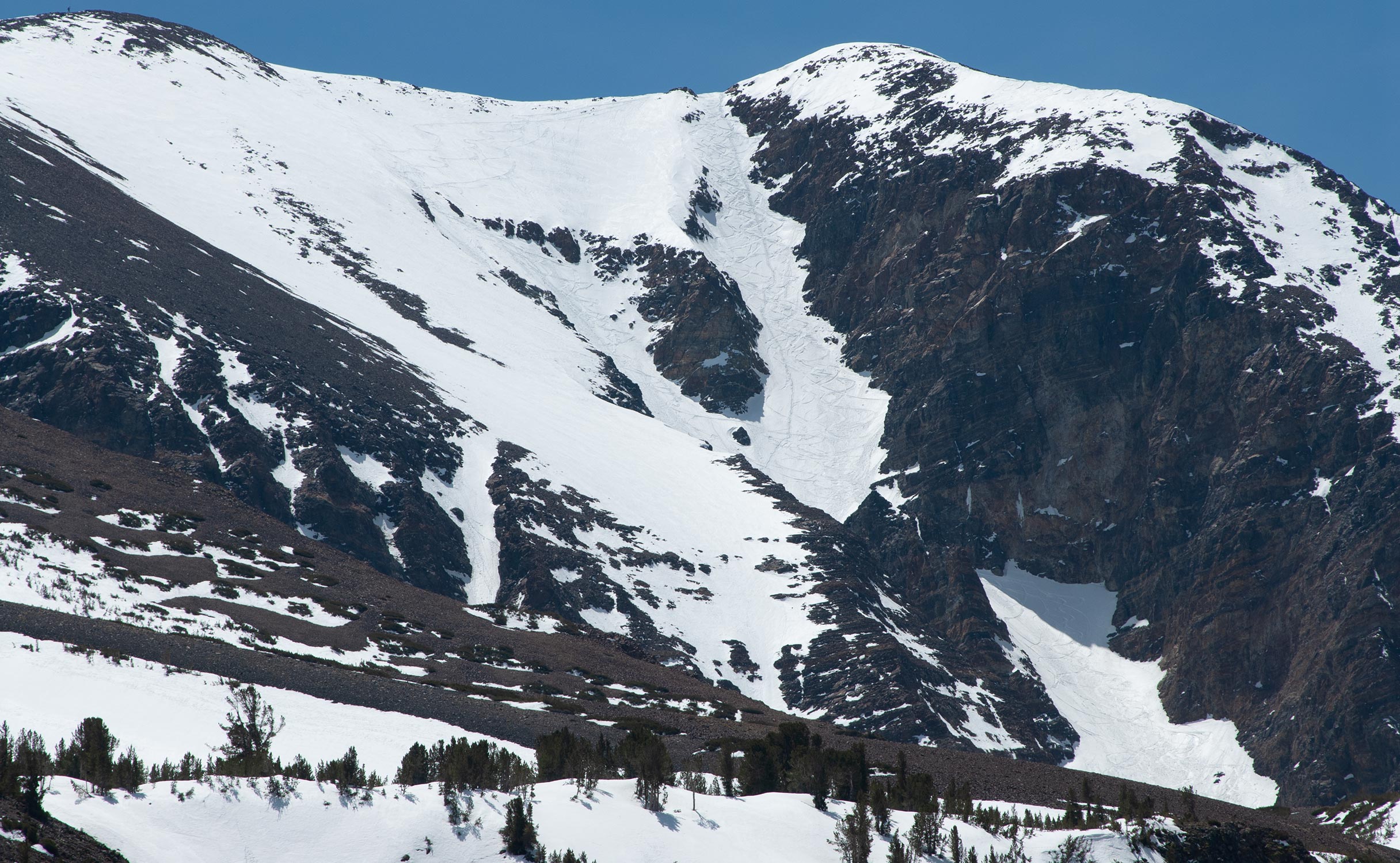
I pass the pyramid-shaped First Pillar.
Now, Bloody Couloir's two main options are clearly visible, divided by the Second Pillar.
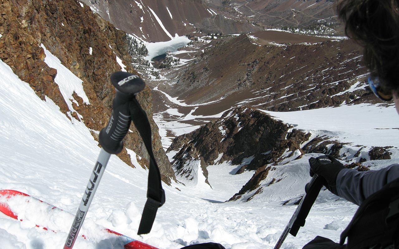
The gully to the right of the upper pillar is noticeably steeper than the main couloir, to the left—but how steep is it?
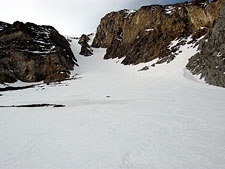
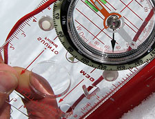
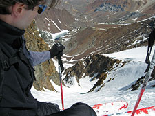
Wanting to get more objective route information this season, I've begun carrying an inclinometer. When I get well into the steeper upper section, I stop and take a measurement of a representative section. To this point, I've felt quite comfortable with the angle in the couloir. I don't expect to measure anything over 45°
Three readings later (to get an average), I'm surprised to learn that Bloody Couloir's crux approaches 50°. That's steep enough to spook me. I take a careful look down the hill, contemplating the suddenly-apparent exposure. Yes, I think to myself, there is a bit of air down there, after all.
Self-induced vertigo aside, it's time to finish the climb. I kick steps up the couloir's remaining two or three hundred vertical feet, filled with anticipation of the ski descent ahead.
Summit Views
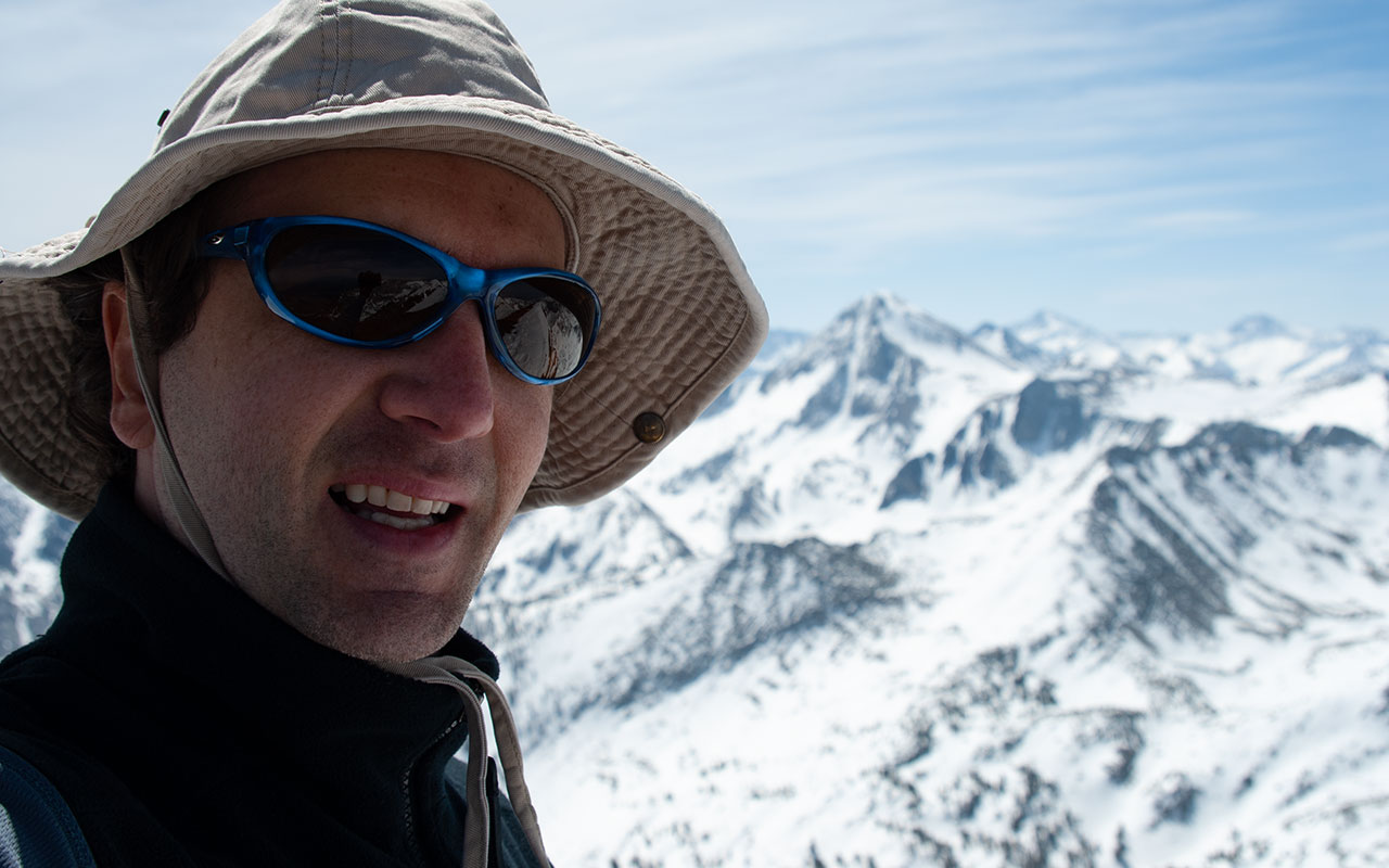
Atop 12,544' Bloody Mountain, I am greeted by warm temperatures, a gusty southwest wind, and expansive views of the surrounding Sierra Nevada Mountains.
Thanks to a narrow strip of snow traversing Bloody Mountain's sharp ridgeline, it will be possible to ski today from the peak's very summit—always a plus when it comes to collecting style points. I sit on the lee side of the summit and eat lunch, enjoying the panorama.
Mount Morrison's dark, fractured summit lies just a short distance to the east, looking every bit as menacing as you'd expect.
Though details remain sketchy, Morrison's northwest couloir (a.k.a. the "Death Couloir") was reportedly skied in 1997, made possible by the heavy snowfall of an El Nino Winter
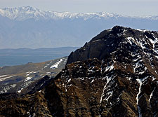
Beyond Morrison, on the Nevada border, is California-Fourteener White Mountain.
Another local treasure, for backcountry skiers, is Red Slate Mountain, due south, and its gorgeous Red Slate Couloir.
Bloody Mountain's summit offers a birds-eye view of the aesthetic couloir.
For many skiers—myself included—Red Slate Couloir is on the must-do list.
Unfortunately, things look a little bare on Red Slate this year—at least on the couloir's upper section.
That coveted ski descent will have to wait until next year.
Just left of Red Slate Mountain, I see a high black spire on the horizon.
Could this be Mount Humphreys, I wonder?
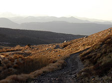
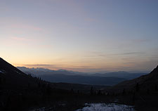
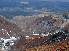
Looking north, our vista is dominated by the wonderful sweep of the Laurel Creek Drainage.
The postcard-perfect drainage stretches from my toes clear down to Highway 395, a vertical mile below. And this view, more than any other, seems to encompass the full range of Bloody Mountain's striking colors: red, blue, orange, green, gray. Laurel Lakes Road is plainly visible zig-zagging its way up the drainage's eastern slope, as is the boggy meadow where I camped last night.
In a normal snow year, it would undoubtedly be possible to ski all the way to the meadow, and perhaps beyond. I sign my name in the summit register, then pack up my belongings and begin the shift from climbing to descent mode. It's time to ski.
The Descent
I snap my skis on beside Bloody Mountain's summit cairn and traverse the narrow strip of snow between the west and east summits. From the day's ignoble start—floundering in the lower Laurel Creek Drainage—it is a dramatic change of fortune to be skiing now from the very top of the mountain.
I stop at the top of my chosen descent route. The slope has a bit of a roll to it, so that the couloir itself isn't visible from above—a good reason to always climb what you intend to ski. As I peer over that roll, contemplating what lies beneath, I have to admit I'm intimidated.
This has little to do with what's happening around me and everything to do with what's happening in my mind. 50°, my mind is whispering.
Do I ski 50° slopes?
Yes—and steeper. But I don't usually stop to measure them. This objective bit of data cuts both ways: it raises my mindfulness of risk, which is good.
But it also raises my anxiety—and this is no friend of the steep skier.
I drop into the chute carefully, bouncing my edges to get a feel for the snow and the steepness. If I'd been hoping for consolidated spring corn, the reality is much less pleasant—crusty, transitional, unconsolidated mank laced with ice balls.
For good measure, the snow is also cut up with skier and snowboarder tracks from the previous week's storm.
This will not be easy.
One of the most seductive aspects of skiing the steep, I find, is the intense confrontation it forces between faith and doubt.
Perched high on a snowy slope with slippery sticks strapped to one's feet inevitably rouses the ancient howl of our self-preservation instincts. Here, with the forces of doubt screeching in all their overpowering glory, the steep skier learns not only to cope but to thrive.
The first turn is literally a leap of faith—in your skills, your experience, your judgment, yourself.
Time and again, I have stared down that void and wondered how I was going to make that first turn.
And each time, as I do now, I quiet my doubts, plant my pole, and drop in.
Beyond the mental challenge, a key technical aspect of skiing steep terrain is getting an efficient unweighting motion. Inexperienced skiers, experts included, may try to use vigorous upward motion to initiate their turns on steep pitches.
These attempts at 'hop' turns break down as the angle exceeds 45°. An alternative is to ski not up but out, using gravity and the airy void beneath your body to create separation from the hill.
Begin with a subtle upward motion—a sequential extension of the legs.
Simultaneously, allow your upper body to flow out and down (the brain loves this maneuver).
Pivot your skis through the resulting space between yourself and the hill by flexing (raising) your legs in one deft motion.
This technique is based on the turn developed by French Extremists Anselm Baud and Patrick Vallencant in the 1970's to cope with the horrifically steep slopes of the French Alps. Frozen via photograph, skiers will appear mid-turn to be skiing directly down the hill, shoulders square to the fall line, legs together and flexed.
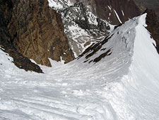
When executed correctly, the turn is extraordinarily fluid and graceful. My efforts today are greatly hindered by the crust, which forces me to break my skis loose before I can pivot them. But my descent is safe and steady—and that is the ultimate goal. Skiing that cranky crust through the upper steeps and then the main body of the couloir proves to be an exhausting endeavor.
I keep hoping the snow's surface will smoothen, but the snow remains quirky all the way to the bottom of the couloir. There, at last, the surface consolidates, and I am able to make sweeping GS turns as I schuss down the apron. Midway down, I stop to swap information with a skier making a late ascent of the couloir. I offer the requisite warnings about the warming snow, and then I'm off. A few turns later, I reach the end of the line.
I stop to look back up at Bloody Mountain's north couloir, studying the line I've just skied. Unquestionably, it's a classic—as that well-tracked face attests. Now, the task ahead shifts from climbing and skiing to packing up and hiking down. But wait—there's a bicycle waiting for me at camp. If all goes well, I'll be cruising down that road in no time.
Surely, I think, I'll be able to ride my bicycle downhill. What could go wrong with that?
Bloodied But Unbowed
Bloody Couloir
After walking a short distance, I reach a snowy section of Laurel Lakes Road. This allows me to ski back within about 500 vertical feet of my camp. The rest of the way down the switchbacks is dry.
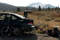
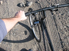
I'm jealous of the parked vehicles I pass en route to my camp. If I had a 4WD, I'd be done for the day. Instead, it's time to resume my unorthodox experiments in backcountry bicyclization. A big problem with the previous day's biking was load carrying.
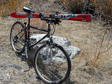
Having the skis on my back seemed to make balance and steering exceptionally difficult. Today, I'm going to try to tie my skis directly to the bicycle.
Hopefully, that will make the ride easier.
It takes a while to figure out a viable means to secure skis to bike. The system I come up with ain't pretty, but it'll work.
With the skis tails pointing forward, I've got just enough clearance to keep my ski bindings away from my knees.
Oh, I hope this is going to work.
I heft my heavy pack and push the bike up a short rise to rejoin Laurel Lakes Road.
And...we're off. Not!
To my dismay, going downhill proves to be just as problematic as going uphill.
The road is too steep, too soft, and too rough.
I bounce like crazy, unable to steer, fighting to keep the brakes just shy of locking.
Soon, my front tire aims for a large boulder. I can't steer around it and crash attempt #1 comes to a halt.
The bike topples over, but I at least stay on my feet.
Hmm. I try again.
Part of the problem, going downhill, is that my pack's weight transfers completely to my arms. It's as if I'm continuously bench pressing seventy or eighty pounds.
The strain on my arms and hands is tremendous. And this is the easy part of the road. Once I hit the switchbacks, I have no choice but to walk the bike downhill.
This is hardly the bicycle salvation I'd envisioned. But, given the right conditions, I can see how bicycling could make for an easier approach. If this was a flat, paved road, I'd have no trouble riding along—and it would be much faster and easier than walking. I try again to ride downhill during another relatively moderate section of the road.
This time, my front tire buries itself in a deep pool of gravel.
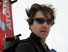
I'm headed over the falls. I try to make a Matrix-like saving twist in mid-air, but forget about that 50 lb pack on my back, which pile-drives me into the stony ground like a WWWF Villain. Ouch! When I pick myself up, I've punched a nifty hole in my arm and I've wrecked my sunglasses.
Eventually, of course, I make it back to my car, more or less in one piece. I only go over the handlebars once more. That, officially, is all I'll admit too. Biking and skiing may not be a perfect match, but the experience has added up to a rousing adventure, filled to the brim with those quintessential backcountry moments that make the sport so inscrutable to outsiders and so irresistible to us free-form disciples.
As for Bloody Couloir, I can't say enough how much I enjoyed hiking, climbing, and skiing the region. I'll be back—of that I have no doubt. But the bicycle will stay at home.