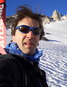
Matterhorn Peak
Skiing The East Ridge Ramp on California's Matterhorn
Matterhorn Peak, California — Surely this must be one of the treasures of the Sierra Nevada. Bridgeport's Sawtooth Range and the surrounding Hoover Wilderness is a lush Alpine wonderland.
Whether or not you agree Matterhorn Peak bears a likeness to its famous Swiss namesake, you'll find the terrain brimming with backcountry skiing possibilities. Among the many fine choices is Matterhorn Peak's East Ridge Ramp, a steep snowfield suitable for advanced skiers and snowboarders.
The angle of the slope will quicken the pulse, to be sure, but the broad runout onto the mini-glacier below adds a considerable safety margin.
Matterhorn Peak is accessible year-round via paved road, thanks to the Twin Lakes Resort. The easy approach, plus the immense terrain variety, make this one of the more notable descents in the range, and a solid starting point for the inexperienced but ambitious ski mountaineer.
In the aftermath of 2005's near-record winter, I decided to do a late season tour in the Matterhorn Peak region, with the East Ridge Ramp as my destination.
Twin Lakes is open year round, and the resort is an impressive reminder that if the fishermen don't yet own the entire Sierra, they will soon. God bless them, however, as they demand and get the paved-road access that backcountry skiers are denied.
You have to pay for parking at this trailhead, as it sits on a privately owned RV park. I packed up and hurried through the park, the skis on my back drawing stares from the barbecuing fishermen and their families who were basking in the warm lakeside sun.
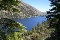
The Twin Lakes area, and the Hoover Wilderness in general, is an especially scenic part of the range. Both lakes sit around 7000' in elevation. Their cool blue waters are surrounded by vibrant green forests that are quite removed from the dry stands of timber to the south.
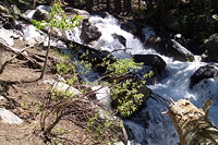
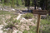
Finding the trailhead, and then taking the quick westward-fork, can be a bit confusing, but once on-route, the trail climbs rapidly along a neighboring stream that's just perfect for cooling off. In winter, this area would be snowbound (the RV park remains open), allowing ski mountaineers to skin up right from the parking lot. Today, however, I didn't expect to see snow until 9000' or higher.
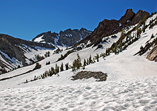
Mountain Meadows
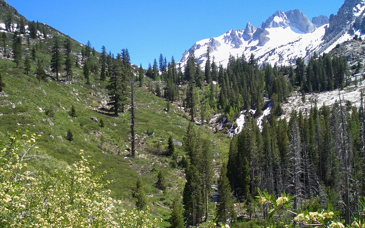
After a series of forested switchbacks that bordered Horse Creek, I gained a saddle, and the canyon opened, revealing a glorious mountain meadow.
The Sawtooth Range rose majestically in the distance, and I found myself tempted to break into song—the Hills are Alive here, indeed. I was beginning to wonder, however, when I would reach the snow. After all, this was supposed to be a skiing adventure, not just a sightseeing foray.
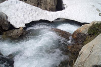
The trail meandered alongside Horse Creek, occasionally dipping in and out of small forest glades. Snow began to appear in patches near the creek, some forming partial snowbridges across the water.
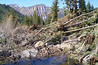
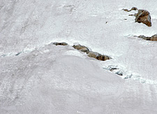
I was pleased to be on a well-maintained, easy to follow trail—another perk that is all too rare in the Southern Sierra. It was therefore something of a shock when the trail suddenly ended in a giant pile of avalanche debris.
This was a most unwelcome development, especially since I had skis on my back. The trail looked utterly impassible.
Not wanting to try to climb a 20' high pile of loose trees and branches, I crossed the creek and made slow progress on the rough talus away from the debris.
This made for a challenging sideshow, easily adding half an hour or more to my travel time, but eventually I got myself safely back on the other side of the creek, back on the trail.
Soon after that, patches of snow began appearing on the either side of the drainage. I climbed perhaps 500 vertical feet higher, beneath a broad snowy slope.
This looked like a good place to stop. From here, I could snap into my skis tomorrow and skin up the rest of the way. With much pleasure, I dropped my pack and began scouting for a good place to pitch my tent.
A Night at High Camp
As the sun begins its journey beyond the horizon, shadows lengthen, and the wind picks up. I wander about camp, taking pictures and sipping tea.
Such quiet moments are priceless to me: when there is nothing to do but wander about, find a fine rock to sit upon, and bask in Nature's serene majesty. There is also the anticipation of tomorrow, and the skiing that lies ahead.
Time passes slowly.
I set a pot of water on the stove, ready for another cup of tea.
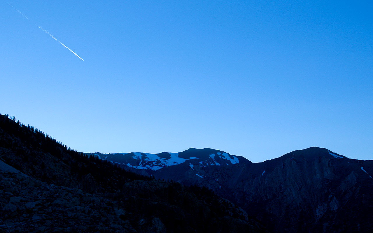
A jet streaks overhead. The wind grows stronger. It's going to be a breezy night.
One by one, the surrounding peaks go dark, until the sun's color remains on only one small spire. As I watch, sipping hot tea, the peak's color intensifies, glowing orange, then red, and then it's gone, and the day settles into night.
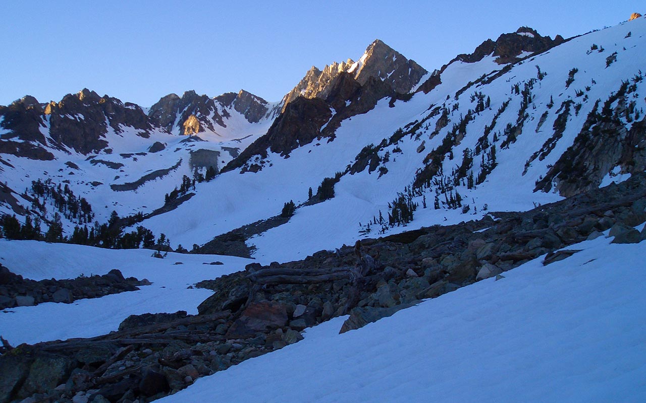
Horsecreek Valley
I awaken just before the sun rises. I've placed a thermometer outside my tent to see how low the temperature dropped overnight. The reading is a disappointing high 40's, but I'm hopeful the snow at higher elevations has frozen.
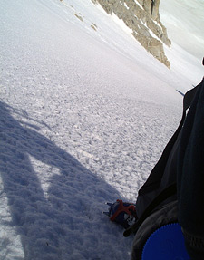
Despite the mild night, the snow beside my tent is firm, crunching reassuringly beneath my boots. I'm using new equipment today: Garmont Mega Ride A/T boots, at a weight savings of nearly four pounds versus my alpine boots.
Climbing in crampons, I notice and appreciate the weight savings right away. But I'm concerned that the boots are too short for my feet. My toes are getting jammed.
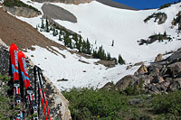
My planned route briefly remains in the Horse Creek Drainage, ascending the broad snowfield over my campsite. I'll need to traverse west at some point to get to Matterhorn's Drainage.
As the sun appears, the wind quickly rises, pushing squarely into my face, as wind always seems to. This constant headwind slows my ascent, but I know I've started early enough to get to the top of the ridge while the snow is still in good shape. When I reach the next saddle I'm concerned that I may have made a mistake in climbing so far to the east. Ahead of me stretches Horsecreek Valley, with its own plentiful ski touring possibilities.
While it's tempting to try one of the many enticing routes ahead, I want to get back to Matterhorn Peak. I see two possibilities: I can gain a rocky ridge to my immediate right, or climb up a steep snowfield immediately ahead, with a tricky traverse toward the ridge line.
That ridge concerns me. I've no idea what's on the other side of it, and if it's a cliff band, I'll be hung up, looking down at my ski descent with no way to get to it. Nonetheless, I decide to climb up the rocky ridge, following snow lines as far as possible upward. Hopefully, the ridge line will put me back on route.
Ascent
When I crest the ridge, I'm pleased to see the familiar spire of Matterhorn Peak ahead. Earlier in the season, it would likely be possible to ascend directly up the rocky face above camp.
I ascend to the left, in the long shadows of early morning, trying to avoid the heat of the sun. Given that it is June, the snow looks terrific, with no sun-cupping to speak of, and a firm, hard texture. The wind continues its assault, occasionally tilting my balance, but I see nothing to interfere with a fine ski descent today.
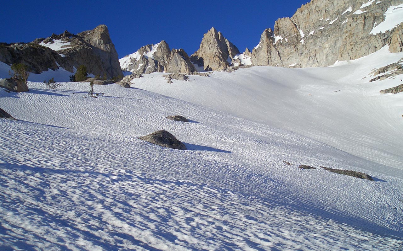
I'm again struck by the quality of the views and skiing. I'm surrounded by wide, open, rolling, intermediate terrain, with abundant chutes and gullies feeding in from the jagged ridge lines above.
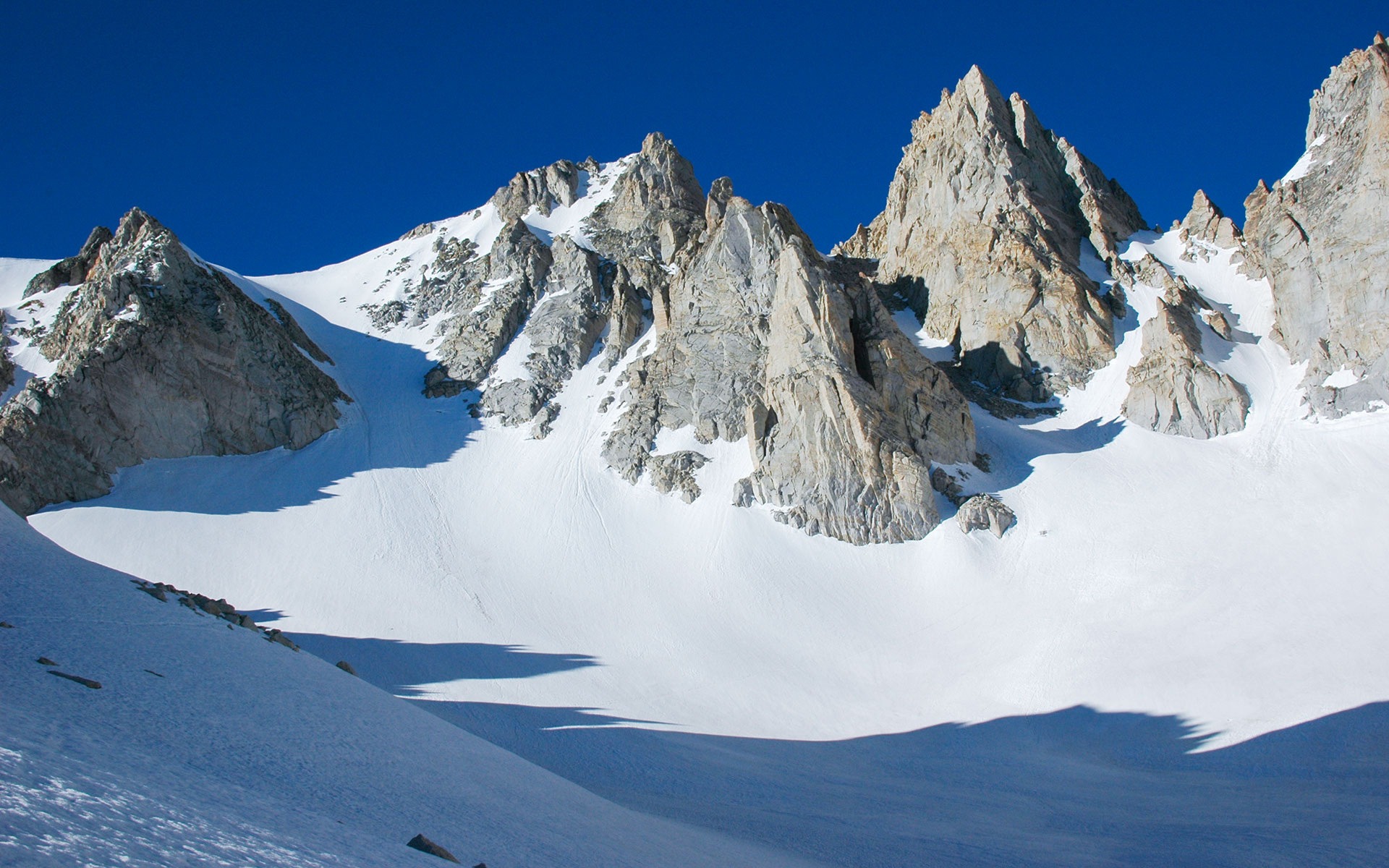
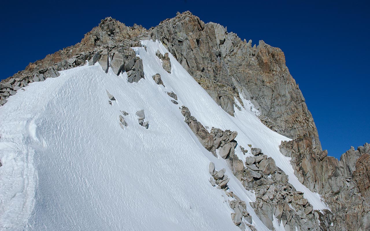
I soon have a clear view of the East Ridge Ramp, as well as Matterhorn Peak's East and West couloirs.
Unfortunately the East Couloir has lost most of its snow, making it unsuitable for descent. Like many of the Sierra's east couloirs, this one has trouble filling in at the top, from what I've heard. I don't know what causes this phenomenon, though I'd suspect the wind is involved.
On the other hand, the West Couloir looks very tempting. I notice that the snow is already sitting in the sun, however. Given the mild overnight temperatures, I decide that the route will probably be too soft for comfort.
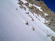
The East Ridge Ramp, however, looks ideal.
Paul Ritchens notes all the Matterhorn routes are steep, but he considers the East Ridge Ramp the best of the lot.
To me, the pitch looks like it's around 35 to 40 degrees, certainly invigorating. I like the broad runout, which makes this a more forgiving route in the event of a fall.
There's nothing to do but start climbing.
I decide I'll stay to the left of the central snowfield, ascending alongside the rocks in shadow.
And what's this?
A bona-fide crevasse appears, though a small one, at that. The mini-crevasse is concrete evidence that I'm on a small glacier.
This is in fact the bergschrund—the separation between the downward-creeping glacier and the permanent snow pack above.
As I hit the steeper section, the going gets tough. I'm feeling the altitude, and each step is a bit of a labor. The angle remains just moderate enough for me to feel comfortable using French Technique for my ascent: I sink my axe as a belay, and ascend in an odd, foot-over-foot manner that reminds me of a sidewinder's gait.
The technique, however, keeps the feet flat, as they remain pointed across the hill, boosting efficiency and resulting in much less stain on the lower leg muscles. After a brisk climb, I top the east ridge. The wind, temporarily forgotten, now blasts me with 60mph gusts, encouraging little sightseeing. I take a few photos nonetheless, doing my best to keep my gear—and myself—from getting blown off the mountain. It's time for the descent.
Descent
The wind is getting annoying. There's no possibility of wind-loading today to create any avalanche hazard, but constant buffeting confuses my sense of balance.
It's 9 a.m. I'd like to make the scramble up to the summit of Matterhorn Peak, but accessing the top from my position involves traversing over rough ground. I see little evidence of a trail. And the wind doesn't encourage loitering.
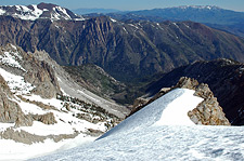
It's hard not to be impressed with the view. The surrounding terrain looks terrific, with numerous chutes and high-altitude snowfields just waiting to be skied.
One could easily spend an entire season here and barely scratch the surface of the ski touring possibilities.
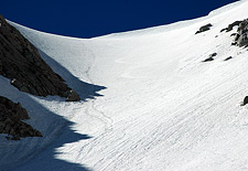
From where I'm standing, the East Ridge Ramp rolls off nicely, disappearing from view.
It's a great way to start the day, nerves a little jangley. The snow is hard and crunchy. A little softer would make things easier, but the wind isn't going to allow that—not for a while, at least.
I'm ready to ski.
I snap in to my skis, taking great care not to lose a pole to the windstorm, and then I traverse into the broad top of the ridge, bouncing a little, trying to get a feel for the conditions.
The steepness keeps asserting itself—this is a great little run!
I can't help but smile as I lay down turn after turn, aggressively anticipating the hill with my upper body.
The East Ridge Ramp turns out be a terrific place to practice your steep-craft, with just the right mix of angle and safety.
Soon—too soon—I've reached the bottom of the steep ridge's face.
I look back, admiring my handiwork. But there's still quite a bit of skiing to be had. I traverse back into Horsecreek Basin, working my way beneath a cliff band. As the slope's aspect shifts more easterly, the snow softens dramatically. The skiing is sloppy: mashed potatoes.
Smallish sloughs peel away beneath my edges, suggesting I get a move on. I wind my way down through several cliff bands, feeling my legs burn from the work. Eventually, I essentially rejoin my ascent route, though I'm a bit higher up the valley. In contrast to the East Ridge's smooth skiing, the snow here is deeply sun-cupped, making for a comical schuss back to the saddle above camp.
Epilogue
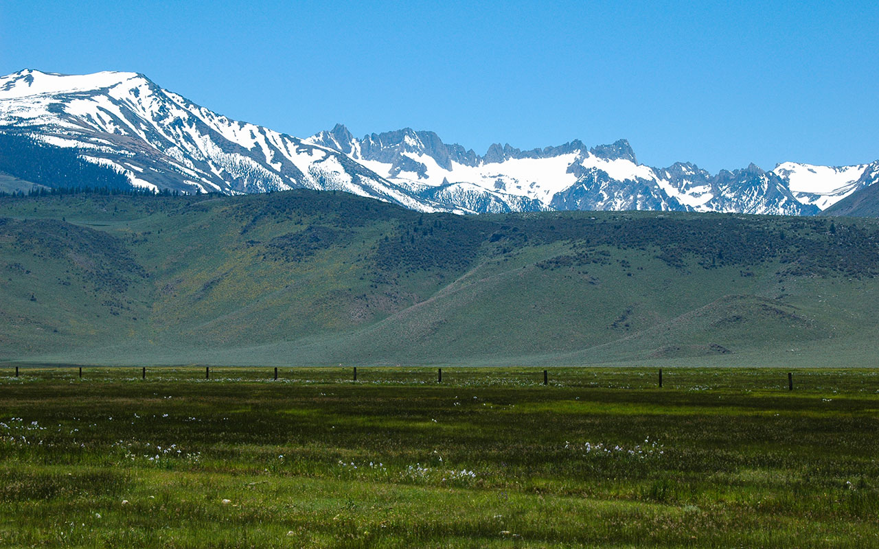
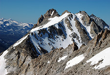
The Sawtooth Range from Bridgeport
It's been a long morning, but I've got a lot of work ahead: packing up, hiking out, and driving back home. My feet register quite a bit of unhappiness as I remove my boots.
My back and shoulders feel cranked from all the carrying I've done over the past 24 hours. I'm not looking forward to putting that pack back on. The lush scenery of the Sawtooth Range helps keep my mind off the heavy load on my back, but I still feel my muscles protesting, and I struggle to avoid cramping, fiddling repeatedly with my Black Diamond pack to try to get the weight to behave.
Beyond scenery, this part of the Sierra offers undeniably wonderful and abundant terrain: the kind of rolling, gentle hills that make Colorado's groomers such a delight, plus the usual suspects—chutes and cliff bands—that make California's Tahoe resorts famous.
The Sawtooth peaks, and the Hoover Wilderness, combine both into one magnificent package. This is ski country, pure and simple, with easy paved road access. The scenery ought to be good, I suppose, given that Matterhorn Peak actually sits within Yosemite National Park.
After a long hike down, I cooled off in the nearby lake, one again drawing the stares of the friendly fisher-persons and company. Their barbecues tempted me to try to buy a hotdog from one of them, but I figured I'd get a bite to eat in Bridgeport. After picking up a deli sandwich and something cold to drink, I rolled casually down 395, heading home. This is the good life, I figure, hiking up and skiing down. What could be better?