The Hotlum-Wintun Ridge
California's Premier Backcountry Ski Descent
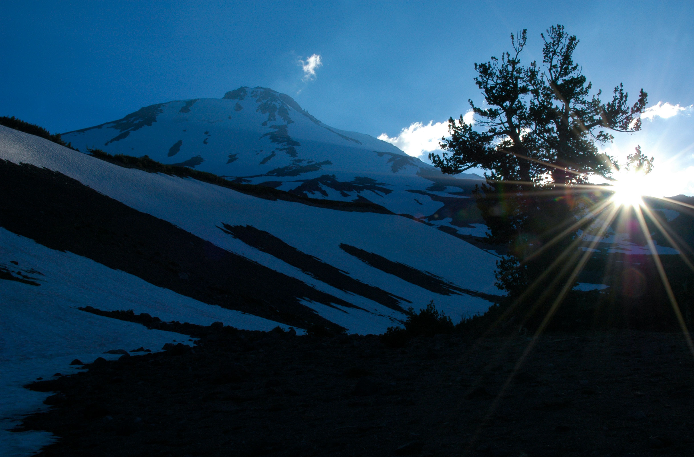
Mount Shasta, California — It feels like a dream. I am camped around 8000 feet, watching the sun drop behind Mount Shasta's Hotlum Ridge, casting giant rays of light that stream across the sky.
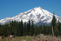
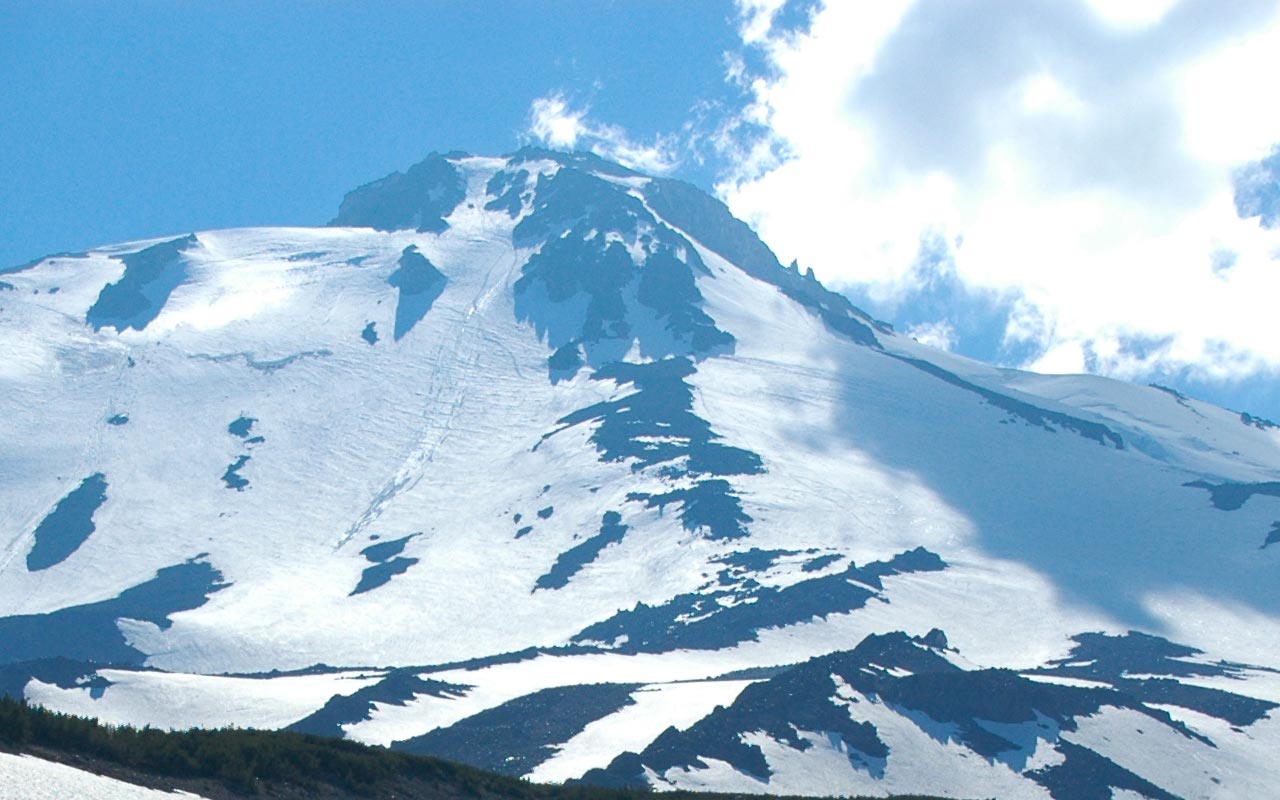
Hotlum-Wintun Ridge splits the divide between Shasta's Hotlum and Wintun Glaciers, offering 7000+ vertical feet of spectacular skiing right from the mountain's 14,132-foot summit. Unlike the popular—and crowded—Avalanche Gulch climbing route, you may well find yourself alone on Shasta's northern aspects, making this route a Soul Skier's paradise.
The Hotlum-Wintun Ridge is accessible once Military Pass Road opens, usually in mid-April. The road to the Brewer Creek trailhead, however, may not be fully open until June or even July, depending on how much snow fell during winter.
Driving 590 miles from Southern California to see Mount Shasta in person for the first time, I really had no idea what to expect. After the seemingly endless stretch of the Central Valley, I at last passed Redding and got my first real glimpse of Shasta.
To those who have not yet stood in person at the foot of this magnificent mountain, I will say only this: go now, and be awed like all the rest of us.
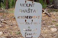
Collect your supplies in the village and the requisite Summit Pass from the Ranger Station in the tiny town of Mt. Shasta, and then make your way to the Brewer Creek Trailhead.
Here, you'll likely find almost supernaturally-easy access to Shasta's snowy north flank, which is broad, sparesely treed, and walk-about gentle. And, unlike those delightfully dry Southern Sierra approaches, you may well encounter snow right at the trailhead—assuming you haven't already been stopped by snowbanks even lower down the road.
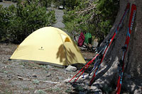
Today, July 20, I find smooth snow perhaps fifteen minutes from the parking lot. My plan is to camp low and wake early, so I find myself in the unusual but welcome position of having an abundance of free time. I amuse myself for a while by melting snow. That done, I wander about the lower reaches of the Brewer Creek Drainage, taking pictures, scouting the mountain, enjoying the day.
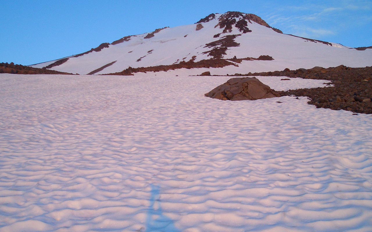
When you drive nine hours to reach a mountain, weather is naturally a concern. I eye the sky warily, but it's sparkling-clear from horizon to horizon. Everything looks good. The weather looks good. The snow looks good. The Route looks good: massive, gleaming white above, a dramatic spine and a triangular spit of snow dividing two bona-fide glaciers.
I find a nice warm rock and lean back against it, gazing up at Shasta, basking in the mountain's incredible magnetism. Tomorrow, if all goes well, I will stand upon that summit and enjoy what must surely be an extraordinary panorama of sights. And then, as if that weren't incentive enough, I will snap into my skis on a warm July day and begin a 6000-vertical-foot ski descent.
Scouting the Ridge
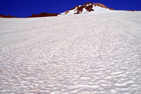
For late July, the snow appears to be in good shape, with relatively little sun-cupping. Earlier in the season, I know, Brewer Creek drainage would be completely snowbound.
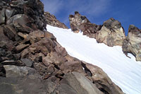
Today, however, I will have to ascend along the north side of the drainage, which still holds several long, continuous fingers of snow connecting to the mountain's upper slopes. The traditional route ascends the obvious ridge between the Hotlum and Wintun glaciers. Around 12,000 feet, where the ridge steepens noticeably, skiers traverse left beneath two obvious rock buttresses, onto the Wintun glacier's upper snow pack, which leads to the summit.
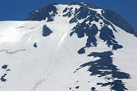
On closer inspection, however, I spy a narrow finger of snow on the ridge proper which seems to go almost all the way to the summit.
The snow appears smoother there, as well as steeper and generally more interesting. I decide I will alter the standard route a bit, remaining on the Hotlum-Wintun spine instead of traversing, following the snow finger as far up as it will take me.
It looks like I may be forced to hike over a short section of talus near the top, but I hope that will prove to be at most a minor inconvenience.
Shasta's reputation can be intimidating.
In fact, I myself have avoided climbing the peak because, frankly, I'm a little scared of it. Mount Shasta is famous for its ill-tempered weather. The mountain stands barely 60 miles from the Pacific Ocean, putting it squarely in the sights of the Pacific storm track.
Any time of year, Shasta can form a menacing lenticular cloud, blanketing the summit in a white-out, assaulting would-be climbers with savage winds, blinding snows, and zero visibility. This is also a mountain whose entire south face is aptly named, 'Avalanche Gulch'. Shasta thus demands a large measure of respect.
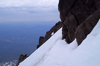
The Hotlum-Wintun route, however, avoids at least a few of Shasta's greater perils by remaining principally on the ridge line, (one must still be on the lookout for small crevasses within the permanent snow pack), making it perhaps one of the safest lines to the summit. The route is also quite straightforward: simply follow the ridge line up, then traverse near the top.
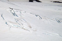
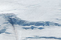
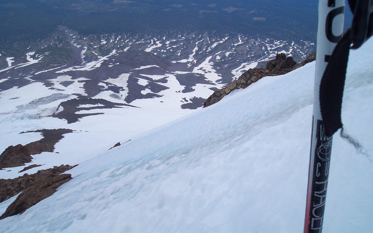
From the ridge's exposed vantage point you'll enjoy outstanding views of the bordering Hotlum and Wintun Glaciers, and their crevasses, seracs, and ice falls, all of which will remain at a safe distance—at least in theory. Meanwhile, I spend a long afternoon wandering the rolling hills beneath that impressive ridge line, pondering past, present, and future, until at last the sun finally sets. Then I retire to my camp, eager to begin tomorrow's ascent.
Dawn Patrol
Wanting to preserve as big a descent as possible, I've camped at a relatively low elevation—around 8500 feet. Consequently, I set my alarm for a very early 4:30 a.m. start.
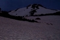
I'm excited to at last be underway. But what's this? As I scan the pre-dawn sky, I see disturbing patterned clouds glowing in the moonlight. It looks like a substantial flow of moisture has ridden in from the south overnight—Monsoon moisture is my guess. I wish I'd camped higher. I can only hope I'm misreading the weather.
But looking at those clouds here in the dark, I'm already betting I'll be racing thunderstorms to the summit today.
Skinning in the darkness, meanwhile, is proving to be a bit tricky. True, with the full moon, the terrain is bright enough for me to see without a headlamp.
But the snow is crunchy, and it's hard to judge exposure in the dark. I decide to switch to crampons and put my skis on my back. The security of crampons makes it possible to travel fast: on hard snow, a boot-hiking climber heading directly up can easily outrace a zig-zagging skier.
Crampons aren't without their problems, however. First of all, you have to learn how to use them, how to swing your legs, ever mindful of not catching the sharp points. And may the gods pity you if the snow softens and you start to post-hole. Efficiency goes out the window then, and the skis on your back grow heavier with each labored step.
As the sky begins to glow with the approaching dawn, I reach the start of the true ridge line. The angle is quite moderate here, and I know I ought to switch back over to skins, but I'm alarmed by the sky and I decide I don't want to take the time to stop and change over.
To my eyes, clearly, the air is loaded with monsoon moisture. I know that sight well, and I know what it means. I'm motivated to keep going, unwilling to give up even the ten or so minutes it would take to change gear. I decide I'll conduct an experiment: a test of crampons' speed and efficiency. The snow still isn't as hard as I would like for crampons, but it's solid enough. I keep climbing.
A Race to the Summit
As the first rays of sun glow pink on the Wintun Glacier, the sky seems momentarily to clear. The clouds dissipate. Perhaps I'm wrong about the weather.
The snow unfortunately softens the instant the sun touches it. Yes, I guess it is July after all. Despite the moderate incline, and the softening snow, I stubbornly remain on foot, hiking in crampons, using my ski poles for balance. No doubt about it: I'm running behind schedule. I'd hoped to be on the upper snow fields by now.
Like most volcanoes, Shasta's size is deceptive. The gradually-sloping angle fools the eye. Moreover, the gently-sloping base requires climbers to travel a substantial distance horizontally.
As the snow continued to soften, and the air began to thin, my pace slows. I find a boot track. By staying in the footsteps, I don't tend to sink as far.
I don't recall who first said it, but climbing offers as much travel within the confines of one's own head as without; I've come to treasure these moments of introspection, when all life is reduced to the simplicity of pressing onward, onward, for no reason other than because you can.
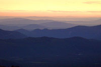
The heart races; the lungs protest. Below, the magnificent sweep of Shasta's girth extends outward. The wind picks up, blowing squarely into my face.
The weight of my skis makes my shoulders ache. The passing time also clears up any confusion regarding the weather: cells of concern are sprouting across the eastern horizon.
As for Shasta, the summit remains clear—for the moment—but a menacing Lenticular is forming about a mile away. Urged onward by the building clouds, I will myself to continue.
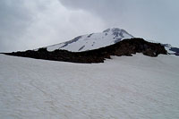
As planned, I break with the traditional ascent route. Rather than traversing left onto the Wintun glacier, I instead veer right, following the steepening snow pack below a band of rocks and cliffs.
At last, I've reached the upper snowfield. The slope steepens. Now, I'm sinking into the snow with each step—bona fide post-holing. The effect on my pace and my morale is devastating. I stop, looking north toward the nearby Hotlum, admiring the glacier's three impressive ice falls.
The weather continues its schizophrenic character. The sky overhead is blue, but the horizons grow darker. Shasta's summit inexplicably remains clear. The cloud formation to the north has returned, darker and more menacing than ever. Meanwhile, the softening snow has degraded to the point that good travel on foot is all but impossible. I head for the rocks to scramble up raw talus rather than continue this dismal post-holing.
The soft snow, however, has extracted its price: I'm wasted. Overhead, wisps of clouds suddenly streak from Shasta's summit. Still on the rocks, I veer toward the Wintun glacier. A short traverse shows I'm within perhaps two or three hundred vertical feet of the summit. To the southeast I now see a horizon darkened with rain clouds, all of which are rushing toward me.
The lead offender is perhaps 30 minutes away from the summit. I look upwards, gauge my possibilities. Given my energy level, I doubt I can reach the summit in time. Still, I give it a try. The cloud and I jockey for position, trying to be first to the top of the mountain.
Descent
The storm wins the race. The transition from clear weather to foul is striking: the moment the cloud reaches the summit, I am blasted with wind and falling snow.
Now only fifty vertical feet below the summit, I'm hugely tempted to keep going, weather be damned. Then again: it's time to descend. I've no desire to be standing on the summit when the lightning starts. I drop my pack and hurriedly switch over to skis. Then I ski down a nearby finger of snow, which hangs somewhat perilously over the Hotlum Glacier's headwall.
There's a patch or two of blue ice along the way, but the ice has softened to the point that it skis just like snow.
Still, I'm cautious as I traverse across it, having learned the hard way to avoid ice when on skis. The presence of ice here suggests that in colder times, the standard route, which traverses over the upper Wintun glacier, would likely be safer.
The skiing is good, corn snow at a rousing 35-40 degree angle, but I'm exhausted and spooked by the storm, just trying to quickly burn off some vertical.
Meanwhile the weather has stopped playing coy. It's overcast and/or raining from horizon to horizon.
Once I've dropped below 13,500 feet, I stop, out of breath, legs mushy-jello, feeling fully disgruntled by the conditions.
'Ten percent chance of Thunderstorms, eh?', I repeat to myself over and over, an angry mantra, as I survey the horizon.
Settling down to the business of skiing, I negotiate the tricky section above the Hotlum headwall, traversing back to the safety of the Hotlum-Wintun ridge's upper snow pack. The skiing gets mushy, but this mitigates the increasing runnels and sun-cupping. If I wasn't so tired, it would make for a fine run, but my race to beat the storm clouds has left me with little energy to spare. It's hard not to feel good about skiing in July, however, summit or not. And this descent marks the highest point I've skied from, by far, with a starting point over 14,000 feet in elevation.
Before I know it, I've reached my base camp, over 6000 vertical feet of skiing, officially qualifying the day as epic, rogue weather or not. I snap out of my bindings and look back at the mountain. I can't help but wonder what this route might be like under slightly more favorably conditions. I imagine the Hotlum-Wintun ridge blanketed from top to bottom with perfect, velvety corn snow...
Today, however, the rain begins to pour as soon as I flop into my tent. I rest until the squall passes. Then, in a cool drizzle, I pack up, heft my backpack, and hike back to the car. Less than an hour later I'm back at the trailhead, switching to dry clothes, still thinking about that missed summit, and already planning my return.