Island in the Sky
Hiking San Jacinto Peak via Round Valley Trail
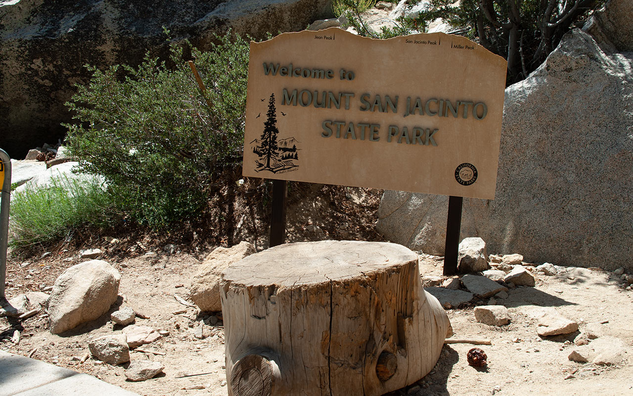
San Jacinto Peak — Call it Southern California's Hanging Gardens. The 14,000-acre San Jacinto Wilderness and State Park is a lofty haven of forests and meadows.
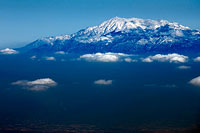
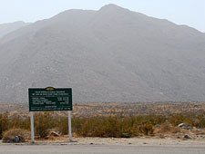
Like the Sierra Nevada Mountains to the north, the San Jacintos were formed by powerful fault action that fractured the Earth's crust, thrusting the range's bold northeast escarpment upward—and creating one of the most dramatic juxtapositions of desert and alpine landscapes to be found in North America.
Perched high above Palm Springs, temperatures in the San Jacinto Wilderness average in excess of 40 degrees cooler than the desert floor, providing a welcome escape from the heat in summer, and a fine Nordic playground in winter.
Due to the range's remarkably abrupt rise from the desert floor, author John McKinney (Day Hiker's Guide to Southern California) calls the San Jacintos an "Island in the Sky."
But even that phrase fails to evoke the sheer verticality of the place. San Jacinto Peak's summit lies a mere five horizontal miles from the city of Palm Springs.
Such close proximity has led to the creation of several unofficial "trails", including the Skyline or Cactus-to-Clouds climb, an extreme hike from the end of Palm Springs' Ramon Road, elevation 400 feet, to either the 8516' top of Mountain Station or 10,804' San Jacinto itself.
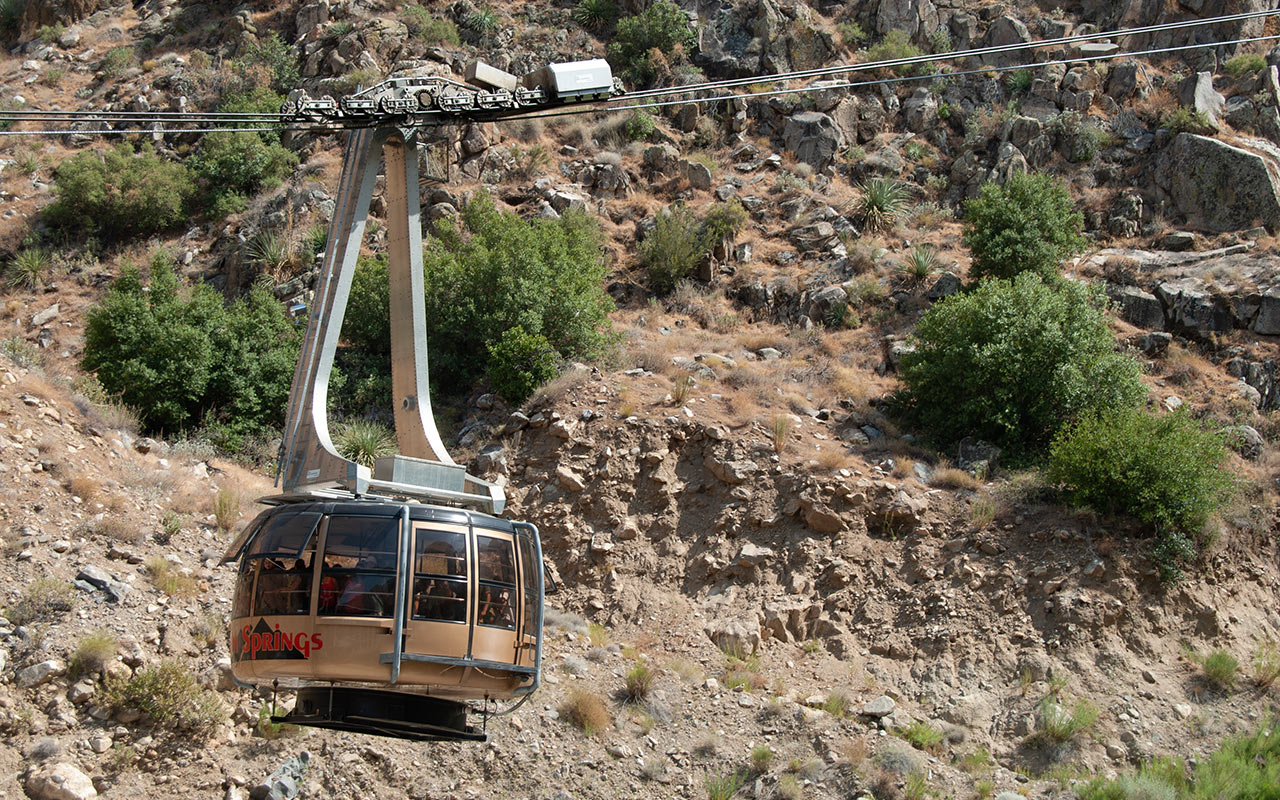
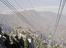
Thankfully, there is a much easier route to the summit: the Palm Springs Aerial Tram, which gives visitors a 6000 vertical foot boost in a vertigo-inspiring fifteen minutes. However you choose to get there, the view from the top is well worth the effort. Hikers and climbers will find the experience similar to looking through an airplane window...without the plane.
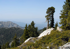
Looking down—seemingly straight down—from the summit toward Interstate-10 some 10,000 feet below, the mind boggles as it tries to contemplate the simultaneous sense of closeness and great distance. On a clear day, the view is a 360 degree feast that includes the Pacific Ocean, the San Gabriel and San Bernardino Mountains, the Los Angeles Basin, portions of Mexico and Arizona, California's High and Low Deserts, and places beyond.
Take the Tram
Despite my conservationist roots, I've come to appreciate the wisdom of exposing people to wilderness—especially those who would otherwise never experience it. True, such intrusions are not without cost.
But people can be changed by nature, and the value of such transformations can be formidable indeed. The Palm Springs Aerial Tram accomplishes exactly this purpose. Without it, only a handful of extreme hikers would ever access the San Jacinto Wilderness from the north. Via the Tram, hikers and sightseers are whisked from the desert's chalky sand to cool mountain pines and meadows, which they may wander at their leisure.
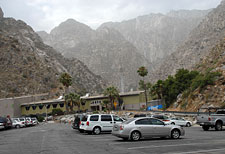
My brother and I agreed to meet at the Tram's parking lot early on a Sunday for our own adventure in the San Jacintos.
Oddly, I'd never hiked to the top of Mount San Jacinto.
Too many other California mountains had grabbed my attention instead.
But San Jacinto was a prominent target for my brother, who was spending a year in nearby San Diego, and often saw the peak's impressive outline on the horizon.
So we'd agreed to climb it.
Driving east on the 10 freeway, temperatures were already in the nineties by seven a.m.
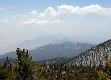
The sky over the Los Angeles basin was thick with smoke from severe forest fires over the San Bernardino Mountains, mixed with an unwelcome flow of monsoon moisture coming up from Mexico.
Southern California thunderstorms are rare, even in the mountains, but every so often the monsoon drifts westward, making severe storms possible.
As I waited at the parking lot for my brother to arrive, the sky was dark and discouraging. A group of German tourists approached and asked if I thought it was worth it to buy a Tram ticket. I told them I figured the Tram would get us above all the smoke, at least—but I didn't tell them I expected it would be raining at the top by the time we got there.
My brother arrived. We bought our tickets and boarded the Tram. For those who've never taken the Palm Springs Aerial Tram, the ride alone is well worth the ticket price. The steep and rapid ascent up 6000 vertical feet is inspiring. A little terrifying, too, unless you're extremely fond of heights. Most impressively, the Tram takes you to another world in the span of fifteen minutes—Cactus to Clouds indeed.
With each tower we passed, the Tram car would make a great, swooping arc that filled our stomachs with butterflies and made our knees shake. In its current incarnation, the Palm Springs Tram features a rotating cabin to allow travelers a 360 degree view. While this design probably looked good on paper, in person it is primarily just annoying. Let us hope the powers that be will eventually replace it with a more classic cabin.
Regardless, the view as we ascended grew more and more impressive. The Tram's base station and parking lot soon vanished in the distance. And, as I had hoped, the Tram did indeed take us up above the smoke. Better yet, the clouds melted away, revealing a bright blue sky overhead.
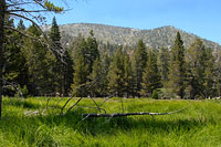
Round Valley
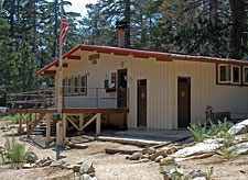
Arriving at the tram's Mountain Station, elevation 8516, my brother and I stepped out into cool air that was rich with fresh pine. Mountain Station features a restaurant, snack and gift shops, and restrooms.
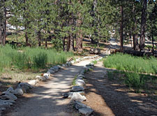
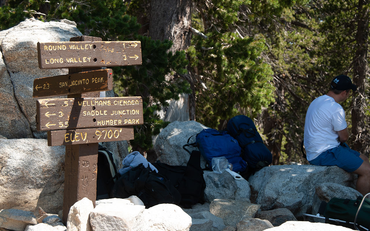
It is also a key access point to several trails, including a short nature loop. My brother an I hefted our packs and hit the trail, following the ample signs pointing toward Mount San Jacinto. Because this is an official wilderness area, backcountry travelers must get permits if they travel beyond the nature loop. These are available for free at the Ranger Station.
From Mountain Station to the Summit of Mount San Jacinto is approximately six miles one-way, with an elevation gain of 2300 feet.
For hikers looking for a shorter adventure, the Desert View Trail is a 1 1/2 mile loop with outstanding views of the Coachella Valley.
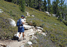
The initial phase of the climb up San Jacinto takes hikers across a series of gentle valleys, traversing alongside a quiet creek.
My brother set a quick pace across this relatively flat section, and I did my best to follow, wondering if he'd slow down at all once we started climbing.
Of the two of us, I was potentially the fitter, but my brother is younger, and he likes to put a kick in his step, so I expected we'd be racing along all day.
We passed many day hikers heading up and down, as well as a surprising number of overnight backpackers.
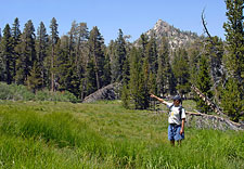
The San Jacinto Wilderness is a popular backpacking destination, though camping is only permitted in a limited number of areas. Sight-seeing in the Round Valley area is rather limited at first, as you travel flat country through dense forests and glades. The day warmed quickly despite the elevation. I stopped to take some pictures, drink some water, and generally catch my breath.
It was good to be up in the mountains with my brother.
We get few chances to hike together nowadays. There was a time when my brother was a fanatic solo hiker of canyons and deserts, traveling some of the most remote and beautiful lands in the Desert Southwest. At the time, I was wrapped up in my own concerns, unwilling and/or unable to join him. Now our roles seem to have reversed. In any case, it is cause for celebration whenever we venture into the high country together.
Wellman Divide
Eventually, my brother and I crossed Round Valley, and the trail began to climb. After a quick 700 vertical foot gain, we arrived at Wellman Divide, a spiny ridge overlooking the south side of the San Jacinto Range.
From the Divide, hikers get a good look at how small and isolated the fin-like San Jacinto Range actually is. Seeing the spectacle of the range's north side before us, as well as a large crew of resting hikers, I briefly wondered if we had already reached the summit. No, San Jacinto's peak is still another thousand feet higher. Wellman Divide is however a fine place to stop and rest, which we did.
Following the relatively limited views along Round Valley Trail, the wide-open panorama was a refreshing change.
Hemet and Murieta/Temecula lie due West, along with the Pacific Ocean.
To the south are the Santa Rosa Mountains, and the town of Idyllwild, which provides access to Suicide Rock and Tahquitz Peak, favored spots for Southern California rock climbers.
After bartering peanuts for sunflower seeds, my brother and I left Wellman Divide, and soon reached a series of long switchbacks.
Backcountry skiers take note: this east-facing section is a wide-open expanse of rolling intermediate terrain, well deserving consideration.
As we passed above 10,000 feet, I was relieved to see my brother slowing down—at least a little. As a sea-level dweller myself, I notice this to be the point at which I typically find my own performance level plummeting.
The hike up Mount San Jacinto may be short, especially compared to my recent adventures to the north, but it remains a strenuous little climb.
For our efforts, however, we were treated to increasingly expansive views to the east. Much of the north and eastern horizons were veiled with forest fire smoke, but we could now look back toward Mountain Station and Round Valley.
I noticed some cloud buildup to the east, but nothing of concern. Overhead, the sky remained cloudless. The air remained stubbornly warm, easily in the mid to upper seventies, with no hint of a cool breeze. And the switchbacks went on and on, as switchbacks always do.
San Jacinto's Summit
Are brothers competitive? Maybe just a little. Despite the heat and elevation, My brother and I pushed the pace up the final section relentlessly, unwilling to give an inch.
Finally, below the jumbled blocks of granite atop Mount San Jacinto's summit, my brother pulled to a halt, saying he needed a rest. Victory! It will be only temporary, of course, as my brother is now on his way to a new home at 7000 feet in the mountains of Northern Arizona, a sure advantage the next time we meet in the high country.
But nonetheless today's round goes to the older brother.
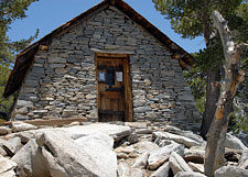
Once my brother's heart valves stopped fluttering, we resumed the climb, passing a stone shelter built in the 1930's by the 'Civilian Conservation Corps', and still in use today by overnight travelers.
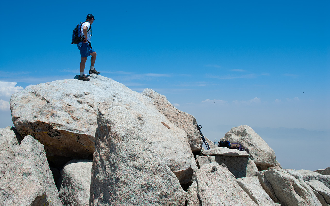
Past the shelter, the trail becomes a class 2 or 3-ish scramble up a hundred vertical foot section of granite blocks.
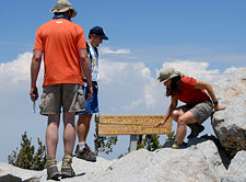
And then, with no further fuss, the trees part, revealing the summit blocks and a sign informing you you've reached the top.
The summit at the moment held a fair crowd of weekend hikers, all of whom were basking in the warm sun.
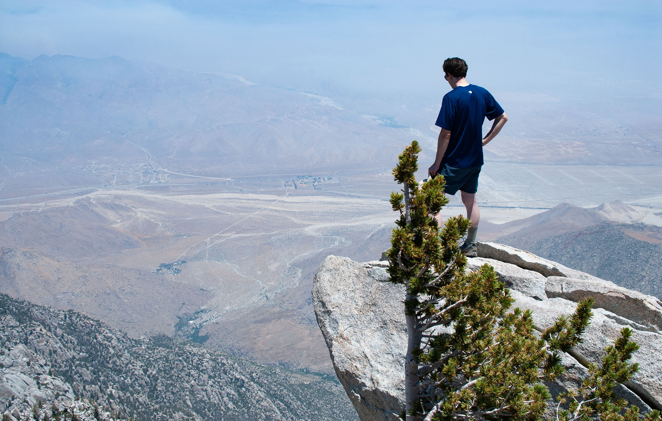
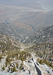
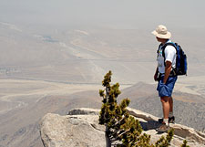
After the mandatory scramble atop the summit block, we worked our way a hundred yards or so to the northeast, escaping the crowds and finding a rocky premonitory that seemed to hang out over the north couloirs and the desert 9500 feet below.
I tentatively inched out along a rocky outcropping until I seemed to be floating out above the desert. Surprisingly, I saw patches of snow still lingering in the couloir below. Now was an excellent time to scout the north face of Mount San Jacinto for future ski possibilities.
The couloir did not look as steep as I expected—perhaps a modest 40° average in the steeper segments. But the vertical drop...
Confronted with such a giant expanse of space, the mind struggles to form a coherent sense of perspective.
Inevitably, the brain compresses the distance, trying to get the view to conform to expected patterns of how the world is supposed to look. But no, there is no way to reconcile it, and so the vertigo becomes overpowering.
John Muir is said to have called the view atop Mount San Jacinto, "The most sublime spectacle to be found anywhere on this earth!" Given Muir's legendary wanderings, that's quite an endorsement. I crept back from the rock and traded places with my brother to get a photo or two, enjoying his wide-eyed look as he cautiously stepped toward the void below.
The hike back down seemed to be quite a bit longer than the way up, and we were both covered in salt and sweat by the time we returned to Mountain Station, some two hours later. There, we washed up, grabbed some pizza and Gatorade, and sat on the station's balcony overlooking Palm Springs, two brothers on top of the world.