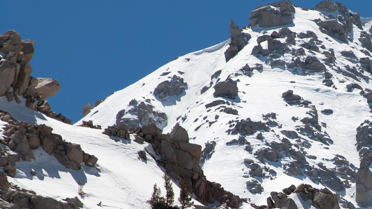
Langley's Northeast Couloir
Skiing the Steeps on California's Southernmost Fourteener
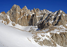
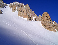
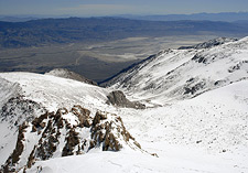
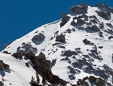
Mount Langley, California — sunlight breaks through swirling clouds, revealing a giant, winding couloir that drop past spires and buttresses to the Tuttle Creek Drainage, 3500 vertical feet below.
I and my climbing partner Dave Silver stop to look up at that inspiring and intimidating line. Tomorrow, if all goes well, we will ascend that spectacular ribbon of snow, following it all the way to Langley's 14,027' apex. And then we will ski it.
Like many people, I saw Mount Langley for the first time while visiting nearby Mount Whitney. After giving up following a particularly unsuccessful attempt to ski Whitney, I found myself with unexpected time to kill.
So I decided to scout the surrounding mountains for other descent possibilities—the most interesting of which quickly proved to be Mount Langley, just to the south.
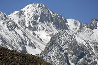
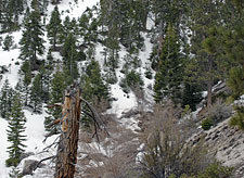
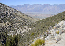
As seen from Lone Pine, Mount Langley is a remote, aloof peak, usually just a hooded outline visible on the horizon through the haze of the Owens Valley.
Two features, however, make Langley of interest to the ski mountaineer. First is the broad high-altitude terrain along the peak's flanks, which hold gleaming snowfields well into summer. Both the Tuttle and Diaz Creek drainages offer excellent ski touring possibilities. Second is Langley's North Face, and the striking couloir that drops just east of the peak's 14,000' summit plateau.
The Couloir is massive in every respect, easily ranking among the Sierra's biggest skiable lines—from the summit of a fourteener, no less. Such tempting ingredients would seem to make Langley a perfect mountain for backcountry skiers. Of course, in the Eastern Sierra, nothing is ever as easy as it looks. Both Dave and I have tried previously to get up the rugged Tuttle Creek Drainage—Terrible Tuttle, we call it now.
Tuttle Creek, Revisited
The weather coming up Highway 395 was discouraging. Storms brought record snow to the Sierra this year, but even late into April, the storms seemed unwilling to quit.
The forecast called for clearing skies, but I'd seen nothing but rain and thunderstorms since the Antelope Valley. Dave and I discussed the weather and our options. Since the Tuttle Creek drainage wouldn't expose us to much lightning hazard, we decided to hike up to our base camp and hope the weather cleared the following day, as forecast.
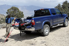
The sun did seem to be coming out when we reached the trailhead. Thanks to Dave's 4x4, we were able to drive up to a whopping 6900', which was better than I'd done in my Civic, at least.
That still meant over seven thousand vertical feet of climbing lay ahead.
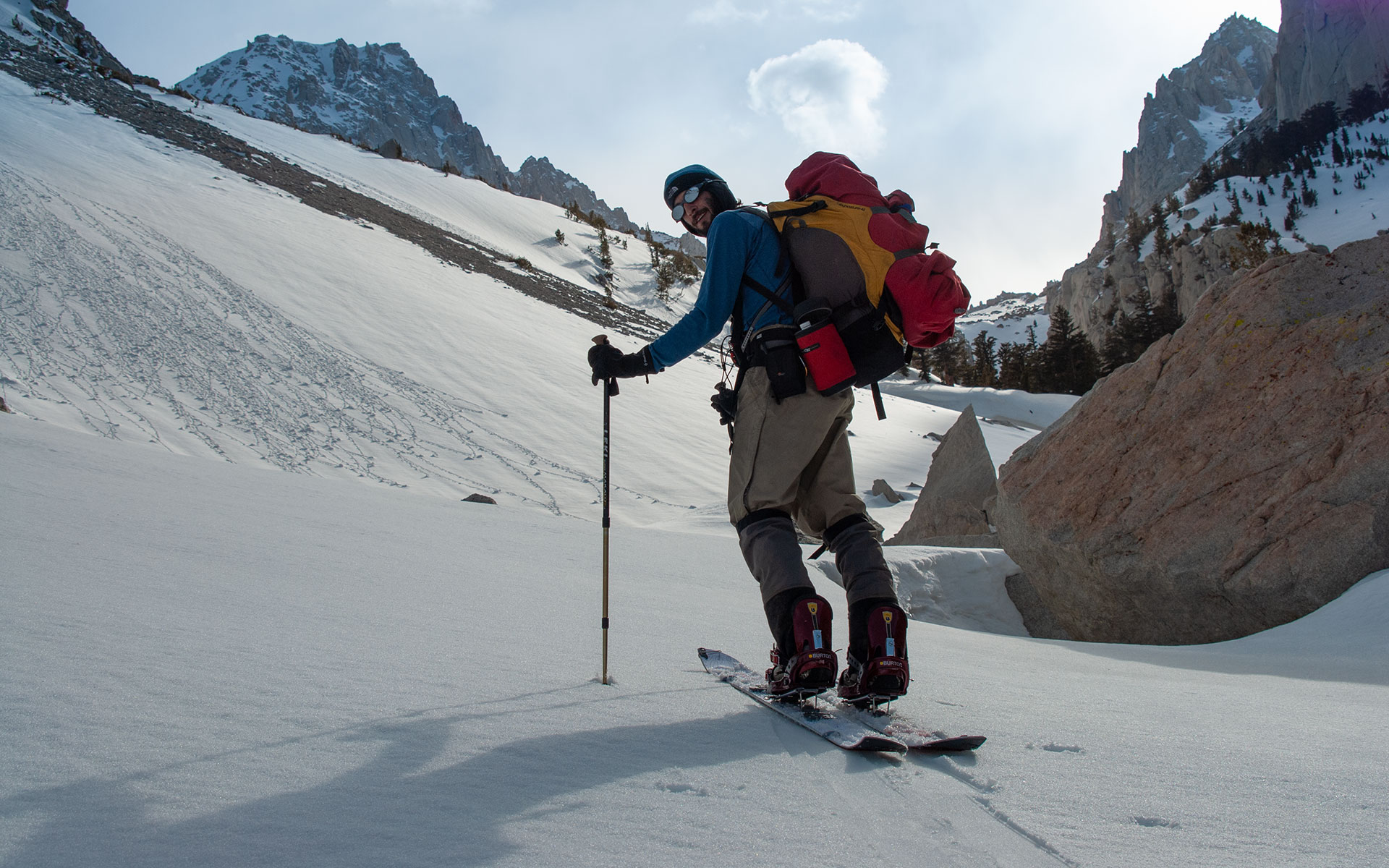
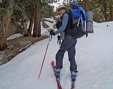
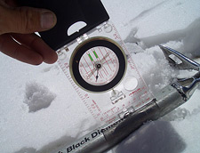
I'd given up trying to pack everything into a midsize pack, so I was carrying my Gregory and a smaller Black Diamond pack for the summit attempt.
With skis, overnight gear, and heavy alpine boots, I was overloaded, to be sure—but after my winter camping experience in Tuttle Creek, I wasn't willing to be caught unprepared.
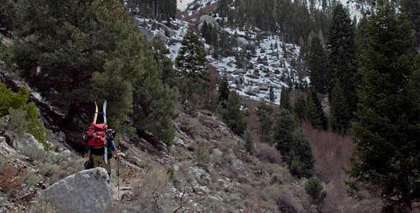
From the upper parking area, there is an established trail for a little less than a mile and a thousand vertical feet, to the first creek crossing.
The trail continues up the north fork of the drainage, to a stone religious shelter.
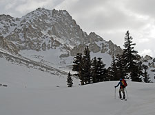
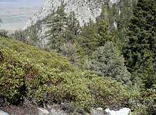
From this point onward, you are mostly on your own. Scattered use trails appear here and there, but often fade. We soon saw snow along the drainage's north aspect, but we were making good time up the opposite side despite the brush and gravel, so we kept the skis (and for Dave, splitboard) on our backs.
As we climbed higher, the sky became a sullen, sulky gray. Occasional raindrops fell, though not enough to cause concern. Hiking up rough, trailless terrain from low starting points is just a fact a life in the Southern Sierra. I found myself envying those skiers who enjoy drive-up access to the snowline—especially as the weight of my full pack began to work its dark magic on my body.
During such times it often seems to me to be a wonder that anyone chooses such an arduous sport and calls it fun: staggering about beneath a heavy load, taking step after step across steep, rocky gravel, occasionally getting swiped by thorny bushes and sharp branches.
Skiing must indeed be a compelling activity to persuade us to put up with such indignities. Luckily, we found a vestigial trail that began switch-backing up the north side of the creek. This made the going if not easy, at least bearable, and soon enough, we arrived at the first bench—and the snow.
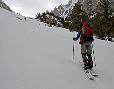
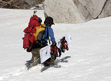
Skinning Up
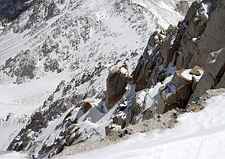
Dave Silver climbing up
At the first bench (around 8800') the steep drainage opens up to a flat, snowy valley, where I'd camped earlier this year, in February. I was eager to get my skis and boots off my back, and I was also eager to see Dave's splitboard in action.
A Splitboard is a snowboard that can be separated into two halves, allowing a skis-style ascent. On the descent, the two halves are once again locked together, making for a normal Snowboard.
...Sort of.
The Splitboard concept is innovative, but the technology hasn't quite caught up yet.
Splitboarders must put up with a variety of mechanical quirks, as well as considerable additional weight.
Still, the advantages of being able to ascend on skins appear to outweigh the liabilities.
On the relatively flat terrain at the base of the drainage, Dave had no trouble keeping up with me.
Of course, I was also carrying a virtual house on my back.
We kept climbing upward, making easy progress on Tuttle Creek's rolling terrain.
The snow was consolidated corn, more or less, with a layer of windblown powder on top.
It looked like it would make for perfect skiing, and I found myself imaging tomorrow's descent through this delightfully open section of the mountain.
As time passed, the sky began to darken, and the wind picked up. Clouds rushed about overhead. An uncooperative strap on my pack kept whipping about, catching me repeatedly in the back of the head. I did my best to ignore it.
If the weather looked the same tomorrow, I didn't see much hope in gaining the summit—unless we got a very early start. I kept trying to read the sky, wanting to know if tomorrow's forecast—clear and calm—would still somehow come to pass.
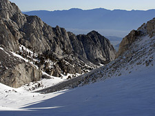
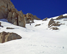
Dave and I reached the second bench, around 9500'. Now, we could start to see Mount Langley's northeast face looming on the horizon. This was as far as I had traveled in February. I was excited to pass this point and keep going, knowing we would soon be at the base of the couloir.
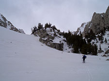
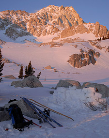
Base Camp
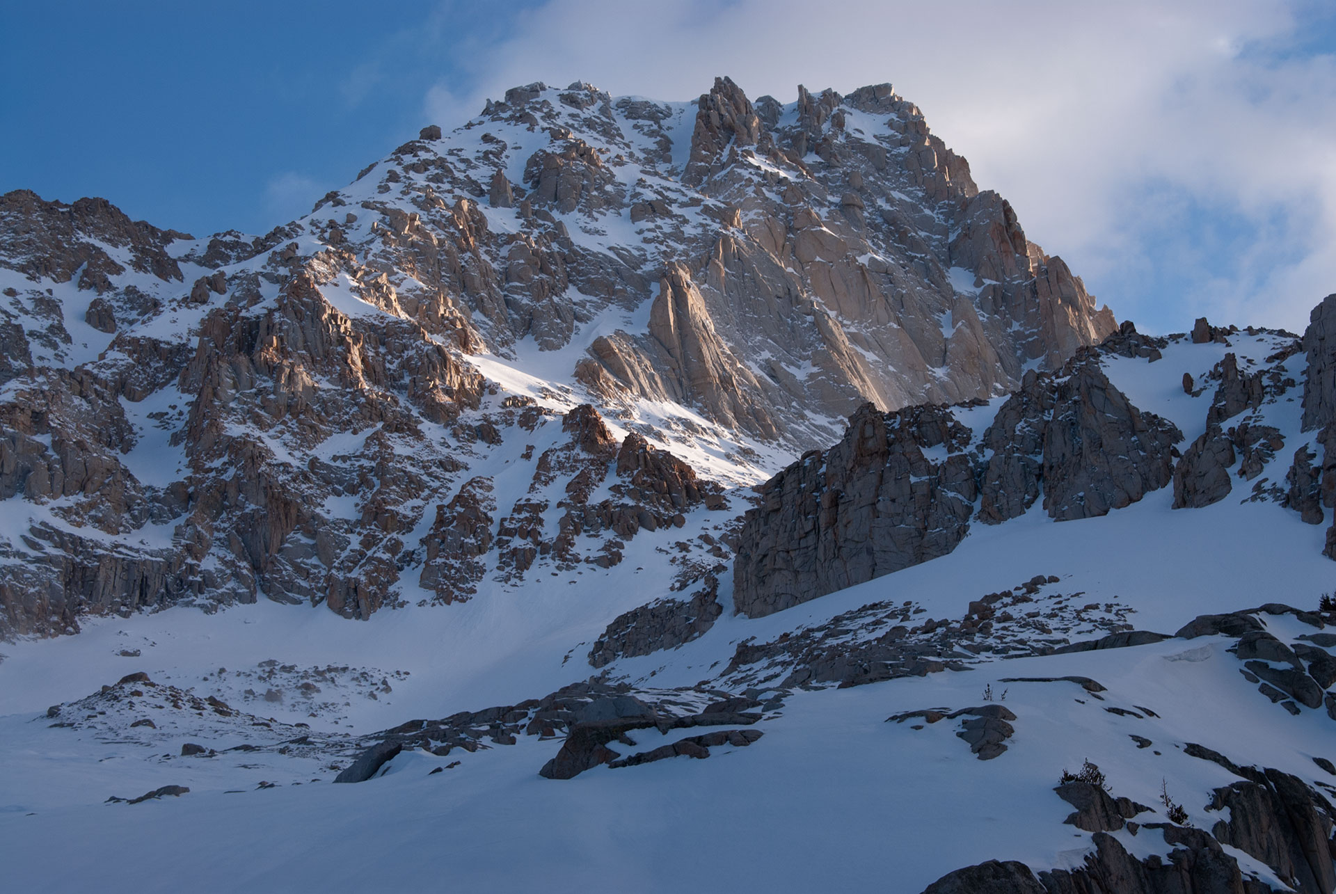
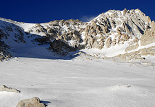
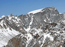
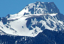
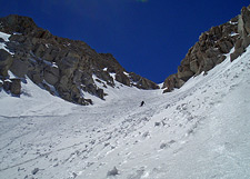
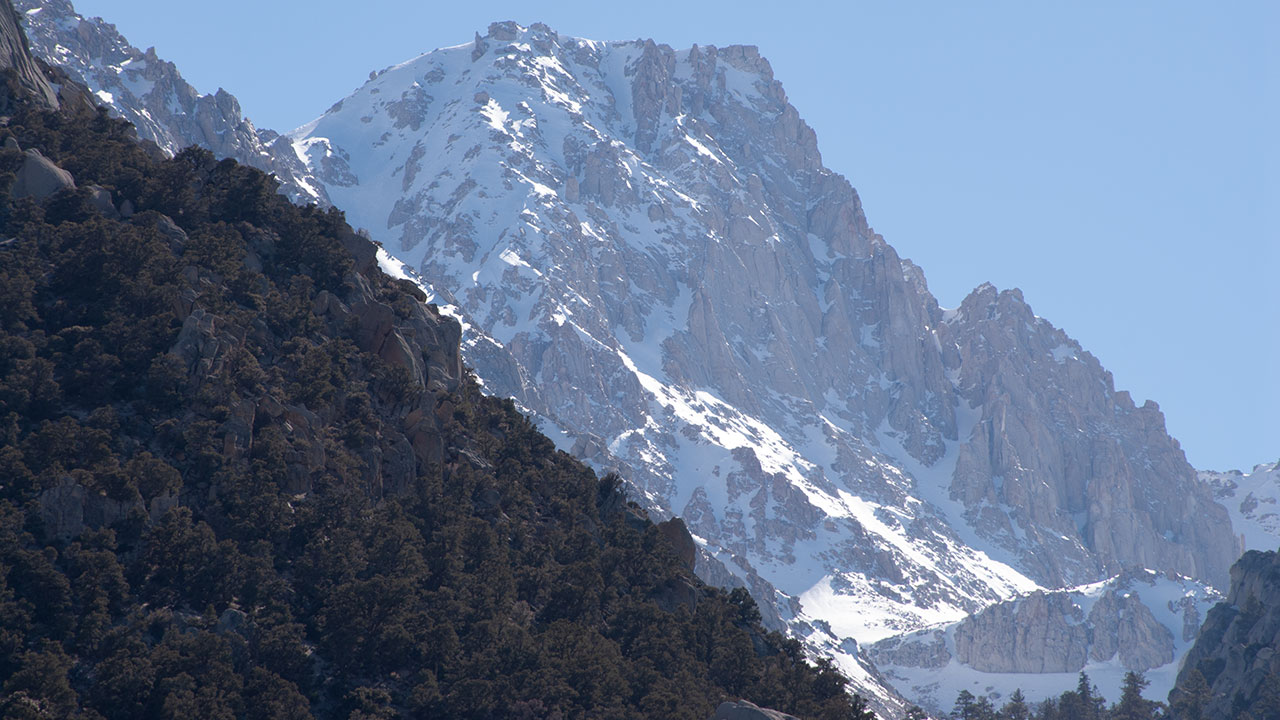
Mount Langley's North Face
Miraculously, the weather suddenly seemed to be turning. The clouds which only minutes previously had been gathering now burned away. The sun appeared.
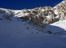
After cresting the second bench, the terrain again flattened, opening up into a large valley with the Corcoran Pinnacles to the right, and Langley's impressive north wall to the left. Dave and I stopped to take a moment to discuss our route.
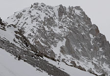
Dropping directly down the center of Langley's north face was a severe, discontinuous line that would require at least a few rappels.
Both Dave and I agreed this was well beyond the scope of our adventure.
The top of the northeast couloir was visible against Langley's broad left shoulder. I assumed this was the traditional route, which would continue around the mountain's southeast buttress, and then on to the summit.
Assuming there were no significant technical challenges hidden from sight below, the northeast couloir was clearly a viable (potentially even moderate) descent route.
I also pointed out another possibility: a steep, east-facing gully which began just left of a needle-like spire from the very top of Langley's summit plateau, descending perhaps 800 vertical feet or more before rejoining the main couloir.
The line was clearly continuous, but of unknown steepness. If I liked the look of it when we got up there, I intended to ski it.
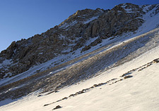
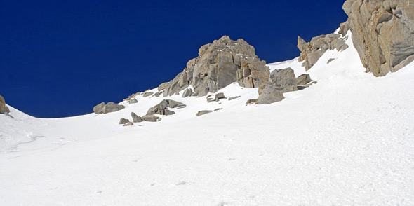
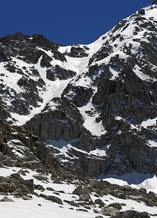
The Northeast Couloir continued to slowly, teasingly reveal itself as we traveled farther up the drainage. Fierce winds raked across Langley's north face, sending plumes of snow streaking off to the east. This raised the unwanted specter of potential wind loading, and associated avalanche danger. That seemed like a remote possibility so late in the year, but then again, it had been a very unusual year.
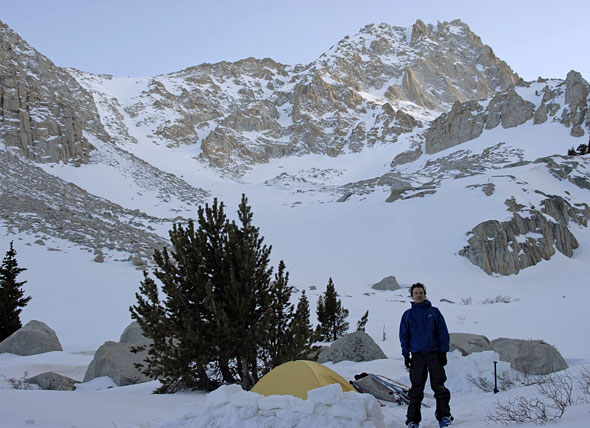
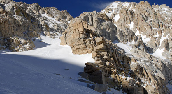
The wind also continued its assault on us. I did not look forward to trying to set up my tent in the gale. At 10,400', we reached a flat area with a small scattering of trees that provided some shelter from the wind. It looked like a good place to camp. We were at the base of what might be called the northeast couloir's apron, though the size of it seemed to demand some new terminology.
Though the bulk of the northeast couloir was now hidden from view behind a towering buttress, numerous other skiable lines had appeared. At this elevation in the Tuttle Creek Drainage, nearly everything looked good. With Dave's help, I got my tent up, and built a short wall of snow blocks for a windbreak. The day was ebbing, and I was looking forward to eating dinner and getting into my sleeping bag for a well-deserved rest.
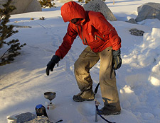
Having company for dinner was a fine change from my normal solo tours. Dave and I took turns melting snow to make water, talking eagerly about the big ascent to come. I was surprised to learn that Dave traveled without a sleeping bag: he was going to sleep in a bivy, with only his clothes to keep him warm. That sounded a bit radical by my standards, but after lugging so much weight up from the car, I was convinced he was on to something.
Somehow, I knew I needed to travel lighter. Soon enough, the day's last rays of sun set Langley's granite ablaze with light. After all the stormy weather, it was starting to look like tomorrow would be a perfect day for summiting.
Dawn
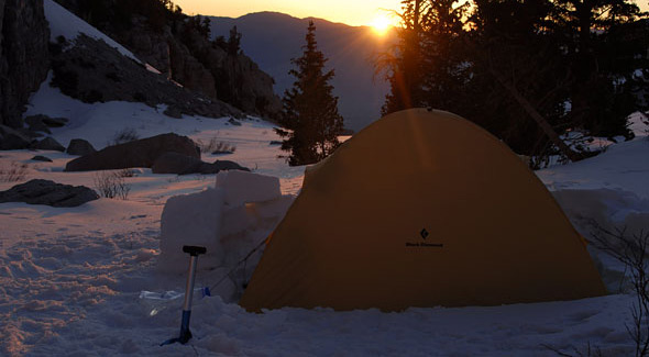
Dawn. The sky had cleared overnight, and as the new day broke, the weather looked fabulous. To the east, over Lone Pine and the Owens Valley, I saw no hint of cloud.
There would be no thunderstorms today to prevent us from reaching the summit. This did, however, raise a new problem. Expecting cool, cloudy weather, Dave and I had planned to start hiking around 6 a.m. I estimated we would make the summit around 11.
With clear, warm weather, however, the snow in the Southern Sierra can get awfully soft by then. The rising sun lit Mount Langley's north face.
While it was clear here at camp, I could see contrails of snow blowing off the crest near the summit.
The wind helped ease my concerns about softening snow. A good wind can prevent snow from melting, even when the air temperature is well above freezing.
Dave and I went through the usual morning rituals—melting snow and boiling water. On the menu today for me was Lipton Chicken Noodle Cup-a-Soup: a hearty 45 calories of salty water. I planned to get most of my fuel snacking on-route.
Dave, on the other hand, preferred a more substantial meal, and so ordered a hearty breakfast of macaroni and cheese.
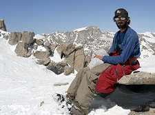
A word about Dave: he is a friendly, earnest soul who seeks his solace in the mountains. While I'd spent the winter (mostly) at sea level, Dave has toured throughout the eastern Sierra, living from a base camp in Lone Pine.
Given the vast difference in our respective levels of acclimatization, I expected Dave would crush me like a bug on the ascent.
I expressed my concerns to Dave, and told him I was going to start climbing. I expected he'd catch me soon enough. For his part, Dave was happy to get a more relaxed start.
And so, at last, it was summit day, and the start of the climb.
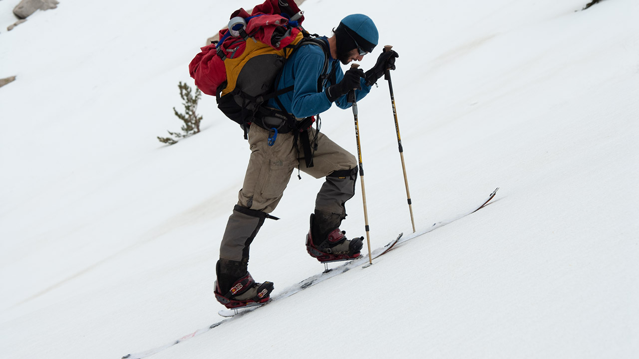
On hard, windblown snow, I skinned up easily, feeling strong and well-rested, ready for whatever Mount Langley had to throw at us.
I don't think I can fully explain the joy of a moment like this. Years of planning and preparation have gone into its making, all in the hopes that the conditions, the weather, even myself will be just right.
Many times I have been disappointed in the past. Weather can turn, demanding a speedy retreat. The route may not come into shape at all for a season or more.
Gear can fail, or prove inadequate. And sometimes, it is the body—or more likely the mind—that simply isn't ready, and on such days it is at best small comfort to claim there's always next year.
Today does not appear to be such a day. I make slow but steady progress upwards. Dave is still fiddling around at camp.
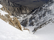
I enjoy the silence and scenery, the patterns of light on rock and snow, the immense spectacle around me. White plumes of snow stream east from Langley's granite pinnacles, contrasting vibrant blue sky and steel-gray rock.
Now, at last, the scale of Langley's northeast face is beginning to reveal itself.
I climb higher, higher above camp, yet I'm still barely halfway up the massive apron of snow beneath the entrance to Langley's northeast couloir.
If I'm reading my topo map correctly, the entrance to the chute is around 12,000'.
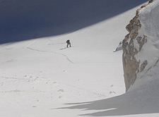
That means I have to climb 1600 vertical feet just to get to the base of it. Looking back toward camp, I see Dave has at last begun climbing. He is visible as a tiny red dot roughly halfway between me and our camp, and his presence hammers home how big Langley's northeast couloir actually is. I find myself wishing we'd gotten an earlier start. It's too late to cry about that, but I do whoosh more air into my lungs and pick up the pace.
Since leaving camp, I've been doing my best to stay high on the sides of this giant apron, and thus avoid climbing straight up the middle of an avalanche path. There is, however, no way to sugar-coat the truth: I'm in the runout zone of several massive slide paths, each of which comes from a different aspect high above. I don't see how this area could be skied safely in mid-winter, except under the most unusual of circumstances.
Moving on, I am encouraged to see I'm getting closer to the massive, diagonal buttress that hides the northeast couloir's entrance. Soon, I'll be able to see up the belly of the chute, getting, for the first time, an up-close look at it. Behind me, surprisingly, Dave has dropped off a bit. I decide I'll climb up until I can see into the couloir, and wait for him there.
Climbing the Couloir
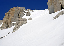
The granite buttresses on either side grow high above me as I near the couloir's entrance, and at last peek around the corner to see what lies within. The grand moment of revelation has arrived.
I'm almost giddy with excitement, overwhelmed by a sense of how lucky I am to be here. What a special privilege it is to climb and ski the Eastern Sierra. I skin a little way up the couloir before deciding it's time to switch to axe and crampons.
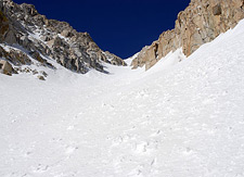
The air is calm within the couloir's deep granite walls, and the snow is softening.
The top of the couloir—and Mount Langley's summit—is about two thousand vertical feet above.
Here again, the scale plays tricks on the mind.
It's impossible to appreciate how big the chute is.
I take a few photos of Dave as he works his way toward the top of the couloir's apron.
Dave stops to take a few photos of me.
That taken care of, I pull out my snack bag and munch on sunflower seeds while Dave climbs up.
Our camp is an indistinct grouping of trees far below. I can't see my tent any more.
It is 8:10 a.m.
It has taken me one hour and forty minutes to climb from camp, at 10,400', to the base of the couloir.
When Dave arrives, he measures our present elevation at 12,100' via GPS.
I'm satisfied with the pace, but I know I'll get slower as the elevation increases.
Plus, the softening snow will likely slow us down further.
I'm ready to go, so I resume climbing.
Dave is still switching to crampons.
Snowboarders in general tend to have a troubled relationship with crampons.
The problem is the soft, rounded boot, which doesn't provide a good point of attachment.
You'd expect a good strap-on crampon to stay on just about anything, but even these tend to slide off the rounded nose of a soft snowboard boot.
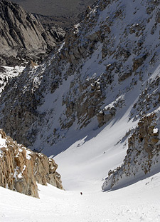
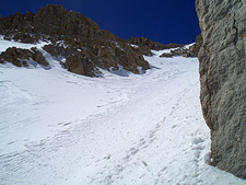
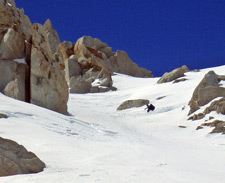
While Dave is working to get his crampons on, I climb up the sunny west side of the couloir. The snow is more solid here, and provides a solid base to stand on. I make good progress upward, and soon enough, Dave is once again a tiny red dot below. Here in the lower couloir, the angle is a moderate 35-38 degrees, an easy climb.
The Tuttle Creek drainage is now far below. Beyond that lies the dusty brown earth of the Owens Valley. I pick out buttresses along the sides of the Northeast Couloir and use them as mental checkpoints to measure my progress. It's slow going. Langley's Northeast Couloir seems to stretch on forever. My feet begin to sink into the softening snow, which unhelpfully balls up beneath my crampons, forcing me to put an awkward little kick into each step.
For variety's sake, I occasionally bang my feet with my axe handle to clear the snow. Dave, meanwhile, vanishes behind one of the many rolls within the belly of the Couloir. He reappears from time to time, about 500' vertical below, before again vanishing. The climb goes on.
To The Summit
It is 10:34 a.m. I have gained a thousand vertical feet since switching to crampons, putting me around 13,000 feet in elevation. Just another thousand feet to go.
At last, I can see the top of the Northeast Couloir, as well as the top of the east-facing gully I want to ski. The east gully is easily identifiable, even now, thanks to its entrance cornice. Additionally, I identify that neighboring sharp needle of rock—a perfect landmark.
The gully is clearly much steeper than the 35-40° main couloir, but it looks like a go. Dave is once again visible as a red dot climbing up the midsection of the couloir.
As I near the top of the couloir, the wind returns, gusting to 40 or 50 miles per hour.
At this elevation, the snow looks less like spring corn and more like winter wind pack. Either way, it still sticks to my crampons.
This last thousand feet is going to be a killer.
I bang the snow from my boots with my axe and bend myself again to the task of climbing upward. In all my web surfing, I'd only once found any reports from Langley's Northeast Couloir: a trip report by Bill Henry.
In his report, Bill talked about the couloir seeming to go on forever.
In the end, his party stopped about halfway, turned back by fatigue and poor weather. Still, the report was useful. It showed me first of all that Langley's Northeast Couloir was skiable.
Just as important, it prepared me for the difficulty of the climb.
With a last few tired steps, I crest the top of Mount Langley's Northeast Couloir, feeling much elation as I stand atop the mountain's east ridge.
A marvelous panorama confronts me now: Owens Valley and Owens Lake, the Diaz Creek drainage, the mountains of Nevada (to the distant east) and Olancha Peak to the south.
I had stood atop this ridgeline the previous summer, and dreamt of returning in winter, with skis, to descend this inspiring terrain.
That dream was about to become reality. Ahead, I had only a short gain of perhaps three or four hundred vertical feet to reach Langley's 14,027' summit.
The altitude conspires to slow me down despite my enthusiasm. I work my way south and west, rounding the ridge to climb up Langley's southeast buttress.
The south-facing snow here might be near 14,000 feet, but the sun has cooked it into mush nonetheless. Oddly, the wind which moments before had been howling abruptly stops. That makes the snow all the softer as I push up the final pitch to the summit plateau.
What a moment, coming up those final thirty feet or so, and seeing the summit come into view! The horizon north of Mount Langley's summit is dominated by Mount Whitney, which looks every bit the state's highest peak from this perspective. I cross about a hundred yards of flat terrain to reach Langley's true summit. Here, I drop my pack and stretched my tired muscles. The climb is over. Dave is not far behind.
We shake hands, congratulating each other on a successful summit, a pair of grinning, sunburned, exhausted madmen. With the snow softening as we speak, I suggest it's time to ski, so we discuss our descent plans. I say I'm going to give the east needle variation a try. Dave decides he will ride the main couloir.
I have skied once before from this altitude, on Mount Shasta's Hotlum-Wintun Ridge, but I did not reached the summit that day because of weather. This will be my first true descent from the very top of a fourteener, my first true Sierra Descent.
Needle Variation
I had scouted Langley's northeast face in summer, when the sheer rock had seemed much too steep to hold snow, much less to ski. Now, I see a snowy elevator shaft of a line down into the belly of the main couloir.
Atop the summit, I snap into my skis and traverse Mount Langley's broad plateau until I reach the needle spire marking the entrance to the gully. Peering over the edge of the north face offers a vertigo-inspiring glimpse into the abyss.
It's probably not much steeper than 45°, I tell myself. This is perhaps a clever ruse on my part to prevent the saner parts of my brain from shrieking in protest.
The snow looks variable: harder to the east edge, softer to the west. Hopefully there will be good conditions somewhere in the middle.
I don't believe in hesitating at the top of a steep chute. If you're going to ski it, ski it, so I traverse beneath the needle spire in one smooth motion and side-slip into the gully.
Steep¹.
I can't plant my uphill pole; the slope is too steep. I'm forced to fold my ski pole against the hill, so that my uphill hand skates against the snow.
The snow is crap: too hard here, too soft there, and sticky as if I've got Velcro on my skis. I sideslip down a bit, trying to get a feel for the snow, trying without success to get some sort of a predictable edge.
No.
Just that cursed stickiness. I'm going to have to break my skis loose on the unweight with each turn. Given the angle and exposure, that's going to mean a hell of a commitment.
There will be one mistake, or there will be none.
Below me is somewhere in the neighborhood of 500 vertical feet of super-steeps, which gets to the first choke point. After that, the gully angles east, out of sight. I feel like I'm perched on an airplane wing looking down at Tuttle Creek 4000 vertical feet below.
It's time to make that first turn. Now, it's a matter of trust: I must believe I can make this turn. No half-ass hesitation or leaning into the hill, no doubt, no compromise on legs that have climbed 7000 vertical feet in less than 24 hours.
And...there! First turn, clean and smooth, a perfect unweight, no foolish hop, I land it dead-center as if I've been doing such crazy things my whole life. And maybe I have.
Sideslip again, try to feel that bastard snow, slide, slide, TURN! Steep! Softer here, but still cranky. I piece together more turns, cut and wait for the sluff to fall, listen to the snow cascading down, down. Turn, reset, turn. I reach the choke. The angle is still balls-to-the-wall steep, but the exposure is not so unwieldy.
I've got another 400-500' to go before I rejoin the main couloir.
Now I see Dave at the junction below, setting up to take some photos with my Casio. No Kodak courage here, but I do feel comfortable linking my turns now, though I must still stop to cut sluffs. I knock a smallish wet slide loose. It slowly pushes down toward Dave. It'll miss him, I see, so I go back to work, finishing out the descent.
I bang off the last few turns and collapse, completely exhausted, alongside Dave.
"That'll get the heartbeat going," I say. Dave is not pleased about the sluff I just sent in his direction. We take a moment to discuss the proper avalanche etiquette given the situation. That settled, Dave wants to ski the full 3000' vertical beneath us in one giant push. I convince him to let me ski ahead to get some photos of him. Aside from wet slide concerns, all the day's technical difficulties are behind us. I'm relieved and exhilarated as I make my first turns in Langley's Northeast Couloir, proper.
¹ Update: How steep was the 'Needle Variation' of Langley's Northeast Couloir route? Subsequent comparisons with Bloody Couloir and North Peak's North Couloir have convinced me this remains perhaps the steepest sustained pitch I've skied—possibly approaching 55°
Skiing the Main Couloir
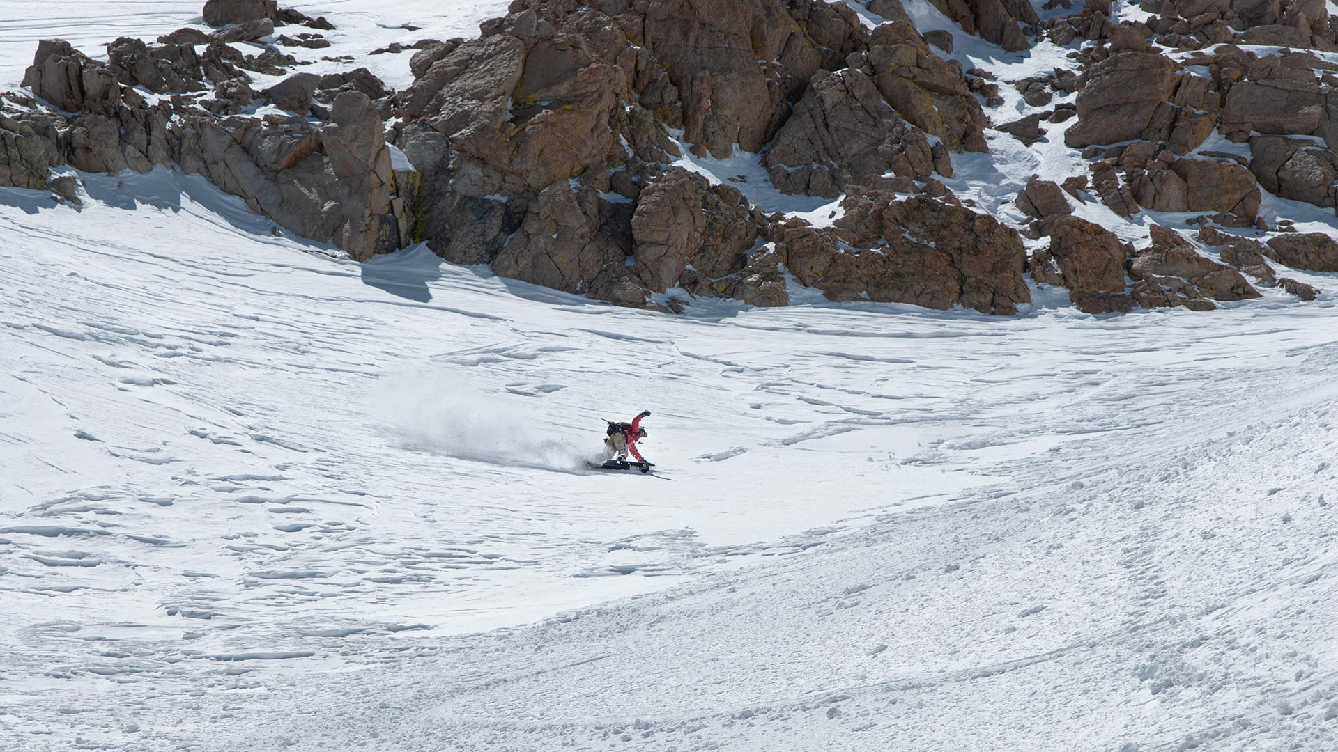
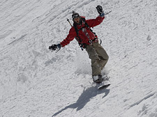
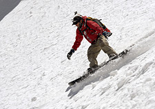
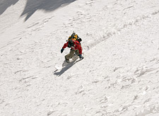
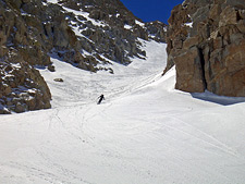
Dave opens it up in Langley's Northeast Couloir
Skiing the main couloir made me feel a little like Jack in the Giant's house. At times, Langley's Northeast Couloir is as wide as a football field—truly immense.
For all the effort we had put into ascending it, we were now rewarded with a descent that seemed every bit as long as the climb up. We had nearly three thousand vertical feet to ski above camp, plus another two before we reached the snowline in Tuttle.
Faced with such an abundance of terrain, what can a man do...
But RIDE it?
Dave has a fluid, easy style inspired by his love of surfing.
It was fun watching him arc through the belly of Langley's massive northeast couloir, riding the soft corn as if it were the world's finest powder.
Normally descents like these are over all too soon.
But this time, Langley's massive couloir just kept on going.
Turn after turn we continued our descent.
We were a bit late on the gloppy snow, to be sure, which would have made better skiing earlier in the day, before the sun had worked it over.
I didn't mind.
The details of this extraordinary day's descent were only just starting to register in my mind. My first ski descent from the top of a fourteener. Langley's Northeast Couloir. The east gully/needle variation.
I think the smile is still stuck on my face.
I put the camera away and skied down to Dave, who was kind enough to return the favor and take a few photos of me.
He's got a good eye, that Dave. Next time I'll force him to bring his Nikon.
My spent legs were protesting in the mushy snow, which grew softer as we descended. But oh, what a descent! What an epic, masterpiece of a line. This might be a good time to mention again that Langley's Northeast Couloir is huge. While I'm skiing it, I'll just call up a few stats with my Topo! software:
Vertical Gain (car to summit): 7000'
Vertical Gain (camp to summit): 3600'
Vertical Gain (camp to the top of the couloir): 3230'
1.7 miles (camp to summit)
Total Miles (round trip): 8.4
Piece of Cake!
After skiing another thousand feet or so, I stopped to look back at our tracks. Dave kept on going, carving his way out the mouth of the chute and onto the broad apron below, then down, down, another thousand vertical feet to camp, his whoops of joy and his tiny outline gradually fading in the distance.
Exit
And so, today's drama is nearly done. We have only the tedious business of packing up camp, skiing down the Tuttle Creek drainage until the snow gives out, and then hiking the rest of the way to the car.
Dave speaks of the mountains' magnetism, the pull of the hills as a tangible force acting upon him. I feel the calling in a different way. To me, mountains speak of permanence and clarity. They seem to endure beyond time, places of refuge next to the constant change of the human world.
And often have I longed for the clarity of an alpine route when trying to find my path elsewhere in life.
In the mountains, you can always see your destination, even if it's not entirely clear how to get there.
I pack up my tent and load up my much-too-heavy backpack.
With a last glance at Langley, and our ski tracks in the distance, it's time to leave this place.
We ski along the flats at the base of the drainage.
Now 2 p.m., the snow is being nuked by the blazing Southern California sun.
I have the advantage on skis, as I can cross flat ground.
Dave is forced into the unhappy position of clicking out of his board and trying to walk through these sections. Inevitably, he falls through the weakened snow, and must struggle mightily to right himself. I hear his shouts of frustration and wait for him to reappear, hiding my amusement.
Soon enough, our roles are reversed: the snow below 9000' is too soft and rotten even to ski. Both of us must cross the creek and hike out the rest of the way.
Dave goes on ahead, leaving me to contend with Tuttle's infamous brush on my own. Eventually, my path connects to the remnants of a trail, easing my passage somewhat. Thoughts of the carne asada plate at Bonanza Restaurant in Lone Pine begin to dance inside my head.
I quicken my pace despite my pack's crushing weight.
Half an hour later or so, I connect back to the main trail leading to the religious shelter. The infamous heat of the Owens Valley begins to make itself known. The air grows hot and dry; this last mile extracts everything I've got.
Dave's truck appears as I round the bend, and now, at last, this adventure is over. I drop my pack in the back, kick off my hiking boots, and take a long drink of water. The air conditioning feels heavenly as Dave drives down the rough road, heading back toward Lone Pine. We stop about halfway down and take a long look at Mount Langley, now nearly ten thousand vertical feet above.
From here, we have a perfect view of the upper portion of the mountain, including both the Northeast Couloir and the steeps of the Needle Variation. It's difficult to believe we both stood upon that same summit only hours earlier. Now it looks as far away as the moon.
I picture myself skiing down that sheer face, cutting turns across haze-tinged snow. Did it really happen, I wonder...or did I just imagine it? And just like that, this day fades to memory.