Mount Langley — Cottonwood Lakes Loop
Up The East-Southeast Ridge and Down Army Pass
Mount Langley, California — Looking for a spectacular high-altitude day hike in the Southern Sierra? Mount Langley via Horseshoe Meadows is an excellent choice.
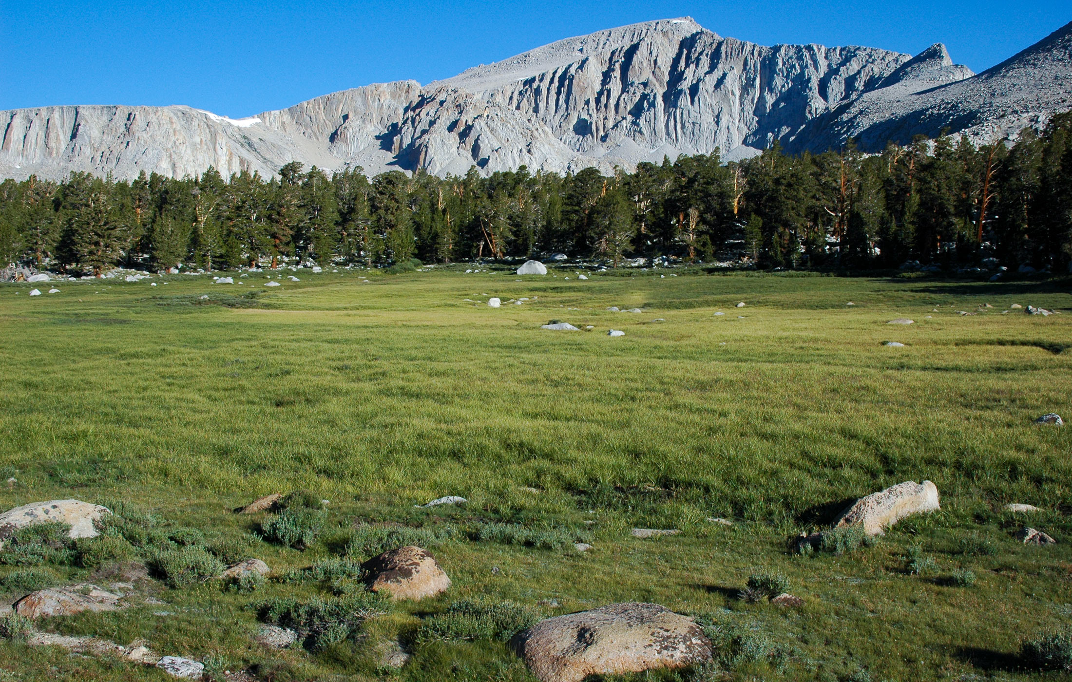
The paved Horseshoe Meadows road winds its way up the sheer east side of the Sierra from Lone Pine and Owens Valley to the Cottonwood Lakes trailhead, nearly 10,000 feet in elevation. Such a high starting point is a rare and welcome feature in a Southern Sierra climb, making this a terrific access point to Mount Langley's south-facing hiking routes, as well as the peak's dramatic south face.
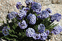
Remote, high meadows, scattered jewel-blue lakes, and cool pines are among the many fine features in this part of the Sierra. I had been here a year earlier, wanting to climb Langley via its Class 3 east-southeast ridge.
On that hike, I'd climbed up the ridge too soon and gotten hung up atop Peak 12,819, a giant shark-tooth whose sheer north face made getting back on route impossible.
A year later I am back at the trailhead, eager to correct my mistake—and also eager to revisit Peak 12,819. Is it really as steep as I remember?
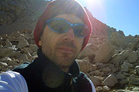
It's just before dawn. For creature comforts, I spent the night in Lone Pine, California. Now, the sky is just beginning to lighten as I arrive at the Horseshoe Meadows parking lot. The air is chilly when I step out of my car. The rich scent of fresh pine surrounds me. Despite the chill and the early hour, I'm happy to be back on the trail, hiking once again toward the summit of a California fourteener.
The first four miles of the Cottonwood Lakes trail cross a long, gentle bowl, following a creek past forests and meadows. Given how flat the terrain is these first few miles, they could have easily extended the road farther. Of course, keeping the road short keeps the people out, making the Cottonwood Lakes region quiet and remote.
But when you're eager to start climbing at 6 a.m. and there are miles of flat, dusty trail ahead, it's hard not to get impatient.
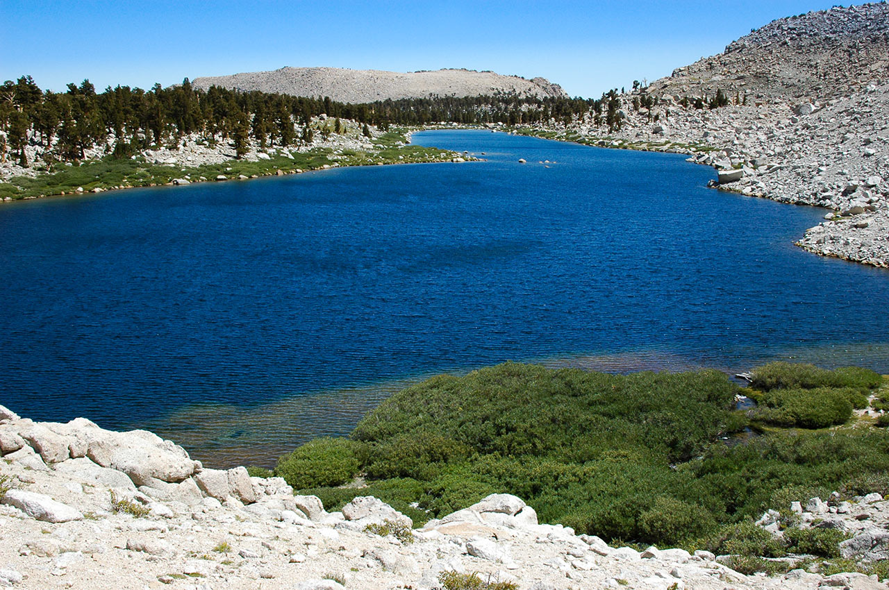
Cottonwood Lakes
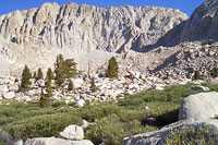
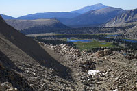
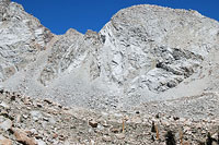
From the trailhead it takes me a little over an hour to reach the first of Cottonwood Lakes. Here, the south face of Langley comes into view, as well as Army Pass, and Peak 12,891.
Now is a good time to stop, scout the route ahead, and take some photos, as the rising sun casts long shadows across damp grass, interrupted by the occasional bleached-white boulder. It makes for a rich visual palate, but I'm feeling impatient and don't want to spend too much time sightseeing.
I intend to hike one big loop today, up Langley's east-southeast ridge to the summit, and then down via the south slopes and Army Pass, either 'old' or 'new', back to the Lakes.
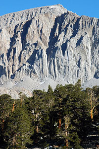
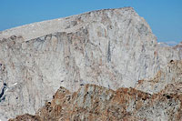
From what I see so far, the route looks feasible, though it means a lot of walking. I survey Langley's imposing south face, one of the Sierra's big walls of crack-lined granite. The rock-climbing opportunities are abundant, but I think I'll stick with hiking today.
In Climbing California's Fourteeners, authors Stephen Porcella and Cameron Burns note Langley has been called an "uninteresting" mountain.
I'll vigorously second their opinion that nothing could be farther from the truth. If Mount Langley's imposing south wall isn't enough for you, the north face is every bit as sheer, with even greater vertical relief. And you can ski it.
There is, of course, one huge reason why Langley's rock is mostly untouched: we're right next door to Whitney Peak, only a few miles north. The glamor and prestige of Whitney acts like a magnet, drawing climbers in the region, leaving Langley an unloved sister in comparison.
Meanwhile, crossing the meadows is proving to be something of a chore today. Heavy winter snows have transformed the Cottonwood Lakes area into one giant marsh.
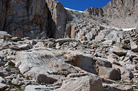
I struggle to stay on dry land, cutting back and forth. The obvious solution is to stay right and traverse beneath the southeast ridge, but past experience has shown that way to be riddled with difficult talus. In the end, I'm forced to tiptoe across a section of thick green grass, beneath which bubbles running water.
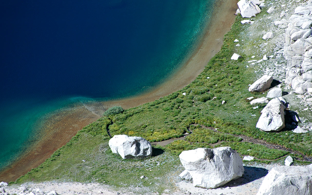
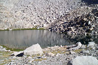
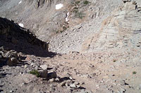
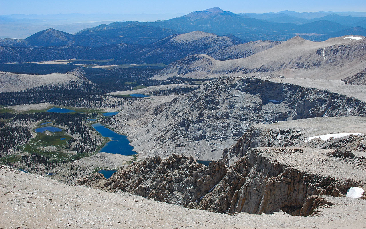
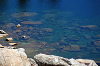
My shoes get a little wet, but I eventually reach solid ground. And with that bold maneuver, I at last pass beyond the soggy meadows. The necessary route to the top of the east-southeast ridge lies ahead, hidden (for now) along Langley's south wall. I reach the last and highest of the Cottonwood Lakes, a clear-blue glacial pond set beneath a chaotic tumble of talus blocks.
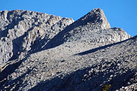
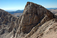
The air remains cool. Unlike my last big hike, on Mount Williamson, it doesn't look like the day is going to warm up much—it feels more like fall than summer. I stop for a bite to eat beside the lake. Peak 12,891 rises to the east. As I scan that big granite obstacle, I'm still uncertain as to where, exactly, my route lies.
Is it up against the south face? Or is it closer, somewhere underneath the overhanging rock of Peak 12891? Unless my guidebook has been playing tricks on me, I'll find a narrow gully somewhere between these walls of granite, permitting passage to the ridgeline above. From my current position, however, I can't see anything other than Class 5 climbing.
The East-Southeast Ridge
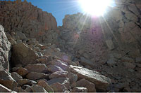
At the last of the lakes I stop for a quick lunch. Soon, I'm hiking again, now scrambling up and over talus. To my relief, the route—a hidden chute—finally comes into view.
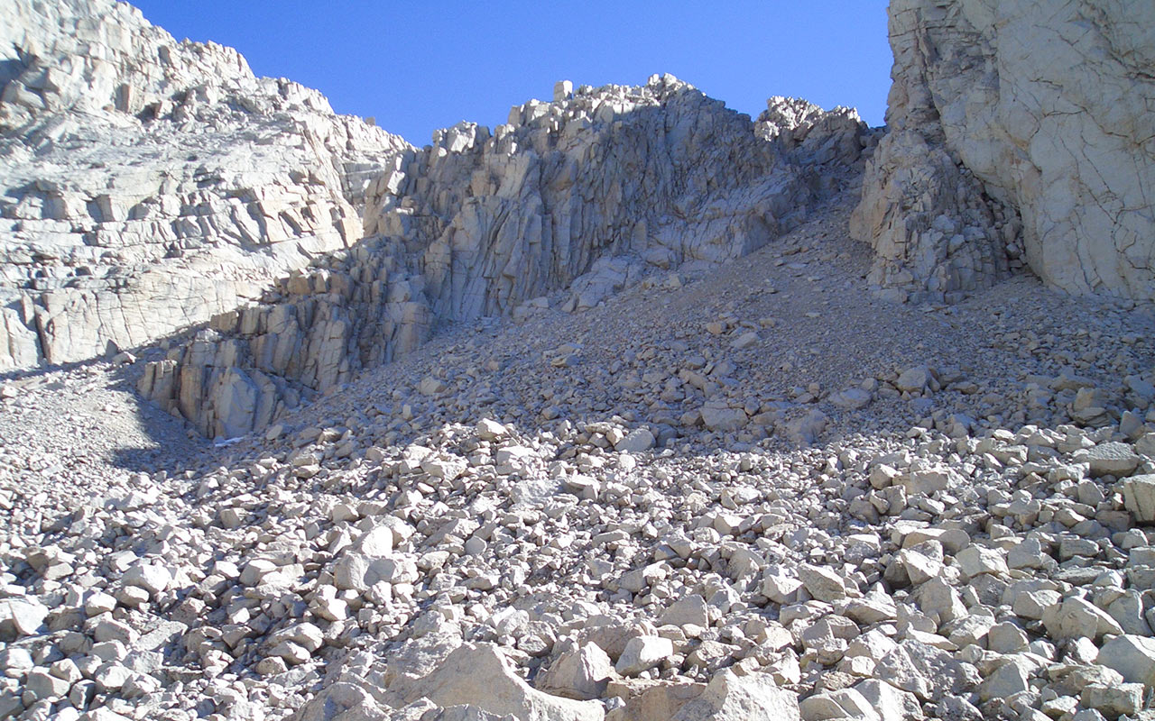
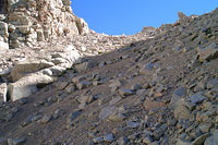
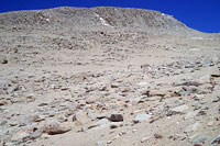
Twin gullies appear, one to the north, against Langley's south wall, the other to the south, adjacent Peak 12891. This part of the mountain features huge talus blocks—many of them car-sized and beyond, all of them loose or questionable. As I climb higher, the terrain soon rivals Williamson Bowl for sheer difficulty of travel.
To deal with loose talus, I try to stay focused when I'm climbing. I concentrate on placing my feet wherever they slide the least. Often, this means looking for larger rocks buried within the gravel and dirt, and using them as stepping stones.
I specifically avoid passing beneath large blocks, as these can and do come loose—sometimes with frightening speed.
When it's not possible to avoid a large, loose boulder, I'll make quick, decisive moves—remaining ready to leap clear at the first sign of trouble.
For a moment, as I gain elevation, I'm uncertain which gully to choose—left or right. I don't want to make another bad decision and be forced to turn back once again without reaching the summit.
Instinct tells me to keep left, so I traverse northward. And at last, the final piece of the route materializes.
I spy a narrow gully right against the south wall of Langley, leading to a notch on the ridge just north of Peak 12,891. I'm pleased to be on-route for certain, now, but the climbing quite simply is abominable: some of the loosest, sandiest gravel and talus I've ever seen, all of it powdery-white, like a bizarre high-altitude beach. The going is slow and tiring. I'm feeling the altitude now, and in fact I've developed a tiny bit of a headache. The chilly air doesn't help.
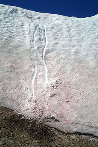
I look back, and I'm rewarded with a fine view of the cottonwood lakes, now nearly 1000 vertical feet below. The water in the lakes is a sparkling blue. It looks inviting, but I know it's icy cold. In fact, I've already passed several patches of snow. The sky is clear from horizon to horizon. The weather is fair, the air calm and cool, and I'm on-route, making slow but steady progress.
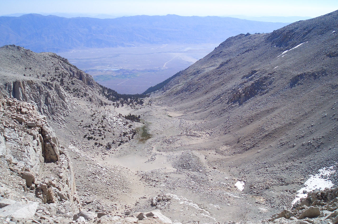
Diaz Creek & Owens Valley
It's been a strenuous climb up this short chute, 1000 feet of climbing up some of the crankiest talus I've ever seen. I've heard rumors about this mountain's powdered granite.
Porcella and Burns call it the ultimate 'high desert'—but seeing it in person makes you appreciate the geology's uniqueness. The massive blocks of talus at the base of Langley's Southeast Ridge gradually give way to smaller boulders. Soon, boulders and gives give way to a fine, sandy granite that makes me very glad I'm wearing my ankle gaiters.
I'm just below the notch at the top of the couloir, waiting eagerly to see what views await atop the ridge. I always get a thrill when I'm approaching a notch like this.
In moments, a new vista will open before me, revealing the Diaz Creek Drainage and the entire Owens Valley.
Though my heart is pounding and I'm out of breath, the cheers of a phantom crowd urge me to quicken my pace.
There is more climbing ahead, of course, but for now, gaining the notch is all I'm thinking about.
A last few steps up sandy gravel and talus take me to the top of the notch, allowing me to look out over Owens Valley.
It's a magnificent vista.
Below, the Diaz Creek valley stretches toward Lone Pine, a tiny collection of buildings and trees on the valley floor.
Even though it is summer, I can't help thinking about the skiing possibilities as I look out upon this remarkable valley. Surely the Langley Region ranks among the finer backcountry skiing terrain in the Southern Sierra. I'm eager to stand here in winter, when the talus is covered with snow, snap into my bindings, and push off downhill. Oh yes, I'll be back.
I can see Peak 12891 in its entirety now, and its sheer northeast walls are every bit as steep as I remember. The sight answers a question I've had since turning back last year: was there any easy way to get from the top of the Peak back to the Langley Route? Answer: Nope.
Not unless you're into free-soloing exposed Class 4-5 rock. For now, however, there is a summit to climb, and more skiing opportunities to scout. I want to look at Langley's grand northeast couloir and see if it looks feasible for a return trip in winter.
Moonscape
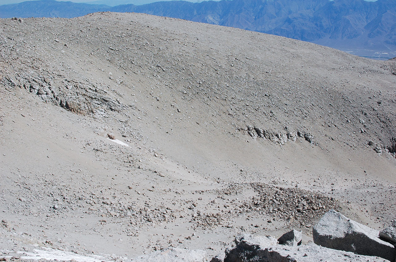
If the landscape has been interesting to this point, it suddenly takes on the appearance of a surreal moonscape. Here above 13,000 feet, Mount Langley's southeast slopes are barren.
Palm-sized chunks of quartz crystals are everywhere, mixed in with a fine granitic sand that stretches to the horizon like a beach. Mount Whitney is approximately five miles north-northwest of here, yet the two neighbors seem to have little in common. It's as if Langley is an island unto itself of sand, tundra, and weird, mottled rocks.
The swoop of the vista down toward Diaz Creek is vertigo-inspiring. And that feeling is certainly enhanced by the altitude, which makes every movement slower, more labored.
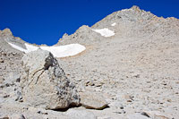
I'm not exactly sure how to proceed. There's little-to-no sign of a trail to follow. It looks like I could gain a nearby ridge line to the southwest, which leads above Langley's south wall.
I want to look down into Tuttle Creek, however, so I angle more northerly, toward the obvious spire above which I hope is Langley's summit. I stop to take a photo of a large boulder. It is pattered with strange ripples and ridges somehow sewn into its bulk.
Despite what appears to be a line of footprints heading toward the pass to the west, I head straight up, toward a eastern buttress that seems to lead to the summit.
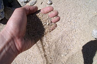
The 'sand' also compels me to stop and take another photo. Like sands through the hourglass I think, as it sifts through my fingers. Time seems to be ticking slowly now. My pace has fallen off considerably since the energetic pace of my early morning.
My head hurts. I'm usually lucky with regard to altitude—especially considering I live at sea level. My body normally lets me get away with dashing up from the ocean to the mountain tops, but today I'm dragging. I focus on my breathing and tell myself I'll be descending soon enough.
The landscape is dramatic, disturbed only by the occasional sound of invisible jets flying somewhere overhead. We must be near a flight corridor, possibly Air Force.
Mount Langley's east buttress is listed as Class 3 in my book. The climbing actually looks quite a bit easier, reminding me as always that rating climbs is a highly subjective business. Each of the Sierra's mountains is unique, of course. But I find myself fascinated by Langley's geology. There is something almost volcanic in its austere high reaches. And the dramatic sweep of its vistas, which offer gorgeous lines that run all the way to Owens Valley, over ten thousand vertical feet below.
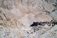
Perhaps this barren landscape is too featureless to satisfy the aesthetics of most climbers, but I love it. To me, discovering such unexpected sights is what mountaineering is all about. I struggle onward, seeking harder climbing lines up the buttress to justify the Class 3 rating, perhaps push it a bit. I'm excited when I finally reach the edge of Langley's north face, allowing me to peer over the precipice down into Tuttle Creek.
This is it: what can only be called an extraordinary future-descent, a jarringly-steep chute that plummets down thousands of feet to the open valley below. Call it the world's greatest downhill course. Here on the edge of Langley's north face, one thing is instantly clear: the north face is steep! I crawl over to the edge of the rocks, gingerly peering over, feeling my stomach sink as I'm confronted with all that air below.
I'm forced to reconsider my assessment of the ski terrain. This is at least experts-only stuff, possibly a good deal harder than that. I continue scampering up the rocks along the edge. There is a final snow pack to be navigated, and then I'm standing on Langley's summit plateau, with only a hundred yards or so of flat ground to cover until I reach the summit-proper.
14,039 Feet Above Sea Level
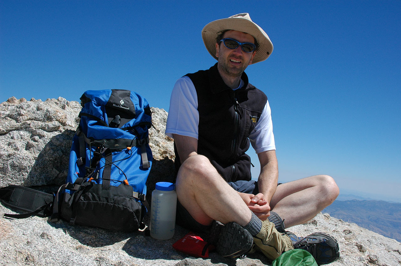
The great, sweeping lines of Mount Langley stretch out and down in all directions. There is, as they say, nowhere higher to go. I'm alone today on this fine peak, and the solitude is welcome.
Two hundred miles to the south, 25 million people cluster together in the coastal basins, busy, busy, busy. Here, in this quiet, thin air, time seems to tick more slowly. Thunderstorms have kept me away from the Sierra since my ski descent of Shasta. Today the sky is cloudless from horizon to horizon; the winds are calm.
Despite a fall chill in the air, this is as fine a summit day as I could have picked. I take a few scampering steps up Langley's mottled summit blocks and drop my pack.
The view of Owens Valley is magnificent. I'm a bit weakened by my persistent headache, but my spirits rise when I remember I have a box of Crackerjack in my pack.
Moments later, I'm munching on caramel-coated popcorn and peanuts, smiling without a care in the world.
Afterward, I find and sign the summit register, which includes a tribute to our soldiers stationed in Iraq placed by the members of a local air base.
Now it's time for some sightseeing.
While I've been snacking, I've failed to mention that Mount Whitney, the celebrity of the range, is less that four miles north. If it's quiet here it's certainly crowded over there.
I'd guess a hundred or more people are on the peak at this very moment.
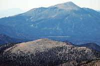
To the south lies the rising outline of Olancha Peak, the proper pronunciation of which remains a mysterious.
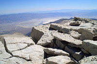
Olancha Peak is the last of the Southern Sierra's high marks before the desert begins, at around 11,000 feet high. Looking west I see the Kaweahs, a remote and technical part of the Sierra whose coloring is darker and more dramatic than the bleached granite of the other south peaks. Despite the vertigo, I can't resist crawling to the edge of Langley's north face and peering over.
I take a quick photo, looking straight down, as I'm perched on blocks of granite that hang over two thousand feet of air. Surprisingly, I see several fingers of snow remaining in a series of discontinuous chutes across the face. Each of these hidden snow fingers suggest the possibility of a madman's ski line in winter... Such dreams will have to wait for another time, however (or more likely never). For now, I'm ready to begin the second half of my loop, down the south slopes and Army Pass.
Crashing Army Pass
I've enjoyed my time on the summit of Mount Langley, but I'm ready to begin the descent toward Army Pass. But where is it? The challenge ahead is principally staying on-route.
Several saddles in the area resemble Army Pass, including New Army Pass, and I'm a little concerned I'll miss the right one. Luckily, I know the proper line is guarded by a broad snow pack. I assume I can use the snow pack to verify I'm in the right place. Of course, descending a steep snowfield without an ice axe promises to be interesting.
But I'll cross that bridge when I come to it. From the summit, I begin descending south and west. Somewhere in this region is the upper south wall of Langley, which looked like an impenetrable cliff from the Cottonwood Lakes basin.
I find a set of footprints and follow them, figuring they'll lead around the steep obstacle. Instead, I soon find myself at the top of the upper south face. The footsteps end at a steep gully, suggesting at least someone decided to climb up (or down) this way.
Feeling adventurous, I decide to try the gully, and scramble down without incident. And now it's time to find the entryway to Army Pass. If I've picked the right chute, I should find snow blocking the top of it.
Sure enough, a large field of snow covers the chute's upper third or so. As per my scouting, the south end of the snow pack is thinner, only about 16 feet high.
Since I don't have an axe to do a proper self-arrest, my plan is to slide down on my feet, knowing I'll quickly get out of control, but hoping my speed won't be too excessive by the time I reach the soft gravel underneath the snow.
Sometimes, you just have to do silly things—curiosity demands it. I'm tired and cranky from the headache, and feeling a little foolish, so I just step onto the snow, crouch down, and let go.
As predicted, I'm instantly out of control. Being a superior ski mountaineer (if not always a wise one), I manage to stay on my feet, but wrench my arm in a futile attempt to dig into the snow to slow down.
I hit the gravel with a painful crash and come to a stop, exactly as planned. What have we learned? If you step onto steep snow without an axe and crampons, be prepared for a fast and violent descent. Who knew? The remainder of the route is difficult, with a mixture of loose talus, boulder hopping, and some down-climbing. My guidebook calls this a "mule route."
Unless mules are more skilled climbers than I am, I'd have to disagree. I see little evidence of an established trail, just difficult scrambling over steep, rough ground. I keep heading down, crossing another, much flatter snowfield, heading toward the blue jewels of the cottonwood lakes. I'm a little low on water, and eager to take a break. From the pass, I have a perfect vantage point to look back at my ascent route along the east-southeast ridge.
The chute I took alongside Peak 12,891 is visible against Langley's sheer south wall. Clearly, the non-technical climber has no other way to gain the ridge if they miss this critical little chute. There's a final section of steps and blocks to down-climb before I reach the first lake, but I'm urged onward by the sight of the lake's clear, blue water. The loop—and the hike—is almost finished.
Finishing The Loop
Today's loop circles the west edge of the Cottonwood Lakes. I'll traverse around the lakes to their southern edge, then cut east and rejoin the trail home.
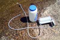
First, though, I stop to take off my shoes, dump out the gravel, and pump some water. Though this is prime camping territory, I'm still alone here. The four-mile walk from the parking lot to the lakes evidently keeps the human population to a minimum. Tired and aching, I'm content to sit in the sun, eat a few handfuls of sunflower seeds, and drink cold water.
Thoughts of cheeseburgers begin to dance in my head, motivating me to hit the trail. Thankfully, I find a footpath that skirts the lakes, making travel much, much easier.
Circumnavigating the lakes takes an hour or so, made easier by the green scenery and warm air. I pick up the pace, wanting to cover the remaining flat ground quickly.
Eventually I pass pair of fishermen, then a lone hiker who's basking himself, shirtless, on a flat rock. Civilization can't be far.
The path continues to wind around the lakes, which I pass, one by one, as the afternoon draws onward.
I'm not sure how many miles I've covered so far, but my tired bones call attention to the fact that this is a big hike despite its relatively-lofty 10,000 foot trailhead elevation. At last the trail angles eastward, and I rejoin my earlier path in the broad, green meadow beneath Langley's rousing south face.
From here, I can follow the broad loop I've made up Langley's eastern ridge, passing peak 12891, climbing up the eastern buttress to the summit, then descending the upper south wall, traversing around an unknown sub-peak to Army Pass, and finally connecting back to the Cottonwood Lakes.
It's been a fine day's hike, though I've still several miles to go to get back to my car. There's still a bit of marshy travel to be had as I work eastward through the lakes back to the main trail. Once again, I find myself wishing the trail builders had put the parking lot a little closer to the lakes. The long, flat travel ahead tests the spirit.
Eventually, after much grumbling and flat pacing, I reach the parking lot, rinse myself off, and get into my car. The hike is over, nearly twelve hours after it began. As the sun throws lengthening shadows, I drive the winding horseshoe meadows road back to the heat and dust of the Owens Valley, leaving Langley's cool pines and austere talus fields gone but not forgotten.